Gouhelans
Gouhelans is a commune in the Doubs department in the Bourgogne-Franche-Comté region in eastern France.
Gouhelans | |
|---|---|
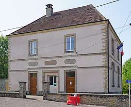
 The town hall in Gouhelans | |
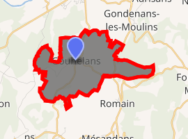
Location of Gouhelans 
| |
 Gouhelans  Gouhelans | |
| Coordinates: 47°27′25″N 6°21′14″E | |
| Country | France |
| Region | Bourgogne-Franche-Comté |
| Department | Doubs |
| Arrondissement | Besançon |
| Canton | Baume-les-Dames |
| Intercommunality | Pays de Rougemont |
| Government | |
| • Mayor (2008–2014) | Christian Lepape |
| Area 1 | 6.17 km2 (2.38 sq mi) |
| Population (2017-01-01)[1] | 118 |
| • Density | 19/km2 (50/sq mi) |
| Time zone | UTC+01:00 (CET) |
| • Summer (DST) | UTC+02:00 (CEST) |
| INSEE/Postal code | 25279 /25680 |
| Elevation | 265–438 m (869–1,437 ft) |
| 1 French Land Register data, which excludes lakes, ponds, glaciers > 1 km2 (0.386 sq mi or 247 acres) and river estuaries. | |
Population
| Year | Pop. | ±% |
|---|---|---|
| 1962 | 99 | — |
| 1968 | 113 | +14.1% |
| 1975 | 89 | −21.2% |
| 1982 | 88 | −1.1% |
| 1990 | 83 | −5.7% |
| 1999 | 116 | +39.8% |
| 2008 | 116 | +0.0% |
| 2012 | 110 | −5.2% |
gollark: Oh, like the GTech™ Experimental Hyperfractal Officeplex.
gollark: This reminds me vaguely of a web serial I semi-follow: https://www.royalroad.com/fiction/25442/doing-gods-work.
gollark: There are n discussions, where n! - n² + ln(ln(4^n - 7)) = 76.
gollark: Combine the flexibility of JSON with semantic search and graph technology for next generation feature extraction even for large datasets.
gollark: Ah, punycode?
See also
References
- "Populations légales 2017". INSEE. Retrieved 6 January 2020.
| Wikimedia Commons has media related to Gouhelans. |
This article is issued from Wikipedia. The text is licensed under Creative Commons - Attribution - Sharealike. Additional terms may apply for the media files.