Le Mémont
Le Mémont is a commune in the Doubs department in the Bourgogne-Franche-Comté region in eastern France.
Le Mémont | |
|---|---|
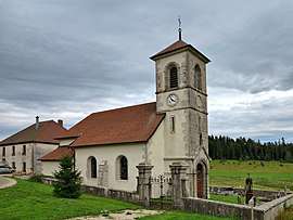 The church in Le Mémont | |
Location of Le Mémont 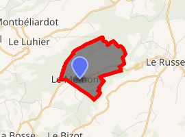
| |
 Le Mémont  Le Mémont | |
| Coordinates: 47°09′25″N 6°40′57″E | |
| Country | France |
| Region | Bourgogne-Franche-Comté |
| Department | Doubs |
| Arrondissement | Pontarlier |
| Canton | Morteau |
| Intercommunality | Plateau du Russey |
| Government | |
| • Mayor (2008–2014) | Éric Maes |
| Area 1 | 3.16 km2 (1.22 sq mi) |
| Population (2017-01-01)[1] | 44 |
| • Density | 14/km2 (36/sq mi) |
| Time zone | UTC+01:00 (CET) |
| • Summer (DST) | UTC+02:00 (CEST) |
| INSEE/Postal code | 25373 /25210 |
| Elevation | 940–1,051 m (3,084–3,448 ft) |
| 1 French Land Register data, which excludes lakes, ponds, glaciers > 1 km2 (0.386 sq mi or 247 acres) and river estuaries. | |
Geography
The commune lies 4 km (2.5 mi) from Le Russey.
Population
| Year | Pop. | ±% |
|---|---|---|
| 2012 | 41 | — |
gollark: #13 is most palaiologistic at the surface level, but they probably made #6.
gollark: Probably, they're complicated.
gollark: No.
gollark: Okay, SAT solve it.
gollark: Wait, this is just a SAT solver.
See also
External links
| Wikimedia Commons has media related to Le Mémont. |
This article is issued from Wikipedia. The text is licensed under Creative Commons - Attribution - Sharealike. Additional terms may apply for the media files.