Longemaison
Longemaison is a commune in the Doubs département in the Bourgogne-Franche-Comté region in eastern France.
Longemaison | |
|---|---|
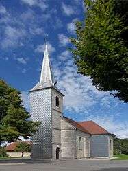 The church in Longemaison | |
Location of Longemaison 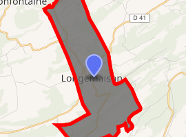
| |
 Longemaison  Longemaison | |
| Coordinates: 47°04′56″N 6°27′36″E | |
| Country | France |
| Region | Bourgogne-Franche-Comté |
| Department | Doubs |
| Arrondissement | Pontarlier |
| Canton | Valdahon |
| Intercommunality | Pays de Pierrefontaine-Vercel |
| Government | |
| • Mayor (2008–2014) | Claude Brisebard |
| Area 1 | 9.63 km2 (3.72 sq mi) |
| Population (2017-01-01)[1] | 154 |
| • Density | 16/km2 (41/sq mi) |
| Time zone | UTC+01:00 (CET) |
| • Summer (DST) | UTC+02:00 (CEST) |
| INSEE/Postal code | 25343 /25690 |
| Elevation | 730–1,091 m (2,395–3,579 ft) |
| 1 French Land Register data, which excludes lakes, ponds, glaciers > 1 km2 (0.386 sq mi or 247 acres) and river estuaries. | |
Geography
The village likes on the wooded slopes of the Mont Chaumont, which is the highest point of the commune at 1092 meters.
Population
| Year | Pop. | ±% |
|---|---|---|
| 1962 | 187 | — |
| 1968 | 191 | +2.1% |
| 1975 | 140 | −26.7% |
| 1982 | 116 | −17.1% |
| 1990 | 112 | −3.4% |
| 1999 | 121 | +8.0% |
| 2008 | 131 | +8.3% |
| 2012 | 136 | +3.8% |
gollark: So things will treat an image with a ZIP file on the end, mostly, as either an image with extra junk on the end, or a ZIP with extra junk at the start.
gollark: The header is at the end.
gollark: ZIP files are, for some odd reason, read backward.
gollark: Thus, python-able image file.
gollark: A fun feature of python is that it actually will run `__main__.py` or something from ZIP files, and ZIP files are weird and backward and can be concatenated onto the end of another file without decoders caring much.
See also
External links
| Wikimedia Commons has media related to Longemaison. |
| Authority control |
|
|---|
This article is issued from Wikipedia. The text is licensed under Creative Commons - Attribution - Sharealike. Additional terms may apply for the media files.