Cendrey
Cendrey is a commune in the Doubs department in the Bourgogne-Franche-Comté region in eastern France. It is located close to the border with Haute-Saone, on the river Beune.
Cendrey | |
|---|---|
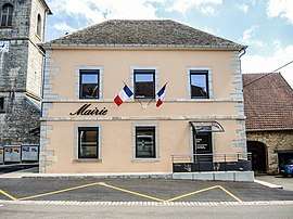
 The town hall in Cendrey | |
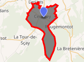
Location of Cendrey 
| |
 Cendrey  Cendrey | |
| Coordinates: 47°24′17″N 6°14′44″E | |
| Country | France |
| Region | Bourgogne-Franche-Comté |
| Department | Doubs |
| Arrondissement | Besançon |
| Canton | Baume-les-Dames |
| Intercommunality | La Bussière |
| Government | |
| • Mayor (2008–2014) | Gérard Marcand |
| Area 1 | 5.52 km2 (2.13 sq mi) |
| Population (2017-01-01)[1] | 191 |
| • Density | 35/km2 (90/sq mi) |
| Time zone | UTC+01:00 (CET) |
| • Summer (DST) | UTC+02:00 (CEST) |
| INSEE/Postal code | 25107 /25640 |
| Elevation | 232–481 m (761–1,578 ft) |
| 1 French Land Register data, which excludes lakes, ponds, glaciers > 1 km2 (0.386 sq mi or 247 acres) and river estuaries. | |
Population
| Year | Pop. | ±% |
|---|---|---|
| 1657 | 53 | — |
| 1688 | 92 | +73.6% |
| 1790 | 354 | +284.8% |
| 1826 | 324 | −8.5% |
| 1851 | 452 | +39.5% |
| 1876 | 352 | −22.1% |
| 1901 | 307 | −12.8% |
| 1926 | 252 | −17.9% |
| 1954 | 217 | −13.9% |
| 1962 | 159 | −26.7% |
| 1968 | 187 | +17.6% |
| 1975 | 217 | +16.0% |
| 1982 | 203 | −6.5% |
| 1990 | 175 | −13.8% |
| 1999 | 188 | +7.4% |
| 2008 | 175 | −6.9% |
| 2012 | 184 | +5.1% |
gollark: It can probably be modified to hold a mapping from (recent) message IDs of things it bridges to original message IDs.
gollark: Odd.
gollark: Well, I used tcpdump, and it looks like it sees the connections but ignores them?
gollark: So I disagree.
gollark: > A records are the standard record type, and are used in XMPP when there are no XMPP SRV records for a domain. This allows simple setups to work with no extra DNS configuration.however.
See also
References
- "Populations légales 2017". INSEE. Retrieved 6 January 2020.
| Wikimedia Commons has media related to Cendrey. |
This article is issued from Wikipedia. The text is licensed under Creative Commons - Attribution - Sharealike. Additional terms may apply for the media files.