Montlebon
Montlebon is a commune in the Doubs department in the Bourgogne-Franche-Comté region in eastern France.
Montlebon | |
|---|---|
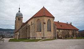
 Convent of Minimes de la Seigne | |
 Coat of arms | |
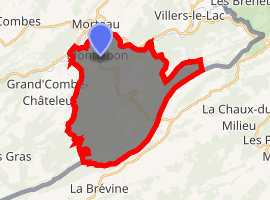
Location of Montlebon 
| |
 Montlebon  Montlebon | |
| Coordinates: 47°02′33″N 6°36′29″E | |
| Country | France |
| Region | Bourgogne-Franche-Comté |
| Department | Doubs |
| Arrondissement | Pontarlier |
| Canton | Morteau |
| Intercommunality | Val de Morteau |
| Government | |
| • Mayor (2008–2014) | Christophe André |
| Area 1 | 27.27 km2 (10.53 sq mi) |
| Population (2017-01-01)[1] | 2,081 |
| • Density | 76/km2 (200/sq mi) |
| Time zone | UTC+01:00 (CET) |
| • Summer (DST) | UTC+02:00 (CEST) |
| INSEE/Postal code | 25403 /25500 |
| Elevation | 750–1,287 m (2,461–4,222 ft) |
| 1 French Land Register data, which excludes lakes, ponds, glaciers > 1 km2 (0.386 sq mi or 247 acres) and river estuaries. | |
Geography
Montlebon lies 2 km (1.2 mi) south of Morteau.
Population
| Year | Pop. | ±% |
|---|---|---|
| 1962 | 1,394 | — |
| 1968 | 1,435 | +2.9% |
| 1975 | 1,465 | +2.1% |
| 1982 | 1,404 | −4.2% |
| 1990 | 1,587 | +13.0% |
| 1999 | 1,710 | +7.8% |
| 2008 | 1,919 | +12.2% |
| 2012 | 1,974 | +2.9% |
gollark: I have it *half* working, I just need to patch around this broken pytio library slightly.
gollark: Er, yes it does.
gollark: Working on converting <@509849474647064576> to support TIO instead of Coliru. It is not going well.
gollark: So just write no code?
gollark: Ah.
See also
This article is issued from Wikipedia. The text is licensed under Creative Commons - Attribution - Sharealike. Additional terms may apply for the media files.