Rémondans-Vaivre
Rémondans-Vaivre is a commune in the Doubs department in the Bourgogne-Franche-Comté region in eastern France.
Rémondans-Vaivre | |
|---|---|
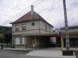 The town hall in Rémondans-Vaivre | |
Location of Rémondans-Vaivre 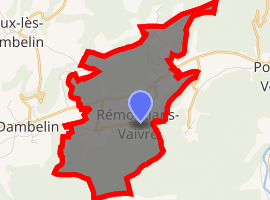
| |
 Rémondans-Vaivre  Rémondans-Vaivre | |
| Coordinates: 47°22′34″N 6°42′50″E | |
| Country | France |
| Region | Bourgogne-Franche-Comté |
| Department | Doubs |
| Arrondissement | Montbéliard |
| Canton | Valentigney |
| Government | |
| • Mayor (2008–2014) | Jean-Claude Bonnot |
| Area 1 | 9.19 km2 (3.55 sq mi) |
| Population (2017-01-01)[1] | 234 |
| • Density | 25/km2 (66/sq mi) |
| Time zone | UTC+01:00 (CET) |
| • Summer (DST) | UTC+02:00 (CEST) |
| INSEE/Postal code | 25485 /25150 |
| Elevation | 377–772 m (1,237–2,533 ft) |
| 1 French Land Register data, which excludes lakes, ponds, glaciers > 1 km2 (0.386 sq mi or 247 acres) and river estuaries. | |
Population
| Year | Pop. | ±% |
|---|---|---|
| 1962 | 97 | — |
| 1968 | 102 | +5.2% |
| 1975 | 101 | −1.0% |
| 1982 | 155 | +53.5% |
| 1990 | 181 | +16.8% |
| 1999 | 180 | −0.6% |
| 2008 | 220 | +22.2% |
| 2012 | 231 | +5.0% |
gollark: Hmm, the most convoluted and reasonably practical way to do this would be to... use my RTL-SDR to listen to Radio 4, but hook it up to my server, run it through some kind of audio compression thing, somehow figure out how to stream the resulting audio over HTTP, then stick that on my website.
gollark: Hmm. I should really listen to these announcements... what's the most convoluted way to do that, I wonder.
gollark: Wait, the UK?! I live there!
gollark: It comes with many features like:- account on the osmarks.tk RSS reader and wiki thing- you can get random bits of the SQL dumps if you want- access to some of the osmarks.tk™ media library and memeCLOUD™- priority support - maximum turnaround time of 10^36 years
gollark: You could also buy an osmarks.tk™ premium subscription and support osmarks.tk.
See also
References
- "Populations légales 2017". INSEE. Retrieved 6 January 2020.
| Wikimedia Commons has media related to Rémondans-Vaivre. |
| Authority control |
|
|---|
This article is issued from Wikipedia. The text is licensed under Creative Commons - Attribution - Sharealike. Additional terms may apply for the media files.