Métabief
Métabief is a commune in the Doubs department in the Bourgogne-Franche-Comté region in eastern France.
Métabief | |
|---|---|
The church in Métabief | |
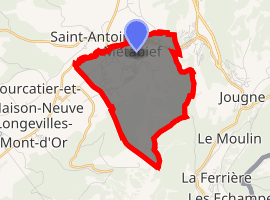
Location of Métabief 
| |
 Métabief  Métabief | |
| Coordinates: 46°46′27″N 6°21′09″E | |
| Country | France |
| Region | Bourgogne-Franche-Comté |
| Department | Doubs |
| Arrondissement | Pontarlier |
| Canton | Frasne |
| Intercommunality | Mont d'Or et des Deux Lacs |
| Government | |
| • Mayor (2008–2014) | Gérard Deque |
| Area 1 | 5.76 km2 (2.22 sq mi) |
| Population (2017-01-01)[1] | 1,196 |
| • Density | 210/km2 (540/sq mi) |
| Time zone | UTC+01:00 (CET) |
| • Summer (DST) | UTC+02:00 (CEST) |
| INSEE/Postal code | 25380 /25370 |
| Elevation | 923–1,419 m (3,028–4,656 ft) |
| 1 French Land Register data, which excludes lakes, ponds, glaciers > 1 km2 (0.386 sq mi or 247 acres) and river estuaries. | |
Geography
The commune lies 14 km (8.7 mi) northeast of Mouthe close to the Swiss border near Jougne.
Population
| Year | Pop. | ±% |
|---|---|---|
| 1962 | 123 | — |
| 1968 | 165 | +34.1% |
| 1975 | 197 | +19.4% |
| 1982 | 250 | +26.9% |
| 1990 | 504 | +101.6% |
| 1999 | 691 | +37.1% |
| 2008 | 954 | +38.1% |
| 2012 | 1,089 | +14.2% |
Tourism
Métabief is known for its winter sports, but it is also a center for tourism in the summer with hiking, mountain biking, hang gliding, mountain climbing, and spelunking. It is one of the six communes that operate the Métabief-Mont-d'Or ski resort.
Gallery
The Morond, seen from Les Hôpitaux-Neufs
The church
gollark: ... `of`, not `in`; thanks javascript.
gollark: Only if you add better diagnostics into RPNCalcV4.
gollark: What?
gollark: I have no idea what my reasons actually were but I don't care very much apart from mildly disliking them for arbitrary reasons.
gollark: Well, you can't judge me for anything I may have said more than 2µs ago.
See also
This article is issued from Wikipedia. The text is licensed under Creative Commons - Attribution - Sharealike. Additional terms may apply for the media files.