Saint-Julien-lès-Montbéliard
Saint-Julien-lès-Montbéliard is a commune in the Doubs department in the Bourgogne-Franche-Comté region in eastern France.
Saint-Julien-lès-Montbéliard | |
|---|---|
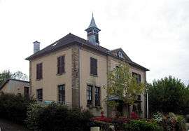 The town hall in Saint-Julien-lès-Montbéliard | |
Location of Saint-Julien-lès-Montbéliard 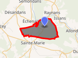
| |
 Saint-Julien-lès-Montbéliard  Saint-Julien-lès-Montbéliard | |
| Coordinates: 47°31′23″N 6°42′41″E | |
| Country | France |
| Region | Bourgogne-Franche-Comté |
| Department | Doubs |
| Arrondissement | Montbéliard |
| Canton | Bavans |
| Intercommunality | Vallée du Rupt |
| Government | |
| • Mayor (2008–2014) | Michel Piernavieja |
| Area 1 | 3.81 km2 (1.47 sq mi) |
| Population (2017-01-01)[1] | 165 |
| • Density | 43/km2 (110/sq mi) |
| Time zone | UTC+01:00 (CET) |
| • Summer (DST) | UTC+02:00 (CEST) |
| INSEE/Postal code | 25521 /25550 |
| Elevation | 344–447 m (1,129–1,467 ft) |
| 1 French Land Register data, which excludes lakes, ponds, glaciers > 1 km2 (0.386 sq mi or 247 acres) and river estuaries. | |
Geography
The commune lies 8 km (5.0 mi) west of Montbéliard.
Population
| Year | Pop. | ±% |
|---|---|---|
| 1962 | 89 | — |
| 1968 | 102 | +14.6% |
| 1975 | 122 | +19.6% |
| 1982 | 153 | +25.4% |
| 1990 | 174 | +13.7% |
| 1999 | 173 | −0.6% |
| 2008 | 172 | −0.6% |
| 2012 | 170 | −1.2% |
gollark: It happens.
gollark: I see. Same sort of effect.
gollark: Previous version is deprecated, new version is unreleased…
gollark: *brain melting noises*
gollark: This may be a bad project for you.
External links
| Wikimedia Commons has media related to Saint-Julien-lès-Montbéliard. |
This article is issued from Wikipedia. The text is licensed under Creative Commons - Attribution - Sharealike. Additional terms may apply for the media files.