Emanuel County, Georgia
Emanuel County is a county located in the U.S. state of Georgia. As of the 2010 census, the population was 22,598.[1] The county seat is Swainsboro.[2]
Emanuel County | |
|---|---|
 | |
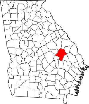 Location within the U.S. state of Georgia | |
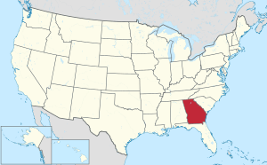 Georgia's location within the U.S. | |
| Coordinates: 32°35′N 82°18′W | |
| Country | |
| State | |
| Founded | 1812 |
| Named for | David Emanuel |
| Seat | Swainsboro |
| Largest city | Swainsboro |
| Area | |
| • Total | 690 sq mi (1,800 km2) |
| • Land | 681 sq mi (1,760 km2) |
| • Water | 9.6 sq mi (25 km2) 1.4%% |
| Population | |
| • Estimate (2019) | 22,646 |
| • Density | 33/sq mi (13/km2) |
| Time zone | UTC−5 (Eastern) |
| • Summer (DST) | UTC−4 (EDT) |
| Congressional district | 12th |
| Website | Emanuel County, Georgia |
History
The County was created on December 10, 1812, by an act of the Georgia General Assembly from land originally in parts of Bulloch and Montgomery counties.[3] Emanuel County is named in honor of former Governor of Georgia David Emanuel.[4]
Portions of Johnson (1858), Jenkins (1905), Toombs (1905), Candler (1914), and Treutlen (1918) counties were taken from Emanuel's original borders.
Courthouses
Emanuel County has had seven courthouses in its over 200 years of existence.[5] In the county's early years, the court met at Steven Rich's home. Emanuel County's first courthouse was erected in 1814 and burned in 1841. It wasn't until 1854, the same time that the city of Swainsboro was formally incorporated, that the county was allowed to build a replacement. In a string of bad luck, this new courthouse burned in 1855 and was replaced by another courthouse, which burned in 1857. Emanuel County's fourth courthouse burned in 1919 and was replaced by a three-story brick structure which, characteristically, burned in 1938. The next courthouse, a two-story marble structure, was built in 1940 and was the first courthouse in Emanuel County's history not to be destroyed by fire. However, by the 1990s, the courthouse's cramped and deteriorating condition caused several county offices to vacate the courthouse and move into vacant office space surrounding the courthouse square. The courthouse was demolished in the spring of 2000, leaving only the sheriff's office annex. In the late 1990s, the Emanuel County commissioners purchased the former U.S. Post Office building, which was built in 1936, to serve as an interim courthouse. In 2000, the county commission acquired land adjacent to the old Post Office to build a new courthouse and sheriff's office. Emanuel County's current courthouse, a large, single story brick structure incorporating the old Post Office building, was completed in 2002, and a city square was built on the former courthouse site with the old sheriff's office renovated to serve as the city's visitors' center as well as the office for Swainsboro-Emanuel County Chamber of Commerce.[6]
Geography
According to the U.S. Census Bureau, the county has a total area of 690 square miles (1,800 km2), of which 681 square miles (1,760 km2) is land and 9.6 square miles (25 km2) (1.4%) is water.[7]
The northern portion of Emanuel County, centered on Summertown and defined by a southern border heading from Garfield east-northeast and running north of Modoc, is located in the Upper Ogeechee River sub-basin of the Ogeechee River basin. The eastern portion of the county, east of Swainsboro, is located in the Canoochee River sub-basin of the same Ogeechee River basin. The western and southern portions of Emanuel County are located in the Ohoopee River sub-basin of the Altamaha River basin.[8]
Major highways


Adjacent counties
- Jefferson County - north
- Jenkins County - northeast
- Burke County - northeast
- Candler County - east
- Tattnall County - southeast
- Bulloch County - southeast
- Toombs County - south
- Laurens County - southwest
- Johnson County - west
- Treutlen County - west
Demographics
| Historical population | |||
|---|---|---|---|
| Census | Pop. | %± | |
| 1820 | 2,928 | — | |
| 1830 | 2,673 | −8.7% | |
| 1840 | 3,129 | 17.1% | |
| 1850 | 4,577 | 46.3% | |
| 1860 | 5,081 | 11.0% | |
| 1870 | 6,134 | 20.7% | |
| 1880 | 9,759 | 59.1% | |
| 1890 | 14,703 | 50.7% | |
| 1900 | 21,279 | 44.7% | |
| 1910 | 25,140 | 18.1% | |
| 1920 | 25,862 | 2.9% | |
| 1930 | 24,101 | −6.8% | |
| 1940 | 23,517 | −2.4% | |
| 1950 | 19,789 | −15.9% | |
| 1960 | 17,815 | −10.0% | |
| 1970 | 18,189 | 2.1% | |
| 1980 | 20,795 | 14.3% | |
| 1990 | 20,546 | −1.2% | |
| 2000 | 21,837 | 6.3% | |
| 2010 | 22,598 | 3.5% | |
| Est. 2019 | 22,646 | [9] | 0.2% |
| U.S. Decennial Census[10] 1790-1960[11] 1900-1990[12] 1990-2000[13] 2010-2019[1] | |||
2000 census
As of the census[14] of 2000, there were 21,837 people, 8,045 households, and 5,752 families living in the county. The population density was 32 people per square mile (12/km²). There were 9,419 housing units at an average density of 14 per square mile (5/km²). The racial makeup of the county was 63.69% White, 33.28% Black or African American, 0.14% Native American, 0.24% Asian, 2.13% from other races, and 0.51% from two or more races. 3.41% of the population were Hispanic or Latino of any race.
There were 8,045 households out of which 34.30% had children under the age of 18 living with them, 50.10% were married couples living together, 17.10% had a female householder with no husband present, and 28.50% were non-families. 25.00% of all households were made up of individuals and 11.10% had someone living alone who was 65 years of age or older. The average household size was 2.61 and the average family size was 3.10.
In the county, the population was spread out with 27.80% under the age of 18, 10.40% from 18 to 24, 26.00% from 25 to 44, 22.40% from 45 to 64, and 13.30% who were 65 years of age or older. The median age was 35 years. For every 100 females there were 92.80 males. For every 100 females age 18 and over, there were 90.50 males.
The median income for a household in the county was $24,383, and the median income for a family was $31,113. Males had a median income of $26,605 versus $18,145 for females. The per capita income for the county was $13,627. About 21.80% of families and 27.40% of the population were below the poverty line, including 36.70% of those under age 18 and 27.50% of those age 65 or over.
2010 census
As of the 2010 United States Census, there were 22,598 people, 8,430 households, and 5,833 families living in the county.[15] The population density was 33.2 inhabitants per square mile (12.8/km2). There were 9,968 housing units at an average density of 14.6 per square mile (5.6/km2).[16] The racial makeup of the county was 61.6% white, 33.5% black or African American, 0.7% Asian, 0.3% American Indian, 3.0% from other races, and 0.9% from two or more races. Those of Hispanic or Latino origin made up 4.1% of the population.[15] In terms of ancestry, 12.9% were American, 8.0% were English, and 7.3% were Irish.[17]
Of the 8,430 households, 35.9% had children under the age of 18 living with them, 44.9% were married couples living together, 19.1% had a female householder with no husband present, 30.8% were non-families, and 26.5% of all households were made up of individuals. The average household size was 2.57 and the average family size was 3.10. The median age was 36.8 years.[15]
The median income for a household in the county was $30,205 and the median income for a family was $36,402. Males had a median income of $31,434 versus $23,340 for females. The per capita income for the county was $16,076. About 17.0% of families and 24.2% of the population were below the poverty line, including 35.8% of those under age 18 and 13.3% of those age 65 or over.[18]
Communities
Census-designated places
Other unincorporated communities
- Dellwood
- Old Dellwood
- Stevens Crossing, Georgia
Politics
Since 1964, the only times the county has failed to back a Republican candidate in a presidential election were when southern Democrats Jimmy Carter and Bill Clinton were on the ballot.
| Year | Republican | Democratic | Third parties |
|---|---|---|---|
| 2016 | 67.9% 5,335 | 31.0% 2,435 | 1.1% 90 |
| 2012 | 63.1% 5,100 | 36.2% 2,927 | 0.8% 62 |
| 2008 | 61.9% 5,110 | 37.2% 3,068 | 0.9% 74 |
| 2004 | 62.4% 4,666 | 37.1% 2,774 | 0.4% 33 |
| 2000 | 53.4% 3,343 | 45.3% 2,835 | 1.4% 85 |
| 1996 | 41.7% 2,451 | 50.2% 2,947 | 8.1% 475 |
| 1992 | 41.4% 2,662 | 45.9% 2,951 | 12.6% 812 |
| 1988 | 59.0% 3,530 | 39.9% 2,387 | 1.2% 71 |
| 1984 | 61.5% 3,920 | 38.5% 2,458 | |
| 1980 | 35.2% 2,199 | 63.5% 3,971 | 1.3% 81 |
| 1976 | 24.5% 1,493 | 75.5% 4,603 | |
| 1972 | 80.1% 3,684 | 19.9% 916 | |
| 1968 | 21.2% 1,297 | 24.7% 1508 | 54.1% 3,307 |
| 1964 | 59.2% 3,311 | 40.8% 2,279 | |
| 1960 | 30.8% 1,120 | 69.2% 2,513 | |
| 1956 | 22.2% 678 | 77.8% 2,373 | |
| 1952 | 20.0% 661 | 80.0% 2,642 | |
| 1948 | 29.9% 717 | 59.9% 1,436 | 10.2% 245 |
| 1944 | 16.2% 317 | 83.7% 1,635 | 0.1% 1 |
| 1940 | 5.4% 81 | 94.5% 1,428 | 0.1% 2 |
| 1936 | 6.0% 125 | 93.4% 1,943 | 0.6% 13 |
| 1932 | 1.3% 33 | 98.5% 2,420 | 0.2% 4 |
| 1928 | 24.8% 355 | 75.2% 1,076 | |
| 1924 | 5.0% 39 | 91.7% 710 | 3.2% 25 |
| 1920 | 11.6% 190 | 88.4% 1,444 | |
| 1916 | 14.8% 266 | 83.6% 1,500 | 1.6% 28 |
| 1912 | 14.9% 129 | 82.6% 715 | 2.5% 22 |
References
- "State & County QuickFacts". United States Census Bureau. Archived from the original on June 7, 2011. Retrieved February 15, 2014.
- "Find a County". National Association of Counties. Archived from the original on May 31, 2011. Retrieved June 7, 2011.
- Krakow, Kenneth K. (1975). Georgia Place-Names: Their History and Origins (PDF). Macon, GA: Winship Press. p. 72. ISBN 0-915430-00-2.
- Gannett, Henry (1905). The Origin of Certain Place Names in the United States. Govt. Print. Off. pp. 119.
- Hellmann, Paul T. (May 13, 2013). Historical Gazetteer of the United States. Routledge. p. 248. Retrieved November 30, 2013.
- "Emanuel County Courthouse". Georgia Info. Retrieved October 30, 2012.
- "US Gazetteer files: 2010, 2000, and 1990". United States Census Bureau. February 12, 2011. Retrieved April 23, 2011.
- "Georgia Soil and Water Conservation Commission Interactive Mapping Experience". Georgia Soil and Water Conservation Commission. Retrieved November 20, 2015.
- "Population and Housing Unit Estimates". Retrieved May 21, 2020.
- "U.S. Decennial Census". United States Census Bureau. Retrieved June 22, 2014.
- "Historical Census Browser". University of Virginia Library. Retrieved June 22, 2014.
- "Population of Counties by Decennial Census: 1900 to 1990". United States Census Bureau. Retrieved June 22, 2014.
- "Census 2000 PHC-T-4. Ranking Tables for Counties: 1990 and 2000" (PDF). United States Census Bureau. Retrieved June 22, 2014.
- "U.S. Census website". United States Census Bureau. Retrieved May 14, 2011.
- "DP-1 Profile of General Population and Housing Characteristics: 2010 Demographic Profile Data". United States Census Bureau. Archived from the original on February 13, 2020. Retrieved December 29, 2015.
- "Population, Housing Units, Area, and Density: 2010 - County". United States Census Bureau. Archived from the original on February 13, 2020. Retrieved December 29, 2015.
- "DP02 SELECTED SOCIAL CHARACTERISTICS IN THE UNITED STATES – 2006-2010 American Community Survey 5-Year Estimates". United States Census Bureau. Archived from the original on February 13, 2020. Retrieved December 29, 2015.
- "DP03 SELECTED ECONOMIC CHARACTERISTICS – 2006-2010 American Community Survey 5-Year Estimates". United States Census Bureau. Archived from the original on February 13, 2020. Retrieved December 29, 2015.
- Leip, David. "Dave Leip's Atlas of U.S. Presidential Elections". uselectionatlas.org. Retrieved March 19, 2018.
External links
- The New Georgia Encyclopedia entry for Emanuel County
- Emanuel County history at GeorgiaInfo website
- Emanuel County historical marker
- Summerville historical marker
Places adjacent to Emanuel County, Georgia | ||||||||||
|---|---|---|---|---|---|---|---|---|---|---|
| ||||||||||
Municipalities and communities of Emanuel County, Georgia, United States | ||
|---|---|---|
| Cities | Map of Georgia highlighting Emanuel County | |
| CDPs | ||
| Unincorporated communities | ||
| Footnotes | ‡This populated place also has portions in an adjacent county or counties | |
| Authority control |
|
|---|