Clinch County, Georgia
Clinch County is a county located in the southeastern part of the U.S. state of Georgia. As of the 2010 census, the population was 6,798.[1] The county seat is Homerville.[2] The county was created on February 14, 1850, named in honor of Duncan Lamont Clinch.[3]
Clinch County | |
|---|---|
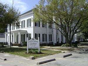 Clinch County Courthouse in Homerville | |
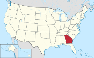
 Location within the U.S. state of Georgia | |
 Georgia's location within the U.S. | |
| Coordinates: 30°55′N 82°42′W | |
| Country | |
| State | |
| Founded | 1850 |
| Named for | Duncan Lamont Clinch |
| Seat | Homerville |
| Largest city | Homerville |
| Area | |
| • Total | 824 sq mi (2,130 km2) |
| • Land | 800 sq mi (2,000 km2) |
| • Water | 24 sq mi (60 km2) 2.9%% |
| Population | |
| • Estimate (2019) | 6,618 |
| • Density | 8.5/sq mi (3.3/km2) |
| Time zone | UTC−5 (Eastern) |
| • Summer (DST) | UTC−4 (EDT) |
| Congressional district | 1st |
| Website | clinchcountyga |
With just 8.5 people per square mile (land), Clinch has one of the lowest population densities of any county in Georgia.
Geography
According to the U.S. Census Bureau, the county has a total area of 824 square miles (2,130 km2), of which 800 square miles (2,100 km2) is land and 24 square miles (62 km2) (2.9%) is water.[4] It is the fourth-largest county in Georgia by land area and third-largest by total area. Eastern and southeastern portions of the county lie within the Okefenokee Swamp and its federally protected areas.
The vast majority of Clinch County is located in the Upper Suwannee River sub-basin of the Suwannee River basin, with just a portion of the western and northwestern edge of the county, southwest and well northwest of Du Pont, located in the Alapaha River sub-basin of the same Suwannee River basin.[5]
Major highways


Adjacent counties
- Atkinson County (north)
- Ware County (east)
- Columbia County, Florida (south)
- Baker County, Florida (south)
- Echols County (southwest)
- Lanier County (west)
National protected area
Demographics
| Historical population | |||
|---|---|---|---|
| Census | Pop. | %± | |
| 1850 | 637 | — | |
| 1860 | 3,063 | 380.8% | |
| 1870 | 3,945 | 28.8% | |
| 1880 | 4,138 | 4.9% | |
| 1890 | 6,652 | 60.8% | |
| 1900 | 8,732 | 31.3% | |
| 1910 | 8,424 | −3.5% | |
| 1920 | 7,984 | −5.2% | |
| 1930 | 7,015 | −12.1% | |
| 1940 | 6,437 | −8.2% | |
| 1950 | 6,007 | −6.7% | |
| 1960 | 6,545 | 9.0% | |
| 1970 | 6,405 | −2.1% | |
| 1980 | 6,660 | 4.0% | |
| 1990 | 6,160 | −7.5% | |
| 2000 | 6,878 | 11.7% | |
| 2010 | 6,798 | −1.2% | |
| Est. 2019 | 6,618 | [6] | −2.6% |
| U.S. Decennial Census[7] 1790-1960[8] 1900-1990[9] 1990-2000[10] 2010-2019[1] | |||
2000 census
As of the census[11] of 2000, there were 6,878 people, 2,512 households, and 1,823 families living in the county. The population density was 8 people per square mile (3/km²). There were 2,837 housing units at an average density of 4 per square mile (1/km²). The racial makeup of the county was 68.93% White or European American, 29.50% Black or African American, 0.51% Native American, 0.12% Asian, 0.10% from other races, and 0.84% from two or more races. 0.79% of the population were Hispanic or Latino of any race.
As of the census of 2010[12] there were 6,798 people in Clinch County. 69.7% were White or European American, 27.7% were Black or African American, 0.8% were American Indian or Alaska Native, 0.2% were Asian and 0.1% were Native Hawaiian and other Pacific Islander.[12]
There were 2,512 households out of which 36.50% had children under the age of 18 living with them, 51.70% were married couples living together, 16.90% had a female householder with no husband present, and 27.40% were non-families. 24.60% of all households were made up of individuals and 9.20% had someone living alone who was 65 years of age or older. The average household size was 2.60 and the average family size was 3.09.
In the county, the population was spread out with 27.90% under the age of 18, 8.60% from 18 to 24, 29.00% from 25 to 44, 22.70% from 45 to 64, and 11.80% who were 65 years of age or older. The median age was 35 years. For every 100 females there were 98.90 males. For every 100 females age 18 and over, there were 96.50 males.
The median income for a household in the county was $26,755, and the median income for a family was $31,755. Males had a median income of $26,905 versus $19,347 for females. The per capita income for the county was $13,023. About 22.20% of families and 23.40% of the population were below the poverty line, including 26.90% of those under age 18 and 30.90% of those age 65 or over.
2010 census
As of the 2010 United States Census, there were 6,798 people, 2,572 households, and 1,821 families living in the county.[13] The population density was 8.5 inhabitants per square mile (3.3/km2). There were 3,007 housing units at an average density of 3.8 per square mile (1.5/km2).[14] The racial makeup of the county was 67.4% white, 27.7% black or African American, 0.6% American Indian, 0.2% Asian, 0.1% Pacific islander, 2.6% from other races, and 1.4% from two or more races. Those of Hispanic or Latino origin made up 3.5% of the population.[13] In terms of ancestry, 11.0% were English, 8.0% were Irish, and 8.0% were American.[15]
Of the 2,572 households, 38.4% had children under the age of 18 living with them, 46.5% were married couples living together, 19.4% had a female householder with no husband present, 29.2% were non-families, and 25.7% of all households were made up of individuals. The average household size was 2.58 and the average family size was 3.10. The median age was 36.8 years.[13]
The median income for a household in the county was $31,963 and the median income for a family was $45,350. Males had a median income of $31,739 versus $25,972 for females. The per capita income for the county was $16,709. About 19.1% of families and 25.7% of the population were below the poverty line, including 37.7% of those under age 18 and 24.3% of those age 65 or over.[16]
Education
Communities
Politics
| Year | Republican | Democratic | Third parties |
|---|---|---|---|
| 2016 | 70.4% 1,727 | 27.9% 686 | 1.7% 42 |
| 2012 | 64.6% 1,598 | 34.4% 852 | 1.0% 25 |
| 2008 | 62.1% 1,678 | 36.6% 989 | 1.3% 35 |
| 2004 | 66.2% 1,501 | 33.1% 750 | 0.8% 17 |
| 2000 | 56.6% 1,091 | 42.3% 816 | 1.1% 22 |
| 1996 | 40.4% 789 | 49.9% 973 | 9.7% 190 |
| 1992 | 43.0% 790 | 41.3% 759 | 15.7% 288 |
| 1988 | 58.9% 863 | 40.6% 594 | 0.6% 8 |
| 1984 | 58.0% 862 | 42.0% 625 | |
| 1980 | 27.5% 513 | 71.1% 1,325 | 1.4% 26 |
| 1976 | 21.3% 383 | 78.7% 1,414 | |
| 1972 | 82.5% 1,127 | 17.5% 239 | |
| 1968 | 17.1% 304 | 18.8% 334 | 64.2% 1,142 |
| 1964 | 60.6% 1,084 | 39.4% 706 | |
| 1960 | 30.7% 397 | 69.3% 898 | |
| 1956 | 24.7% 518 | 75.3% 1,577 | |
| 1952 | 23.1% 350 | 76.9% 1,168 | |
| 1948 | 16.5% 287 | 73.6% 1,283 | 10.0% 174 |
| 1944 | 9.9% 64 | 90.1% 582 | |
| 1940 | 5.7% 63 | 94.3% 1,049 | |
| 1936 | 6.6% 71 | 93.2% 1,002 | 0.2% 2 |
| 1932 | 2.3% 11 | 97.3% 461 | 0.4% 2 |
| 1928 | 16.6% 143 | 83.4% 717 | |
| 1924 | 4.9% 13 | 88.7% 235 | 6.4% 17 |
| 1920 | 20.8% 77 | 79.3% 294 | |
| 1916 | 1.8% 8 | 86.0% 374 | 12.2% 53 |
| 1912 | 2.7% 9 | 83.2% 283 | 14.1% 48 |
Notable people
Clinch County is the birthplace of actors Ossie Davis and Matthew Lintz, politician Iris Faircloth Blitch, Jonathan Smith (football player), Jolene Ammons (basketball player), politician W. Benjamin Gibbs, politician William Chester Lankford,
References
- "State & County QuickFacts". United States Census Bureau. Archived from the original on February 27, 2016. Retrieved June 20, 2014.
- "Find a County". National Association of Counties. Archived from the original on May 31, 2011. Retrieved June 7, 2011.
- Krakow, Kenneth K. (1975). Georgia Place-Names: Their History and Origins (PDF). Macon, GA: Winship Press. p. 46. ISBN 0-915430-00-2.
- "US Gazetteer files: 2010, 2000, and 1990". United States Census Bureau. February 12, 2011. Retrieved April 23, 2011.
- "Georgia Soil and Water Conservation Commission Interactive Mapping Experience". Georgia Soil and Water Conservation Commission. Retrieved November 27, 2015.
- "Population and Housing Unit Estimates". Retrieved May 21, 2020.
- "U.S. Decennial Census". United States Census Bureau. Retrieved June 20, 2014.
- "Historical Census Browser". University of Virginia Library. Retrieved June 20, 2014.
- "Population of Counties by Decennial Census: 1900 to 1990". United States Census Bureau. Retrieved June 20, 2014.
- "Census 2000 PHC-T-4. Ranking Tables for Counties: 1990 and 2000" (PDF). United States Census Bureau. Retrieved June 20, 2014.
- "U.S. Census website". United States Census Bureau. Retrieved May 14, 2011.
- "Archived copy". Archived from the original on June 7, 2011. Retrieved July 6, 2011.CS1 maint: archived copy as title (link)
- "DP-1 Profile of General Population and Housing Characteristics: 2010 Demographic Profile Data". United States Census Bureau. Archived from the original on February 13, 2020. Retrieved December 27, 2015.
- "Population, Housing Units, Area, and Density: 2010 - County". United States Census Bureau. Archived from the original on February 13, 2020. Retrieved December 27, 2015.
- "DP02 SELECTED SOCIAL CHARACTERISTICS IN THE UNITED STATES – 2006-2010 American Community Survey 5-Year Estimates". United States Census Bureau. Archived from the original on February 13, 2020. Retrieved December 27, 2015.
- "DP03 SELECTED ECONOMIC CHARACTERISTICS – 2006-2010 American Community Survey 5-Year Estimates". United States Census Bureau. Archived from the original on February 13, 2020. Retrieved December 27, 2015.
- Leip, David. "Dave Leip's Atlas of U.S. Presidential Elections". uselectionatlas.org. Retrieved March 19, 2018.
External links
- The Clinch County News - Local newspaper
- Okefenokee National Wildlife Refuge U.S. Fish and Wildlife Service
- Clinch County historical marker
- Bethany Baptist Church historical marker
Places adjacent to Clinch County, Georgia | ||||||||||
|---|---|---|---|---|---|---|---|---|---|---|
| ||||||||||
Municipalities and communities of Clinch County, Georgia, United States | ||
|---|---|---|
| Cities | Map of Georgia highlighting Clinch County | |
| Towns | ||
| Unincorporated communities | ||

| Authority control |
|
|---|