Dougherty County, Georgia
Dougherty County is located in the southwestern portion of the U.S. state of Georgia. As of the 2010 census, the population was 94,565.[1] The county seat and sole incorporated city is Albany.[2]
Dougherty County | |
|---|---|
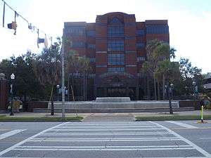 Dougherty County Government Center | |
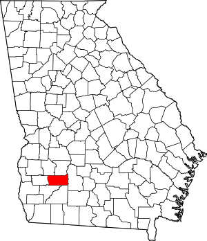 Location within the U.S. state of Georgia | |
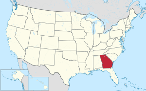 Georgia's location within the U.S. | |
| Coordinates: 31°32′N 84°13′W | |
| Country | |
| State | |
| Founded | 1853 |
| Named for | Charles Dougherty |
| Seat | Albany |
| Largest city | Albany |
| Area | |
| • Total | 335 sq mi (870 km2) |
| • Land | 329 sq mi (850 km2) |
| • Water | 5.9 sq mi (15 km2) 1.8%% |
| Population | |
| • Estimate (2019) | 87,956 |
| • Density | 288/sq mi (111/km2) |
| Time zone | UTC−5 (Eastern) |
| • Summer (DST) | UTC−4 (EDT) |
| Congressional district | 2nd |
| Website | www |
Dougherty County is included in the Albany, GA Metropolitan Statistical Area. Historically dominated by cotton plantation agriculture in the nineteenth century, it is part of the Black Belt of the South. Its population continues to be majority African American.
History
The county was created by the Georgia General Assembly on December 15, 1853, from a part of Baker County.[3] It was named after Charles Dougherty,[4] a respected judge and lawyer from Athens, Georgia. In 1854 and 1856 small areas were added from Worth County.
As noted above, the county was developed by European Americans using enslaved African Americans as workers for the production of cotton as a commodity crop. Its county seat of Albany, Georgia is located on the Flint River, which was originally the chief means of transportation for shipped products. Albany was later served by seven railroad lines, adding to its significance as a market center. The city was a center of the Civil Rights Movement, particularly during the early 1960s.
Geography
According to the U.S. Census Bureau, the county has a total area of 335 square miles (870 km2), of which 329 square miles (850 km2) is land and 5.9 square miles (15 km2) (1.8%) is water.[5]
The majority of Dougherty County is located in the Lower Flint River sub-basin of the ACF River Basin (Apalachicola-Chattahoochee-Flint River Basin). The northeastern corner of the county, northeast of Albany, is located in the Middle Flint River sub-basin of the same ACF River basin. A very small portion of Dougherty County, north of Albany, is located in the Kinchafoonee-Muckalee sub-basin of the larger ACF River Basin. The remaining western portion of the county is located in the Ichawaynochaway Creek sub-basin of the same ACF River Basin.[6]
Major highways


Adjacent counties
- Lee County – north
- Worth County – east
- Mitchell County – south
- Baker County – southwest
- Calhoun County – west
- Terrell County – northwest
Demographics
| Historical population | |||
|---|---|---|---|
| Census | Pop. | %± | |
| 1860 | 8,295 | — | |
| 1870 | 11,517 | 38.8% | |
| 1880 | 12,622 | 9.6% | |
| 1890 | 12,206 | −3.3% | |
| 1900 | 13,679 | 12.1% | |
| 1910 | 16,035 | 17.2% | |
| 1920 | 20,063 | 25.1% | |
| 1930 | 22,306 | 11.2% | |
| 1940 | 28,565 | 28.1% | |
| 1950 | 43,617 | 52.7% | |
| 1960 | 75,680 | 73.5% | |
| 1970 | 89,639 | 18.4% | |
| 1980 | 100,718 | 12.4% | |
| 1990 | 96,311 | −4.4% | |
| 2000 | 96,065 | −0.3% | |
| 2010 | 94,565 | −1.6% | |
| Est. 2019 | 87,956 | [7] | −7.0% |
| U.S. Decennial Census[8] 1790-1960[9] 1900-1990[10] 1990-2000[11] 2010-2019[1] | |||
2010 census
As of the 2010 United States Census, there were 94,565 people, 36,508 households, and 23,422 families living in the county.[12] The population density was 287.7 inhabitants per square mile (111.1/km2). There were 40,801 housing units at an average density of 124.1 per square mile (47.9/km2).[13] The racial makeup of the county was 67.1% black or African American, 29.6% white, 0.8% Asian, 0.2% American Indian, 0.1% Pacific islander, 1.0% from other races, and 1.2% from two or more races. Those of Hispanic or Latino origin made up 2.2% of the population.[12] In terms of ancestry, 6.1% were English, 6.0% were American, and 5.3% were Irish.[14]
Of the 36,508 households, 34.3% had children under the age of 18 living with them, 33.7% were married couples living together, 25.6% had a female householder with no husband present, 35.8% were non-families, and 30.2% of all households were made up of individuals. The average household size was 2.47 and the average family size was 3.08. The median age was 33.2 years.[12]
The median income for a household in the county was $32,435 and the median income for a family was $39,951. Males had a median income of $34,444 versus $27,848 for females. The per capita income for the county was $19,210. About 22.7% of families and 28.9% of the population were below the poverty line, including 42.7% of those under age 18 and 15.5% of those age 65 or over.[15]
2000 census
As of the 2000 census[16] of 2000, there were 96,065 people, 35,552 households, and 24,282 families living in the county. The population density was 292 people per square mile (113/km²). There were 39,656 housing units at an average density of 120 per square mile (46/km²). The racial makeup of the county was 60.13% Black or African American, 37.80% White, 0.23% Native American, 0.57% Asian, 0.03% Pacific Islander, 0.49% from other races, and 0.74% from two or more races. 1.34% of the population were Hispanic or Latino of any race.
The largest European ancestry groups in Dougherty County are English (6.6%), Irish (6.5%), "American" (mostly English and Scots-Irish)(5.6%), German (4.5%) and Scots-Irish (1.6%).[17]
There were 35,552 households out of which 32.90% had children under the age of 18 living with them, 40.90% were married couples living together, 23.20% had a female householder with no husband present, and 31.70% were non-families. 26.80% of all households were made up of individuals and 8.90% had someone living alone who was 65 years of age or older. The average household size was 2.58 and the average family size was 3.13.
In the county, the population was spread out with 27.70% under the age of 18, 12.20% from 18 to 24, 27.60% from 25 to 44, 20.90% from 45 to 64, and 11.70% who were 65 years of age or older. The median age was 32 years. For every 100 females, there were 87.40 males. For every 100 females age 18 and over, there were 82.30 males.
The median income for a household in the county was $30,934, and the median income for a family was $36,655. Males had a median income of $30,742 versus $22,254 for females. The per capita income for the county was $16,645. About 19.60% of families and 24.80% of the population were below the poverty line, including 35.30% of those under age 18 and 17.20% of those age 65 or over.
Education
Communities
City
Census-designated place
Unincorporated communities
- Acree
- Dosaga
- Doublegate
- Ducker
- Four Points
- Gillionville
- Hotalihuyana
- Pecan City
- Pretoria
- Radium Springs
- Turner City
- Walker
- Williamsburg
Ghost town
- Ocmulgee
Politics
| Year | Republican | Democratic | Third parties |
|---|---|---|---|
| 2016 | 30.0% 10,232 | 68.4% 23,311 | 1.6% 544 |
| 2012 | 30.2% 11,449 | 69.2% 26,295 | 0.6% 231 |
| 2008 | 32.3% 12,547 | 67.2% 26,135 | 0.5% 204 |
| 2004 | 40.7% 13,711 | 58.8% 19,805 | 0.5% 171 |
| 2000 | 42.1% 12,248 | 57.3% 16,650 | 0.6% 166 |
| 1996 | 40.0% 11,144 | 56.0% 15,600 | 4.1% 1128 |
| 1992 | 40.3% 12,455 | 49.3% 15,236 | 10.5% 3240 |
| 1988 | 50.9% 15,520 | 41.2% 12,579 | 7.9% 2,418 |
| 1984 | 56.7% 16,920 | 43.3% 12,904 | |
| 1980 | 47.8% 12,726 | 50.5% 13,430 | 1.7% 459 |
| 1976 | 44.9% 9,337 | 55.1% 11,461 | |
| 1972 | 78.0% 12,878 | 22.0% 3,625 | |
| 1968 | 29.9% 5,611 | 20.4% 3834 | 49.7% 9,317 |
| 1964 | 70.9% 12,776 | 29.1% 5,248 | |
| 1960 | 48.9% 4,323 | 51.1% 4,522 | |
| 1956 | 44.1% 3,248 | 56.0% 4,126 | |
| 1952 | 36.4% 2,535 | 63.6% 4,435 | |
| 1948 | 19.6% 768 | 64.2% 2,517 | 16.2% 636 |
| 1944 | 9.6% 338 | 90.4% 3,199 | |
| 1940 | 7.6% 180 | 92.3% 2,175 | 0.0% 1 |
| 1936 | 4.5% 122 | 95.4% 2,591 | 0.1% 3 |
| 1932 | 4.5% 95 | 95.0% 2,012 | 0.5% 10 |
| 1928 | 27.9% 379 | 72.2% 982 | |
| 1924 | 12.7% 167 | 81.1% 1,065 | 6.2% 82 |
| 1920 | 14.5% 105 | 85.5% 621 | |
| 1916 | 1.9% 17 | 93.9% 836 | 4.2% 37 |
| 1912 | 2.7% 18 | 94.1% 617 | 3.2% 21 |
See also
- National Register of Historic Places listings in Dougherty County, Georgia
- W.E.B. Du Bois, The Souls of Black Folk (1903) contains two essays that are surveys of race relations in Dougherty County from Reconstruction to the end of the 19th century.
- "Of the Black Belt"
- "Of the Quest of the Golden Fleece"
References
- "State & County QuickFacts". United States Census Bureau. Archived from the original on July 3, 2011. Retrieved June 22, 2014.
- "Find a County". National Association of Counties. Archived from the original on May 31, 2011. Retrieved June 7, 2011.
- Krakow, Kenneth K. (1975). Georgia Place-Names: Their History and Origins (PDF). Macon, GA: Winship Press. p. 63. ISBN 0-915430-00-2.
- Gannett, Henry (1905). The Origin of Certain Place Names in the United States. Govt. Print. Off. pp. 108.
- "US Gazetteer files: 2010, 2000, and 1990". United States Census Bureau. February 12, 2011. Retrieved April 23, 2011.
- "Georgia Soil and Water Conservation Commission Interactive Mapping Experience". Georgia Soil and Water Conservation Commission. Retrieved November 27, 2015.
- "Population and Housing Unit Estimates". Retrieved May 21, 2020.
- "U.S. Decennial Census". United States Census Bureau. Retrieved June 22, 2014.
- "Historical Census Browser". University of Virginia Library. Retrieved June 22, 2014.
- "Population of Counties by Decennial Census: 1900 to 1990". United States Census Bureau. Retrieved June 22, 2014.
- "Census 2000 PHC-T-4. Ranking Tables for Counties: 1990 and 2000" (PDF). United States Census Bureau. Retrieved June 22, 2014.
- "DP-1 Profile of General Population and Housing Characteristics: 2010 Demographic Profile Data". United States Census Bureau. Archived from the original on February 13, 2020. Retrieved December 29, 2015.
- "Population, Housing Units, Area, and Density: 2010 - County". United States Census Bureau. Archived from the original on February 13, 2020. Retrieved December 29, 2015.
- "DP02 SELECTED SOCIAL CHARACTERISTICS IN THE UNITED STATES – 2006-2010 American Community Survey 5-Year Estimates". United States Census Bureau. Archived from the original on February 13, 2020. Retrieved December 29, 2015.
- "DP03 SELECTED ECONOMIC CHARACTERISTICS – 2006-2010 American Community Survey 5-Year Estimates". United States Census Bureau. Archived from the original on February 13, 2020. Retrieved December 29, 2015.
- "U.S. Census website". United States Census Bureau. Retrieved May 14, 2011.
- Bureau, U.S. Census. "American FactFinder - Results". factfinder.census.gov. Archived from the original on February 10, 2020. Retrieved March 19, 2018.
- Leip, David. "Dave Leip's Atlas of U.S. Presidential Elections". uselectionatlas.org. Retrieved March 19, 2018.
External links
- Dougherty County official website
- Official Downtown Albany website
- New Georgia Encyclopedia
- Georgia Place Names
- Dougherty County Courthouse history
- Dougherty County historical marker
Places adjacent to Dougherty County, Georgia | ||||||||||
|---|---|---|---|---|---|---|---|---|---|---|
| ||||||||||
Municipalities and communities of Dougherty County, Georgia, United States | ||
|---|---|---|
| City | Map of Georgia highlighting Dougherty County | |
| CDP | ||
| Unincorporated communities | ||
| Authority control |
|
|---|