Decatur County, Georgia
Decatur County is a county located in the U.S. state of Georgia. As of the 2010 census, the population was 27,842.[1] The county seat is Bainbridge.[2]
Decatur County | |
|---|---|
.JPG) Decatur County Courthouse in Bainbridge | |
 Location within the U.S. state of Georgia | |
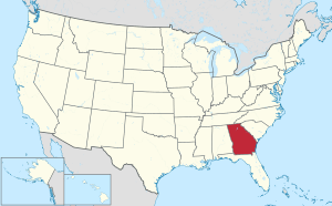 Georgia's location within the U.S. | |
| Coordinates: 30°53′N 84°35′W | |
| Country | |
| State | |
| Founded | 1823 |
| Named for | Stephen Decatur |
| Seat | Bainbridge |
| Largest city | Bainbridge |
| Area | |
| • Total | 623 sq mi (1,610 km2) |
| • Land | 597 sq mi (1,550 km2) |
| • Water | 26 sq mi (70 km2) 4.2%% |
| Population | |
| • Estimate (2019) | 26,404 |
| • Density | 47/sq mi (18/km2) |
| Time zone | UTC−5 (Eastern) |
| • Summer (DST) | UTC−4 (EDT) |
| Congressional district | 2nd |
| Website | www |
Decatur County comprises the Bainbridge, GA Micropolitan Statistical Area, which is included in the Tallahassee-Bainbridge, FL-GA Combined Statistical Area.
History
The county was created by an act of the Georgia General Assembly on December 8, 1823, from a portion of Early County.[3] Three other counties were created from land that was originally part of Decatur County.
In 1825, a portion of Decatur was used in the creation of Thomas County. In 1905, another portion of Decatur was used in the creation of part of Grady County. In 1920, the western portion of Decatur County was used to form Seminole County in its entirety.
Decatur County is named for United States Navy Commodore Stephen Decatur, a hero of the War of 1812.[4]
Geography

According to the U.S. Census Bureau, the county has a total area of 623 square miles (1,610 km2), of which 597 square miles (1,550 km2) is land and 26 square miles (67 km2) (4.2%) is water.[5]
The bulk of Decatur County, from northeast to southwest, and centered on Bainbridge, is located in the Lower Flint River sub-basin of the ACF River Basin (Apalachicola-Chattahoochee-Flint River Basin). Almost all of the county's western border is located in the Spring Creek sub-basin of the same ACF River Basin. The southwestern portion of Decatur County, centered on Attapulgus, and bordered on the west by State Route 302, is located on the Lower Ochlockonee River sub-basin of the larger Ochlockonee River basin. Finally, the county's southwestern corner, west of State Route 302, is located in the Apalachicola River sub-basin of the same larger ACF River basin.[6]
Major highways


Adjacent counties
- Miller County - north
- Mitchell County - northeast
- Baker County - northeast
- Grady County - east
- Gadsden County, Florida - south
- Seminole County - west
Demographics
| Historical population | |||
|---|---|---|---|
| Census | Pop. | %± | |
| 1830 | 3,854 | — | |
| 1840 | 5,872 | 52.4% | |
| 1850 | 8,262 | 40.7% | |
| 1860 | 11,922 | 44.3% | |
| 1870 | 15,183 | 27.4% | |
| 1880 | 19,072 | 25.6% | |
| 1890 | 19,949 | 4.6% | |
| 1900 | 29,454 | 47.6% | |
| 1910 | 29,045 | −1.4% | |
| 1920 | 31,785 | 9.4% | |
| 1930 | 23,622 | −25.7% | |
| 1940 | 22,234 | −5.9% | |
| 1950 | 23,620 | 6.2% | |
| 1960 | 25,203 | 6.7% | |
| 1970 | 22,310 | −11.5% | |
| 1980 | 25,495 | 14.3% | |
| 1990 | 25,511 | 0.1% | |
| 2000 | 28,240 | 10.7% | |
| 2010 | 27,842 | −1.4% | |
| Est. 2019 | 26,404 | [7] | −5.2% |
| U.S. Decennial Census[8] 1790-1960[9] 1900-1990[10] 1990-2000[11] 2010-2019[1] | |||
2000 census
As of the census[12] of 2000, there were 28,240 people, 10,380 households, and 7,546 families living in the county. The population density was 47 people per square mile (18/km²). There were 11,968 housing units at an average density of 20 per square mile (8/km²). The racial makeup of the county was 57.10% White, 39.91% Black or African American, 0.24% Native American, 0.33% Asian, 0.04% Pacific Islander, 1.64% from other races, and 0.74% from two or more races. 3.20% of the population were Hispanic or Latino of any race.
There were 10,380 households out of which 35.40% had children under the age of 18 living with them, 49.00% were married couples living together, 19.50% had a female householder with no husband present, and 27.30% were non-families. 24.30% of all households were made up of individuals and 10.40% had someone living alone who was 65 years of age or older. The average household size was 2.65 and the average family size was 3.14.
In the county, the population was spread out with 28.50% under the age of 18, 9.10% from 18 to 24, 28.00% from 25 to 44, 21.10% from 45 to 64, and 13.30% who were 65 years of age or older. The median age was 34 years. For every 100 females, there were 91.00 males. For every 100 females age 18 and over, there were 85.90 males.
The median income for a household in the county was $28,820, and the median income for a family was $32,635. Males had a median income of $27,180 versus $20,745 for females. The per capita income for the county was $15,063. About 19.20% of families and 22.70% of the population were below the poverty line, including 33.00% of those under age 18 and 19.20% of those age 65 or over.
2010 census
As of the 2010 United States Census, there were 27,842 people, 10,390 households, and 7,255 families living in the county.[13] The population density was 46.6 inhabitants per square mile (18.0/km2). There were 12,125 housing units at an average density of 20.3 per square mile (7.8/km2).[14] The racial makeup of the county was 54.2% white, 41.1% black or African American, 0.5% Asian, 0.4% American Indian, 2.5% from other races, and 1.2% from two or more races. Those of Hispanic or Latino origin made up 5.0% of the population.[13] In terms of ancestry, 9.8% were American, 5.9% were English, and 5.7% were Irish.[15]
Of the 10,390 households, 35.4% had children under the age of 18 living with them, 44.7% were married couples living together, 20.0% had a female householder with no husband present, 30.2% were non-families, and 26.4% of all households were made up of individuals. The average household size was 2.58 and the average family size was 3.10. The median age was 37.7 years.[13]
The median income for a household in the county was $33,297 and the median income for a family was $44,322. Males had a median income of $36,176 versus $25,750 for females. The per capita income for the county was $17,833. About 19.4% of families and 24.0% of the population were below the poverty line, including 32.9% of those under age 18 and 18.7% of those age 65 or over.[16]
Education
Communities
Cities
Town
Unincorporated communities
Ghost town
- Miriam
Politics
| Year | Republican | Democratic | Third parties |
|---|---|---|---|
| 2016 | 58.5% 6,020 | 40.1% 4,124 | 1.4% 142 |
| 2012 | 55.5% 5,824 | 43.7% 4,591 | 0.8% 85 |
| 2008 | 56.7% 5,890 | 42.6% 4,424 | 0.7% 71 |
| 2004 | 59.7% 5,348 | 39.9% 3,577 | 0.4% 31 |
| 2000 | 54.8% 4,187 | 44.4% 3,398 | 0.8% 63 |
| 1996 | 44.7% 3,035 | 47.7% 3,245 | 7.6% 517 |
| 1992 | 42.4% 3,142 | 43.1% 3,198 | 14.6% 1079 |
| 1988 | 62.0% 3,866 | 37.6% 2,348 | 0.4% 27 |
| 1984 | 60.9% 4,134 | 39.1% 2,656 | |
| 1980 | 46.8% 2,919 | 51.9% 3,242 | 1.3% 82 |
| 1976 | 40.1% 2,500 | 59.9% 3,736 | |
| 1972 | 78.2% 4,292 | 21.8% 1,196 | |
| 1968 | 10.6% 749 | 24.5% 1729 | 64.9% 4,576 |
| 1964 | 71.6% 5,060 | 28.4% 2,011 | 0.0% 1 |
| 1960 | 24.8% 918 | 75.2% 2,780 | |
| 1956 | 22.3% 1,062 | 77.7% 3,699 | |
| 1952 | 28.0% 1,001 | 72.1% 2,581 | |
| 1948 | 33.3% 757 | 53.2% 1,209 | 13.5% 306 |
| 1944 | 15.5% 294 | 84.5% 1,606 | |
| 1940 | 10.9% 217 | 89.1% 1,781 | 0.1% 2 |
| 1936 | 3.9% 79 | 95.7% 1,965 | 0.4% 9 |
| 1932 | 5.2% 65 | 93.0% 1,169 | 1.8% 23 |
| 1928 | 61.2% 1,156 | 38.8% 734 | |
| 1924 | 16.4% 151 | 69.1% 637 | 14.5% 134 |
| 1920 | 23.4% 300 | 76.6% 982 | |
| 1916 | 8.9% 116 | 88.4% 1,147 | 2.7% 35 |
| 1912 | 6.0% 34 | 88.2% 500 | 5.8% 33 |
See also
- National Register of Historic Places listings in Decatur County, Georgia
- Sowegalive.com - Bainbridge, GA News, Radio and Community Information
References
- "State & County QuickFacts". United States Census Bureau. Archived from the original on June 7, 2011. Retrieved June 21, 2014.
- "Find a County". National Association of Counties. Archived from the original on May 31, 2011. Retrieved June 7, 2011.
- Krakow, Kenneth K. (1975). Georgia Place-Names: Their History and Origins (PDF). Macon, GA: Winship Press. p. 60. ISBN 0-915430-00-2.
- Gannett, Henry (1905). The Origin of Certain Place Names in the United States. Govt. Print. Off. pp. 102.
- "US Gazetteer files: 2010, 2000, and 1990". United States Census Bureau. February 12, 2011. Retrieved April 23, 2011.
- "Georgia Soil and Water Conservation Commission Interactive Mapping Experience". Georgia Soil and Water Conservation Commission. Retrieved November 24, 2015.
- "Population and Housing Unit Estimates". Retrieved May 21, 2020.
- "U.S. Decennial Census". United States Census Bureau. Retrieved June 21, 2014.
- "Historical Census Browser". University of Virginia Library. Retrieved June 21, 2014.
- "Population of Counties by Decennial Census: 1900 to 1990". United States Census Bureau. Retrieved June 21, 2014.
- "Census 2000 PHC-T-4. Ranking Tables for Counties: 1990 and 2000" (PDF). United States Census Bureau. Retrieved June 21, 2014.
- "U.S. Census website". United States Census Bureau. Retrieved May 14, 2011.
- "DP-1 Profile of General Population and Housing Characteristics: 2010 Demographic Profile Data". United States Census Bureau. Archived from the original on February 13, 2020. Retrieved December 29, 2015.
- "Population, Housing Units, Area, and Density: 2010 - County". United States Census Bureau. Archived from the original on February 13, 2020. Retrieved December 29, 2015.
- "DP02 SELECTED SOCIAL CHARACTERISTICS IN THE UNITED STATES – 2006-2010 American Community Survey 5-Year Estimates". United States Census Bureau. Archived from the original on February 13, 2020. Retrieved December 29, 2015.
- "DP03 SELECTED ECONOMIC CHARACTERISTICS – 2006-2010 American Community Survey 5-Year Estimates". United States Census Bureau. Archived from the original on February 13, 2020. Retrieved December 29, 2015.
- Leip, David. "Dave Leip's Atlas of U.S. Presidential Elections". uselectionatlas.org. Retrieved March 19, 2018.
External links
| Wikimedia Commons has media related to Decatur County, Georgia. |
- Decatur County historical marker
- Amsterdam historical marker
- Cyrene historical marker
Places adjacent to Decatur County, Georgia | ||||||||||
|---|---|---|---|---|---|---|---|---|---|---|
| ||||||||||
Municipalities and communities of Decatur County, Georgia, United States | ||
|---|---|---|
| Cities | Map of Georgia highlighting Decatur County | |
| Town | ||
| Unincorporated communities | ||
| Ghost towns | ||
| Footnotes | ‡This populated place also has portions in an adjacent county or counties | |
| Authority control |
|
|---|