Georgia State Route 86
State Route 86 (SR 86) is a 51.3-mile-long (82.6 km) state highway that travels mostly through rural areas of the central part of the U.S. state of Georgia. The highway travels from a point southeast of East Dublin southeast to a point about halfway between Lyons and Reidsville, via Oak Park.
| ||||
|---|---|---|---|---|
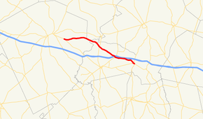 Georgia State Route 86 highlighted in red | ||||
| Route information | ||||
| Maintained by GDOT | ||||
| Length | 51.3 mi[1] (82.6 km) | |||
| Existed | 1941[2][3]–present | |||
| Major junctions | ||||
| West end | ||||
| East end | ||||
| Location | ||||
| Counties | Laurens, Treutlen, Emanuel, Toombs | |||
| Highway system | ||||
| ||||

Route description
SR 86 begins at an intersection with SR 29 southeast of East Dublin. The highway heads easterly to an intersection with SR 15/SR 78 south of Adrian. Farther to the southeast, SR 86 crosses, but does not have an interchange with, Interstate 16 (I-16) northeast of Soperton. Almost immediately afterward, US 221/SR 56 crosses the path. SR 86 parallels I-16 until just before an intersection with SR 46. The two highways form a concurrency for about 6 miles (9.7 km) to an intersection with US 1/SR 4 in Oak Park. Here, SR 46 splits off of SR 86. SR 86 travels through the city, on a former alignment of US 1/SR 4, before a four-lane bypass of the main part of Oak Park was built. At Harrington Street, SR 86 departs from the former path of US 1/SR 4. The highway then takes a more southerly turn toward its eastern terminus. There are intersections with SR 152 and SR 292 in rural Toombs County. Finally, SR 86 meets its eastern terminus at an intersection with US 280/SR 30 halfway between Lyons and Reidsville. Here, the roadway continues as Rose Hollow Road.[1]
History
The roadway that would eventually become SR 86 was proposed between 1919 and the end of 1921. It was labeled as SR 17 as a "contingent road" in Oak Park.[4][5] By the end of 1926, SR 17 and US 1 were designated on this same segment.[5][6] By the end of 1929, SR 17 was shifted to a different alignment. Its former path was redesignated as part of SR 4.[6][7] The next year, US 1 and SR 4 in Oak Park had a "completed hard surface".[7][8] About seven years later, SR 46 was established just west of Oak Park.[9][10] At the end of the year, this segment of SR 46 was under construction.[11][12] By the end of 1939, it had a completed hard surface.[13][14] A few months later, SR 160 was established from SR 78 south of Adrian to SR 46 west of Oak Park.[14][15] Later that year, SR 160's segment from south of Adrian to SR 56 northeast of Soperton had a completed hard surface. The eastern part of the highway was under construction.[15][16] By the end of 1941, all of SR 160 was redesignated as SR 86, with the portion from northeast of Soperton to west of Oak Park having a completed hard surface.[2][3] By the end of 1946, SR 46's portion just west of Oak Park was shifted to the southern part of the city, since it then had a concurrency with US 1/SR 4.[17][18] Between 1957 and the end of 1960, SR 322 was established from US 1/SR 4/SR 46 in Oak Park then south-southeast to SR 292 north of Ohoopee.[19][20] By the end of 1963, an unnumbered road was established from SR 29 southeast of East Dublin to SR 15/SR 78 south of Adrian.[20][21] Between 1963 and 1966 this road was designated as a western extension of SR 86. SR 322 was redesignated as an eastern extension of the highway, with a further extension south-southeast to US 280/SR 30 south-southeast of Ohoopee.[21][22]
Major intersections
| County | Location | mi[1] | km | Destinations | Notes |
|---|---|---|---|---|---|
| Laurens | | 0.0 | 0.0 | Western terminus | |
| Treutlen | | 13.3 | 21.4 | ||
| | 20.0 | 32.2 | |||
| | 26.9 | 43.3 | Western end of SR 46 concurrency | ||
| Emanuel | | 27.3 | 43.9 | ||
| Oak Park | 32.1 | 51.7 | Eastern end of SR 46 concurrency; former western end of US 1/SR 4 concurrency | ||
| 33.3 | 53.6 | Harrington Street south – Lyons | Former eastern end of US 1/SR 4 concurrency; former US 1 south/SR 4 south | ||
| Toombs | | 40.2 | 64.7 | ||
| Ohoopee | 46.7 | 75.2 | |||
| | 51.3 | 82.6 | Eastern terminus of SR 86; northern terminus of Rose Hollow Road | ||
1.000 mi = 1.609 km; 1.000 km = 0.621 mi
| |||||
See also
.svg.png)

References
- Google (December 3, 2019). "Overview map of SR 86" (Map). Google Maps. Google. Retrieved December 3, 2019.
- State Highway Department of Georgia (July 1, 1941). System of State Roads (PDF) (Map). Scale not given. Atlanta: State Highway Department of Georgia. OCLC 5673161. Retrieved March 28, 2017.
- State Highway Department of Georgia (January 1, 1942). System of State Roads (PDF) (Map). Scale not given. Atlanta: State Highway Department of Georgia. OCLC 5673161. Retrieved March 28, 2017.
- State Highway Department of Georgia (1920). System of State Aid Roads as Approved Representing 4800 Miles of State Aid Roads Outside the Limits of the Incorporated Towns (PDF) (Map). Scale not given. Atlanta: State Highway Department of Georgia. Retrieved March 28, 2017.
- State Highway Department of Georgia (1921). System of State Roads (PDF) (Map). Scale not given. Atlanta: State Highway Department of Georgia. Retrieved March 28, 2017.
- State Highway Department of Georgia (October 1926). System of State Roads (PDF) (Map). Scale not given. Atlanta: State Highway Department of Georgia. Retrieved March 28, 2017.
- State Highway Department of Georgia (October 1929). System of State Roads (PDF) (Map). Scale not given. Atlanta: State Highway Department of Georgia. Retrieved March 28, 2017.
- State Highway Department of Georgia (June 1930). System of State Roads (PDF) (Map). Scale not given. Atlanta: State Highway Department of Georgia. Retrieved March 28, 2017.
- State Highway Department of Georgia (April 1, 1937). System of State Roads (PDF) (Map). Scale not given. Atlanta: State Highway Department of Georgia. Retrieved March 28, 2017.
- State Highway Department of Georgia (July 1, 1937). System of State Roads (PDF) (Map). Scale not given. Atlanta: State Highway Department of Georgia. Retrieved March 28, 2017.
- State Highway Department of Georgia (October 1, 1937). System of State Roads (PDF) (Map). Scale not given. Atlanta: State Highway Department of Georgia. Retrieved March 28, 2017.
- Georgia State Highway Board (January 1, 1938). System of State Roads (PDF) (Map). Scale not given. Atlanta: State Highway Department of Georgia. OCLC 5673161. Retrieved March 28, 2017.
- State Highway Department of Georgia (October 1, 1939). System of State Roads (PDF) (Map). Scale not given. Atlanta: State Highway Department of Georgia. OCLC 5673161. Retrieved March 28, 2017.
- State Highway Department of Georgia (January 1, 1940). System of State Roads (PDF) (Map). Scale not given. Atlanta: State Highway Department of Georgia. OCLC 5673161. Retrieved March 28, 2017.
- State Highway Department of Georgia (April 1, 1940). System of State Roads (PDF) (Map). Scale not given. Atlanta: State Highway Department of Georgia. OCLC 5673161. Retrieved March 28, 2017.
- State Highway Department of Georgia (October 1, 1940). System of State Roads (PDF) (Map). Scale not given. Atlanta: State Highway Department of Georgia. OCLC 5673161. Retrieved March 28, 2017.
- State Highway Department of Georgia (January 1, 1945). System of State Roads (PDF) (Map). Scale not given. Atlanta: State Highway Department of Georgia. OCLC 5673161. Retrieved March 28, 2017.
- State Highway Department of Georgia (1946). System of State Roads (PDF) (Map). Scale not given. Atlanta: State Highway Department of Georgia. OCLC 5673161. Retrieved March 28, 2017. (Corrected to November 7, 1946.)
- State Highway Department of Georgia (1957). State Highway System and Other Principal Connecting Roads (PDF) (Map). Scale not given. Atlanta: State Highway Department of Georgia. OCLC 5673161. Retrieved March 28, 2017. (Corrected to July 1, 1957.)
- State Highway Department of Georgia (1960). State Highway System and Other Principal Connecting Roads (PDF) (Map) (1960–1961 ed.). Scale not given. Atlanta: State Highway Department of Georgia. OCLC 5673161. Retrieved March 28, 2017. (Corrected to June 1, 1960.)
- State Highway Department of Georgia (1963). State Highway System and Other Principal Connecting Roads (PDF) (Map). Scale not given. Atlanta: State Highway Department of Georgia. OCLC 5673161. Retrieved March 28, 2017. (Corrected to June 1, 1963.)
- State Highway Department of Georgia (January 1966). Official Highway Map (PDF) (Map). Scale not given. Atlanta: State Highway Department of Georgia. Retrieved March 28, 2017.