Tabuk, Kalinga
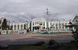
Tabuk, officially the City of Tabuk (Ilocano: Siudad ti Tabuk; Tagalog: Lungsod ng Tabuk), is a 5th class component city and capital of the province of Kalinga, Philippines. According to the 2015 census, it has a population of 110,642 people.[3]
Tabuk | |
|---|---|
| City of Tabuk | |
 City Hall | |
 Seal | |
 Map of Kalinga with Tabuk highlighted | |
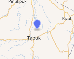
OpenStreetMap 
| |
.svg.png) Tabuk Location within the Philippines | |
| Coordinates: 17°27′00″N 121°27′30″E | |
| Country | |
| Region | Cordillera Administrative Region (CAR) |
| Province | Kalinga |
| District | Lone District |
| Founded | June 16, 1950 |
| Cityhood | June 23, 2007 (Lost cityhood in 2008 and 2010) |
| Affirmed Cityhood | February 15, 2011 |
| Barangays | 42 (see Barangays) |
| Government | |
| • Type | Sangguniang Panlungsod |
| • Mayor | Darwin C. Estrañero |
| • Vice Mayor | Bernard Glenn M. Dao-as |
| • Congressman | Allen Jesse C. Mangaoang |
| • Electorate | 62,691 voters (2019) |
| Area | |
| • Total | 700.25 km2 (270.37 sq mi) |
| Population (2015 census)[3] | |
| • Total | 110,642 |
| • Density | 160/km2 (410/sq mi) |
| • Households | 22,350 |
| Economy | |
| • Income class | 5th city income class |
| • Poverty incidence | 17.7% (2015)[4] |
| • Revenue (₱) | 778,971,527.59 (2016) |
| Time zone | UTC+8 (PST) |
| ZIP code | 3800 |
| PSGC | |
| IDD : area code | +63 (0)74 |
| Climate type | tropical rainforest climate |
| Native languages | Kalinga language Ga'dang Ilocano Tagalog |
| Website | www |
History

The former municipal district of Tabuk was transformed into a regular municipality by Republic Act No. 533, approved June 16, 1950.[5]
Cityhood
Tabuk became the Cordillera's second city after Baguio on June 23, 2007, when 17,060 voters ratified Republic Act No. 9404. On November 18, 2008, the SC voted 6-5 to revert Tabuk City, among other 15 cities', status back to municipalities. However, on December 21, 2009, the Supreme Court reversed its first decision, returning the 16 back to cities. It contended that these cities were not covered by Republic Act 9009 – the law enacted in June 2001 that increased the income requirement for cities from P20 million to P100 million – as proven by transcripts of Senate debates while crafting RA 9009.
But on August 24, 2010, the SC made a reversal again, reinstating its November 2008 decision. It concluded that the Local Government Code as amended by RA 9009 should be followed, without exception.
Finally, on February 15, 2011, the 16 became cities again after the SC made a third reversal. This time, the High Court acknowledged, among others, that the 16 cityhood laws amended RA 9009, effectively amending the Local Government Code itself.
Geography
Tabuk City is 461 kilometres (286 mi) from Manila via Cauayan/Roxas and 443 kilometres (275 mi) via San Mateo/Roxas.
Barangays
Tabuk is politically subdivided into 42 barangays. [2]
- Agbannawag
- Amlao
- Appas
- Bado Dangwa
- Bagumbayan
- Balawag
- Balong
- Bantay
- Bulanao
- Bulanao Norte
- Bulo
- Cabaritan
- Cabaruan
- Calaccad
- Calanan
- Casigayan
- Cudal
- Dagupan Centro (Poblacion)
- Dagupan West
- Dilag
- Dupag
- Gobgob
- Guilayon
- Ipil
- Lacnog
- Lanna
- Laya East
- Laya West
- Lucog
- Magnao
- Magsaysay
- Malalao
- Malin-awa
- Masablang
- Nambaran
- Nambucayan
- Naneng
- New Tanglag
- San Juan
- San Julian
- Suyang
- Tuga
Climate
| Climate data for Tabuk City | |||||||||||||
|---|---|---|---|---|---|---|---|---|---|---|---|---|---|
| Month | Jan | Feb | Mar | Apr | May | Jun | Jul | Aug | Sep | Oct | Nov | Dec | Year |
| Average high °C (°F) | 25 (77) |
27 (81) |
29 (84) |
32 (90) |
31 (88) |
31 (88) |
30 (86) |
30 (86) |
30 (86) |
29 (84) |
27 (81) |
26 (79) |
29 (84) |
| Average low °C (°F) | 20 (68) |
20 (68) |
21 (70) |
23 (73) |
24 (75) |
24 (75) |
24 (75) |
24 (75) |
24 (75) |
23 (73) |
23 (73) |
21 (70) |
23 (73) |
| Average precipitation mm (inches) | 78 (3.1) |
60 (2.4) |
49 (1.9) |
51 (2.0) |
194 (7.6) |
197 (7.8) |
209 (8.2) |
226 (8.9) |
185 (7.3) |
180 (7.1) |
143 (5.6) |
183 (7.2) |
1,755 (69.1) |
| Average rainy days | 15.6 | 12.5 | 11.8 | 12.5 | 21.0 | 23.3 | 25.2 | 26.1 | 22.6 | 17.1 | 16.7 | 19.6 | 224 |
| Source: Meteoblue [6] | |||||||||||||
Demographics
|
| |||||||||||||||||||||||||||||||||||||||||||||
| Source: Philippine Statistics Authority[3][7][8][9] | ||||||||||||||||||||||||||||||||||||||||||||||
In the 2015 census, the population of Tabuk was 110,642 people,[3] with a density of 160 inhabitants per square kilometre or 410 inhabitants per square mile.
Languages
Tabuk is home to two indigenous languages, the Kina-linga language which is used throughout the Kalinga province a town in Mountain Province, and the Malaweg language which is used in Tabuk and southwest Cagayan province. In the 1970s, Ilokano and Kankanaey migrants came to the province and imported the Ilokano and Kankanaey languages during the martial law era.
References
- "City". Quezon City, Philippines: Department of the Interior and Local Government. Retrieved 30 May 2013.
- "Province: Kalinga". PSGC Interactive. Quezon City, Philippines: Philippine Statistics Authority. Retrieved 12 November 2016.
- Census of Population (2015). "Cordillera Administrative Region (CAR)". Total Population by Province, City, Municipality and Barangay. PSA. Retrieved 20 June 2016.
- "PSA releases the 2015 Municipal and City Level Poverty Estimates". Quezon City, Philippines. Retrieved 12 October 2019.
- "R.A. No. 533: An Act to Convert the Municipal District of Tabuk, Sub-province of Kalinga, Mountain Province, into a Regular Municipality to be Known as the Municipality of Tabuk". PhilippineLaw.info. Archived from the original on 4 January 2015. Retrieved 4 January 2015.
- "Tabuk: Average Temperatures and Rainfall". Meteoblue. Retrieved 8 March 2020.
- Census of Population and Housing (2010). "Cordillera Administrative Region (CAR)". Total Population by Province, City, Municipality and Barangay. NSO. Retrieved 29 June 2016.
- Censuses of Population (1903–2007). "Cordillera Administrative Region (CAR)". Table 1. Population Enumerated in Various Censuses by Province/Highly Urbanized City: 1903 to 2007. NSO.
- "Province of Kalinga". Municipality Population Data. Local Water Utilities Administration Research Division. Retrieved 17 December 2016.
External links
| Wikivoyage has a travel guide for Tabuk City. |
| Wikimedia Commons has media related to Tabuk, Kalinga. |
