Pulaski County, Georgia
Pulaski County is a county located in the central portion of the U.S. state of Georgia. As of the 2010 census, the population was 12,010.[1] The county seat is Hawkinsville.[2]
Pulaski County | |
|---|---|
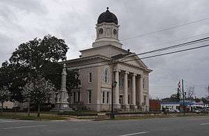 Pulaski County Courthouse | |
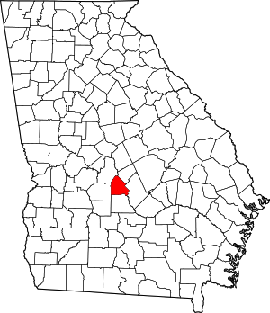 Location within the U.S. state of Georgia | |
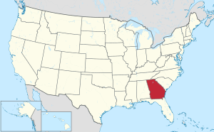 Georgia's location within the U.S. | |
| Coordinates: 32°14′N 83°28′W | |
| Country | |
| State | |
| Founded | December 13, 1808 |
| Named for | Kazimierz Pułaski |
| Seat | Hawkinsville |
| Largest city | Hawkinsville |
| Area | |
| • Total | 251 sq mi (650 km2) |
| • Land | 249 sq mi (640 km2) |
| • Water | 2.2 sq mi (6 km2) 0.9%% |
| Population | |
| • Estimate (2018) | 11,069 |
| • Density | 48/sq mi (19/km2) |
| Time zone | UTC−5 (Eastern) |
| • Summer (DST) | UTC−4 (EDT) |
| Congressional district | 8th |
| Website | hawkinsville-pulaski |
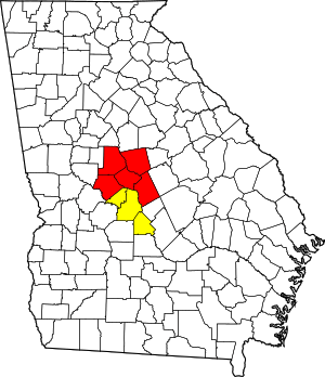
Pulaski County is included in the Warner Robins, GA Metropolitan Statistical Area, which is also included in the Macon-Warner Robins, GA Combined Statistical Area.
History
Pulaski County was created by an act of the Georgia General Assembly on December 13, 1808 from a portion of Laurens County.[3] In the antebellum years, it was developed for cotton cultivation and is part of the Black Belt of Georgia, an arc of highly fertile soil.
In 1870, Dodge County was partially created from a section of Pulaski County by another legislative act. In 1912, the northwestern half of Pulaski County was used to create Bleckley County via a constitutional amendment approved by Georgia voters.
The County was named for Count Kazimierz Pułaski of Poland who fought and died for United States independence in the American Revolutionary War.
The county population fell by more than half from 1910 to 1930, as residents moved to cities. African Americans especially joined the Great Migration to northern and midwestern cities, both to gain work and to escape the Jim Crow racial oppression of the South.
Government and infrastructure
Pulaski County is one of only a handful of counties in Georgia with the sole commissioner form of county government, in which the county is governed by a single elected official. Georgia is the only state that permits this form of government. In 2018, Jenna Mashburn was elected to the office of sole commissioner.[4]
The Georgia Department of Corrections operates the Pulaski State Prison in Hawkinsville.[5]
Politics
| Year | Republican | Democratic | Third parties |
|---|---|---|---|
| 2016 | 67.6% 2,437 | 30.6% 1,104 | 1.8% 64 |
| 2012 | 66.3% 2,444 | 33.1% 1,219 | 0.6% 22 |
| 2008 | 64.4% 2,553 | 34.8% 1,377 | 0.8% 32 |
| 2004 | 62.6% 2,202 | 36.8% 1,294 | 0.6% 21 |
| 2000 | 57.4% 1,922 | 41.5% 1,390 | 1.0% 34 |
| 1996 | 39.5% 1,196 | 51.3% 1,554 | 9.2% 280 |
| 1992 | 31.2% 1,075 | 50.9% 1,756 | 18.0% 620 |
| 1988 | 48.5% 1,400 | 51.1% 1,476 | 0.4% 12 |
| 1984 | 51.2% 1,509 | 48.8% 1,440 | |
| 1980 | 35.7% 1,153 | 61.8% 1,997 | 2.5% 82 |
| 1976 | 17.3% 485 | 82.7% 2,318 | |
| 1972 | 81.6% 1,966 | 18.4% 444 | |
| 1968 | 22.2% 595 | 19.2% 514 | 58.6% 1,569 |
| 1964 | 64.9% 1,768 | 35.0% 953 | 0.2% 5 |
| 1960 | 22.4% 334 | 77.6% 1,156 | |
| 1956 | 10.7% 171 | 89.3% 1,422 | |
| 1952 | 9.5% 165 | 90.5% 1,572 | |
| 1948 | 20.3% 161 | 71.4% 567 | 8.3% 66 |
| 1944 | 8.5% 55 | 91.5% 592 | |
| 1940 | 7.3% 38 | 91.9% 478 | 0.8% 4 |
| 1936 | 4.5% 38 | 94.6% 808 | 0.9% 8 |
| 1932 | 1.4% 14 | 98.6% 973 | |
| 1928 | 14.1% 105 | 85.9% 639 | |
| 1924 | 5.9% 29 | 89.8% 442 | 4.3% 21 |
| 1920 | 14.4% 57 | 85.6% 338 | |
| 1916 | 5.5% 23 | 91.4% 383 | 3.1% 13 |
| 1912 | 3.4% 39 | 95.1% 1,080 | 1.5% 17 |
Geography
According to the U.S. Census Bureau, the county has a total area of 251 square miles (650 km2), of which 249 square miles (640 km2) is land and 2.2 square miles (5.7 km2) (0.9%) is water.[7] The entirety of Pulaski County is located in the Lower Ocmulgee River sub-basin of the Altamaha River basin.[8]
Major highways


Adjacent counties
- Bleckley County - northeast
- Dodge County - east
- Wilcox County - south
- Dooly County - west
- Houston County - northwest
Demographics
| Historical population | |||
|---|---|---|---|
| Census | Pop. | %± | |
| 1810 | 2,093 | — | |
| 1820 | 5,283 | 152.4% | |
| 1830 | 4,906 | −7.1% | |
| 1840 | 5,389 | 9.8% | |
| 1850 | 6,627 | 23.0% | |
| 1860 | 8,744 | 31.9% | |
| 1870 | 11,940 | 36.6% | |
| 1880 | 14,058 | 17.7% | |
| 1890 | 16,559 | 17.8% | |
| 1900 | 18,489 | 11.7% | |
| 1910 | 22,835 | 23.5% | |
| 1920 | 11,587 | −49.3% | |
| 1930 | 9,005 | −22.3% | |
| 1940 | 9,829 | 9.2% | |
| 1950 | 8,808 | −10.4% | |
| 1960 | 8,204 | −6.9% | |
| 1970 | 8,066 | −1.7% | |
| 1980 | 8,950 | 11.0% | |
| 1990 | 8,108 | −9.4% | |
| 2000 | 9,588 | 18.3% | |
| 2010 | 12,010 | 25.3% | |
| Est. 2018 | 11,069 | [9] | −7.8% |
| U.S. Decennial Census[10] 1790-1960[11] 1900-1990[12] 1990-2000[13] 2010-2013[1] | |||
As of the 2010 United States Census, there were 12,010 people, 4,475 households, and 3,010 families residing in the county.[14] The population density was 48.2 inhabitants per square mile (18.6/km2). There were 5,151 housing units at an average density of 20.7 per square mile (8.0/km2).[15] The racial makeup of the county was 63.9% white, 31.8% black or African American, 0.9% Asian, 0.3% American Indian, 1.9% from other races, and 1.0% from two or more races. Those of Hispanic or Latino origin made up 3.9% of the population.[14] In terms of ancestry, 21.3% were American, 11.3% were English, 7.6% were Irish, and 6.2% were German.[16]
Of the 4,475 households, 30.6% had children under the age of 18 living with them, 45.3% were married couples living together, 17.6% had a female householder with no husband present, 32.7% were non-families, and 29.3% of all households were made up of individuals. The average household size was 2.40 and the average family size was 2.96. The median age was 41.1 years.[14]
The median income for a household in the county was $36,262 and the median income for a family was $46,850. Males had a median income of $34,154 versus $21,073 for females. The per capita income for the county was $16,621. About 8.5% of families and 11.6% of the population were below the poverty line, including 7.6% of those under age 18 and 10.6% of those age 65 or over.[17]
Communities
- Finleyson
- Goose Neck
- Hartford
- Hawkinsville
- Wallace
References
- "State & County QuickFacts". United States Census Bureau. Archived from the original on December 5, 2015. Retrieved February 18, 2014.
- "Find a County". National Association of Counties. Retrieved June 7, 2011.
- Krakow, Kenneth K. (1975). Georgia Place-Names: Their History and Origins (PDF). Macon, GA: Winship Press. p. 182. ISBN 0-915430-00-2.
- Garrett, Miles (December 4, 2018). "'Thank you so much': Mashburn to serve as Pulaski County's sole commissioner". WGXA. Retrieved February 26, 2019.
- "Pulaski State Prison Archived 2011-05-23 at the Wayback Machine." Georgia Department of Corrections. Retrieved on September 14, 2010.
- Leip, David. "Dave Leip's Atlas of U.S. Presidential Elections". uselectionatlas.org. Retrieved March 22, 2018.
- "US Gazetteer files: 2010, 2000, and 1990". United States Census Bureau. February 12, 2011. Retrieved April 23, 2011.
- "Georgia Soil and Water Conservation Commission Interactive Mapping Experience". Georgia Soil and Water Conservation Commission. Retrieved November 27, 2015.
- "Population and Housing Unit Estimates". Retrieved July 31, 2019.
- "U.S. Decennial Census". United States Census Bureau. Retrieved June 25, 2014.
- "Historical Census Browser". University of Virginia Library. Retrieved June 25, 2014.
- "Population of Counties by Decennial Census: 1900 to 1990". United States Census Bureau. Retrieved June 25, 2014.
- "Census 2000 PHC-T-4. Ranking Tables for Counties: 1990 and 2000" (PDF). United States Census Bureau. Retrieved June 25, 2014.
- "DP-1 Profile of General Population and Housing Characteristics: 2010 Demographic Profile Data". United States Census Bureau. Archived from the original on February 13, 2020. Retrieved December 30, 2015.
- "Population, Housing Units, Area, and Density: 2010 - County". United States Census Bureau. Archived from the original on February 13, 2020. Retrieved December 30, 2015.
- "DP02 SELECTED SOCIAL CHARACTERISTICS IN THE UNITED STATES – 2006-2010 American Community Survey 5-Year Estimates". United States Census Bureau. Archived from the original on February 13, 2020. Retrieved December 30, 2015.
- "DP03 SELECTED ECONOMIC CHARACTERISTICS – 2006-2010 American Community Survey 5-Year Estimates". United States Census Bureau. Archived from the original on February 13, 2020. Retrieved December 30, 2015.
