List of listed buildings in Kirkpatrick Durham, Dumfries and Galloway
This is a list of listed buildings in the civil parish of Kirkpatrick Durham in Dumfries and Galloway, Scotland.
List
| Name | Location | Date Listed | Grid Ref. [note 1] | Geo-coordinates | Notes | LB Number [note 2] | Image |
|---|---|---|---|---|---|---|---|
| Kirkpatrick-Durham, 1 Victoria Street | 55°00′41″N 3°53′52″W | Category B | 10184 |  | |||
| Kirkpatrick-Durham, 45 And 47 Victoria Street | 55°00′41″N 3°53′39″W | Category B | 10185 | | |||
| Kirkpatrick-Durham, 50 Victoria Street | 55°00′42″N 3°53′39″W | Category C(S) | 10187 | | |||
| Walton Park Stables, Dovecot, Horsemill And Walled Garden | 55°01′03″N 3°56′19″W | Category B | 10193 | | |||
| Walton Park Lodge | 55°01′06″N 3°56′05″W | Category B | 10194 | | |||
| Durhamhill House And Flanking Steadings | 55°00′49″N 3°53′31″W | Category B | 9670 | | |||
| Brooklands, Ornamental Walling Opposite Brooklands Lodge | 55°02′08″N 3°51′16″W | Category B | 9666 | | |||
| Corsock, Signpost At Junction Of A712 And B794 | 55°03′35″N 3°55′52″W | Category B | 50001 | | |||
| Brooklands House And Walled Garden | 55°02′18″N 3°51′45″W | Category B | 10176 | | |||
| Kirkpatrick-Durham, St David's Street Schoolhouse | 55°00′50″N 3°53′45″W | Category C(S) | 10183 | | |||
| Kilquhanity School | 55°00′51″N 3°55′55″W | Category B | 9656 | | |||
| Kirkpatrick-Durham Parish Church (Church Of Scotland) And Churchyard | 55°00′32″N 3°53′58″W | Category B | 9657 | | |||
| Kirkpatrick-Durham, Beechgrove | 55°00′51″N 3°53′45″W | Category C(S) | 9658 | | |||
| Brooklands Lodge | 55°02′08″N 3°51′18″W | Category B | 9665 | | |||
| Crocketford, The Toll Cottage | 55°02′09″N 3°49′47″W | Category B | 9669 | | |||
| Old Bridge Of Urr, Signpost At B794 Junction | 54°59′22″N 3°54′44″W | Category B | 50002 | | |||
| Kirkpatrick-Durham 10 Victoria Street, Crown Hotel | 55°00′42″N 3°53′49″W | Category B | 10186 | | |||
| Old Bridge Of Urr | 54°59′20″N 3°54′53″W | Category B | 10190 | | |||
| Old Bridge Of Urr Mill | 54°59′20″N 3°54′49″W | Category A | 10191 | 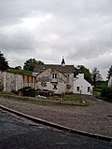 | |||
| Kirkpatrick-Durham, 1 St David's Street, Walton Road, Post Office, Savings Bank And Masonic Hall | 55°00′42″N 3°53′53″W | Category B | 9659 | | |||
| Chipperkyle Stables And Dovecot | 55°00′00″N 3°54′16″W | Category B | 9668 | | |||
| Kirkpatrick-Durham, 52 Victoria Street | 55°00′42″N 3°53′38″W | Category C(S) | 10188 | | |||
| Kirkpatrick-Durham, 54 Victoria Street | 55°00′42″N 3°53′37″W | Category B | 10189 | | |||
| Walton Park | 55°01′03″N 3°56′15″W | Category B | 10192 | | |||
| Chipperkyle House | 54°59′58″N 3°54′11″W | Category B | 9667 | | |||
| Kirkpatrick-Durham, 39 St David's Street | 55°00′49″N 3°53′48″W | Category C(S) | 10182 | | |||
| Glaisters Bridge | 55°06′00″N 3°57′08″W | Category B | 9654 | | |||
| Holmhead | 55°03′48″N 3°55′55″W | Category B | 9655 | | |||
| Durham House (Former Manse) | 55°00′38″N 3°53′58″W | Category B | 9660 | | |||
| Kirkpatrick-Durham 37 St David's Street | 55°00′49″N 3°53′48″W | Category B | 9661 | |
Key
The scheme for classifying buildings in Scotland is:
- Category A: "buildings of national or international importance, either architectural or historic; or fine, little-altered examples of some particular period, style or building type."[1]
- Category B: "buildings of regional or more than local importance; or major examples of some particular period, style or building type, which may have been altered."[1]
- Category C: "buildings of local importance; lesser examples of any period, style, or building type, as originally constructed or moderately altered; and simple traditional buildings which group well with other listed buildings."[1]
In March 2016 there were 47,288 listed buildings in Scotland. Of these, 8% were Category A, and 50% were Category B, with the remaining 42% being Category C.[2]
Notes
- Sometimes known as OSGB36, the grid reference (where provided) is based on the British national grid reference system used by the Ordnance Survey.
• "Guide to National Grid". Ordnance Survey. Retrieved 2007-12-12.
• "Get-a-map". Ordnance Survey. Retrieved 2007-12-17. - Historic Environment Scotland assign a unique alphanumeric identifier to each designated site in Scotland, for listed buildings this always begins with "LB", for example "LB12345".
gollark: (well, not *everyone*, but lots)
gollark: People have art on their walls and whatnot.
gollark: People eat nice-tasting food instead of nutrition paste.
gollark: We have buildings other than generic grey cubes, because despite beauty not really being a rational thing to care about in pursuit of common goals (other than just "happiness" or whatever), *people care*.
gollark: Many things are irrational, and yet people are still care about that.
References
- All entries, addresses and coordinates are based on data from Historic Scotland. This data falls under the Open Government Licence
- "What is Listing?". Historic Environment Scotland. Retrieved 29 May 2018.
- Scotland's Historic Environment Audit 2016 (PDF). Historic Environment Scotland and the Built Environment Forum Scotland. pp. 15–16. Retrieved 29 May 2018.
This article is issued from Wikipedia. The text is licensed under Creative Commons - Attribution - Sharealike. Additional terms may apply for the media files.