List of listed buildings in Dumfries
List
| Name | Location | Date Listed | Grid Ref. [note 1] | Geo-coordinates | Notes | LB Number [note 2] | Image |
|---|---|---|---|---|---|---|---|
| Newbridge, Roadbridge Over Cluden Water (On Former Line Of A76) | 55°05′43″N 3°38′55″W | Category B | 26290 |  | |||
| Newbridge, Embassy Hotel, Bothy At Former Stables | 55°05′42″N 3°39′00″W | Category B | 26294 | | |||
| Nith Bank, Nith Bank Hospital, Terrace, North Lodge And Detached Blocks To North East | 55°03′45″N 3°36′08″W | Category B | 26295 | | |||
| Nith Bank, Beechwood Bank | 55°03′41″N 3°36′13″W | Category C(S) | 26302 | | |||
| Nith Bank, The Grange And Gatepiers | 55°03′40″N 3°36′13″W | Category C(S) | 26303 | | |||
| 8-22 Nunholm Road (Even Numbers) Albany Place | 55°04′36″N 3°36′27″W | Category B | 26309 | | |||
| 28 Queen Street | 55°04′05″N 3°36′30″W | Category B | 26314 | | |||
| 109 Queensberry Street, (Both Ranges) Opus And Patties And Bracken Fabrics | 55°04′13″N 3°36′41″W | Category B | 26319 | | |||
| 52 Queensberry Street And 3 Great King Street, Bank Of Scotland | 55°04′10″N 3°36′38″W | Category B | 26321 | | |||
| 84-94 Queensberry Street (Even Numbers) And Courtyard Buildings To Rear | 55°04′12″N 3°36′39″W | Category B | 26323 | | |||
| 136-142 Queensberry Street (Even Numbers) And 2 Academy Street | 55°04′15″N 3°36′41″W | Category C(S) | 26325 | | |||
| St Michael's Bridge (Over River Nith) | 55°03′51″N 3°36′36″W | Category B | 26334 | 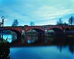 | |||
| Shakespeare Street, Towers Of Old St Andrews Cathedral | 55°04′07″N 3°36′26″W | Category B | 26342 | | |||
| Station Road, Dumfries Station, Including Platforms, Lamp Standards, Footbridge, Chargeman's Hut, Railings, Gates And Gatepiers | 55°04′19″N 3°36′15″W | Category B | 26343 | 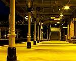 | |||
| 1-13 Terregles Street And 2 Laurieknowe | 55°04′06″N 3°37′14″W | Category C(S) | 26345 | | |||
| Troqueer Road, Rosefield Mills | 55°03′47″N 3°36′32″W | Category B | 26348 |  | |||
| 1-8 Victoria Terrace, (Inclusive Numbers) And 1 Moffat Road And Garden Terrace Balustrades | 55°04′23″N 3°36′03″W | Category B | 26352 | | |||
| Whitesands, Suspension Foot Bridge | 55°03′54″N 3°36′37″W | Category B | 26355 | 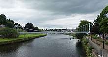 | |||
| Glencaple Road, Castledykes View And Drybridge Over Wallace's Loaning, Garden Walls And Gatepiers | 55°03′29″N 3°36′09″W | Category B | 26212 | 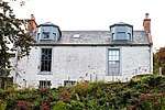 | |||
| 55 High Street | 55°04′03″N 3°36′37″W | Category C(S) | 26216 | | |||
| 117 High Street | 55°04′07″N 3°36′39″W | Category C(S) | 26224 | | |||
| 119, 121 High Street | 55°04′07″N 3°36′39″W | Category C(S) | 26225 | | |||
| 96, 98, 100 High Street | 55°04′06″N 3°36′36″W | Category B | 26231 | | |||
| 136, 140 High Street/16, 17 Queensberry Square, Former Trades Hall | 55°04′08″N 3°36′38″W | Category A | 26234 | | |||
| 178, 180, 182, 184 Irish Street And 56 Buccleuch Street | 55°04′12″N 3°36′50″W | Category C(S) | 26253 | | |||
| Johnstone Park, 1-10 Carruthers Cottages (Inclusive Numbers) | 55°03′41″N 3°36′03″W | Category B | 26256 | | |||
| 4-12 Laurieknowe (Even Numbers) | 55°04′05″N 3°37′14″W | Category B | 26260 | | |||
| 42, 44, 46 Laurieknowe | 55°03′59″N 3°37′23″W | Category C(S) | 26267 | | |||
| 52, 54, 56 Laurieknowe | 55°03′59″N 3°37′24″W | Category C(S) | 26269 | | |||
| 98, 104, 106, 112 Loreburn Street | 55°04′15″N 3°36′36″W | Category C(S) | 26272 | | |||
| Loreburn Street, Loreburn United Free Church | 55°04′15″N 3°36′36″W | Category C(S) | 26273 | | |||
| 19, 21, 23, 25 Lovers Walk (And Gatepiers) | 55°04′21″N 3°36′27″W | Category C(S) | 26276 | | |||
| Maxwell Street St Benedict's Convent | 55°03′57″N 3°37′10″W | Category B | 26281 | | |||
| 53 Moffat Road, Greystone And Stables And Gatepiers | 55°04′32″N 3°35′59″W | Category B | 26285 | | |||
| 12 Castle Street | 55°04′13″N 3°36′47″W | Category B | 26121 | | |||
| 14-24 Castle Street (Even Numbers) | 55°04′14″N 3°36′47″W | Category A | 26122 | | |||
| 1 Charlotte Street | 55°04′11″N 3°36′56″W | Category B | 26125 | | |||
| Church Street, 1-5 Corberry Terrace (Inclusive) | 55°03′54″N 3°36′50″W | Category B | 26139 | | |||
| Craigs Road, St Joseph's College, Gatepiers Near Mount St Michael's | 55°03′48″N 3°36′06″W | Category B | 26145 | | |||
| Craigs Road, St Joseph's College, Chapel And Freestanding Lamp | 55°03′50″N 3°36′01″W | Category B | 26148 | | |||
| Dock Park Bandstand | 55°03′45″N 3°36′22″W | Category B | 26153 | 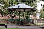 | |||
| 2 Edinburgh Road, Elmbank Lodge And Gatepiers | 55°04′22″N 3°36′33″W | Category B | 26155 | | |||
| 1, 3 English Street And 84-94 High Street (Even Numbers) | 55°04′05″N 3°36′36″W | Category B | 26160 | | |||
| 9, 9A English Street | 55°04′06″N 3°36′35″W | Category C(S) | 26162 | | |||
| 33, 35, 37 English Street | 55°04′07″N 3°36′33″W | Category C(S) | 26166 | | |||
| Dobie's Wynd To Rear Of 33-7 English Street | 55°04′07″N 3°36′34″W | Category C(S) | 26167 | | |||
| 47, 49, 51, 53 English Street Corner Of Loreburn Street | 55°04′07″N 3°36′32″W | Category B | 26169 | | |||
| 8 English Street, Bank Of Scotland | 55°04′05″N 3°36′34″W | Category B | 26176 | | |||
| 20, 22 English Street And 1-7 Queen Street (Odd Numbers) | 55°04′06″N 3°36′33″W | Category C(S) | 26180 | | |||
| 17, 19, 21 Friars Vennel | 55°04′08″N 3°36′52″W | Category C(S) | 26191 | | |||
| 71, 75 Friars Vennel And 161 Irish Street | 55°04′10″N 3°36′49″W | Category B | 26192 | | |||
| 30-36 Friars Vennel, (Even Numbers) | 55°04′08″N 3°36′51″W | Category C(S) | 26194 | | |||
| 35, 37 George Street | 55°04′15″N 3°36′52″W | Category B | 26202 | | |||
| Academy Street, Dumfries Academy Including 1936 Addition, Link Building, Boundary Wall, Gatepiers, Steps And Terraces | 55°04′19″N 3°36′40″W | Category B | 26077 | 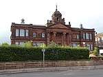 | |||
| 6 And A Half-10 Assembly Street (Even Nos) | 55°04′02″N 3°36′38″W | Category C(S) | 26081 | | |||
| 17, 19 Bank Street, Royal Bank Of Scotland | 55°04′05″N 3°36′43″W | Category B | 26084 | | |||
| 23 Bank Street 96 Irish Street Clydesdale Bank | 55°04′05″N 3°36′42″W | Category B | 26085 | | |||
| 10 Bank Street | 55°04′04″N 3°36′43″W | Category C(S) | 26089 | | |||
| Bankend Road, St Michael's (Formerly St Michael's Manse) | 55°03′38″N 3°36′05″W | Category B | 26093 | | |||
| 21, 23, 25, 27 Buccleuch Street | 55°04′11″N 3°36′57″W | Category B | 26098 | | |||
| Buccleuch Street, Nithsdale District Offices | 55°04′13″N 3°36′51″W | Category C(S) | 26099 | | |||
| 10, 12 Buccleuch Street | 55°04′10″N 3°36′58″W | Category C(S) | 26104 | | |||
| 42, 44 Buccleuch Street | 55°04′11″N 3°36′53″W | Category B | 26109 | | |||
| 25-37 Castle Street (Odd Numbers) | 55°04′14″N 3°36′49″W | Category A | 26118 | | |||
| The Crichton, Eskdale House | 55°02′51″N 3°35′39″W | Category C(S) | 6700 | | |||
| The Crichton, Hestan House | 55°02′56″N 3°35′35″W | Category C(S) | 6702 | | |||
| The Crichton, Kindar And Merrick | 55°02′59″N 3°35′31″W | Category C(S) | 6703 | | |||
| Ladyfield West (Formerly Hannayfield) | 55°03′13″N 3°36′05″W | Category A | 3829 | | |||
| Midpark (Crichton Farm) | 55°03′09″N 3°35′18″W | Category C(S) | 3833 | | |||
| Craigs House | 55°03′20″N 3°34′24″W | Category B | 3838 | | |||
| Heathall Uniroyal Factory | 55°05′45″N 3°35′06″W | Category B | 3819 | | |||
| The Crichton, Boundary Walls, Railings, Gatepiers And Gates Along Bankend Road And Glencaple Road | 55°02′54″N 3°35′51″W | Category C(S) | 50999 | | |||
| 24 Nith Place | 55°04′00″N 3°36′34″W | Category A | 26305 | | |||
| 30, 34 Queen Street | 55°04′05″N 3°36′30″W | Category B | 26315 | | |||
| 7 And A Half St Andrew Street | 55°04′13″N 3°36′43″W | Category B | 26331 | | |||
| Shakespeare Street, Theatre Royal | 55°04′05″N 3°36′27″W | Category B | 26341 | 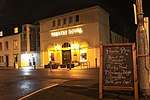 | |||
| 42 Terregles Street, Palmerston House, Gatepiers And Garden Walls | 55°04′09″N 3°37′21″W | Category B | 26347 | | |||
| 3 Whitesands | 55°04′09″N 3°36′58″W | Category C(S) | 26357 | | |||
| 32 Whitesands, The Poachers Rest | 55°04′06″N 3°36′53″W | Category C(S) | 26358 | | |||
| 1, 5 Glasgow Street | 55°04′07″N 3°38′05″W | Category B | 26210 |  | |||
| High Street, Midsteeple | 55°04′09″N 3°36′39″W | Category A | 26215 |  | |||
| 83, 85, 87 High Street | 55°04′05″N 3°36′38″W | Category C(S) | 26219 | | |||
| 123, 125, 127 High Street | 55°04′07″N 3°36′40″W | Category B | 26226 | | |||
| 1, 2, 3, Hope Place | 55°04′06″N 3°37′13″W | Category B | 26238 | | |||
| 29 Irish Street And 92 Whitesands Including Garden And Courtyard Walls, Outbuildings And Gatepiers | 55°03′59″N 3°36′39″W | Category A | 26240 |  | |||
| 61 Irish Street, Albert Club | 55°04′01″N 3°36′41″W | Category B | 26241 | | |||
| 63, 65 Irish Street And 7 Assembly Street | 55°04′02″N 3°36′41″W | Category B | 26242 | | |||
| 133, 135 Irish Street | 55°04′08″N 3°36′46″W | Category C(S) | 26245 | | |||
| Johnstone Park, 1-6 Johnstone Cottages (Inclusive Numbers) | 55°03′40″N 3°36′02″W | Category B | 26257 | | |||
| Kellwood Place, Essex Park And Gatepiers | 55°04′02″N 3°35′06″W | Category B | 26258 | | |||
| Laurieknowe, Ymca, Y2 Centre (Former Maxwelltown Free Church) | 55°04′03″N 3°37′20″W | Category B | 26263 | | |||
| 30 Laurieknowe | 55°04′01″N 3°37′20″W | Category B | 26266 | | |||
| 48, 50 Laurieknowe | 55°03′59″N 3°37′23″W | Category C(S) | 26268 | | |||
| 122 Loreburn Street | 55°04′16″N 3°36′37″W | Category C(S) | 26274 | | |||
| Church Place, Burns' Statue | 55°04′12″N 3°36′44″W | Category B | 26133 | 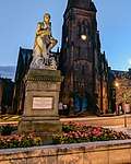 | |||
| Church Street, 3, 4 Corberry Place | 55°03′52″N 3°36′49″W | Category C(S) | 26138 | | |||
| Craigs Road, St Joseph's College Presbytery | 55°03′49″N 3°36′00″W | Category B | 26147 | | |||
| Dalbeattie Road, Macgowan Memorial Fountain | 55°03′55″N 3°37′30″W | Category B | 26151 | | |||
| 19, 21, 23 English Street | 55°04′07″N 3°36′34″W | Category B | 26164 | | |||
| 103, 105, 107 English Street | 55°04′09″N 3°36′26″W | Category B | 26171 | | |||
| English Street, Kirkbank | 55°04′12″N 3°36′21″W | Category B | 26175 | | |||
| 18 English Street, 2-6 Queen Street (Even Numbers) | 55°04′06″N 3°36′34″W | Category C(S) | 26179 | | |||
| 30, 32 English Street | 55°04′06″N 3°36′33″W | Category C(S) | 26181 | | |||
| 102, 104 English Street | 55°04′08″N 3°36′26″W | Category C(S) | 26187 | | |||
| George Street, Former Freemasons Hall | 55°04′13″N 3°36′58″W | Category B | 26201 |  | |||
| George Street, St George's Church (Church Of Scotland) | 55°04′16″N 3°36′48″W | Category B | 26206 |  | |||
| 1 Georgetown Road, Dunibert/196 Annan Road, Rowanlea | 55°04′10″N 3°35′12″W | Category C(S) | 26208 | | |||
| 1 Bank Street 66 Whitesands Coach And Horses Inn | 55°04′04″N 3°36′46″W | Category C(S) | 26082 | | |||
| 33-41 Bank Street (Odd Numbers) | 55°04′06″N 3°36′41″W | Category B | 26086 | | |||
| 17 Buccleuch Street | 55°04′10″N 3°36′58″W | Category C(S) | 26097 | | |||
| 75, 77, 79 Buccleuch Street | 55°04′13″N 3°36′50″W | Category B | 26100 | | |||
| Netherwood House Gatepiers On Main Drive And At Lodge | 55°02′20″N 3°35′09″W | Category B | 3834 | | |||
| Brownrig Farmhouse And Gatepiers | 55°04′36″N 3°34′34″W | Category C(S) | 3836 | | |||
| Netherwood Mains Farmhouse And Gatepiers To North (Garden Access) | 55°02′09″N 3°35′25″W | Category B | 3822 | | |||
| Market Square, Brigend Theatre | 55°04′04″N 3°37′05″W | Category C(S) | 51408 | | |||
| Newbridge, Smithy | 55°05′40″N 3°38′53″W | Category C(S) | 26289 | | |||
| 3, 7 Nith Bank | 55°03′40″N 3°36′11″W | Category C(S) | 26298 | | |||
| Old Bridge Street, Folk Museum Adjoining Devorgilla Bridge | 55°04′04″N 3°37′00″W | Category B | 26310 |  | |||
| 63, 65 Queensberry Street, Including Rob Roy Public House | 55°04′10″N 3°36′39″W | Category B | 26316 | | |||
| Ryedale Road, Ryedale House | 55°03′42″N 3°36′44″W | Category C(S) | 26330 | | |||
| 14 St Andrew Street And 121 Queensberry Street | 55°04′13″N 3°36′41″W | Category C(S) | 26332 | | |||
| St Michael's Churchyard And Main Gate And Holy Cross Churchyard | 55°03′55″N 3°36′21″W | Category A | 26336 | .jpg) | |||
| Station Road, Station Hotel And Retaining Wall And Railings | 55°04′19″N 3°36′18″W | Category B | 26344 | | |||
| Troqueer Road, Troqueer Church, Churchyard And Session House | 55°03′34″N 3°36′26″W | Category B | 26349 |  | |||
| 48, 49, 50 Whitesands, Market Office And Warehouse To North East | 55°04′05″N 3°36′49″W | Category B | 26360 | | |||
| 71, 73, 75 High Street | 55°04′04″N 3°36′37″W | Category C(S) | 26217 | | |||
| 79 High Street, County Hotel | 55°04′04″N 3°36′37″W | Category C(S) | 26218 | | |||
| 144, 146, 148, 150 High Street And 1 Queensberry Square | 55°04′10″N 3°36′41″W | Category C(S) | 26235 | | |||
| 152, 154, 156, 158 High Street Including Hole I' The Wa' Inn | 55°04′10″N 3°36′41″W | Category B | 26236 | | |||
| 139 Irish Street, Employment Office | 55°04′08″N 3°36′46″W | Category B | 26246 | | |||
| 9, 11, 15A, 15 Irving Street | 55°04′16″N 3°36′46″W | Category B | 26255 | | |||
| Laurieknowe Place North Hazelwood, Garden Wall, Gatepiers, Gates And Fountain | 55°04′02″N 3°37′27″W | Category B | 26270 | | |||
| 31 (Torbay Lodge), 33 Lovers Walk And Gatepiers | 55°04′21″N 3°36′25″W | Category B | 26278 | | |||
| 4, 6 Church Crescent | 55°04′13″N 3°36′44″W | Category C(S) | 26130 | | |||
| Craigs Road, The Ranch, Formerly St Michael's Lodge | 55°03′48″N 3°36′09″W | Category B | 26143 | | |||
| 28 Edinburgh Road, Gracefield Arts Centre And Gatepiers | 55°04′27″N 3°36′27″W | Category B | 26157 | | |||
| Edinburgh Road, Nunfield | 55°04′47″N 3°36′12″W | Category B | 26159 | | |||
| 5, 7 English Street | 55°04′05″N 3°36′35″W | Category C(S) | 26161 | | |||
| 114, 116, 118 English Street | 55°04′09″N 3°36′25″W | Category C(S) | 26188 | | |||
| 1, 2, 3, 4 Galloway Street, Market Square Including Clydesdale Bank | 55°04′07″N 3°37′05″W | Category B | 26197 |  | |||
| Coach-House To Rear Of 32 George Street | 55°04′14″N 3°36′52″W | Category B | 26205 | | |||
| 18 Bank Street | 55°04′04″N 3°36′43″W | Category C(S) | 26090 | | |||
| 20, 22 Brewery Street | 55°04′08″N 3°36′54″W | Category C(S) | 26095 | | |||
| Buccleuch Street, Buccleuch Street Bridge | 55°04′08″N 3°37′03″W | Category B | 26096 | 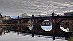 | |||
| 83 Buccleuch Street, Former Methodist Church And Railings | 55°04′13″N 3°36′48″W | Category A | 26102 | 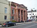 | |||
| 6, 8 Buccleuch Street | 55°04′09″N 3°36′58″W | Category C(S) | 26103 | | |||
| 40 Buccleuch Street, Sheriff Court House And Offices And Piers And Railings | 55°04′10″N 3°36′54″W | Category B | 26108 | 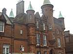 | |||
| 52, 54 Buccleuch Street | 55°04′11″N 3°36′51″W | Category B | 26111 | | |||
| 9-15 Castle Street (Odd Numbers) | 55°04′12″N 3°36′46″W | Category B | 26116 | | |||
| The Crichton, Easterbrook Hall | 55°03′04″N 3°35′30″W | Category B | 6699 | | |||
| Kelton Former Stables | 55°01′47″N 3°34′51″W | Category B | 3821 | | |||
| Brooke Street, St Andrew's Church Hall With Boundary Wall And Railings | 55°04′06″N 3°36′22″W | Category C(S) | 49595 | | |||
| The Crichton, Campbell House | 55°03′13″N 3°35′41″W | Category C(S) | 51000 | | |||
| The Crichton, Galloway House | 55°02′58″N 3°35′37″W | Category C(S) | 51001 | | |||
| Newbridge, Embassy Hotel Formerly Woodlands | 55°05′37″N 3°39′10″W | Category B | 26291 | | |||
| Newbridge, Embassy Hotel (Formerly Woodlands) Southwest Entrance, Gatepiers And Quadrant Walls | 55°05′34″N 3°39′09″W | Category B | 26292 | | |||
| Nith Viaduct, (Former Castle Douglas-Dumfries Line Over River Nith) | 55°04′47″N 3°36′46″W | Category B | 26306 |  | |||
| 29 Rotchell Road, Rotchell House | 55°03′51″N 3°36′59″W | Category B | 26329 | | |||
| St Mary's Street, St Mary's Church And Churchyard And Gatepiers | 55°04′14″N 3°36′23″W | Category B | 26333 | | |||
| 103, 105, 107 St Michael's Street, Moorhead's Hospital | 55°03′53″N 3°36′26″W | Category B | 26339 | | |||
| Whitesands Caul | 55°04′03″N 3°36′54″W | Category B | 26353 | | |||
| 24, 26, 28 Laurieknowe, Including Garden Walls And Gatepiers | 55°04′02″N 3°37′19″W | Category B | 26265 | | |||
| 29, 30 Maxwell Street, St Benedict's | 55°03′57″N 3°37′14″W | Category B | 26282 | | |||
| Church Crescent, Greyfriars' Church | 55°04′14″N 3°36′45″W | Category A | 26126 |  | |||
| 8, 10, 12, 14 Church Crescent | 55°04′13″N 3°36′44″W | Category C(S) | 26131 | | |||
| Craigs Road, St Joseph's College, Main College Building | 55°03′49″N 3°36′04″W | Category B | 26144 | | |||
| Craigs Road, St Joseph's College Mount St Michael's (Brothers' Recreation Block) | 55°03′48″N 3°35′58″W | Category B | 26146 | | |||
| 4 Edinburgh Road, Elmbank House (Elmbank School And Radio Solway) | 55°04′22″N 3°36′29″W | Category B | 26156 | | |||
| 11, 13, 15, 17 English Street | 55°04′06″N 3°36′34″W | Category B | 26163 | | |||
| 25, 29, 31 English Street | 55°04′07″N 3°36′34″W | Category B | 26165 | | |||
| 39, 41, 43 English Street | 55°04′07″N 3°36′33″W | Category C(S) | 26168 | | |||
| 54, 56 English Street | 55°04′07″N 3°36′31″W | Category B | 26184 | | |||
| 5, 7, 9 Friars Vennel, Corner Of Brewery Street | 55°04′08″N 3°36′54″W | Category C(S) | 26189 | | |||
| 43, 44, 45, 46 Galloway Street | 55°04′08″N 3°37′06″W | Category C(S) | 26200 |  | |||
| 1, 3 Academy Street | 55°04′16″N 3°36′43″W | Category C(S) | 26076 | | |||
| Academy Street, Townhead Dining Centre | 55°04′21″N 3°36′33″W | Category B | 26079 | | |||
| 8 Bank Street | 55°04′04″N 3°36′43″W | Category B | 26088 | | |||
| 52 Bank Street | 55°04′06″N 3°36′39″W | Category C(S) | 26092 | | |||
| Bankend Road, St Michael's Coach House | 55°03′37″N 3°36′03″W | Category C(S) | 26094 | | |||
| The Crichton, Crichton Memorial Church | 55°03′03″N 3°35′39″W | Category A | 6695 | 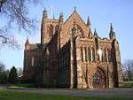 | |||
| The Crichton, Rutherford House And Mccowan House | 55°02′52″N 3°35′19″W | Category B | 6696 | | |||
| The Crichton, Annandale House | 55°02′54″N 3°35′39″W | Category C(S) | 6697 | | |||
| Heathall Farm Railway Bridge | 55°05′27″N 3°35′03″W | Category C(S) | 3820 | | |||
| Kingholm Leeholm Currie House Belonging To Sai And House Adjoining | 55°02′48″N 3°36′19″W | Category B | 3826 | | |||
| Edinburgh Road, Marchfield House With Ancillary Structure | 55°05′05″N 3°35′38″W | Category C(S) | 48571 | | |||
| Newbridge Woodlands Lodge, Gatepiers And Quadrant Walls At East Gate To Embassy Hotel | 55°05′40″N 3°38′57″W | Category B | 26293 | | |||
| 2 Nith Bank | 55°03′41″N 3°36′11″W | Category C(S) | 26297 | | |||
| 8, 10 Nith Place, Queen O' The South Bar | 55°03′59″N 3°36′34″W | Category B | 26304 | | |||
| 37 (Crindau) And 39 Nunholm Road | 55°04′43″N 3°36′33″W | Category B | 26307 | | |||
| Rae Street, Former St John's School | 55°04′15″N 3°36′32″W | Category B | 26326 | | |||
| Troqueer Road, Troqueer Manse (And Gatepiers) | 55°03′32″N 3°36′23″W | Category B | 26350 | | |||
| 2 Troqueer Road, Charter House | 55°03′49″N 3°36′44″W | Category B | 26351 | | |||
| 105 High Street And 54 Bank Street | 55°04′06″N 3°36′38″W | Category C(S) | 26220 | | |||
| 107, 109 High Street And 51 Bank Street | 55°04′06″N 3°36′39″W | Category B | 26221 | | |||
| 143 High Street | 55°04′09″N 3°36′41″W | Category B | 26227 | | |||
| 93 Irish Street | 55°04′04″N 3°36′42″W | Category B | 26243 | | |||
| 86, 88 Irish Street | 55°04′04″N 3°36′41″W | Category B | 26249 | | |||
| 168, 170, 172 Irish Street | 55°04′11″N 3°36′48″W | Category B | 26252 | | |||
| Laurieknowe, Maxwelltown West Church | 55°04′04″N 3°37′12″W | Category B | 26259 | | |||
| 14, 14A, 14B, 14C Laurieknowe | 55°04′04″N 3°37′15″W | Category C(S) | 26261 | | |||
| 83 New Abbey Road, Former Lodge And Gatepiers | 55°03′25″N 3°37′17″W | Category B | 26286 | | |||
| 26, 28, 30 Castle Street | 55°04′17″N 3°36′51″W | Category A | 26123 | | |||
| Catherine Street, Ewart Library | 55°04′17″N 3°36′34″W | Category B | 26124 | | |||
| 2 Church Crescent | 55°04′12″N 3°36′43″W | Category B | 26129 | | |||
| Craigs Road, St Joseph's College Glebe Cottage (Facing Aldermanhill Road) | 55°03′53″N 3°36′10″W | Category C(S) | 26150 | | |||
| Dalbeattie Road, Cassalands House | 55°03′54″N 3°37′29″W | Category C(S) | 26152 | | |||
| 30 Edinburgh Road (Education Offices) | 55°04′28″N 3°36′26″W | Category C(S) | 26158 | | |||
| 14 English Street | 55°04′05″N 3°36′34″W | Category C(S) | 26177 | | |||
| 48, 50 English Street | 55°04′07″N 3°36′31″W | Category B | 26183 | | |||
| 27, 28 Galloway Street | 55°04′06″N 3°37′11″W | Category B | 26198 | | |||
| 43-49 Bank Street (Odd Numbers) | 55°04′06″N 3°36′40″W | Category B | 26087 | | |||
| 16 Buccleuch Street | 55°04′10″N 3°36′57″W | Category C(S) | 26105 | | |||
| 22 Buccleuch Street | 55°04′10″N 3°36′57″W | Category C(S) | 26106 | | |||
| The Crichton, Carmont House | 55°02′49″N 3°35′13″W | Category B | 6692 | | |||
| The Crichton, Crichton Farm | 55°02′50″N 3°35′32″W | Category A | 6693 | | |||
| Kingholm Quay | 55°02′46″N 3°36′22″W | Category B | 3827 | | |||
| 1, 2, 3 And 4 Maidenbower | 55°03′17″N 3°34′53″W | Category B | 3830 | | |||
| Crichton Royal Infirmary Low Lodge And Gatepiers | 55°03′14″N 3°36′00″W | Category C(S) | 3816 | | |||
| Crichton Royal Hospital Octagonal Pavilion | 55°03′17″N 3°35′49″W | Category B | 3817 | | |||
| Ellangowan House And Gatepiers | 55°03′12″N 3°35′22″W | Category B | 3818 | | |||
| Heathall Industrial Estate, Dumfries And Galloway Aviation Museum, Former Control Tower | 55°05′28″N 3°34′06″W | Category C(S) | 50613 | | |||
| 1 Nith Bank | 55°03′41″N 3°36′12″W | Category C(S) | 26296 | | |||
| 5, 5A Nith Bank | 55°03′40″N 3°36′10″W | Category C(S) | 26300 | | |||
| 24 Queen Street | 55°04′05″N 3°36′31″W | Category B | 26313 | | |||
| 128 Queensberry Street | 55°04′15″N 3°36′40″W | Category B | 26324 |  | |||
| St Michael's Street, St Michael's Churchyard Burns' Mausoleum | 55°03′54″N 3°36′18″W | Category A | 26337 | | |||
| Whitesands, Devorgilla Bridge | 55°04′06″N 3°36′58″W | Category A | 26354 |  | |||
| 1, 2 Whitesands And 2, 4 Buccleuch Street | 55°04′09″N 3°36′59″W | Category C(S) | 26356 | | |||
| 43 Whitesands | 55°04′05″N 3°36′50″W | Category C(S) | 26359 | | |||
| 111 High Street | 55°04′07″N 3°36′39″W | Category B | 26222 | | |||
| 153 High Street, Royal Bank Of Scotland (Northern Block Only) | 55°04′09″N 3°36′41″W | Category C(S) | 26228 | | |||
| 120, 122, 124 High Street And 3 Old Union Street | 55°04′07″N 3°36′37″W | Category B | 26232 | | |||
| Hill Street, Mount Pleasant | 55°03′59″N 3°37′15″W | Category C(S) | 26237 | | |||
| 9 Irish Street And 99 Whitesands | 55°03′58″N 3°36′38″W | Category C(S) | 26239 | | |||
| 119-127 Irish Street (Odd Numbers Only) | 55°04′07″N 3°36′45″W | Category C(S) | 26244 | | |||
| 15, 17 Lovers Walk (And Gatepiers) | 55°04′21″N 3°36′27″W | Category B | 26275 | | |||
| Lovers Walk, St John's Episcopal Church And Hall | 55°04′18″N 3°36′24″W | Category B | 26279 | | |||
| Moffat Road, Huntingdon | 55°04′26″N 3°36′00″W | Category B | 26284 | | |||
| 7 Church Place, Corner Of St Andrew Street | 55°04′12″N 3°36′43″W | Category B | 26134 |  | |||
| Church Street, Dumfries Museum Observatory | 55°03′55″N 3°36′52″W | Category A | 26135 | .jpg) | |||
| Church Street, Arundel House | 55°03′53″N 3°36′48″W | Category B | 26140 | | |||
| College Road, Old Stakeford | 55°04′35″N 3°37′10″W | Category C(S) | 26142 | | |||
| English Street, Queensberry Column (In Front Of Regional Council Offices) | 55°04′09″N 3°36′39″W | Category A | 26173 |  | |||
| 16 English Street, Queensberry Hotel | 55°04′05″N 3°36′34″W | Category B | 26178 |  | |||
| 34, 36 English Street | 55°04′07″N 3°36′32″W | Category B | 26182 | | |||
| 114, 116 Friars Vennel | 55°04′11″N 3°36′45″W | Category B | 26196 | | |||
| 32-40 George Street (Even Numbers) | 55°04′15″N 3°36′52″W | Category B | 26204 | | |||
| 54, 56 George Street, Assembly Rooms Corner Of Irving Street | 55°04′16″N 3°36′47″W | Category B | 26207 | | |||
| Georgetown Road, Lochvale House | 55°03′51″N 3°34′51″W | Category B | 26209 | | |||
| 26-30 Academy Street (Even Numbers) | 55°04′16″N 3°36′39″W | Category C(S) | 26078 | | |||
| 5, 7, 9, 11 Bank Street | 55°04′04″N 3°36′45″W | Category A | 26083 | | |||
| Buccleuch Street, Bethany Hall | 55°04′12″N 3°36′49″W | Category C(S) | 26112 | | |||
| 24 Burns Street, Robert Burns' House | 55°03′58″N 3°36′29″W | Category A | 26115 |  | |||
| 39 Castle Street/42 George Street | 55°04′15″N 3°36′51″W | Category B | 26119 | | |||
| The Crichton, Grierson Gate Lodge And Gatepiers (Upper Brownhall Lodge) | 55°03′02″N 3°35′23″W | Category B | 6694 | | |||
| The Crichton, The Conservatories And Boiler House | 55°02′58″N 3°35′51″W | Category B | 6698 | | |||
| The Crichton, Mochrum And Monreith | 55°02′55″N 3°35′42″W | Category C(S) | 6704 | | |||
| Ladyfield East House And Gatepiers | 55°03′01″N 3°36′01″W | Category B | 3828 | | |||
| Marchmount Avenue Marchmount | 55°04′34″N 3°35′42″W | Category B | 3831 | | |||
| Martinton Bridge (Railway Viaduct Over River Nith) | 55°05′04″N 3°36′35″W | Category B | 3832 |  | |||
| The Crichton, Johnston House | 55°03′08″N 3°35′35″W | Category B | 3815 |  | |||
| 2 Hill Street, Mayfield House Summer House And Tool Shed | 55°03′59″N 3°37′20″W | Category B | 50281 | | |||
| The Crichton, Boiler House | 55°02′53″N 3°35′31″W | Category C(S) | 50998 | | |||
| The Crichton, Dudgeon And Cardoness | 55°02′58″N 3°35′22″W | Category B | 42473 | | |||
| The Crichton, Maxwell House | 55°02′59″N 3°35′26″W | Category B | 42474 | | |||
| Newall Terrace, Baptist Church | 55°04′16″N 3°36′27″W | Category B | 26288 | | |||
| 2, 4, 6 Nunholm Road, Albany Place | 55°04′36″N 3°36′27″W | Category C(S) | 26308 | | |||
| Park Road Park Farmhouse | 55°03′42″N 3°37′27″W | Category C(S) | 26311 | | |||
| 69 Queensberry Street | 55°04′11″N 3°36′40″W | Category B | 26317 | | |||
| 71 Queensberry Street | 55°04′11″N 3°36′40″W | Category B | 26318 | | |||
| 117 Queensberry Street, Tam O'shanter Inn | 55°04′13″N 3°36′41″W | Category C(S) | 26320 | | |||
| 82 Queensberry Street | 55°04′11″N 3°36′38″W | Category B | 26322 | | |||
| Rotchell Park, Bank House And Gatepiers | 55°03′50″N 3°36′51″W | Category C(S) | 26327 | | |||
| 44, 46 Rotchell Park, The Oaks And Machrie And Gatepiers | 55°03′47″N 3°37′00″W | Category B | 26328 | | |||
| St Michael's Street, St Michael's Church | 55°03′54″N 3°36′21″W | Category A | 26335 | | |||
| Terregles Street, Young Offenders' Institution, Formerly Dumfries Prison | 55°04′05″N 3°37′33″W | Category B | 26346 | | |||
| Hardthorn, Pump At Nunwood | 55°05′27″N 3°39′20″W | Category C(S) | 26213 | | |||
| 197 High Street | 55°04′11″N 3°36′44″W | Category B | 26229 | | |||
| 56 High Street, Globe Inn | 55°04′03″N 3°36′35″W | Category A | 26230 |  | |||
| 151 Irish Street | 55°04′09″N 3°36′47″W | Category C(S) | 26247 | | |||
| 92, 94 Irish Street And 30 Bank Street | 55°04′05″N 3°36′41″W | Category B | 26250 | | |||
| 16 Laurieknowe, Chapelmount | 55°04′03″N 3°37′17″W | Category B | 26262 | | |||
| 27 (Kinderloch), 29 Lovers Walk And Gatepiers | 55°04′21″N 3°36′26″W | Category B | 26277 | | |||
| Mill Road, Dumfries Town Mills (Robert Burns Centre) Sluice Gate And Outflow | 55°04′00″N 3°36′51″W | Category B | 26283 | | |||
| 9 Church Crescent Dumfries Savings Bank | 55°04′15″N 3°36′45″W | Category B | 26128 | | |||
| 32, 34, 36 Church Crescent | 55°04′15″N 3°36′42″W | Category C(S) | 26132 | | |||
| Church Street, Sinclair Memorial | 55°03′56″N 3°36′54″W | Category B | 26136 | | |||
| Craigs Road, St Joseph's College, Aldermanhill House And Gatepiers (Chaplain's House) | 55°03′53″N 3°36′01″W | Category B | 26149 | | |||
| 73, 75, 77 English Street | 55°04′08″N 3°36′29″W | Category B | 26170 | | |||
| English Street, County Buildings | 55°04′11″N 3°36′22″W | Category B | 26174 | | |||
| 68, 70, 72, 74 English Street | 55°04′08″N 3°36′29″W | Category B | 26185 | | |||
| 11, 13, 15 Friars Vennel | 55°04′08″N 3°36′53″W | Category C(S) | 26190 | | |||
| 77 Friars Vennel | 55°04′10″N 3°36′47″W | Category C(S) | 26193 | | |||
| 29, 30 Galloway Street | 55°04′07″N 3°37′10″W | Category B | 26199 | | |||
| 61 George Street. Moat Brae, Including Railings | 55°04′18″N 3°36′47″W | Category B | 26203 | | |||
| 2 Assembly Street, (Former Dumfries And Galloway Club) | 55°04′02″N 3°36′39″W | Category B | 26080 | | |||
| 24-36 Buccleuch Street (Even Numbers) Buccleuch Street Buildings | 55°04′10″N 3°36′55″W | Category B | 26107 | | |||
| 48 Buccleuch Street | 55°04′11″N 3°36′52″W | Category B | 26110 | | |||
| 62, 64 Buccleuch Street | 55°04′12″N 3°36′48″W | Category C(S) | 26113 | | |||
| 41, 43, 45, 47 Castle Street | 55°04′17″N 3°36′53″W | Category A | 26120 | | |||
| The Crichton, Grierson/Cairnsmore | 55°03′02″N 3°35′28″W | Category B | 6701 | | |||
| Netherwood Bank | 55°02′18″N 3°34′35″W | Category C(S) | 3835 | | |||
| Craigs Farm House And Steading | 55°03′22″N 3°34′44″W | Category B | 3837 | | |||
| Crichton Royal Hospital Crichton Hall | 55°03′13″N 3°35′48″W | Category A | 3839 | | |||
| Nunholm Road Nunholm | 55°04′57″N 3°36′42″W | Category B | 3824 | | |||
| Nunholm House | 55°04′59″N 3°36′36″W | Category C(S) | 3825 | | |||
| 43 Newall Terrace Including Lions | 55°04′12″N 3°36′27″W | Category B | 26287 | | |||
| 4, 6 Nith Bank | 55°03′40″N 3°36′11″W | Category C(S) | 26299 | | |||
| Nith Bank, Tormore And Gatepiers | 55°03′42″N 3°36′14″W | Category B | 26301 | | |||
| 9, 11 Queen Street | 55°04′06″N 3°36′32″W | Category C(S) | 26312 | | |||
| 13, 15, 17, 19 Glasgow Street | 55°04′08″N 3°37′09″W | Category B | 26211 |  | |||
| High Street, Fountain | 55°04′05″N 3°36′36″W | Category B | 26214 | 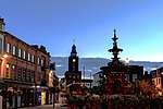 | |||
| 113, 115 High Street | 55°04′07″N 3°36′40″W | Category C(S) | 26223 | | |||
| 126, 128, 130, 132 High Street | 55°04′08″N 3°36′38″W | Category C(S) | 26233 | | |||
| 98 Irish Street | 55°04′05″N 3°36′42″W | Category B | 26251 | | |||
| Irving Street, Congregational Church And Hall | 55°04′16″N 3°36′45″W | Category B | 26254 | | |||
| 18, 18A Laurieknowe And Gatepiers | 55°04′02″N 3°37′19″W | Category C(S) | 26264 | | |||
| 46, 48 Loreburn Street And 63 Newall Terrace Including Myles Bar | 55°04′11″N 3°36′32″W | Category C(S) | 26271 | | |||
| 24, 26 Lovers Walk And 1 Newall Terrace | 55°04′19″N 3°36′22″W | Category B | 26280 | | |||
| 1, 3, 5, 7 Church Crescent | 55°04′14″N 3°36′44″W | Category C(S) | 26127 | | |||
| Church Street, 1, 2, Corberry Place (Flatted) | 55°03′52″N 3°36′49″W | Category C(S) | 26137 | | |||
| College Road, Lincluden House, Stable Buildings | 55°05′05″N 3°37′31″W | Category B | 26141 | | |||
| Eastfield Road, Eastfield | 55°04′03″N 3°35′42″W | Category C(S) | 26154 | | |||
| 109, 111 English Street | 55°04′10″N 3°36′25″W | Category B | 26172 | | |||
| 76, 78 English Street | 55°04′08″N 3°36′29″W | Category C(S) | 26186 | | |||
| 80, 82 Friars Vennel, Corner Of Irish Street | 55°04′10″N 3°36′47″W | Category B | 26195 | | |||
| Abbey Lane, Lincluden Collegiate Church | 55°05′05″N 3°37′15″W | Category A | 26075 |  | |||
| 66, 68 Buccleuch Street | 55°04′12″N 3°36′48″W | Category C(S) | 26114 | | |||
| 17 Castle Street | 55°04′12″N 3°36′47″W | Category B | 26117 | | |||
| St Mary's Street, St Mary's Church Hall With Retaining And Boundary Wall, Gatepiers And Steps | 55°04′13″N 3°36′17″W | Category C(S) | 49594 | |
Key
The scheme for classifying buildings in Scotland is:
- Category A: "buildings of national or international importance, either architectural or historic; or fine, little-altered examples of some particular period, style or building type."[1]
- Category B: "buildings of regional or more than local importance; or major examples of some particular period, style or building type, which may have been altered."[1]
- Category C: "buildings of local importance; lesser examples of any period, style, or building type, as originally constructed or moderately altered; and simple traditional buildings which group well with other listed buildings."[1]
In March 2016 there were 47,288 listed buildings in Scotland. Of these, 8% were Category A, and 50% were Category B, with the remaining 42% being Category C.[2]
Notes
- Sometimes known as OSGB36, the grid reference (where provided) is based on the British national grid reference system used by the Ordnance Survey.
• "Guide to National Grid". Ordnance Survey. Retrieved 12 December 2007.
• "Get-a-map". Ordnance Survey. Retrieved 17 December 2007. - Historic Environment Scotland assign a unique alphanumeric identifier to each designated site in Scotland, for listed buildings this always begins with "LB", for example "LB12345".
gollark: [BEE POLL] bees'); SELECT * FROM bees;--
gollark: And BEE POLL POLLs aren't a thing.
gollark: You cannot DEPLOY bees on something. You need to DEPLOY bees before you USE them.
gollark: !
gollark: Bee deployment is NOT the same as using bees
References
- All entries, addresses and coordinates are based on data from Historic Scotland. This data falls under the Open Government Licence
- "What is Listing?". Historic Environment Scotland. Retrieved 29 May 2018.
- Scotland's Historic Environment Audit 2016 (PDF). Historic Environment Scotland and the Built Environment Forum Scotland. pp. 15–16. Retrieved 29 May 2018.
This article is issued from Wikipedia. The text is licensed under Creative Commons - Attribution - Sharealike. Additional terms may apply for the media files.