Grade I listed buildings in Great Yarmouth
There are over 9,000 Grade I listed buildings in England. This page is a list of these buildings in the district of Great Yarmouth in Norfolk.
Great Yarmouth
| Name | Location | Type | Completed [note 1] | Date designated | Grid ref.[note 2] Geo-coordinates |
Entry number [note 3] | Image |
|---|---|---|---|---|---|---|---|
| Gariannonum Roman Fort | Burgh Castle, Great Yarmouth | Roman fort | 260-280 A.D. | 10 June 1953 | TG4749704474 52°34′54″N 1°39′07″E |
1372902 | 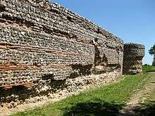 Gariannonum Roman Fort |
| St Olave's Priory | Fritton and St. Olaves | Priory | 1825-1902 | 27 November 1954 | TM4586099544 52°32′18″N 1°37′27″E |
1172374 | 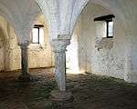 St Olave's Priory |
| Barn at Hall Farm | Hemsby | Farmhouse | 18th century | 4 December 1987 | TG4874216799 52°41′30″N 1°40′46″E |
1216597 |  |
| Church of St Mary | Martham | Parish Church | Late 14th century | 25 September 1962 | TG4549718442 52°42′29″N 1°37′58″E |
1152351 | 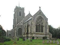 Church of St Mary |
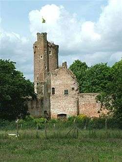
| Caister Castle | West Caister | Castle | Late 14th century or early 15th century | 25 September 1962 | TG5044412291 52°39′02″N 1°42′04″E |
1287573 | |
| Church of Holy Trinity and All Saints | Winterton-on-Sea | Church | 13th century | 25 September 1962 | TG4912219463 52°42′56″N 1°41′13″E |
1216611 | 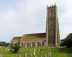 Church of Holy Trinity and All Saints |
| Fishermen's Hospital including Gate Piers and Railings | Great Yarmouth | Hospital | 1702 | 27 June 1953 | TG5244907890 52°36′36″N 1°43′38″E |
1096820 | 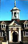 Fishermen's Hospital including Gate Piers and Railings |
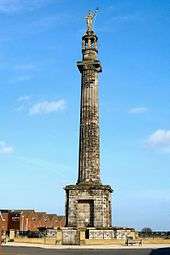
| Nelsons Monument | Great Yarmouth | Commemorative Monument | 1817-1819 | 27 June 1953 | TG5299905508 52°35′18″N 1°44′01″E |
1246057 | |
| Remains of the Church of the Greyfriars | Great Yarmouth | Ruins | After 1538 | 27 June 1953 | TG5240307330 52°36′18″N 1°43′34″E |
1245915 | |
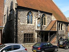
| St Georges Theatre | Great Yarmouth | Church/Theatre | 1974-1979 | 27 June 1953 | TG5261207348 52°36′18″N 1°43′46″E |
1245919 | 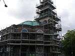 St Georges Theatre |
| St Nicholas (priory) Middle School | Great Yarmouth | Museum | Late 19th century | 27 June 1953 | TG5247907871 52°36′36″N 1°43′40″E |
1245978 | |
| The Tolhouse | Great Yarmouth | Toll House | Before restoration | 27 June 1953 | TG5249607253 52°36′16″N 1°43′39″E |
1245560 | |
| 4 South Quay | Great Yarmouth | House | 1596 | 27 June 1953 | TG5235207360 52°36′19″N 1°43′32″E |
1271611 | |

Notes
- The date given is the date used by Historic England as significant for the initial building or that of an important part in the structure's description.
- Sometimes known as OSGB36, the grid reference is based on the British national grid reference system used by the Ordnance Survey.
- The "List Entry Number" is a unique number assigned to each listed building and scheduled monument by Historic England.
gollark: How does one do multiline comments?
gollark: I might as well try with both.
gollark: I see.
gollark: What's wrong with the stdlib's htmlgen? This seems fine.
gollark: I'm using karax and abusing it to generate stringified HTML.
External links
![]()
This article is issued from Wikipedia. The text is licensed under Creative Commons - Attribution - Sharealike. Additional terms may apply for the media files.