Grade II* listed buildings in Berkshire
Buildings
Bracknell Forest
| Name | Location | Type | Completed [note 1] | Date designated | Grid ref.[note 2] Geo-coordinates |
Entry number [note 3] | Image |
|---|---|---|---|---|---|---|---|
| Binfield Lodge | Binfield | House | Extended and altered 1912 | 7 December 1966 | SU8435273136 51°27′03″N 0°47′15″W |
1390315 |  |
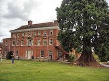
| Binfield Park | Binfield | Country house | 1775 | 7 December 1966 | SU8458571621 51°26′14″N 0°47′04″W |
1390299 | |
| Binfield Place | Binfield | House | Mid-16th century | 7 December 1966 | SU8403070953 51°25′53″N 0°47′33″W |
1390270 | |
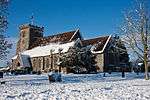
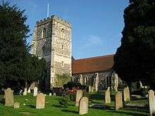
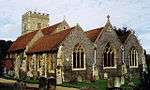
| Church of All Saints | Binfield | Parish church | 14th century | 7 December 1966 | SU8454772148 51°26′31″N 0°47′06″W |
1390256 |  Church of All Saints |
| Wellington College, main blocks and front walls | Crowthorne | College | 1856–59 | 20 December 1972 | SU8317563408 51°21′49″N 0°48′24″W |
1390356 | 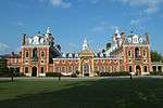 Wellington College, main blocks and front walls |
| Church of St Michael | Sandhurst | Parish church | 1853 | 20 December 1972 | SU8258161862 51°20′59″N 0°48′56″W |
1390382 | 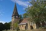 Church of St Michael |
| Old Building with attached lamps, Royal Military Academy | Royal Military Academy, Sandhurst | Barracks | 1807–12 | 20 December 1972 | SU8585660868 51°20′26″N 0°46′08″W |
1390376 | 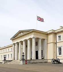 Old Building with attached lamps, Royal Military Academy |
| Church of St Michael and All Angels | Warfield | Parish church | 13th century | 7 December 1979 | SU8800672204 51°26′31″N 0°44′07″W |
1390393 | |
| Church of St Mary | Winkfield | Parish church | 14th century | 7 December 1966 | SU9042172437 51°26′37″N 0°42′01″W |
1390428 | 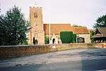 Church of St Mary |
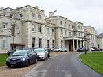
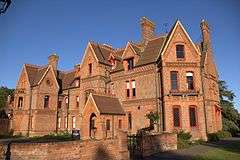
| New Lodge | Winkfield | Country house | c.1857 | 2 May 1989 | SU9118075029 51°28′01″N 0°41′20″W |
1319407 | 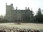 New Lodge |
Reading
| Name | Location | Type | Completed [note 1] | Date designated | Grid ref.[note 2] Geo-coordinates |
Entry number [note 3] | Image |
|---|---|---|---|---|---|---|---|
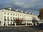
| Albion Place | Reading | Terrace | c.1825–35 | 22 March 1957 | SU7218872994 51°27′05″N 0°57′45″W |
1113506 | |
| Archway connecting Forbury Gardens to Reading Abbey ruins, including retaining walls flanking path to Abbey ruins | Reading | Arch | Mid-19th century | 14 December 1978 | SU7197073585 51°27′24″N 0°57′56″W |
1113478 | .jpg) Archway connecting Forbury Gardens to Reading Abbey ruins, including retaining walls flanking path to Abbey ruins |
| Chazey Farmhouse | Reading | House | Early 19th century | 24 October 1951 | SU6910975208 51°28′18″N 1°00′23″W |
1157139 | |
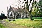
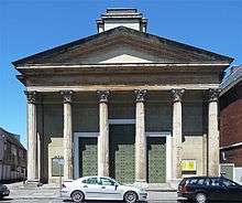
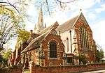
| Christ Church | Reading | Anglican church | 1875 | 14 December 1978 | SU7221272175 51°26′38″N 0°57′44″W |
1113441 | _(cropped).jpg) Christ Church |
| Church of Saint Mary | Reading | Church | 1798 | 22 March 1957 | SU7133473246 51°27′13″N 0°58′29″W |
1113427 | |
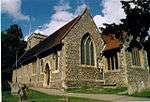
| Church of St Peter | Caversham | Church | From 12th century | 22 March 1957 | SU7088974892 51°28′07″N 0°58′51″W |
1303560 | |
| Culvert on Holy Brook running south-westwards from SU71441/73234 to 71327/73133 | Reading | Culvert | Late 16th century | 24 October 1984 | SU7137973183 51°27′11″N 0°58′27″W |
1321866 | .jpg) Culvert on Holy Brook running south-westwards from SU71441/73234 to 71327/73133 |
| Holybrook House | Reading | House | c.1750 | 22 March 1957 | SU7118773068 51°27′08″N 0°58′37″W |
1113420 |  Holybrook House |
| Main block and flanking wings at Royal Berkshire Hospital | Reading | Hospital | 1882 | 19 March 1975 | SU7241272955 51°27′03″N 0°57′34″W |
1156091 | 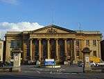 Main block and flanking wings at Royal Berkshire Hospital |
| Nos 154 to 160 (even) and railings to street | Castle Hill, Reading | House | 18th century | 22 March 1957 | SU7085973015 51°27′06″N 0°58′54″W |
1113431 |  Nos 154 to 160 (even) and railings to street |
| Old Grove House | Emmer Green, Reading | Timber-framed house | Probably early to mid-17th century | 22 March 1957 | SU7131876676 51°29′04″N 0°58′28″W |
1302576 | _(cropped).jpg) Old Grove House |
| St David's Hall | Reading | Terrace | 1830s | 22 March 1957 | SU7218572944 51°27′03″N 0°57′45″W |
1303031 | 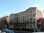 St David's Hall |
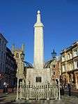
| The Simeon Monument | Reading | Obelisk | 1804 | 22 March 1957 | SU7169773462 51°27′20″N 0°58′10″W |
1113534 | |
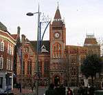
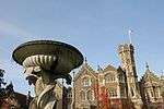
| Town Council chamber and offices with clock tower | Reading | Local government office | 1872–75 | 22 March 1957 | SU7167473578 51°27′24″N 0°58′11″W |
1113400 | |
| Watlington House | Reading | House | Probably earlier than 1763 | 22 March 1957 | SU7224773167 51°27′10″N 0°57′42″W |
1321898 | |
| 19 Castle Street | Reading | House | Early 18th century | 22 March 1957 | SU7132973205 51°27′12″N 0°58′29″W |
1113414 | 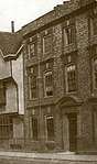 19 Castle Street |
| 78–84 Southampton Street | Reading | Terrace | 1810 | 22 March 1957 | SU7165272846 51°27′00″N 0°58′13″W |
1113584 | |
| 173–183 Kings Road | Reading | House | After 1832 | 22 March 1957 | SU7250473303 51°27′15″N 0°57′29″W |
1155954 | 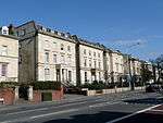 173–183 Kings Road |
| 73 and 75 London Street | Reading | House | 1748 | 22 March 1975 | SU7185373036 51°27′06″N 0°58′02″W |
1156168 | |
| 15 Castle Street | Reading | Jettied house | 16th century | 22 March 1957 | SU7134873216 51°27′12″N 0°58′28″W |
1303734 | 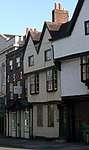 15 Castle Street |
| 17 Castle Street | Reading | House | 16th century | 22 March 1957 | SU7133873211 51°27′12″N 0°58′29″W |
1113413 | .jpg) 17 Castle Street |
| Royal Berkshire Regiment Cenotaph | Reading | War memorial | 1921 | 22 December 1975 | SU6926773725 51°27′30″N 1°00′16″W |
1321912 | |
_(cropped).jpg)
Slough
| Name | Location | Type | Completed [note 1] | Date designated | Grid ref.[note 2] Geo-coordinates |
Entry number [note 3] | Image |
|---|---|---|---|---|---|---|---|
| King Johns Palace | Colnbrook, Colnbrook with Poyle | Jettied house | c.1600 | 11 August 1952 | TQ0281876974 51°28′57″N 0°31′15″W |
1280920 | 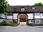 King Johns Palace |
| The Ostrich Public House | Colnbrook, Colnbrook with Poyle | Public house | 16th century | 23 September 1955 | TQ0265277095 51°29′01″N 0°31′23″W |
1124367 | 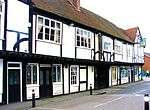 The Ostrich Public House |
| Church of St Mary | Slough | Church | 1876–78 | 29 September 1950 | SU9763479581 51°30′24″N 0°35′41″W |
1321977 | |
| Church of St Peter | Chalvey | Church | 1860–61 | 29 September 1950 | SU9668479569 51°30′24″N 0°36′30″W |
1113376 | 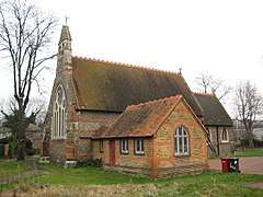 Church of St Peter |
| Upton Court | Slough | House | 17th century | 29 September 1950 | SU9803779058 51°30′07″N 0°35′20″W |
1251585 | 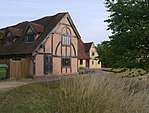 Upton Court |
| 2, 4, 6, 8 St Mary's Road (Kederminster Almshouses) | Langley | Almshouse | 1617 | 29 September 1950 | TQ0047179491 51°30′20″N 0°33′14″W |
1113384 | 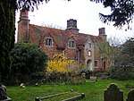 2, 4, 6, 8 St Mary's Road (Kederminster Almshouses) |
| 12, 14, 16, 18, 20, 22 St Mary's Road (Seymour Almshouses) | Langley | Almshouse | 1687 | 29 September 1950 | TQ0046679595 51°30′23″N 0°33′14″W |
1113387 | 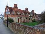 12, 14, 16, 18, 20, 22 St Mary's Road (Seymour Almshouses) |
West Berkshire
| Name | Location | Type | Completed [note 1] | Date designated | Grid ref.[note 2] Geo-coordinates |
Entry number [note 3] | Image |
|---|---|---|---|---|---|---|---|
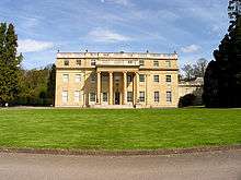
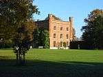
| Aldermaston Court | Aldermaston | House | 1636 | 14 April 1967 | SU5965764807 51°22′45″N 1°08′39″W |
1117317 | 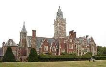 Aldermaston Court |
| North-east lodges and gates to Aldermaston Court | Aldermaston | House | c.1636 | 25 October 1951 | SU5913665086 51°22′54″N 1°09′06″W |
1117332 | 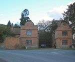 North-east lodges and gates to Aldermaston Court |
| Oxford Lodges to Basildon Park with gates, gatepiers and flanking walls | Basildon | Gate | 1776–87 | 19 June 1984 | SU6124478495 51°30′07″N 1°07′09″W |
1210340 | 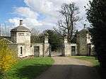 Oxford Lodges to Basildon Park with gates, gatepiers and flanking walls |
| Church of St Mary the Virgin | Beech Hill | Parish church | 1867 | 14 April 1967 | SU6979764397 51°22′28″N 0°59′55″W |
1117135 | 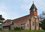 Church of St Mary the Virgin |
| The Priory including adjoining wall on the north-east | Beech Hill | Country house | 16th century | 14 April 1947 | SU7081764340 51°22′25″N 0°59′02″W |
1117130 | |
| Church of St Mary | Beenham | Church | 1794 | 14 April 1967 | SU5908068480 51°24′44″N 1°09′07″W |
1303517 | 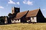 Church of St Mary |
| White Cottage | Beenham | House | 17th century | 10 November 1983 | SU5972569492 51°25′17″N 1°08′33″W |
1117296 | |
| Parish Church of St Andrew | Boxford | Parish church | 13th century | 6 April 1967 | SU4287171632 51°26′31″N 1°23′04″W |
1219764 | 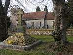 Parish Church of St Andrew |
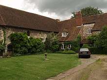
| Bradfield Hall, adjoining kitchen block and adjoining garden wall | Rotten Row, Bradfield | House | c.1700 | 25 October 1951 | SU5886371603 51°26′25″N 1°09′16″W |
1289492 | |
| Church of St Andrew | Bradfield | Church | 16th century | 14 April 1967 | SU6033272580 51°26′56″N 1°08′00″W |
1289580 | 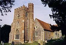 Church of St Andrew |
| Chapel approximately 10m east of Manor Farmhouse | Brimpton | Chapel | c.1100 | 6 April 1967 | SU5582265272 51°23′02″N 1°11′57″W |
1303413 | 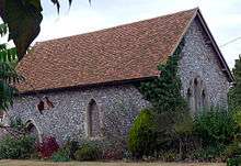 Chapel approximately 10m east of Manor Farmhouse |
| Church of St Mary | Marlston, Bucklebury | Church | 12th century | 7 December 1971 | SU5290971967 51°26′39″N 1°14′24″W |
1212896 | 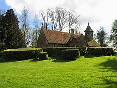 Church of St Mary |
| Marlston House and surrounding terrace | Marlston, Bucklebury | House | 1895–99 | 29 November 1983 | SU5299071882 51°26′36″N 1°14′20″W |
1212898 | _-_geograph.org.uk_-_5841.jpg) Marlston House and surrounding terrace |
| The Old Vicarage | Bucklebury | House | Early 18th century | 25 October 1951 | SU5533870868 51°26′03″N 1°12′19″W |
1212777 | |
| Garston Lock at SU656708 | Kennet and Avon Canal, Burghfield | Lock | Early 18th century | 6 December 1990 | SU6558270746 51°25′55″N 1°03′29″W |
1117125 | 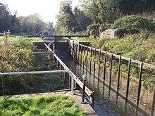 Garston Lock at SU656708 |
| The Old Rectory | Burghfield | Country house | Late 16th century | 25 October 1951 | SU6659168593 51°24′45″N 1°02′38″W |
1135782 | |
| Catmore Farm House | Catmore | Farmhouse | 14th century | 21 October 1951 | SU4536380168 51°31′07″N 1°20′51″W |
1210996 | 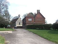 Catmore Farm House |
| Barn with corn mill and attached stable forming north-east side of former farmyard at Woolley House | Woolley Park, Chaddleworth | Corn mill | Probably Early 19th century | 5 November 1990 | SU4106080134 51°31′07″N 1°24′35″W |
1290292 | |
| Woolley Park | Woolley Park, Chaddleworth | Country house | Late 17th century | 25 October 1951 | SU4101480060 51°31′05″N 1°24′37″W |
1290345 | 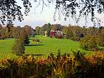 Woolley Park |
| Chieveley House | Chieveley | House | 18th century | 6 April 1967 | SU4759273984 51°27′46″N 1°18′59″W |
1291142 | |
| Church of St Mary | Chieveley | Church | 13th century | 6 April 1967 | SU4744474096 51°27′50″N 1°19′06″W |
1220107 | 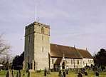 Church of St Mary |
| Prior's Court School | Chieveley | House | Late 18th century | 6 April 1967 | SU4883473677 51°27′36″N 1°17′55″W |
1291103 | 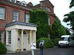 Prior's Court School |
| Garden house at Manor Farm in south-west corner of garden wall | Combe | Garden house | c.1670 | 10 September 1951 | SU3673860697 51°20′39″N 1°28′26″W |
1290619 | 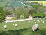 Garden house at Manor Farm in south-west corner of garden wall |
| Wrights Farm House | Combe | Farmhouse | 14th century | 8 June 1984 | SU3666761465 51°21′04″N 1°28′30″W |
1221121 | |
| Church of St Mary and St Nicholas | Compton | Church | 18th century | 24 November 1966 | SU5262579670 51°30′49″N 1°14′35″W |
1135775 | 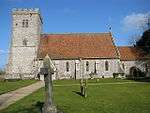 Church of St Mary and St Nicholas |
| Church of All Saints | East Garston | Church | 12th century | 6 February 1982 | SU3612277068 51°29′29″N 1°28′52″W |
1321874 |  Church of All Saints |
| Mask Cottage | East Garston | House | 18th century | 11 July 1983 | SU3667276542 51°29′12″N 1°28′24″W |
1321873 | |
| Kennet House | East Ilsley | House | Early 18th century | 25 October 1951 | SU4929281024 51°31′34″N 1°17′27″W |
1319564 | .jpg) Kennet House |
| Englefield House and entrance courtyard adjoining to north-east | Englefield | House | 1590–1600 | 19 June 1984 | SU6222871943 51°26′35″N 1°06′22″W |
1289194 | 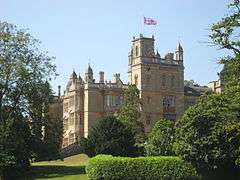 Englefield House and entrance courtyard adjoining to north-east |
| Fawley Manor House | South Fawley | Manor house | c.1600 | 25 October 1951 | SU3914780105 51°31′07″N 1°26′14″W |
1210771 |  Fawley Manor House |
| Church of St Frideswide | Frilsham | Church | 12th century | 29 November 1983 | SU5380473195 51°27′19″N 1°13′37″W |
1213105 | 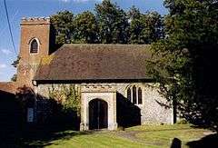 Church of St Frideswide |
| Church of St Mary | Great Shefford | Church | 19th century | 6 February 1962 | SU3801775375 51°28′34″N 1°27′14″W |
1113644 | 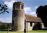 Church of St Mary |
| Manor Farmhouse | Great Shefford | Farmhouse | 16th century | 10 September 1951 | SU3802075326 51°28′32″N 1°27′14″W |
1113648 | |
| Church of St Mary | Greenham | Church | 1875–76 | 6 April 1967 | SU4859865711 51°23′18″N 1°18′11″W |
1291027 | 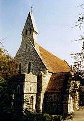 Church of St Mary |
| Greenham Lodge | Greenham | Apartment | 1969 | 9 September 1969 | SU4898765615 51°23′15″N 1°17′51″W |
1291019 | 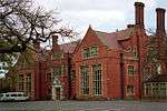 Greenham Lodge |
| Building 50 metres north-west of Morewood House | Hampstead Marshall | Orangery | c.1705–18 | 6 April 1967 | SU4159166724 51°23′53″N 1°24′13″W |
1136066 | |
| Church of St Mary | Hampstead Marshall | Church | 14th century | 6 May 1967 | SU4200066746 51°23′54″N 1°23′52″W |
1117223 | _-_geograph.org.uk_-_6233.jpg) Church of St Mary |
| Pair of gate piers and approximately 2 metres of wall to east and west of piers on edge of Park Lane 162 metres west of entrance to churchyard | Hampstead Marshall | Gate pier | Early 18th century | 6 March 1985 | SU4180966703 51°23′52″N 1°24′02″W |
1117222 | _(geograph_2285798).jpg) Pair of gate piers and approximately 2 metres of wall to east and west of piers on edge of Park Lane 162 metres west of entrance to churchyard |
| Lowsley Tomb, approximately 3 metres south of south wall of Church of St Mary | Hampstead Norreys | Tomb | Late 19th century | 5 June 1986 | SU5293676246 51°28′58″N 1°14′21″W |
1117158 | 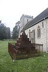 Lowsley Tomb, approximately 3 metres south of south wall of Church of St Mary |
| Holybrook Cottage | Holybrook | House | 17th century | 19 June 1984 | SU6703271406 51°26′16″N 1°02′13″W |
1215618 | 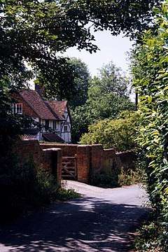 Holybrook Cottage |
| Chilton Lodge | Leverton, Hungerford | Country house | 1890 | 10 September 1951 | SU3296570553 51°25′59″N 1°31′38″W |
1211296 | |
| Church of St Lawrence | Hungerford | Church | 1816 | 6 February 1962 | SU3341868713 51°24′59″N 1°31′15″W |
1289541 | 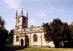 Church of St Lawrence |
| 24 High Street | Hungerford | House | 1951 | 10 September 1951 | SU3376168517 51°24′53″N 1°30′57″W |
1210596 | 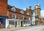 24 High Street |
| Church of St Michael | Lower Green, Inkpen | Church | 13th century | 6 February 1952 | SU3577063776 51°22′19″N 1°29′15″W |
1290597 | 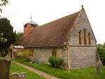 Church of St Michael |
| Inkpen House | Lower Green, Inkpen | House | 1984 | 10 September 1951 | SU3580463731 51°22′17″N 1°29′13″W |
1290598 | 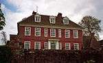 Inkpen House |
| Kirby House | Inkpen | Country house | 18th century | 10 September 1951 | SU3753163209 51°22′00″N 1°27′44″W |
1221220 | 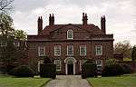 Kirby House |
| Church of St Mary | Kintbury | Church | 12th century | 6 February 1962 | SU3832767005 51°24′03″N 1°27′02″W |
1117242 | 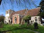 Church of St Mary |
| Bockhampton | Lambourn | House | 17th century | 10 September 1951 | SU3354478030 51°30′01″N 1°31′05″W |
1113654 | 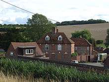 Bockhampton |
| College House | Lambourn | House | 18th century | 10 September 1951 | SU3259578809 51°30′26″N 1°31′54″W |
1136235 | 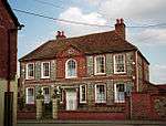 College House |
| Ivy House | Lambourn | House | Late 18th century | 10 September 1951 | SU3275178831 51°30′27″N 1°31′46″W |
1136363 | |
| Manor Farmhouse | Eastbury, Lambourn | Farmhouse | 16th century | 10 September 1951 | SU3452177312 51°29′37″N 1°30′15″W |
1113661 | |
| Market Cross | Lambourn | Market cross | Medieval | 10 September 1951 | SU3265578936 51°30′30″N 1°31′51″W |
1312843 |  Market Cross |
| Parsonage House | Lambourn | House | 16th century | 10 September 1951 | SU3252778936 51°30′30″N 1°31′58″W |
1113704 | |
| Pigeon House | Eastbury, Lambourn | Farmhouse | 1620 | 10 September 1951 | SU3491377076 51°29′30″N 1°29′55″W |
1136193 | 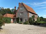 Pigeon House |
| The Pigeonhouse | Eastbury, Lambourn | Dovecote | Early 17th century | 10 September 1951 | SU3488777128 51°29′31″N 1°29′56″W |
1113675 | |
| The Village Cross | Eastbury, Lambourn | Cross | 15th century | 10 September 1951 | SU3465277225 51°29′34″N 1°30′08″W |
1113669 | |
| 21 Newbury Street | Lambourn | House | 18th century | 10 September 1951 | SU3276578817 51°30′26″N 1°31′45″W |
1113701 | |
| Church of St James | Leckhampstead | Church | c.1858–60 | 6 April 1967 | SU4393675958 51°28′51″N 1°22′07″W |
1313057 | 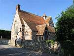 Church of St James |
| Bridge over River Kennet | Newbury | Bridge | 1726 | 29 September 1950 | SU4710567167 51°24′06″N 1°19′27″W |
1290920 |  Bridge over River Kennet |
| Corn Stores | Newbury | Shop | 1970 | 29 September 1950 | SU4728867144 51°24′05″N 1°19′18″W |
1211914 | 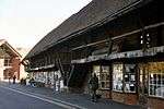 Corn Stores |
| Falkland Garth | Newbury | Farmhouse | 17th century | 29 September 1950 | SU4580765024 51°22′57″N 1°20′35″W |
1290696 | 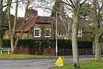 Falkland Garth |
| Litten Chapel (part of the Newbury Commercial School) | Newbury | School | 1983 | 29 September 1950 | SU4693866605 51°23′48″N 1°19′36″W |
1210610 | 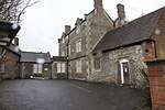 Litten Chapel (part of the Newbury Commercial School) |
| Methodist Chapel | Newbury | Methodist chapel | 1837–38 | 30 September 1977 | SU4702667501 51°24′17″N 1°19′31″W |
1211202 | 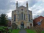 Methodist Chapel |
| North gateway to churchyard of St Nicholas' Church adjoining Bartholomew Street | Newbury | Gate | c.1770 | 10 June 1969 | SU4710367115 51°24′04″N 1°19′27″W |
1291318 | 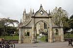 North gateway to churchyard of St Nicholas' Church adjoining Bartholomew Street |
| South gateway to churchyard of St Nicholas' Church adjoining Bartholomew Street | Newbury | Gate | c.1770 | 10 June 1969 | SU4709767092 51°24′03″N 1°19′28″W |
1291423 | 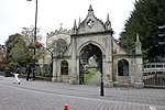 South gateway to churchyard of St Nicholas' Church adjoining Bartholomew Street |
| St Bartholomew's Hospital | Newbury | Almshouse | c.1618 | 10 June 1969 | SU4692966576 51°23′47″N 1°19′37″W |
1219550 | 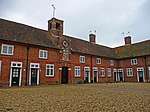 St Bartholomew's Hospital |
| St Mary's Vicarage | Newbury | Vicarage | c.1830 | 2 September 1983 | SU4722167688 51°24′23″N 1°19′21″W |
1221172 | 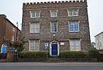 St Mary's Vicarage |
| St Nicolas House | West Mills, Newbury | Town house | early-mid 18th century | 29 September 1950 | SU4697967067 51°24′03″N 1°19′34″W |
1289887 | |
| The Chestnuts | Newbury | House | Early–mid-18th century | 29 September 1950 | SU4687767683 51°24′22″N 1°19′39″W |
1219909 | |
| Wessex Home | Newbury | Villa | Early–mid-19th century | 10 June 1969 | SU4686267767 51°24′25″N 1°19′40″W |
1211380 | |
| 42 Northbrook Street | Newbury | House | c.1724 | 29 September 1950 | SU4709467496 51°24′16″N 1°19′28″W |
1211030 | |
| 91 and 92 Northbrook Street | Newbury | House | c.1740 | 2 September 1983 | SU4707867262 51°24′09″N 1°19′29″W |
1211267 | |
| 24 Northbrook Street | Newbury | House | Early 16th century | 29 September 1950 | SU4711067355 51°24′12″N 1°19′27″W |
1290211 |  24 Northbrook Street |
| 63 Cheap Street | Newbury | Town house | c.1796 | 29 September 1950 | SU4731266842 51°23′55″N 1°19′17″W |
1290759 | |
| 28 Bartholomew Street | Newbury | Town house | Mid-18th century | 2 September 1983 | SU4700766929 51°23′58″N 1°19′32″W |
1219756 | 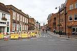 28 Bartholomew Street |
| 6–12 Northbrook Street | Newbury | House | c.1669 | 29 September 1950 | SU4711367253 51°24′08″N 1°19′27″W |
1290298 | |
| 5 Wharf Street | Newbury | Town house | Early–mid-18th century | 29 September 1950 | SU4720967142 51°24′05″N 1°19′22″W |
1211738 | |
| Padworth House | Padworth | House | 17th century | 25 October 1951 | SU6132166252 51°23′31″N 1°07′12″W |
1117314 | |
| Church of St James the Less | Pangbourne | Church | 1718 | 14 April 1967 | SU6342076420 51°28′59″N 1°05′17″W |
1213980 | 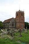 Church of St James the Less |
| Devitt House, Pangbourne College | Pangbourne | House | 1897–98 | 19 June 1984 | SU6191575545 51°28′32″N 1°06′36″W |
1213514 | 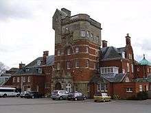 Devitt House, Pangbourne College |
| Hill House/Little Court/Pangbourne English Centre | Pangbourne | House | 1971 | 7 December 1971 | SU6310876764 51°29′11″N 1°05′33″W |
1214033 | |
| The Junior School, Pangbourne College | Pangbourne | House | 1901 | 19 June 1984 | SU6155776054 51°28′48″N 1°06′54″W |
1288792 | |
| Church of St Mary | Purley on Thames | Church | 1626 | 14 April 1967 | SU6674276059 51°28′46″N 1°02′25″W |
1288375 | 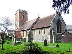 Church of St Mary |
| Purley Hall including stable yard adjoining to east | Purley on Thames | House | 1609 | 25 October 1951 | SU6461775776 51°28′38″N 1°04′15″W |
1214696 | |
| Purley Park | Purley on Thames | House | Designed 1795 | 25 October 1951 | SU6652575857 51°28′40″N 1°02′37″W |
1288453 | |
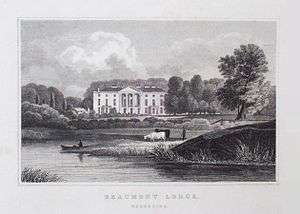
| Donnington Grove | Donnington, Shaw-cum-Donnington | House | c.1782 | 6 June 1952 | SU4585268959 51°25′04″N 1°20′31″W |
1220450 | |
| Donnington Hospital | Shaw-cum-Donnington | Courtyard | 1602 | 6 June 1952 | SU4656468593 51°24′52″N 1°19′55″W |
1290987 | |
| Benham Park | Speen | Country house | 1772–75 | 6 June 1952 | SU4401167742 51°24′25″N 1°22′07″W |
1220740 | |
| Dumbledore | Jennetts Hill, Stanford Dingley | House | 17th century | 29 November 1983 | SU5787971119 51°26′10″N 1°10′07″W |
1213110 | |
| The Old Rectory | Stanford Dingley | House | c.1720 | 29 November 1983 | SU5748771340 51°26′17″N 1°10′28″W |
1213108 | |
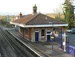
| Mortimer Station | Stratfield Mortimer | Railway station | 1848 | 4 September 1975 | SU6721864112 51°22′20″N 1°02′09″W |
1117145 | |
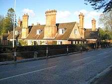
| Waiting room at Mortimer Station on south-west side of railway line | Stratfield Mortimer | Railway station | 1848 | 28 January 1987 | SU6722964103 51°22′19″N 1°02′08″W |
1135802 | 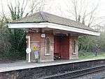 Waiting room at Mortimer Station on south-west side of railway line |
| Streatley Farmhouse | Streatley | Farmhouse | 1675 | 29 November 1983 | SU5932882000 51°32′02″N 1°08′46″W |
1213575 | |
| Streatley House | Streatley | House | Late 18th century | 29 November 1983 | SU5936380763 51°31′22″N 1°08′45″W |
1213395 | 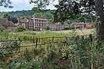 Streatley House |
| Sulham Farmhouse | Sulham | Farmhouse | c.1580 | 19 June 1984 | SU6444474238 51°27′48″N 1°04′25″W |
1288378 | 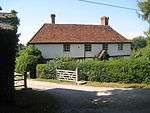 Sulham Farmhouse |
| Church of St Mary | Thatcham | Church | 12th century | 6 April 1967 | SU5164867229 51°24′06″N 1°15′32″W |
1155799 | |
| Calcot Court | Calcot Park, Tilehurst | Flats | 1984 | 25 October 1951 | SU6720472275 51°26′44″N 1°02′04″W |
1215858 | 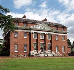 Calcot Court |
| Church of St Gregory | Welford | Church | Late 19th century | 6 March 1985 | SU4088373156 51°27′21″N 1°24′47″W |
1117225 |  Church of St Gregory |
| Church of St Swithin | Wickham, Welford | Church | Saxon/Anglo Saxon | 6 April 1967 | SU3947271520 51°26′29″N 1°26′01″W |
1319533 | 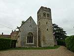 Church of St Swithin |
| Entrance gates, piers and railings to West Woodhay House | West Woodhay | Gate | 18th century | 29 October 1984 | SU3860963306 51°22′03″N 1°26′48″W |
1210179 | |
| Church of St James | Winterbourne | Church | 12th century | 6 April 1967 | SU4506971939 51°26′41″N 1°21′10″W |
1221003 | 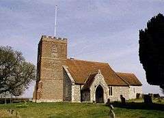 Church of St James |
| Hop Castle (approximately 300 metres to north-west of Penclose Farmhouse) | Winterbourne | House | 1983 | 24 August 1978 | SU4465473766 51°27′40″N 1°21′31″W |
1221027 | |
| Wokefield Park | Wokefield | House | Early 18th century | 14 April 1967 | SU6733165687 51°23′10″N 1°02′02″W |
1135957 | |
| Douai Abbey Church | Upper Woolhampton | Abbey | 1928–33 | 10 November 1983 | SU5770468214 51°24′36″N 1°10′18″W |
1156252 | 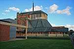 Douai Abbey Church |
| Elstree School, Woolhampton House | Upper Woolhampton | House | 17th century | 9 September 1969 | SU5768367525 51°24′14″N 1°10′20″W |
1117267 | |
| The Rectory | Upper Woolhampton | House | Early 18th century | 10 November 1983 | SU5748368048 51°24′31″N 1°10′30″W |
1319552 | |
| Church of All Saints | Brightwalton | Church | 1862 | 27 June 1972 | SU4270679300 51°30′40″N 1°23′10″W |
1117194 | 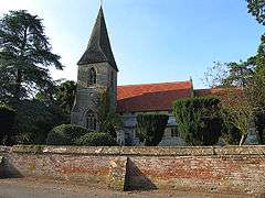 Church of All Saints |
Windsor and Maidenhead
| Name | Location | Type | Completed [note 1] | Date designated | Grid ref.[note 2] Geo-coordinates |
Entry number [note 3] | Image |
|---|---|---|---|---|---|---|---|
| Church of All Saints | Bisham | Parish church | 12th century | 25 March 1955 | SU8480985407 51°33′40″N 0°46′41″W |
1303618 | 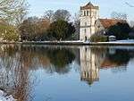 Church of All Saints |
| Tithe Barn | Bisham Abbey, Bisham | Aisled barn | Late 15th century | 25 March 1955 | SU8464984849 51°33′22″N 0°46′49″W |
1117563 | |
| Barn at Stroud Farm, approximately 35 metres east of Stroud Farmhouse | Bray | Threshing barn | 15th century | 2 May 1989 | SU9025677600 51°29′25″N 0°42′05″W |
1136397 | |
| Braywick House | Braywick, Bray | Country house | 17th century | 25 March 1955 | SU8938479289 51°30′20″N 0°42′49″W |
1319441 | |
| Church of St Michael | Bray | Parish church | c.1300 | 25 March 1955 | SU9016979704 51°30′33″N 0°42′08″W |
1312994 | |
| Lych Gate | Bray | Lych gate | Early 15th century | 25 March 1955 | SU9017679644 51°30′31″N 0°42′07″W |
1117492 | 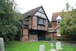 Lych Gate |
| Oakley Court Hotel | Water Oakley, Bray | Country house | 1859 | 21 December 1977 | SU9226577626 51°29′24″N 0°40′21″W |
1117481 | |
| Stroud Farmhouse | Bray | Farmhouse | Late 14th century | 2 May 1989 | SU9020677581 51°29′24″N 0°42′08″W |
1117476 | |
| The Old Farmhouse | Oakley Green, Bray | Farmhouse | 16th century | 11 April 1972 | SU9315676534 51°28′48″N 0°39′36″W |
1117496 | |
| Yew Tree Cottage | Fifield, Bray | House | Late 16th century | 11 April 1972 | SU9037776757 51°28′57″N 0°42′00″W |
1312986 | |
| Church Gate House | Cookham | House | Late 14th century | 25 March 1955 | SU8971285443 51°33′39″N 0°42′26″W |
1303445 | 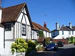 Church Gate House |
| Church of Holy Trinity | Cookham | Parish church | 12th century | 25 March 1955 | SU8970585513 51°33′41″N 0°42′26″W |
1117568 | 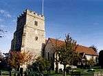 Church of Holy Trinity |
| Noah's House Boathouse | Cookham | Boat house | 1930 | 15 April 1998 | SU8775586895 51°34′27″N 0°44′06″W |
1323741 | |
| Tarrystone House, including iron gates and gate piers and adjoining wall | Cookham | House | Early 18th century | 25 March 1955 | SU8975285369 51°33′36″N 0°42′24″W |
1319371 | 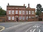 Tarrystone House, including iron gates and gate piers and adjoining wall |
| Bell Farm Farmhouse | Eton Wick, Eton | Farmhouse | c.1375 | 11 April 1950 | SU9487778758 51°29′59″N 0°38′04″W |
1210944 | |
| Lower Chapel, Eton College | Eton | School | 1889–91 | 11 April 1950 | SU9650077783 51°29′27″N 0°36′41″W |
1290001 | |
| St Christopher's | Eton | House | 18th century | 11 April 1950 | SU9663577800 51°29′27″N 0°36′34″W |
1210908 | 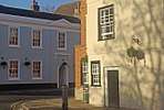 St Christopher's |
| Statue of Henry VI, Eton College | Eton | Statue | 1718 | 14 May 1973 | SU9669977910 51°29′31″N 0°36′31″W |
1210902 | 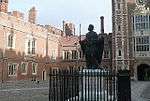 Statue of Henry VI, Eton College |
| The Cock Pitt Cafe | Eton | House | 15th century | 4 November 1950 | SU9669077411 51°29′15″N 0°36′32″W |
1290036 | 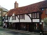 The Cock Pitt Cafe |
| 42 High Street | Eton | House | 18th century | 4 November 1950 | SU9668577462 51°29′16″N 0°36′32″W |
1211362 | 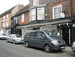 42 High Street |
| Barn at Hurley Farm | Hurley | Barn | Reroofed in 16th century | 25 March 1955 | SU8256783984 51°32′55″N 0°48′38″W |
1319423 | 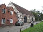 Barn at Hurley Farm |
| Church of St Mary | Hurley | Church | 15th century | 25 March 1955 | SU8258884073 51°32′58″N 0°48′37″W |
1117524 | 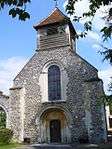 Church of St Mary |
| The Cloisters | Hurley | House | 20th century | 23 March 1955 | SU8259884083 51°32′59″N 0°48′37″W |
1117523 | |
| The Gate House and Archway | Hurley | House | 20th century | 11 April 1972 | SU8256284088 51°32′59″N 0°48′38″W |
1117561 |  The Gate House and Archway |
| The Refectory | Hurley | House | 16th century | 25 March 1955 | SU8259084102 51°32′59″N 0°48′37″W |
1156408 | |
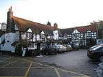
| The Olde Bell | Hurley | Cross wing house | Late 15th century | 25 March 1955 | SU8261883708 51°32′46″N 0°48′36″W |
1156153 | 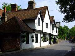 The Olde Bell |
| Beaumont College | Old Windsor | Country house | 1705 | 10 August 1951 | SU9900273251 51°26′59″N 0°34′36″W |
1119795 | |
| Church of St Peter and St Andrew | Old Windsor | Parish church | Early 13th century | 10 August 1951 | SU9925574644 51°27′43″N 0°34′22″W |
1119805 | 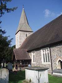 Church of St Peter and St Andrew |
| The Priory | Old Windsor | House | Mid-18th century | 3 March 1972 | SU9921374505 51°27′39″N 0°34′24″W |
1119806 | |
| War memorial at Beaumont College approximately 45 metres from north west corner of main building | Old Windsor | War memorial | c.1920 | 26 June 1998 | SU9890973252 51°26′59″N 0°34′41″W |
1119797 | 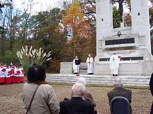 War memorial at Beaumont College approximately 45 metres from north west corner of main building |
| Shottesbrooke Park | Shottesbrooke | Country house | Late 16th century | 11 April 1972 | SU8407977212 51°29′15″N 0°47′26″W |
1117448 | |
| Church of All Souls | South Ascot, Sunninghill and Ascot | Church | 1896–97 | 3 March 1972 | SU9228268001 51°24′13″N 0°40′29″W |
1119809 | 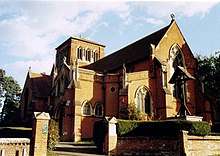 Church of All Souls |
| Bell Inn | Waltham St Lawrence | Inn | c.1400 | 25 March 1955 | SU8296876910 51°29′06″N 0°48′23″W |
1135882 | 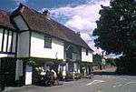 Bell Inn |
| Church of St Lawrence | Waltham St Lawrence | Church | 11th century | 25 March 1955 | SU8295076971 51°29′08″N 0°48′24″W |
1117515 |  Church of St Lawrence |
| Goosenest Farmhouse | West End, Waltham St Lawrence | Aisled house | Early 14th century | 1 March 1988 | SU8242775109 51°28′08″N 0°48′53″W |
1117503 | |
| Kellinghams | Waltham St Lawrence | House | 16th century | 25 March 1955 | SU8309276534 51°28′54″N 0°48′17″W |
1135894 | |
| Church of St Mary | White Waltham | Parish church | 12th century | 11 April 1972 | SU8547977517 51°29′25″N 0°46′13″W |
1117451 | 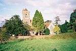 Church of St Mary |
| Church of St Andrew | Wraysbury | Parish church | 13th century | 23 September 1955 | TQ0012573942 51°27′20″N 0°33′37″W |
1117606 | 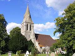 Church of St Andrew |
| King John's Hunting Lodge | Wraysbury | Timber-framed house | Late 15th/early 16th century | 23 September 1955 | SU9963874530 51°27′40″N 0°34′02″W |
1135976 | |
| 1881 Chapel at Convent of St John the Baptist | Clewer | Anglican church | 1881 | 2 October 1975 | SU9519176180 51°28′36″N 0°37′51″W |
1380282 | |
| Adelaide Cottage | Home Park, Windsor | Lodge | Re-erected 1831 | 2 October 1975 | SU9798876512 51°28′45″N 0°35′25″W |
1319270 | |
| All Saints Cottage | Boyn Hill, Maidenhead | House | 1854–57 | 24 July 1970 | SU8776580831 51°31′11″N 0°44′11″W |
1117615 | |
| Ann Foorde's House | Windsor | House | 18th century | 4 January 1950 | SU9699876643 51°28′50″N 0°36′17″W |
1205343 | 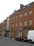 Ann Foorde's House |
| Church of St John the Baptist | Windsor | Church | 1820–22 | 4 January 1950 | SU9688076793 51°28′54″N 0°36′22″W |
1117708 |  Church of St John the Baptist |
| Church Rooms | Windsor | Jettied house | 16th century | 4 January 1950 | SU9687076839 51°28′56″N 0°36′23″W |
1281315 | %2C_Church_St%2C_Windsor.jpg) Church Rooms |
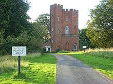
| Cranbourne Tower | Cranbourne | Tower | Late 18th-century alterations | 2 October 1975 | SU9432073120 51°26′57″N 0°38′39″W |
1319295 | |
| Dial House | Windsor | House | Late 18th century | 4 January 1950 | SU9699176647 51°28′50″N 0°36′17″W |
1117728 | 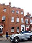 Dial House |
| Edgeworth House Youth Hostel Association | Clewer | House | 1707 | 2 October 1975 | SU9550877100 51°29′05″N 0°37′33″W |
1117723 | |
| Gothic Ruin of Temple by Lake in Frogmore Gardens | Home Park, Windsor | Garden house | c.1792 | 2 October 1975 | SU9758676074 51°28′31″N 0°35′47″W |
1319305 | 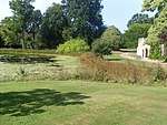 Gothic Ruin of Temple by Lake in Frogmore Gardens |
| Number 4 with entrance to Black Lion Yard | Windsor | House | Late 18th century | 4 January 1950 | SU9700676638 51°28′49″N 0°36′16″W |
1319319 | 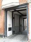 Number 4 with entrance to Black Lion Yard |
| Old Bank House (brewery office) | Windsor | Brewery | Late 18th/early 19th century | 4 January 1950 | SU9682277117 51°29′05″N 0°36′25″W |
1117676 | 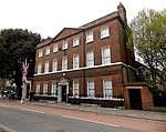 Old Bank House (brewery office) |
| Oldfield Lodge | Maidenhead | House | Late 18th century | 27 February 1950 | SU8994681291 51°31′24″N 0°42′18″W |
1117620 | |
| Parish Centre | Boyn Hill, Maidenhead | Parish hall | 1983 | 24 July 1970 | SU8774880829 51°31′10″N 0°44′12″W |
1312975 | |
| Prince Albert's Dairy and Cottage | Home Park, Windsor | House | Circa 1830–40 | 2 October 1975 | SU9790275995 51°28′28″N 0°35′30″W |
1272281 | |
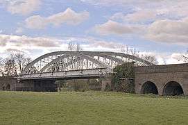
| Railway bridge carrying the Windsor–Slough line over the Thames | Windsor | Railway bridge | 1849 | 2 October 1975 | SU9605377289 51°29′11″N 0°37′05″W |
1319297 | |
| Smythes Almshouses | Maidenhead | Almshouses | 1659 | 27 February 1950 | SU8948381336 51°31′26″N 0°42′42″W |
1136053 | 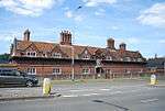 Smythes Almshouses |
| St George's School | Windsor | School | 1803 | 4 January 1975 | SU9690677209 51°29′08″N 0°36′21″W |
1319325 | |
| St Leonards Dale | Windsor | House | 1700–20 | 4 January 1950 | SU9455675139 51°28′02″N 0°38′25″W |
1319329 | |
| The Gate House | Windsor | House | 18th century | 4 January 1950 | SU9701876631 51°28′49″N 0°36′16″W |
1280766 |  The Gate House |
| The Limes | Clewer | House | 17th century | 2 October 1975 | SU9551277142 51°29′07″N 0°37′33″W |
1117722 | 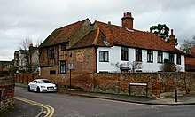 The Limes |
| The Old House Hotel | Windsor | House | Dated 1676 | 4 January 1950 | SU9674077189 51°29′07″N 0°36′29″W |
1319337 | 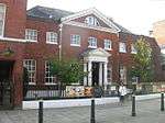 The Old House Hotel |
| The Vicarage | Boyn Hill, Maidenhead | House | 1854–57 | 24 July 1970 | SU8777580859 51°31′11″N 0°44′11″W |
1117617 | 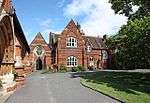 The Vicarage |
| Vicarage Cottage | Boyn Hill, Maidenhead | House | 1857–57 | 12 August 1983 | SU8777480846 51°31′11″N 0°44′11″W |
1136003 | |
| 9–11 Park Street | Windsor | House | Early 19th century | 4 January 1950 | SU9695576663 51°28′50″N 0°36′19″W |
1117729 | 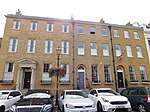 9–11 Park Street |
| 20 Park Street | Windsor | House | Late 18th century | 2 October 1975 | SU9696076699 51°28′51″N 0°36′18″W |
1117730 | 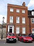 20 Park Street |
| 4 and 6 Church Street | Windsor | House | 1640 | 4 January 1950 | SU9686376852 51°28′56″N 0°36′23″W |
1221042 | 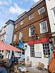 4 and 6 Church Street |
| 12–16 Park Street | Windsor | Terrace | Early 19th century | 4 January 1950 | SU9693276676 51°28′51″N 0°36′20″W |
1280741 | 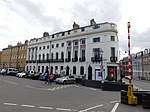 12–16 Park Street |
Wokingham
| Name | Location | Type | Completed [note 1] | Date designated | Grid ref.[note 2] Geo-coordinates |
Entry number [note 3] | Image |
|---|---|---|---|---|---|---|---|
| Bartlett's Farmhouse | Arborfield and Newland | Farmhouse | Late 16th century | 26 January 1967 | SU7528466177 51°23′23″N 0°55′10″W |
1319119 | 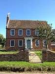 Bartlett's Farmhouse |
| Bearwood House (now Reddam House, Berkshire - school) | Sindlesham | Country house | 1865–74 | 14 October 1986 | SU7770569052 51°24′55″N 0°53′02″W |
1135967 | 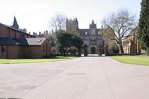 Bearwood House (now Reddam House, Berkshire - school) |
| Foxhill House | Whiteknights Park, Earley | House | 1868 | 19 September 1983 | SU7362872333 51°26′43″N 0°56′31″W |
1136050 | |
| Banisters | Finchampstead | Farmhouse | 16th century | 26 January 1967 | SU7763463087 51°21′42″N 0°53′11″W |
1319143 | |
| Culham Court | Culham, Remenham | Country house | 1771 | 1 August 1952 | SU7892983800 51°32′51″N 0°51′47″W |
1118167 | 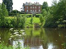 Culham Court |
| Hartley Court | Great Lea Common, Shinfield | Country house | Early 16th century | 26 January 1967 | SU7055368935 51°24′54″N 0°59′13″W |
1319124 | 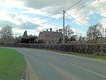 Hartley Court |
| Church of St Andrew | Sonning | Church | Originally Norman | 26 January 1967 | SU7558875571 51°28′27″N 0°54′47″W |
1135979 | |
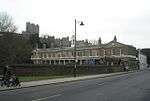
| The Bull Hotel | Sonning | Inn | Late 16th century | 26 January 1967 | SU7567375521 51°28′25″N 0°54′43″W |
1117462 | |
| Haineshill | St. Nicholas, Hurst | Country house | Late 16th century | 1 August 1952 | SU8123674080 51°27′36″N 0°49′56″W |
1117416 | |
| Hinton House | St. Nicholas, Hurst | House | Late 16th century | 1 August 1952 | SU8037974773 51°27′58″N 0°50′39″W |
1117407 | |
| Hurst Lodge | St. Nicholas, Hurst | Country house | Early 17th century | 1 August 1952 | SU8007373718 51°27′24″N 0°50′56″W |
1117439 | |
| Barn approximately 80 metres north of Sheepbridge Court | Sheep Bridge, Swallowfield | Aisled barn | Late 16th century | 14 February 1986 | SU7209265497 51°23′02″N 0°57′56″W |
1135822 | |
| Hall's Farm Kennels | Swallowfield | Farmhouse | Late 16th century | 26 January 1967 | SU7597464470 51°22′27″N 0°54′36″W |
1319167 | |
| Sheepbridge Court | Sheep Bridge, Swallowfield | Farmhouse | Late 16th century | 1 August 1952 | SU7202965515 51°23′03″N 0°57′59″W |
1313105 | |
| Swallowfield Park and adjoining stable block | Swallowfield | Country house | Late 16th and 17th century | 1 August 1952 | SU7311965516 51°23′02″N 0°57′02″W |
1313056 | .jpg) Swallowfield Park and adjoining stable block |
| The Harrison Almshouses | Twyford | Almshouse | 1640 | 1 August 1952 | SU7887476029 51°28′40″N 0°51′56″W |
1118152 | |
| Bear Place | Kiln Green, Wargrave | Country house | Late 18th century | 26 January 1967 | SU8104479114 51°30′19″N 0°50′01″W |
1118177 | |
| Church of St Mary | Wargrave | Church | 1635 | 26 January 1967 | SU7827678469 51°29′59″N 0°52′25″W |
1155023 | 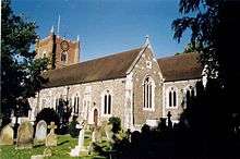 Church of St Mary |
| Hannen Columbarium, 22 metres south-east of Church of St Mary | Wargrave | Mausoleum | 1906–07 | 23 December 1983 | SU7830078438 51°29′58″N 0°52′24″W |
1155027 | 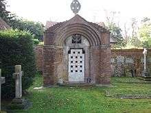 Hannen Columbarium, 22 metres south-east of Church of St Mary |
| Ashridge Farmhouse | Wokingham | Farmhouse | Late 16th century | 12 November 1951 | SU8137669727 51°25′15″N 0°49′52″W |
1319183 | |
| Church of All Saints | Wokingham | Parish church | Late 14th century | 12 November 1951 | SU8152368801 51°24′45″N 0°49′45″W |
1155959 | 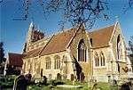 Church of All Saints |
| Church of St Paul | Wokingham | Parish church | 1862–64 | 12 November 1951 | SU8052468983 51°24′51″N 0°50′37″W |
1303384 | 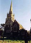 Church of St Paul |
| Montague House and attached garden walls | Wokingham | Town house | Mid-18th century | 12 November 1951 | SU8109468695 51°24′41″N 0°50′07″W |
1319160 | 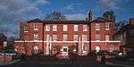 Montague House and attached garden walls |
| Outbuildings at Lucas Hospital | Chapel Green, Wokingham | Almshouse | 19th century | 15 July 1987 | SU8125067405 51°24′00″N 0°50′00″W |
1118047 | |
| Red Lion Public House | Wokingham | House | Early 17th century | 2 October 1969 | SU8121268515 51°24′35″N 0°50′01″W |
1118018 |  Red Lion Public House |
| Shute End House | Wokingham | Town house | 17th century | 12 November 1951 | SU8095868721 51°24′42″N 0°50′14″W |
1118009 | |
| The Elms | Wokingham | Town house | 16th century or earlier | 12 November 1951 | SU8104668659 51°24′40″N 0°50′10″W |
1118045 | |
| The Town Hall | Wokingham | Town hall | 1860–1905 | 2 October 1969 | SU8121168561 51°24′37″N 0°50′01″W |
1303481 |  The Town Hall |
| Tudor House | Wokingham | House | Late 16th century | 12 November 1951 | SU8099868738 51°24′43″N 0°50′12″W |
1319161 |  Tudor House |
| Littlecourt (W.A.D.E. Day Centre) | Wokingham | House | 18th century | 12 November 1951 | SU8068068884 51°24′48″N 0°50′29″W |
1118028 | |
| 6 Market Place | Wokingham | Town house | Mid-18th century | 12 November 1951 | SU8117068564 51°24′37″N 0°50′04″W |
1118021 |  6 Market Place |
| 6 Shute End | Wokingham | Timber-framed house | 16th century | 12 November 1951 | SU8097668709 51°24′42″N 0°50′13″W |
1303232 |  6 Shute End |
| 33 Rose Street | Wokingham | House | Late 15th century | 12 November 1951 | SU8137468733 51°24′42″N 0°49′53″W |
1319178 |  33 Rose Street |
| 35 and 35a Rose Street | Wokingham | House | Mid-15th century | 12 November 1951 | SU8137868734 51°24′42″N 0°49′53″W |
1118002 | |
| 80 Rose Street | Wokingham | House | 17th century | 2 October 1969 | SU8141668792 51°24′44″N 0°49′51″W |
1155568 | |
| 37 Rose Street | Wokingham | House | Mid-15th century | 12 November 1951 | SU8138468740 51°24′43″N 0°49′52″W |
1303276 | |
| 39 Rose Street | Wokingham | House | Late 15th century | 12 November 1951 | SU8139468744 51°24′43″N 0°49′52″W |
1118003 | 39 Rose Street |
| Lock's House | Wokingham Without | House | Early 18th century | 26 August 1967 | SU8335967727 51°24′09″N 0°48′11″W |
1118082 |  Lock's House |
| Bulmershe Manor | Woodley | House | Late 16th century | 1 August 1952 | SU7559473739 51°27′27″N 0°54′48″W |
1312868 | |
| Church of St John the Evangelist | Woodley | Parish church | 1873 | 26 January 1967 | SU7683973692 51°27′25″N 0°53′44″W |
1136276 |  Church of St John the Evangelist |
Notes
- The date given is the date used by Historic England as significant for the initial building or that of an important part in the structure's description.
- Sometimes known as OSGB36, the grid reference is based on the British national grid reference system used by the Ordnance Survey.
- The "List Entry Number" is a unique number assigned to each listed building and scheduled monument by Historic England.
External links
| Wikimedia Commons has media related to Grade II* listed buildings in Berkshire. |
Berkshire Portal | |
| Unitary authorities | |
| Major settlements | |
| Topics | |
This article is issued from Wikipedia. The text is licensed under Creative Commons - Attribution - Sharealike. Additional terms may apply for the media files.