Grade II* listed buildings in Babergh
There are over 20,000 Grade II* listed buildings in England. This page is a list of these buildings in the district of Babergh in Suffolk.
List of buildings
| Name | Location | Type | Completed [note 1] | Date designated | Grid ref.[note 2] Geo-coordinates |
Entry number [note 3] | Image |
|---|---|---|---|---|---|---|---|
| Mill House | Alpheton | House | 15th century | 10 January 1953 | TL8785349205 52°06′33″N 0°44′31″E |
1285943 |  |
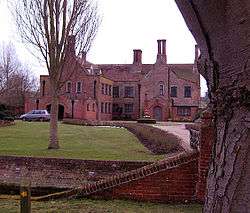
| Erwarton Hall | Arwarton | House | c.1575 | 23 February 1989 | TM2229735122 51°58′12″N 1°14′05″E |
1351638 | .jpg) Erwarton Hall |
| Gatehouse at north approach drive to Erwarton Hall | Arwarton | Gatehouse | c.1549 | 23 February 1989 | TM2232535206 51°58′15″N 1°14′07″E |
1193599 | 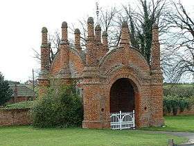 Gatehouse at north approach drive to Erwarton Hall |
| Belstead Hall | Belstead | House | 17th century | 22 February 1955 | TM1273041246 52°01′44″N 1°05′59″E |
1351648 |  Belstead Hall |
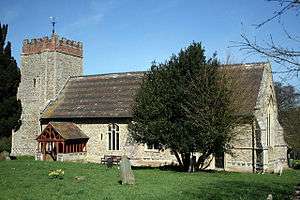
| Church of St Mary | Belstead | Church | 14th century | 22 February 1955 | TM1265941098 52°01′39″N 1°05′54″E |
1194048 | .jpg) Church of St Mary |
| Bentley Hall | Bentley | House | 18th century | 22 February 1955 | TM1187038395 52°00′13″N 1°05′07″E |
1351964 | |
| Meeting Hall/Stables, approximately 30 metres south of Bentley Hall | Bentley | Jettied house | 15th/16th century | 22 February 1955 | TM1187738372 52°00′12″N 1°05′07″E |
1033423 | |
| Barn on opposite side of road and approximately 100 metres north east of Bentley Hall | Bentley | Barn | Early 16th century | 22 February 1955 | TM1193738462 52°00′15″N 1°05′11″E |
1351965 | |
| Church of St Mary | Bentley | Church | 12th century nave | 22 February 1955 | TM1186038142 52°00′05″N 1°05′06″E |
1193823 | .jpg) Church of St Mary |
| Bentley Old Hall | Bentley | House | 13th/14th century | 30 October 1990 | TM1187139700 52°00′55″N 1°05′10″E |
1193864 | |
| Newbury Farmhouse | Bildeston | House | 15th–16th century | 23 January 1958 | TL9939949075 52°06′15″N 0°54′36″E |
1037409 | |
| Bec Cottage, 15 Chapel Street | Bildeston | House | Medieval | 23 January 1958 | TL9921649421 52°06′26″N 0°54′28″E |
1351383 | .jpg) Bec Cottage, 15 Chapel Street |
| 23–33 Chapel Street | Bildeston | House | 15th–16th century | 23 January 1958 | TL9918149403 52°06′25″N 0°54′26″E |
1193239 | .jpg) 23–33 Chapel Street |
| Spinners Cottage and Weavers Cottage, 35 and 37 Chapel Street | Bildeston | House | 15th–16th century | 23 January 1958 | TL9917249398 52°06′25″N 0°54′25″E |
1037448 |  Spinners Cottage and Weavers Cottage, 35 and 37 Chapel Street |
| The Crown Inn | Bildeston | Jettied house | 1495 | 23 January 1958 | TL9931049430 52°06′26″N 0°54′32″E |
1286228 | .jpg) The Crown Inn |
| The Fleece Hotel | Boxford | House | 18th century | 23 January 1958 | TL9629040564 52°01′43″N 0°51′36″E |
1037389 |  The Fleece Hotel |
| Boxted Hall | Boxted | House | 16th century | 10 January 1953 | TL8276850570 52°07′24″N 0°40′06″E |
1351740 | 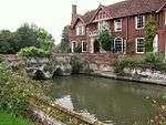 Boxted Hall |
| Fishers | Boxted | Hall house | 15th century | 10 January 1953 | TL8076050394 52°07′20″N 0°38′20″E |
1036708 | |
| Church of St Michael the Archangel | Brantham | Church | 14th century | 22 February 1955 | TM1121634195 51°57′58″N 1°04′24″E |
1033431 | .jpg) Church of St Michael the Archangel |
| Corner Farmhouse | Brent Eleigh | Jettied house | 16th century | 23 January 1958 | TL9424147879 52°05′43″N 0°50′03″E |
1285914 | 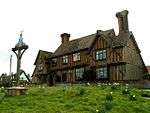 Corner Farmhouse |
| Wall and gateway southwest of Wells Hall | Brent Eleigh | Gate | 16th century | 23 January 1958 | TL9457147304 52°05′24″N 0°50′19″E |
1037386 | 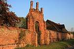 Wall and gateway southwest of Wells Hall |
| Old Buckenham Hall School | Brettenham Park, Brettenham | Country house | 16th century | 23 January 1958 | TL9571652965 52°08′25″N 0°51′31″E |
1037349 | |
| Poplars Farmhouse | Brettenham | House | 15th century and later | 23 January 1958 | TL9527052710 52°08′17″N 0°51′07″E |
1351456 | 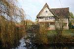 Poplars Farmhouse |
| Great Bevills | Bures St. Mary | House | c.1490 | 10 January 1953 | TL9070934684 51°58′40″N 0°46′31″E |
1036684 | |
| Malthouse and premises occupied by W A Church (Bures) Ltd | Bures St. Mary | House | 16th–17th century | 10 January 1953 | TL9078534135 51°58′23″N 0°46′34″E |
1036677 |  Malthouse and premises occupied by W A Church (Bures) Ltd |
| Sawyer's Farmhouse | Little Cornard, Bures St. Mary | House | 16th century | 9 February 1978 | TL9068737192 52°00′01″N 0°46′35″E |
1036687 | |
| Smallbridge Hall | Bures St. Mary | Country house | c.1550 | 10 January 1953 | TL9293933065 51°57′45″N 0°48′25″E |
1194489 | |
| The Old Bakery | Bures St. Mary | Jettied house | 16th century | 10 January 1973 | TL9075934171 51°58′24″N 0°46′33″E |
1351766 |  The Old Bakery |
| Boynton Hall | Capel St. Mary | House | 16th century | 16 March 1972 | TM0917037231 51°59′39″N 1°02′43″E |
1033394 | |
| Church of St Mary | Capel St. Mary | Church | 13th/14th century | 22 February 1955 | TM0858338242 52°00′12″N 1°02′15″E |
1285712 |  Church of St Mary |
| Church of All Saints | Chattisham | Church | Early 14th century | 22 February 1955 | TM0922642150 52°02′18″N 1°02′57″E |
1351620 |  Church of All Saints |
| Princhetts | Chelsworth | House | Probably 16th–17th century | 23 January 1958 | TL9827148058 52°05′43″N 0°53′35″E |
1037362 | 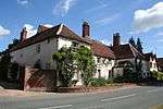 Princhetts |
| The Grange | Chelsworth | House | 17th century | 10 July 1980 | TL9807247982 52°05′41″N 0°53′24″E |
1037325 | 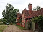 The Grange |
| The Old Forge | Chelsworth | Jettied house | 15th–16th century | 23 January 1958 | TL9832548085 52°05′44″N 0°53′38″E |
1351422 | .jpg) The Old Forge |
| Chilton Hall | Chilton | House | Late 15th century | 10 January 1953 | TL8904342716 52°03′02″N 0°45′20″E |
1036689 | |
| Church House | Cockfield | Cruck house | Medieval | 23 January 1958 | TL9037954944 52°09′36″N 0°46′55″E |
1194237 | .jpg) Church House |
| Church of St Mary | Washbrook, Copdock and Washbrook | Church | 12th century | 22 February 1955 | TM1095342589 52°02′30″N 1°04′28″E |
1194408 | |
| Church of St Peter | Copdock, Copdock and Washbrook | Church | 14th and 15th century | 22 February 1955 | 49°46′01″N 7°33′26″W | 1194324 | 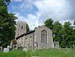 Church of St Peter |
| Bellcage to north side of churchyard | East Bergholt | Bell tower | Late 16th century | 22 February 1955 | TM0704134484 51°58′13″N 1°00′46″E |
1033451 | 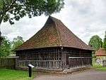 Bellcage to north side of churchyard |
| Bridge Cottage | Flatford, East Bergholt | House | Late 16th century | 22 February 1955 | TM0758233336 51°57′35″N 1°01′12″E |
1033472 | |
| Chaplins | Gaston End, East Bergholt | House | Early 16th century | 22 February 1955 | TM0743635367 51°58′41″N 1°01′08″E |
1286166 | |
| Churchgate House | Rectory Hill, East Bergholt | House | c.1500 | 22 February 1955 | TM0708634463 51°58′12″N 1°00′48″E |
1033454 | |
| Claycotts | Flatford Road, East Bergholt | House | Early 16th century | 22 February 1955 | TM0776534226 51°58′04″N 1°01′23″E |
1351932 | |
| The Gables | The Street, East Bergholt | House | Late 16th century | 22 February 1955 | TM0695834733 51°58′21″N 1°00′42″E |
1285872 | |
| The Lodge | Hadleigh Rd, East Bergholt | House | 18th century | 22 February 1955 | TM0648735428 51°58′44″N 1°00′19″E |
1286124 | |
| Church of St Peter | Freston | Church | 13th–14th century | 22 February 1955 | TM1709639511 52°00′42″N 1°09′43″E |
1036973 | 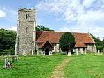 Church of St Peter |
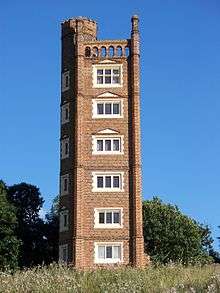
| Freston Tower | Freston Park, Freston | Watchtower | c.1550 | 22 February 1955 | TM1779239664 52°00′46″N 1°10′20″E |
1203980 | |
| Angel House | Glemsford | Jettied house | 16th century | 23 March 1961 | TL8287647515 52°05′45″N 0°40′06″E |
1036656 | 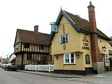 Angel House |
| Monks Hall | Low St, Glemsford | House | 15th century | 23 March 1961 | TL8342048820 52°06′26″N 0°40′37″E |
1285414 | 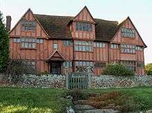 Monks Hall |
| Peverells | 21–25, Tye Green, Glemsford | Hall house | 15th–16th century | 10 January 1953 | TL8262348025 52°06′01″N 0°39′54″E |
1036665 | |
| 13–17, Chequers Lane | Glemsford | Jettied house | 16th and 17th century | 23 March 1961 | TL8298448806 52°06′26″N 0°40′14″E |
1036649 | 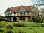 13–17, Chequers Lane |
| Poplars Farmhouse | Great Cornard | House | 15th century | 10 January 1953 | TL9030741094 52°02′08″N 0°46′23″E |
1036630 | |
| Babergh Hall | Great Waldingfield | House | Late 18th–early 19th century | 10 January 1953 | TL9031444498 52°03′58″N 0°46′30″E |
1036634 | |
| Groton Hall | Groton | House | 18th century | 23 January 1958 | TL9597741658 52°02′19″N 0°51′21″E |
1285612 | 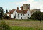 Groton Hall |
| Bank House and the White Lion Hotel | 42 & 44, High St, Hadleigh | House | 18th century | 26 April 1950 | TM0271642428 52°02′35″N 0°57′16″E |
1036802 | 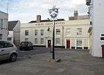 Bank House and the White Lion Hotel |
| Barclays Bank | Hadleigh | Loggia | Early 19th century | 26 April 1950 | TM0272542421 52°02′35″N 0°57′17″E |
1351707 | |
| Benton End House | Raydon Rd, Hadleigh | House | 18th century | 26 April 1950 | TM0334341357 52°02′00″N 0°57′47″E |
1194592 | |
| Deanery | Church Walk, Hadleigh | Deanery | 1831 | 22 May 1972 | TM0249442470 49°46′01″N 7°33′26″W |
1194061 | 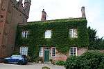 Deanery |
| East House | George St, Hadleigh | House | 18th century | 26 April 1950 | TM0287742615 52°02′41″N 0°57′25″E |
1036786 | |
| Sun Court | 12–16, Bridge St, Hadleigh | Timber-framed house | 16th century | 26 April 1950 | TM0233042967 52°02′53″N 0°56′57″E |
1193958 | |
| Sun Court | 107, High St, Hadleigh | House | Early 16th century | 26 April 1950 | TM0252142695 52°02′44″N 0°57′07″E |
1036746 | |
| The Manse | 90, Benson St, Hadleigh | House | 18th century | 26 April 1950 | TM0294541860 52°02′17″N 0°57′27″E |
1351708 | |
| Toppesfield Bridge | Hadleigh | Bridge | 14th century | 26 April 1950 | TM0257442147 52°02′27″N 0°57′08″E |
1036780 | 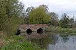 Toppesfield Bridge |
| White Hart Inn | Hadleigh | Inn | 15th/16th century | 26 April 1950 | TM0222843055 52°02′56″N 0°56′52″E |
1193977 | 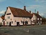 White Hart Inn |
| 95, 97 and 99 Angel Street | Hadleigh | House | 16th century | 26 April 1950 | TM0289242860 52°02′49″N 0°57′26″E |
1193765 | |
| 13 Bridge Street | Hadleigh | Timber-framed house | 17th century | 26 April 1950 | TM0239642836 52°02′49″N 0°57′00″E |
1036811 | 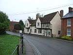 13 Bridge Street |
| 15 Bridge Street | Hadleigh | Timber-framed house | 18th century | 26 April 1950 | TM0238842839 52°02′49″N 0°57′00″E |
1036812 | 15 Bridge Street |
| 21 Bridge Street | Hadleigh | House | 18th century | 26 April 1950 | TM0229442950 52°02′53″N 0°56′55″E |
1193934 | |
| 77–81 Benton Street | Hadleigh | House | 18th century | 26 April 1950 | TM0293941936 52°02′19″N 0°57′27″E |
1193819 | |
| 92 and 94 Benton Street | Hadleigh | Inn | 16th century | 26 April 1950 | TM0299341820 52°02′15″N 0°57′30″E |
1036804 | |
| 45 and 47 High Street | Hadleigh | Hall house | Late 18th century | 26 April 1950 | TM0268442443 52°02′36″N 0°57′15″E |
1036779 | |
| 46 and 48 High Street | Hadleigh | Shop | 17th century | 26 April 1950 | TM0270542444 52°02′36″N 0°57′16″E |
1036757 | 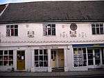 46 and 48 High Street |
| 49 High Street | Hadleigh | Timber-framed house | 1774 | 26 April 1950 | TM0267942450 52°02′36″N 0°57′14″E |
1036735 | |
| 79–83 High Street | Hadleigh | Hall house | 15th century | 26 April 1950 | TM0258442575 52°02′40″N 0°57′10″E |
1036740 | |
| 91 and 93 High Street | Hadleigh | Timber-framed house | 17th century | 26 April 1950 | TM0256342623 52°02′42″N 0°57′09″E |
1194454 | |
| 97 and 99 High Street | Hadleigh | House | 17th century | 26 April 1950 | TM0255042649 52°02′43″N 0°57′08″E |
1036744 | 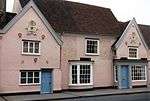 97 and 99 High Street |
| 124 and 126 High Street | Hadleigh | House | 16th century | 26 April 1950 | TM0252342800 52°02′48″N 0°57′07″E |
1194322 | 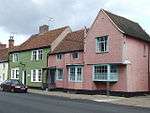 124 and 126 High Street |
| 108 and 110 High Street | Hadleigh | House | 1649 | 26 April 1950 | TM0255142732 52°02′45″N 0°57′08″E |
1194306 | 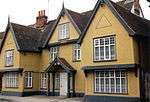 108 and 110 High Street |
| 22–26 George Street | Hadleigh | Timber-framed house | 15th–16th century | 26 April 1950 | TM0283242582 52°02′40″N 0°57′23″E |
1351701 | |
| 28 George Street | Hadleigh | House | 17th–18th century | 26 April 1950 | TM0284042579 52°02′40″N 0°57′23″E |
1036785 | |
| 48 George Street | Hadleigh | Cross-wing house | 15th century | 26 April 1950 | TM0303742686 52°02′43″N 0°57′34″E |
1036788 | |
| Church of St Mary | Harkstead | Church | 12th century | 22 February 1955 | TM1940835280 51°58′22″N 1°11′35″E |
1286085 | 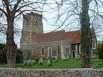 Church of St Mary |
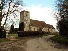
| Church of St Mary | Higham | Church | 13th century | 22 February 1955 | TM0356335232 51°58′42″N 0°57′45″E |
1351625 | 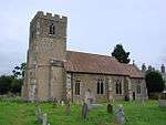 Church of St Mary |
| Service ranges, stables, former coachhouse and brewhouse attached to Hintlesham Hall | Hintlesham | Brewhouse | 18th century | 22 February 1955 | TM0828243846 52°03′14″N 1°02′11″E |
1036918 | |
| Royal Hospital School, main range including assembly hall, dining room, gymnasium, administration and teaching accommodation | Holbrook | Hospital school | c.1925–33 | 16 January 1981 | TM1654335227 51°58′24″N 1°09′05″E |
1036871 | Royal Hospital School, main range including assembly hall, dining room, gymnasium, administration and teaching accommodation |
| Chapel of the Royal Hospital School | Holbrook | Chapel | c.1925–33 | 23 February 1989 | TM1672635223 51°58′23″N 1°09′14″E |
1036873 | 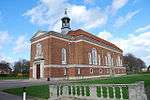 Chapel of the Royal Hospital School |
| Church of All Saints | Holbrook | Church | 14th century | 22 February 1955 | TM1704036128 51°58′52″N 1°09′33″E |
1193727 | 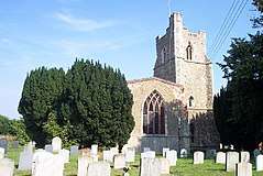 Church of All Saints |
| Church of St Mary | Holton St. Mary | Church | 13th century | 22 February 1955 | TM0592736787 51°59′29″N 0°59′52″E |
1351596 | 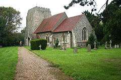 Church of St Mary |
| Ailsa Cottage & Greenan | Kersey | Cross-wing house | 15th–16th century | 23 January 1958 | TM0005144050 52°03′31″N 0°55′00″E |
1037237 | 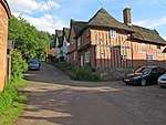 Ailsa Cottage & Greenan |
| Corner House | Kersey | House | 15th–16th century | 23 January 1958 | TM0000144277 52°03′39″N 0°54′58″E |
1180414 | |
| Cressland & Kedges End | Kersey | House | 17th century | 23 January 1958 | TM0002444133 52°03′34″N 0°54′59″E |
1037247 | |
| Kersey Mill | Kersey | Mill | 18th–19th century | 23 January 1958 | TM0117444417 52°03′42″N 0°56′00″E |
1180340 | .jpg) Kersey Mill |
| Mill House | Kersey | Mill house | 17th century | 23 January 1958 | TM0003544208 52°03′36″N 0°55′00″E |
1351458 | |
| River House | Kersey | House | 16th century | 23 January 1958 | TM0007244114 52°03′33″N 0°55′01″E |
1234780 |  River House |
| The Little Manor | Kersey | Cross-wing house | 14th–15th century | 23 January 1958 | TM0014143987 52°03′29″N 0°55′05″E |
1351461 | 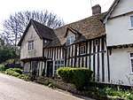 The Little Manor |
| 1 & 2 The Street | Kersey | Jettied house | 16th–17th century | 23 January 1958 | TM0000444180 52°03′36″N 0°54′58″E |
1351485 | |
| 3 & 4 The Street | Kersey | Jettied house | 16th century | 23 January 1958 | TL9999944188 52°03′36″N 0°54′58″E |
1285468 | |
| 5 & 6, The Street | Kersey | Jettied house | 15th–16th century | 23 January 1958 | TL9999844202 52°03′36″N 0°54′58″E |
1037249 | |
| Angel Hotel | Lavenham | Hotel | 18th century | 23 January 1958 | TL9161549357 52°06′34″N 0°47′48″E |
1037184 | 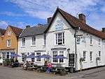 Angel Hotel |
| Little Hall | Lavenham | Cross-wing house | 15th century | 23 January 1958 | TL9163749327 52°06′33″N 0°47′49″E |
1351533 | 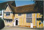 Little Hall |
| Swan Hotel (that part formerly listed as No 102) | Lavenham | House/hotel | 15th–16th century | 23 January 1958 | TL9153949186 52°06′28″N 0°47′44″E |
1037174 | 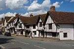 Swan Hotel (that part formerly listed as No 102) |
| Swan Hotel (that part formerly listed as Swan Inn) | Lavenham | House | 16th century | 23 January 1958 | TL9155449185 52°06′28″N 0°47′45″E |
1037175 | Swan Hotel (that part formerly listed as Swan Inn) |
| Swan Hotel (that part formerly listed as No 101) | Lavenham | House | Probably 16th century | 23 January 1958 | TL9153649201 52°06′29″N 0°47′44″E |
1351529 | %2C_Lavenham%2C_Suffolk.jpg) Swan Hotel (that part formerly listed as No 101) |
| The Barn | Lavenham | Barn | 15th–16th century | 23 January 1958 | TL9169249244 52°06′30″N 0°47′52″E |
1037216 |  The Barn |
| The Great House | Lavenham | House | 18th century | 23 January 1958 | TL9163049344 52°06′33″N 0°47′49″E |
1181062 |  The Great House |
| The Manor House | Lavenham | House | 15th century | 23 January 1958 | TL9171849107 52°06′25″N 0°47′53″E |
1037129 |  The Manor House |
| Woolstaplers | Lavenham | House | Early 15th (or possibly 14th) century | 23 January 1958 | TL9175649454 52°06′37″N 0°47′56″E |
1037190 |  Woolstaplers |
| 58 Water Street | Lavenham | Jettied house | 1425 | 23 January 1958 | TL9169149113 52°06′26″N 0°47′52″E |
1037130 | 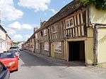 58 Water Street |
| No 9, Church St, including outbuilding adjoining on the north, and no 10 | Lavenham | House | 15th century | 23 January 1958 | TL9153749076 52°06′25″N 0°47′44″E |
1037228 | 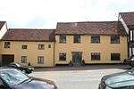 No 9, Church St, including outbuilding adjoining on the north, and no 10 |
| Blaize House, 11 and 12 Church Street | Lavenham | Clothier's house | 15th–16th century | 23 January 1958 | TL9152649062 52°06′24″N 0°47′43″E |
1180575 | 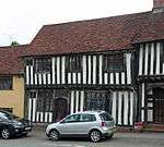 Blaize House, 11 and 12 Church Street |
| 13–15 Church Street | Lavenham | Clothier's house | 15th–16th century | 23 January 1958 | TL9152049054 52°06′24″N 0°47′43″E |
1351478 | 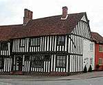 13–15 Church Street |
| 81 Church Street | Lavenham | House | c.1750 | 23 January 1958 | TL9146849054 52°06′24″N 0°47′40″E |
1351480 | 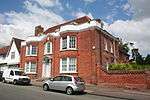 81 Church Street |
| 85 Church Street | Lavenham | Jettied house | 16th century | 23 January 1958 | TL9150349073 52°06′25″N 0°47′42″E |
1180676 | 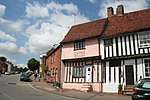 85 Church Street |
| 86 Church Street | Lavenham | Jettied house | 16th century | 23 January 1958 | TL9150649080 52°06′25″N 0°47′42″E |
1037192 | 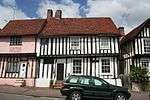 86 Church Street |
| 87 Church Street | Lavenham | Jettied house | 15th–16th century | 23 January 1958 | TL9150849087 52°06′25″N 0°47′42″E |
1351499 | 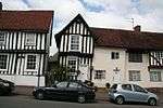 87 Church Street |
| 88 & 89 Church Street | Lavenham | Jettied house | 15th–16th century | 23 January 1958 | TL9151049092 52°06′25″N 0°47′42″E |
1037193 | 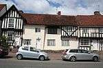 88 & 89 Church Street |
| 90 Church Street | Lavenham | Jettied house | 15th–16th century | 23 January 1958 | TL9151449102 52°06′25″N 0°47′43″E |
1037194 | 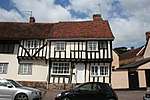 90 Church Street |
| 91 Church Street | Lavenham | House | 16th century | 23 January 1958 | TL9151649119 52°06′26″N 0°47′43″E |
1351500 | 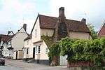 91 Church Street |
| The Willows [92 Church Street] | Lavenham | House | c.1750 | 23 January 1958 | TL9151449146 52°06′27″N 0°47′43″E)] |
1037195 | 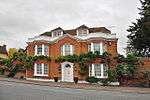 The Willows [92 Church Street] |
| 10–13 High Street | Lavenham | House | 18th or early 19th century | 23 January 1958 | TL9150449271 52°06′31″N 0°47′42″E |
1285335 | 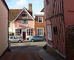 10–13 High Street |
| 97 High Street | Lavenham | House | 15th–16th century | 23 January 1958 | TL9153149228 52°06′30″N 0°47′44″E |
1351528 | 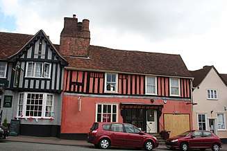 97 High Street |
| 98–100 High Street | Lavenham | Cross-wing house | Early 15th century | 23 January 1958 | TL9153449215 52°06′29″N 0°47′44″E |
1037173 | 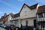 98–100 High Street |
| Lawshall Hall | Lawshall | House | Mid-16th century | 10 January 1953 | TL8633354290 52°09′20″N 0°43′21″E |
1036593 | |
| Honey Hall | Honey Tye, Leavenheath | Hall house | 15th century | 10 January 1953 | TL9559535644 51°59′05″N 0°50′49″E |
1036600 | 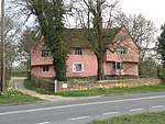 Honey Hall |
| Bourchier Galleries, House and Shop | Long Melford | House | Late 17th century | 23 March 1961 | TL8624745487 52°04′35″N 0°42′59″E |
1033698 | 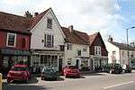 Bourchier Galleries, House and Shop |
| Bridge Street Farmhouse | Bridge Street, Long Melford | House | Medieval | 10 January 1953 | TL8715348463 52°06′10″N 0°43′52″E |
1036574 | 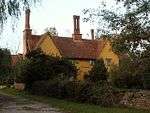 Bridge Street Farmhouse |
| Brook House | Long Melford | House | 16th and 17th century | 10 January 1953 | TL8642945909 52°04′49″N 0°43′09″E |
1183049 |  Brook House |
| Bull Hotel | Long Melford | Hotel | 1580 or earlier | 9 February 1978 | TL8648745878 52°04′47″N 0°43′12″E |
1182781 | 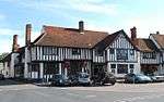 Bull Hotel |
| Chapel at Melford Place | Long Melford | House | 14th century | 10 January 1953 | TL8619644966 52°04′18″N 0°42′55″E |
1183356 | 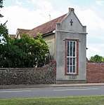 Chapel at Melford Place |
| Dovecote to the southwest of Kentwell Hall | Kentwell, Long Melford | Dovecote | 18th century | 9 February 1978 | TL8630447882 52°05′52″N 0°43′07″E |
1351844 | |
| Garden walls to Melford Hall | Long Melford | Garden wall | c.1559 | 9 February 1978 | TL8657646198 52°04′58″N 0°43′18″E |
1351818 | 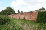 Garden walls to Melford Hall |
| Gateway and lodges to Melford Hall | Long Melford | Gate lodge | c.1559 | 16 April 1971 | TL8658646294 52°05′01″N 0°43′18″E |
1033703 | 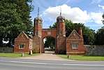 Gateway and lodges to Melford Hall |
| Summerhouse at Melford Hall | Long Melford | Summerhouse | 16th century | 10 January 1953 | TL8659046257 52°05′00″N 0°43′18″E |
1351819 | 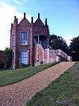 Summerhouse at Melford Hall |
| Premises occupied by Cadge and Son, Builders | Long Melford | Hall house | Medieval | 10 January 1953 | TL8627245180 52°04′25″N 0°43′00″E |
1351864 | 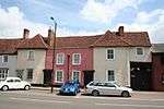 Premises occupied by Cadge and Son, Builders |
| The Elms | Long Melford | House | 18th century | 10 January 1953 | TL8627545305 52°04′29″N 0°43′00″E |
1033641 | 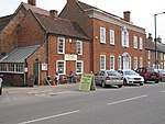 The Elms |
| Water conduit | Long Melford | Conduit | 16th century | 10 January 1953 | TL8659746427 52°05′05″N 0°43′19″E |
1033704 | 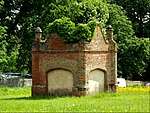 Water conduit |
| Milden Hall | Milden | Timber-framed house | 18th century | 23 January 1958 | TL9443046274 52°04′50″N 0°50′10″E |
1181918 | |
| The Fenn | Swingleton Green, Monks Eleigh | House | 16th century | 23 January 1958 | TL9619247312 52°05′22″N 0°51′44″E |
1182166 | 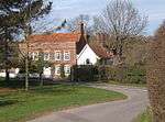 The Fenn |
| Dresden Cottage | Nayland-with-Wissington | House | 15th century | 9 February 1978 | TL9748534427 51°58′24″N 0°52′26″E |
1351862 | |
| Odd Corners | Nayland-with-Wissington | Jettied house | 16th century | 10 January 1953 | TL9748934404 51°58′23″N 0°52′26″E |
1033592 | |
| Wiston Mill | Wiston, Nayland-with-Wissington | House | 18th–19th century | 9 February 1978 | TL9623333282 51°57′48″N 0°51′18″E |
1033616 | .jpg) Wiston Mill |
| 1 Birch Street | Nayland, Nayland-with-Wissington | House | 16th century | 10 January 1953 | TL9748634392 51°58′22″N 0°52′25″E |
1033591 | |
| 6 and 8 Birch Street | Nayland, Nayland-with-Wissington | House | 15th century | 9 February 1978 | TL9748034421 51°58′23″N 0°52′25″E |
1033633 | |
| 17 and 19 Court Street | Nayland, Nayland-with-Wissington | Timber-framed building | 14th century | 9 February 1978 | TL9745434152 51°58′15″N 0°52′23″E |
1351850 | |
| 1 and 3 High Street | Nayland, Nayland-with-Wissington | House | 15th century | 10 January 1953 | TL9748434310 51°58′20″N 0°52′25″E |
1033572 | |
| Brickhouse Farmhouse | Naughton, Nedging-with-Naughton | Farmhouse | 15th–16th century | 10 July 1980 | TM0289248998 52°06′08″N 0°57′40″E |
1037104 | |
| Church of All Saints | Newton | Church | Mainly 14th century | 23 March 1961 | TL9197141267 52°02′12″N 0°47′51″E |
1283418 | |
| Rogers Farmhouse | Newton | Jettied house | c.1600 | 9 February 1978 | TL9314241404 52°02′15″N 0°48′52″E |
1033552 | |
| Polstead Hall | Polstead Park, Polstead, Babergh | House | 16th century | 23 January 1958 | TL9881638157 52°00′22″N 0°53′43″E |
1037049 | 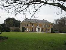 Polstead Hall |
| Preston Hall | Preston St. Mary | House | 16th–17th century | 23 January 1958 | TL9465150231 52°06′58″N 0°50′30″E |
1182472 | 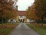 Preston Hall |
| Church of St Mary | Raydon | Church | Late 13th–early 14th century | 22 February 1955 | TM0493138620 52°00′29″N 0°59′04″E |
1286247 | 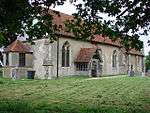 Church of St Mary |
| Church of All Saints | Shelley | Church | Early 14th century | 22 February 1955 | TM0308238457 52°00′27″N 0°57′27″E |
1351959 | 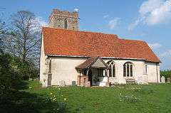 Church of All Saints |
| Church of St Mary | Shotley | Church | 13th/14th century | 22 February 1955 | TM2370136021 51°58′39″N 1°15′21″E |
1194504 | 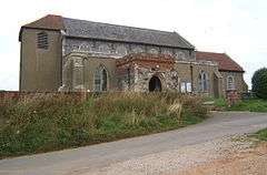 Church of St Mary |
| Church of All Saints | Sproughton | Church | Early 14th century | 22 February 1955 | TM1251545029 52°03′46″N 1°05′56″E |
1285956 | 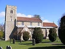 Church of All Saints |
| Church of St James | Stanstead | Church | 14th century | 23 March 1961 | TL8433949342 52°06′42″N 0°41′26″E |
1033528 | _St._James_Church_(geograph_1859238).jpg) Church of St James |
| The Oaklands | Stanstead | House | 16th–17th century | 10 January 1953 | TL8435148590 52°06′18″N 0°41′25″E |
1033523 | 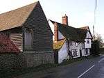 The Oaklands |
| Street House | Stoke-by-Nayland | Jettied house | 15th–16th century | 10 January 1953 | TL9879636286 51°59′22″N 0°53′38″E |
1033538 | |
| The Downs Farmhouse | Stoke-by-Nayland | Farmhouse | Early 16th century | 9 February 1978 | TL9863436054 51°59′15″N 0°53′29″E |
1200113 | |
| The Maltings | Stoke-by-Nayland | House | 16th century and later | 23 March 1961 | TL9856836306 51°59′23″N 0°53′26″E |
1033513 | 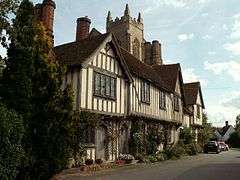 The Maltings |
| The Old Guildhall (Tudor Cottages) | Stoke-by-Nayland | House | 16th and 17th century | 10 January 1953 | TL9856536258 51°59′21″N 0°53′26″E |
1200348 | 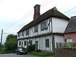 The Old Guildhall (Tudor Cottages) |
| Thorington Hall | Stoke-by-Nayland | Jettied house | 17th century | 10 January 1953 | TM0131235465 51°58′52″N 0°55′48″E |
1200597 | 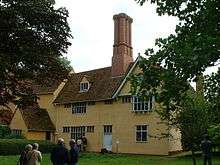 Thorington Hall |
| Lowe Hill House | Stratford St. Mary | House | Early 16th century | 22 February 1955 | TM0425135021 51°58′34″N 0°58′21″E |
1036991 |  Lowe Hill House |
| Weavers House | Stratford St. Mary | House | Early–mid-16th century | 22 February 1955 | TM0426033820 51°57′55″N 0°58′19″E |
1351601 | 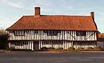 Weavers House |
| Church of St Peter | Stutton | Church | 15th century | 22 February 1955 | TM1615434462 51°58′00″N 1°08′43″E |
1285520 | 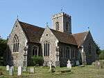 Church of St Peter |
| Crowe Hall | Stutton | House | c.1605 | 22 February 1956 | TM1528034214 51°57′53″N 1°07′56″E |
1036862 | |
| Garden wall and gateway attached to and enclosing a garden to north of Stutton Hall | Stutton Park, Stutton | Gate | 16th century | 23 February 1989 | TM1403433746 51°57′40″N 1°06′50″E |
1180369 | |
| Stutton Hall | Stutton Park, Stutton | House | c.1553 | 22 February 1955 | TM1403233702 51°57′38″N 1°06′50″E |
1036866 | |
| 30 Market Hill | Sudbury | House | 18th century | 3 March 1952 | TL8737541274 52°02′18″N 0°43′50″E |
1351389 | .jpg) 30 Market Hill |
| Ballingdon Hall | Sudbury | Timber-framed house | c.1593 | 3 March 1952 | TL8626740189 52°01′44″N 0°42′50″E |
1037550 | |
| Barn at St Bartholomew's Priory Farm | Sudbury | Grange | 17th century | 26 October 1971 | TL8715942790 52°03′07″N 0°43′41″E |
1037547 | |
| Brundon Hall | Brundon, Sudbury | House | 18th century | 3 March 1952 | TL8657242180 52°02′48″N 0°43′09″E |
1037518 | |
| Chapel at St Bartholomew's Priory Farm | Sudbury | Chapel | Early 15th century | 3 March 1952 | TL8709942803 52°03′07″N 0°43′38″E |
1037546 | 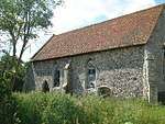 Chapel at St Bartholomew's Priory Farm |
| Corn Exchange & Public Library | Sudbury | Corn exchange | 1841 | 26 October 1971 | TL8735241252 52°02′17″N 0°43′49″E |
1037457 | .jpg) Corn Exchange & Public Library |
| Priory Gate | Sudbury | House | c.1500 | 3 March 1952 | TL8706241036 52°02′10″N 0°43′33″E |
1285460 | 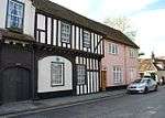 Priory Gate |
| Stour Hall | Sudbury | House | 17th century | 3 March 1952 | TL8697841250 52°02′17″N 0°43′29″E |
1037437 | 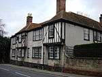 Stour Hall |
| The Red House | Bullocks Lane, Sudbury | House | 17th/18th century | 3 March 1952 | TL8781841412 52°02′21″N 0°44′13″E |
1351342 | |
| Ye Old Moot Hall | Sudbury | House | 15th century | 3 March 1952 | TL8682641046 52°02′11″N 0°43′21″E |
1180344 | .jpg) Ye Old Moot Hall |
| Church of St Mary | Tattingstone | Church | 14th century | 22 May 1955 | TM1360437143 51°59′30″N 1°06′35″E |
1351983 | 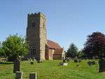 Church of St Mary |
| The Tattingstone Wonder | Tattingstone | House | c.1790 | 22 February 1955 | TM1391436285 51°59′02″N 1°06′49″E |
1033392 | |
| Thorpe Hall | Thorpe Morieux | House | 16th century | 23 January 1958 | TL9432053235 52°08′36″N 0°50′18″E |
1284474 |  Thorpe Hall |
| Church of St Nicholas | Wattisham | Church | 14th century | 23 January 1958 | TM0098251376 52°07′27″N 0°56′04″E |
1037033 | 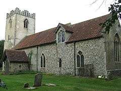 Church of St Nicholas |
| Church of St John | Wenham Magna | Church | 14th century | 22 February 1955 | TM0709838128 52°00′11″N 1°00′57″E |
1033403 | 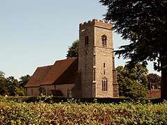 Church of St John |
| Priory Farmhouse | Wenham Magna | House | 15th century or earlier | 22 February 1955 | TM0726038174 52°00′12″N 1°01′05″E |
1351956 | |
| Wenham Place | Wenham Magna | House | 16th century | 22 February 1955 | TM0719537760 51°59′59″N 1°01′01″E |
1351955 | 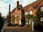 Wenham Place |
| Barn approximately 150 metres north of Little Wenham Castle and west of Church of St Lawrence | Wenham Parva | Timber-framed barn | 16th century | 30 October 1990 | TM0803539212 52°00′44″N 1°01′48″E |
1194552 | 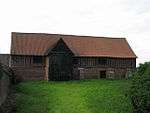 Barn approximately 150 metres north of Little Wenham Castle and west of Church of St Lawrence |
| Church of St Mary | Wherstead Park, Wherstead | Church | 12th century | 22 February 1955 | TM1614140699 52°01′21″N 1°08′56″E |
1204027 | 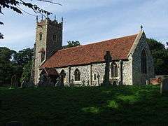 Church of St Mary |
| Church of St Michael | Woolverstone Park, Woolverstone | Church | 14th century | 22 February 1955 | TM1902138583 52°00′09″N 1°11′22″E |
1204060 | 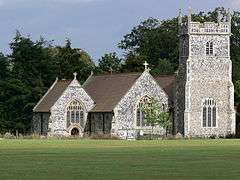 Church of St Michael |
| Woolverstone House including walls attached to each side | Woolverstone | Jettied house | 1901 | 16 March 1972 | TM1828838758 52°00′16″N 1°10′44″E |
1204044 | |
.jpg)
.jpg)

.jpg)
See also
Notes
- The date given is the date used by Historic England as significant for the initial building or that of an important part in the structure's description.
- Sometimes known as OSGB36, the grid reference is based on the British national grid reference system used by the Ordnance Survey.
- The "List Entry Number" is a unique number assigned to each listed building and scheduled monument by Historic England.
External links
![]()
This article is issued from Wikipedia. The text is licensed under Creative Commons - Attribution - Sharealike. Additional terms may apply for the media files.