Grade I listed buildings in Dorset
There are over 9000 Grade I listed buildings in England. This page is a list of these buildings in the county of Dorset, sub-divided by Unitary Authorities.
These unitary authorities are Bournemouth, Christchurch and Poole Council, as well as Dorset Council.
Bournemouth, Christchurch and Poole
Bournemouth
| Name | Location | Type | Completed [note 1] | Date designated | Grid ref.[note 2] Geo-coordinates |
Entry number [note 3] | Image |
|---|---|---|---|---|---|---|---|
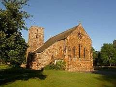
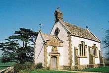
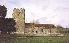
| Church of St Clement | Boscombe, Bournemouth | Church | 1871–73 | 5 May 1952 | SZ1072892127 50°43′43″N 1°50′58″W |
1324751 | .jpg) Church of St Clement |
| Church of St Peter | Bournemouth | Church | 1851 | 5 May 1952 | SZ0888391216 50°43′14″N 1°52′32″W |
1153014 | |
| Church of St Stephen | Bournemouth | Church | 1881–83 | 5 May 1952 | SZ0852391507 50°43′23″N 1°52′50″W |
1324756 |
Christchurch
| Name | Location | Type | Completed [note 1] | Date designated | Grid ref.[note 2] Geo-coordinates |
Entry number [note 3] | Image |
|---|---|---|---|---|---|---|---|
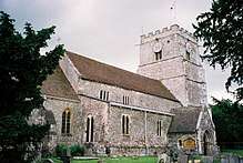
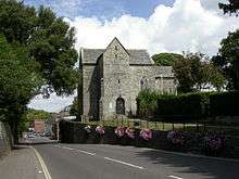
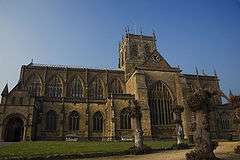
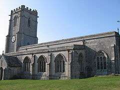
| Christchurch Priory and Parish Church | Christchurch | Parish church | 11th century | 14 October 1953 | SZ1603192531 50°43′56″N 1°46′27″W |
1110141 |  Christchurch Priory and Parish Church |
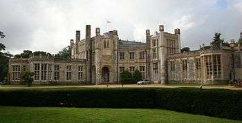
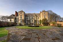
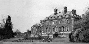
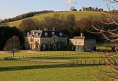
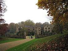
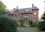
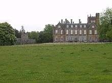
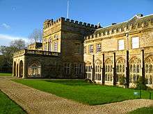
| Highcliffe Castle | Christchurch | Country house | 1830–34 | 14 October 1953 | SZ2028693208 50°44′17″N 1°42′50″W |
1110077 | |
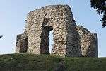
| Christchurch Castle | Christchurch | Castle | 1100–35 | 14 October 1953 | SZ1596892661 50°44′00″N 1°46′30″W |
1153159 | |
| The Constable's House | Christchurch | House | 12th century | 14 October 1953 | SZ1605092706 50°44′02″N 1°46′26″W |
1325069 | |
| Town Bridge | Christchurch | Bridge | 15th or 16th century | 14 October 1953 | SZ1606992753 50°44′03″N 1°46′25″W |
1304408 | 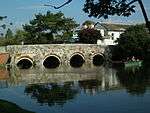 Town Bridge |
| Waterloo Bridge | Christchurch | Bridge | 1816–17 | 14 October 1953 | SZ1625692833 50°44′06″N 1°46′16″W |
1304449 | 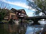 Waterloo Bridge |
Poole
| Name | Location | Type | Completed [note 1] | Date designated | Grid ref.[note 2] Geo-coordinates |
Entry number [note 3] | Image |
|---|---|---|---|---|---|---|---|
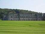
| Canford School | Canford Magna, Poole | Country house | 1825–36 | 14 June 1954 | SZ0335098917 50°47′23″N 1°57′14″W |
1217460 | |
| John of Gaunt's Kitchen, Canford School | Canford Magna | Kitchen block | 15th century | 14 June 1954 | SZ0339598937 50°47′24″N 1°57′12″W |
1217462 |  |
| Nineveh Court, attached carriage arch and screen wall, Canford School | Canford Magna | Sculpture gallery | 1851 | 14 June 1954 | SZ0341498941 50°47′24″N 1°57′11″W |
1217464 | 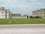 Nineveh Court, attached carriage arch and screen wall, Canford School |
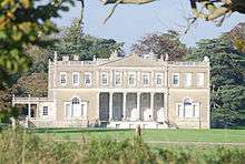
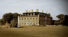
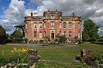
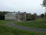
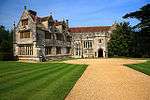
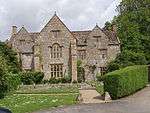
| Merley House | Poole | Country house | 1752–60 | 14 June 1954 | SZ0086498321 50°47′04″N 1°59′21″W |
1275387 | 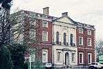 Merley House |
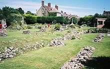
| Scaplen's Court | Poole | House | Late 15th to early 16th century | 14 June 1954 | SZ0087990359 50°42′46″N 1°59′20″W |
1275378 | |
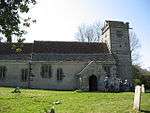
| Parish Church of Canford Magna | Canford Magna | Parish church | c.1200 | 14 June 1954 | SZ0319498812 50°47′20″N 1°57′22″W |
1217465 | |
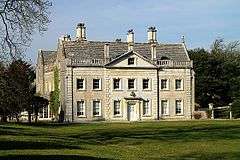
| Sir Peter Thompson House | Poole | House | 1746–49 | 14 June 1954 | SZ0104890692 50°42′57″N 1°59′11″W |
1224145 | 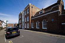 Sir Peter Thompson House |
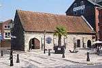
| The Waterfront Museum, Local History Centre | Poole | Warehouse | First half of the 15th century | 14 June 1954 | SZ0086190313 50°42′45″N 1°59′21″W |
1217514 |
.jpg)
Dorset (unitary authority)
Eastern Dorset
| Name | Location | Type | Completed [note 1] | Date designated | Grid ref.[note 2] Geo-coordinates |
Entry number [note 3] | Image |
|---|---|---|---|---|---|---|---|
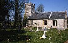
| Church of All Saints | Chalbury | Parish church | 13th-century origin | 18 March 1955 | SU0185606840 50°51′40″N 1°58′30″W |
1120141 | 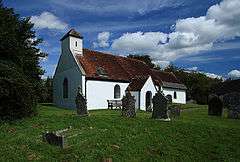 Church of All Saints |
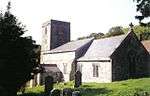
| Church of St Mary and St Bartholomew | Cranborne | Parish church | 12th century | 18 March 1955 | SU0545313247 50°55′07″N 1°55′26″W |
1120181 | |
| Cranborne Manor House | Cranborne | Hunting lodge | c.1207–08 | 18 March 1955 | SU0531313228 50°55′07″N 1°55′33″W |
1120172 | |
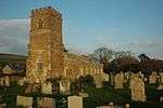
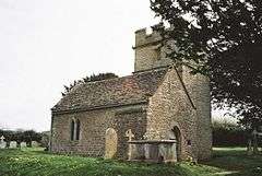
| Church of All Saints | Gussage All Saints | Parish church | 14th century | 18 March 1955 | ST9984510827 50°53′49″N 2°00′13″W |
1304213 | 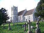 Church of All Saints |
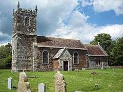
| Church of St Michael | Gussage St Michael | Parish church | 12th-century tower | 18 March 1955 | ST9858511332 50°54′05″N 2°01′17″W |
1120146 | 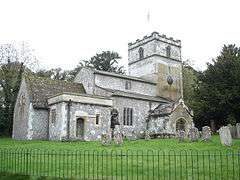 Church of St Michael |
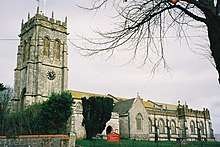
| Church of St Wolfrida | Horton | Parish church | Possible 12th or 13th-century origin | 18 March 1955 | SU0301507447 50°51′59″N 1°57′31″W |
1154780 |  Church of St Wolfrida |
| Crichel House | Moor Crichel | Country house | 1743 | 18 March 1955 | ST9942908324 50°52′28″N 2°00′34″W |
1120155 | |
| Julian's Bridge | Pamphill | Bridge | Probably late 15th century | 14 June 1952 | SZ0035899846 50°47′53″N 1°59′47″W |
1323805 | 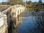 Julian's Bridge |
| Julian's Bridge | Pamphill | Bridge | Probably late 15th century | 18 March 1955 | SZ0035999846 50°47′53″N 1°59′47″W |
1323821 | Julian's Bridge |
| Kingston Lacy House | Pamphill | House | 1663–65 | 18 March 1955 | ST9785301268 50°48′39″N 2°01′55″W |
1119511 | |
| Parish Church of Saint Bartholomew | Shapwick | Parish church | 12th-century origin | 18 March 1955 | ST9365601675 50°48′53″N 2°05′29″W |
1323469 |  Parish Church of Saint Bartholomew |
| White Mill Bridge | Sturminster Marshall | Bridge | 16th century | 18 March 1955 | ST9576700552 50°48′16″N 2°03′41″W |
1120035 | .jpg) White Mill Bridge |
| Church of St Andrew | Gussage St Andrew, Sixpenny Handley | Chapel of ease | 12th century | 18 March 1955 | ST9760714254 50°55′40″N 2°02′08″W |
1153744 | 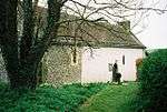 Church of St Andrew |
| Church of St Mary | Almer, Sturminster Marshall | Parish church | 12th century | 18 March 1955 | SY9131798933 50°47′24″N 2°07′28″W |
1154550 | |
| Dean's Court | Wimborne Minster | Country house | 1725 | 14 June 1952 | SZ0098999700 50°47′49″N 1°59′14″W |
1119561 | 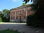 Dean's Court |
| The Minster Church of St Cuthburga | Wimborne Minster | Collegiate church | 12th century | 14 June 1952 | SZ0094599932 50°47′56″N 1°59′17″W |
1119581 | |
| Church of St Giles | Wimborne St Giles | Parish church | 1732 | 18 March 1955 | SU0319111960 50°54′26″N 1°57′22″W |
1120134 | 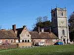 Church of St Giles |
| St Giles House | Wimborne St Giles | Country house | 17th century | 18 March 1955 | SU0323611591 50°54′14″N 1°57′19″W |
1120129 |
.jpg)
Northern Dorset
| Name | Location | Type | Completed [note 1] | Date designated | Grid ref.[note 2] Geo-coordinates |
Entry number [note 3] | Image |
|---|---|---|---|---|---|---|---|
| Anderson Manor | Anderson | Manor house | 1622 | 14 July 1955 | SY8802197604 50°46′40″N 2°10′17″W |
1118633 | |
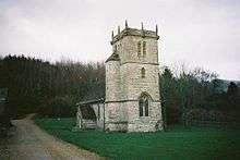
| Church of Saint Andrew | Winterborne Tomson, Anderson | Parish church | 12th century | 14 July 1955 | SY8847597424 50°46′35″N 2°09′53″W |
1118600 | |
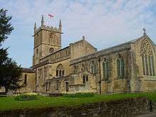
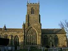
| Church of St Peter and St Paul | Blandford Forum | Parish church | 1732–39 | 27 October 1950 | ST8856406311 50°51′22″N 2°09′50″W |
1251913 | 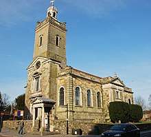 Church of St Peter and St Paul |
| Coupar House | Blandford Forum | House | Mid-18th century | 27 October 1950 | ST8854906388 50°51′25″N 2°09′51″W |
1152976 | 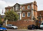 Coupar House |
| Greyhound House | Blandford Forum | Inn | 1753 | 27 October 1950 | ST8845106270 50°51′21″N 2°09′56″W |
1152922 | 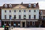 Greyhound House |
| Pump House | Blandford Forum | Portico | 1760 | 27 October 1950 | ST8853406296 50°51′22″N 2°09′51″W |
1324829 | .jpg) Pump House |
| The Old House | Blandford Forum | House | Mid-17th century | 27 October 1950 | ST8868006416 50°51′26″N 2°09′44″W |
1108699 | 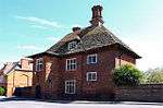 The Old House |
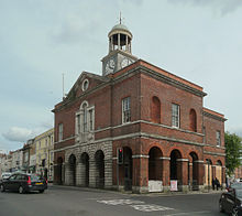
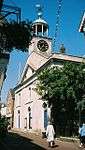
| Town Hall and Corn Exchange | Blandford Forum | Town hall | 1734 | 27 October 1950 | ST8849406328 50°51′23″N 2°09′53″W |
1324806 |  Town Hall and Corn Exchange |
| 18 and 20, Market Place | Blandford Forum | Inn | 18th century | 27 October 1950 | ST8851606273 50°51′21″N 2°09′52″W |
1108646 | .jpg) 18 and 20, Market Place |
| 26, Market Place (Bastard House) | Blandford Forum | House | 18th century | 7 September 1973 | ST8854606276 50°51′21″N 2°09′51″W |
1108648 | .jpg) 26, Market Place (Bastard House) |
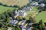
| Bryanston School | Bryanston | Country house | 1889–94 | 11 June 1985 | ST8703907370 50°51′56″N 2°11′08″W |
1305449 | |
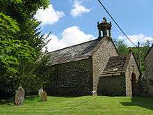
| The Portman Chapel | Bryanston Old Buildings, Bryanston | Parish church | 1745 | 14 July 1955 | ST8746607054 50°51′46″N 2°10′46″W |
1110183 | 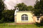 The Portman Chapel |
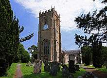
| Church of St Mary | Charlton Marshall | Parish church | 15th-century tower | 14 July 1955 | ST9003804074 50°50′10″N 2°08′34″W |
1171867 | 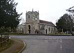 Church of St Mary |
| Chettle House | Chettle | Country house | c.1710 | 14 July 1955 | ST9514013184 50°55′05″N 2°04′14″W |
1118513 | |
| Tower of the former Church of St Mary | East Compton, Compton Abbas | Tower | Late 15th century | 16 August 1960 | ST8755918800 50°58′07″N 2°10′43″W |
1172395 | 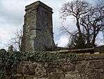 Tower of the former Church of St Mary |
| Church of St Mary | Gillingham | Parish church | 14th century | 16 August 1960 | ST8064326582 51°02′18″N 2°16′39″W |
1172499 | |
| Church of St Paul | Hammoon | Parish church | Late 12th or early 13th century | 24 June 1985 | ST8178414576 50°55′49″N 2°15′38″W |
1324608 | 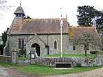 Church of St Paul |
| Church of St Mary and St James | Droop, Hazelbury Bryan | Parish church | 15th century | 4 October 1960 | ST7532508287 50°52′25″N 2°21′07″W |
1110493 | 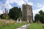 Church of St Mary and St James |
| Parish Church of All Saints | Hilton | Parish church | 15th-century tower | 14 July 1955 | ST7816202975 50°49′33″N 2°18′41″W |
1118613 | 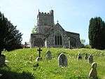 Parish Church of All Saints |
| Church of St Mary | Iwerne Courtney | Parish church | 14th century | 14 July 1955 | ST8598912415 50°54′40″N 2°12′02″W |
1305327 | 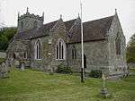 Church of St Mary |
| Ranston | Ranston, Iwerne Courtney | Country house | 1753 | 14 July 1955 | ST8628212356 50°54′38″N 2°11′47″W |
1305285 | |
| Church of St Mary | Iwerne Minster | Parish church | 12th century | 16 August 1960 | ST8683414465 50°55′46″N 2°11′19″W |
1110192 | 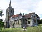 Church of St Mary |
| West Lodge (that part in the parish of Iwerne Minster) | Iwerne Minster | Country house | 18th century | 24 June 1985 | ST8941515742 50°56′28″N 2°09′07″W |
1172300 | |
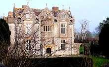
| Stepleton House | Iwerne Stepleton | Country house | Early to mid-17th century | 14 July 1955 | ST8633311294 50°54′03″N 2°11′45″W |
1110203 | |
| Church of St Nicholas | Manston | Parish church | Early 13th century | 4 October 1960 | ST8164615049 50°56′05″N 2°15′45″W |
1110434 | 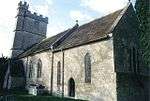 Church of St Nicholas |
| Church of St Peter and St Paul | Mappowder | Parish church | Late 15th century | 4 October 1960 | ST7353805987 50°51′10″N 2°22′38″W |
1287754 | 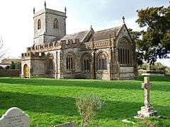 Church of St Peter and St Paul |
| Church of St Gregory | Marnhull | Parish church | 12th century | 4 October 1960 | ST7815118717 50°58′03″N 2°18′45″W |
1172545 | 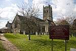 Church of St Gregory |
| Abbey Church of St Mary, St Sansom and St Branwalader | Milton Abbey, Milton Abbas | Abbey church | 14th century | 14 July 1955 | ST7983202296 50°49′11″N 2°17′16″W |
1304822 | 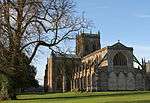 Abbey Church of St Mary, St Sansom and St Branwalader |
| Chapel of Saint Catherine | Milton Abbey, Milton Abbas | Abbey chapel | Late 12th century | 14 July 1955 | ST8011902343 50°49′13″N 2°17′01″W |
1304728 |  Chapel of Saint Catherine |
| Milton Abbey School | Milton Abbey, Milton Abbas | Country house | 1771–76 | 26 June 1953 | ST7985402377 50°49′14″N 2°17′15″W |
1118566 | |
| The Abbot's Hall and Kitchen, Milton Abbey | Milton Abbey, Milton Abbas | Great hall | c.1498 | 26 June 1953 | ST7985302339 50°49′13″N 2°17′15″W |
1152407 |  The Abbot's Hall and Kitchen, Milton Abbey |
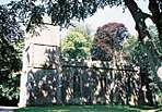
| Park Wall | Gold Hill, Shaftesbury | Boundary wall | c.1365 | 20 June 1952 | ST8626222881 51°00′19″N 2°11′50″W |
1108773 |  Park Wall |
| The remains of Shaftesbury Abbey | Shaftesbury | Abbey | 888 | 20 June 1952 | ST8616322886 51°00′19″N 2°11′55″W |
1108779 | |
| Church of the Holy Rood | Shillingstone | Parish church | Early 12th century | 4 October 1960 | ST8247411470 50°54′09″N 2°15′02″W |
1324658 | 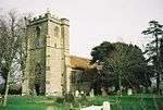 Church of the Holy Rood |
| Church of St Nicholas | Silton | Parish church | Late 12th century | 16 August 1960 | ST7826429344 51°03′47″N 2°18′42″W |
1304821 | 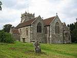 Church of St Nicholas |
| Church of St John | Spetisbury | Parish church | Late 12th or early 13th century | 14 July 1955 | ST9094102924 50°49′33″N 2°07′48″W |
1305220 | 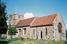 Church of St John |
| Crawford Bridge | Spetisbury | Road bridge | Medieval | 14 July 1955 | ST9189901978 50°49′02″N 2°06′59″W |
1305264 |  Crawford Bridge |
| Church of St Michael | Stour Provost | Parish church | Possibly 13th century origin | 16 August 1960 | ST7940221572 50°59′35″N 2°17′42″W |
1110379 | 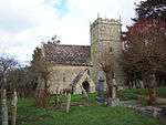 Church of St Michael |
| Parish Church of St Peter | Stourton Caundle | Parish church | 13th century | 4 October 1960 | ST7145215198 50°56′08″N 2°24′28″W |
1228147 | 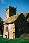 Parish Church of St Peter |
| Church of St Mary | Sturminster Newton | Parish church | c.1400 | 4 October 1960 | ST7880413950 50°55′29″N 2°18′11″W |
1324486 | 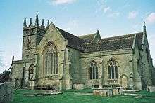 Church of St Mary |
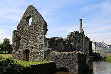
| Fiddleford Mill House | Sturminster Newton | Manor house | Late 14th century | 4 October 1960 | ST8008213580 50°55′17″N 2°17′05″W |
1324484 | 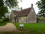 Fiddleford Mill House |
| Town Bridge | Sturminster Newton | Road bridge | Late 15th or early 16th century | 4 October 1960 | ST7844913573 50°55′16″N 2°18′29″W |
1110531 | 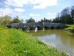 Town Bridge |
| Church of St Mary | Tarrant Crawford | Parish church | 12th century | 26 June 1953 | ST9229603467 50°49′50″N 2°06′39″W |
1110840 | |
| Eastbury House including attached west courtyard and gateway | Eastbury, Tarrant Gunville | Service wing | 1717–38 | 14 July 1955 | ST9323012707 50°54′50″N 2°05′52″W |
1324303 | 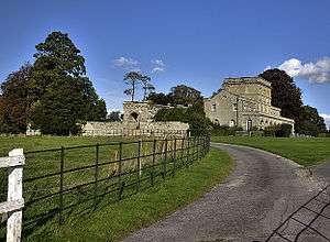 Eastbury House including attached west courtyard and gateway |
| Church of St Mary | Tarrant Hinton | Parish church | 14th century | 14 July 1955 | ST9362511150 50°53′59″N 2°05′31″W |
1118497 | 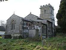 Church of St Mary |
| Manor House | Winterborne Clenston | Manor house | Early 16th century | 14 July 1955 | ST8387203130 50°49′39″N 2°13′49″W |
1172313 | 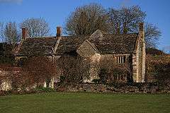 Manor House |
| Manor Farm Barn | Winterborne Clenston | Barn | Late 16th century | 14 July 1955 | ST8384903036 50°49′36″N 2°13′50″W |
1110166 | 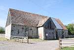 Manor Farm Barn |
| Church of St Mary | Winterborne Stickland | Parish church | 13th century | 14 July 1955 | ST8346004626 50°50′27″N 2°14′11″W |
1305111 | 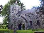 Church of St Mary |
| Church of St Mary | Winterborne Whitechurch | Parish church | Early 13th century | 14 July 1955 | ST8360600121 50°48′01″N 2°14′02″W |
1118538 | 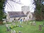 Church of St Mary |
Southern Dorset
| Name | Location | Type | Completed [note 1] | Date designated | Grid ref.[note 2] Geo-coordinates |
Entry number [note 3] | Image |
|---|---|---|---|---|---|---|---|
| Parish Church of St Laurence | Affpuddle | Parish church | 15th century | 20 November 1959 | SY8053493710 50°44′34″N 2°16′38″W |
1323317 | 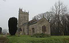 Parish Church of St Laurence |
| Parish Church of St Nicholas | Arne | Parish church | 13th century | 20 November 1959 | SY9723888127 50°41′34″N 2°02′26″W |
1323421 | 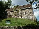 Parish Church of St Nicholas |
| Parish Church of St John the Baptist | Southbrook, Bere Regis | Parish church | 16th century | 20 November 1959 | SY8474294756 50°45′08″N 2°13′04″W |
1170978 | 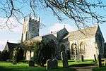 Parish Church of St John the Baptist |
| Bloxworth House, including the attached wall and gate piers on east | Bloxworth | Country house | 1608 | 20 November 1959 | SY8793494961 50°45′15″N 2°10′21″W |
1171112 | |
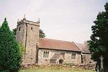
| Parish Church of St Andrew | Bloxworth | Parish church | 14th century | 20 November 1959 | SY8805694715 50°45′07″N 2°10′14″W |
1171073 | 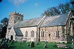 Parish Church of St Andrew |
| Barnston Manor, including attached farm building on south-east | Barnston, Church Knowle | Manor house | 16th century | 20 November 1959 | SY9307681537 50°38′01″N 2°05′57″W |
1120351 |  Barnston Manor, including attached farm building on south-east |
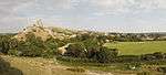
| Corfe Castle | The Square, Corfe Castle | Castle | 14th century | 20 November 1959 | SY9591282286 50°38′25″N 2°03′33″W |
1121000 | |
| Parish Church of Saint James | Kingston | Parish church | c.1880 | 20 November 1959 | SY9555679539 50°36′56″N 2°03′51″W |
1120984 | 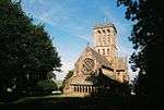 Parish Church of Saint James |
| Lulworth Castle | Lulworth Park, East Lulworth | Hunting lodge | c.1608 | 20 November 1959 | SY8531482172 50°38′21″N 2°12′33″W |
1323323 | |
| Roman Catholic Chapel of St Mary | Lulworth Park, East Lulworth | Private chapel | 1786–87 | 20 November 1959 | SY8524882273 50°38′24″N 2°12′36″W |
1323322 | 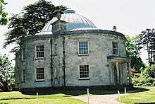 Roman Catholic Chapel of St Mary |
| Parish Church of St Mary the Virgin | Lytchett Matravers | Parish church | c.1500 | 20 November 1959 | SY9359196169 50°45′54″N 2°05′32″W |
1171322 | |
| Charborough Park | Morden | Country house | Mid-17th century | 20 November 1959 | SY9257397886 50°46′50″N 2°06′24″W |
1323286 | |
| Moreton House | Moreton | House | 1742–45 | 20 November 1959 | SY8063289152 50°42′06″N 2°16′32″W |
1305008 |  Moreton House |
| Creech Grange | Steeple | Manor house | 16th-century origin | 20 November 1959 | SY9112482247 50°38′23″N 2°07′37″W |
1304916 | |
| Parish Church of St Michael | Steeple | Parish church | 17th century | 20 November 1959 | SY9113680905 50°37′40″N 2°07′36″W |
1152213 | 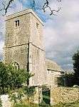 Parish Church of St Michael |
| Parish Church of Saint Nicholas | Studland | Parish church | 12th century | 20 November 1959 | SZ0364382511 50°38′32″N 1°56′59″W |
1120271 | 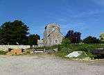 Parish Church of Saint Nicholas |
| Godlingston Manor | Swanage | Cross passage house | c.1300 | 26 June 1952 | SZ0148580221 50°37′18″N 1°58′49″W |
1323633 | |
| Church of St Martin | Wareham | Parish church | c.1030 | 7 May 1952 | SY9221987697 50°41′20″N 2°06′41″W |
1153149 | |
| Holy Trinity Gallery [former Church of Holy Trinity] | Wareham | Church | 14th century | 7 May 1952 | SY9234087212 50°41′04″N 2°06′35″W)] |
1153598 | 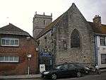 Holy Trinity Gallery [former Church of Holy Trinity] |
| No 9, South St (the Manor House) including garden wall | Wareham | House | 1712 | 7 May 1952 | SY9236987326 50°41′08″N 2°06′34″W |
1323598 | 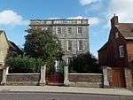 No 9, South St (the Manor House) including garden wall |
| Parish Church of Lady St Mary | Wareham | Parish church | Probably early 16th century | 7 May 1952 | SY9249087193 50°41′04″N 2°06′28″W |
1120029 | 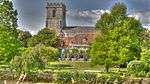 Parish Church of Lady St Mary |
| Remains of Bindon Abbey | Wool | Abbey | Late 12th to mid-13th century | 20 November 1959 | SY8540086814 50°40′51″N 2°12′29″W |
1120360 | |
| Parish Church of Saint Nicholas | Worth Matravers | Parish church | 14th century | 20 November 1959 | SY9728277443 50°35′48″N 2°02′23″W |
1120262 | 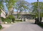 Parish Church of Saint Nicholas |
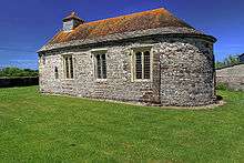
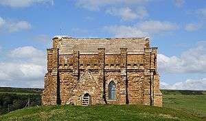
| St Aldhelm's Chapel | Worth Matravers | Chapel of ease | 12th century | 20 November 1959 | SY9607175559 50°34′47″N 2°03′25″W |
1120256 |
.jpg)
Western Dorset
| Name | Location | Type | Completed [note 1] | Date designated | Grid ref.[note 2] Geo-coordinates |
Entry number [note 3] | Image |
|---|---|---|---|---|---|---|---|
| Chapel of St Catherine | Abbotsbury | Chapel | c.1400 | 26 January 1956 | SY5725484836 50°39′42″N 2°36′22″W |
1172576 | |
| North wall of Abbey Church of St Peter | Abbotsbury | Wall | 15th century | 26 January 1956 | SY5775085194 50°39′54″N 2°35′57″W |
1118743 |  North wall of Abbey Church of St Peter |
| Parish Church of St Nicholas | Abbotsbury | Parish church | 14th century | 26 January 1956 | SY5776685209 50°39′54″N 2°35′56″W |
1305224 | |
| The Abbey Dairy House | Abbotsbury | Gatehouse | Late 14th century | 26 January 1956 | SY5771285116 50°39′51″N 2°35′59″W |
1118706 | .jpg) The Abbey Dairy House |
| The Malthouse 5 metres east of the Abbey House and attached walling | Abbotsbury | Abbey building | c.1400 | 26 January 1956 | SY5783585158 50°39′52″N 2°35′53″W |
1118747 | |
| Tithe Barn | Abbotsbury | Tithe barn | c.1400 | 26 January 1956 | SY5779385023 50°39′48″N 2°35′55″W |
1305209 | 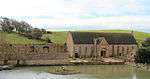 Tithe Barn |
| Athelhampton Hall | Athelhampton | Manor house | 16th century | 26 January 1956 | SY7706194274 50°44′51″N 2°19′35″W |
1323995 | |
| Parish Church of St Mary | Batcombe | Parish church | 15th century | 31 July 1961 | ST6185803867 50°49′59″N 2°32′35″W |
1118654 | 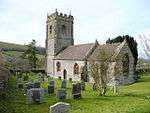 Parish Church of St Mary |
| Church of St Mary | Beaminster | Parish church | 13th century | 11 November 1966 | ST4789601244 50°48′30″N 2°44′27″W |
1219595 | _-_geograph.org.uk_-_717548.jpg) Church of St Mary |
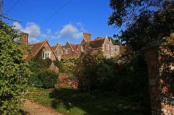
| Parnham House | Parnham, Beaminster | Country house | Mid-16th century | 12 June 1953 | ST4751300284 50°47′59″N 2°44′46″W |
1221178 | |
| Parish Church of Holy Trinity | Bincombe | Parish church | Late 12th century | 26 January 1956 | SY6864484558 50°39′35″N 2°26′42″W |
1119256 | |
| Church of St Peter and St Paul | Bishop's Caundle | Parish church | 14th century | 31 July 1961 | ST6961813157 50°55′01″N 2°26′01″W |
1118887 | 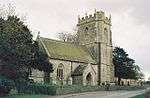 Church of St Peter and St Paul |
| Old Holy Trinity Church | Bothenhampton | Parish church | 15th century | 5 September 1960 | SY4752991753 50°43′23″N 2°44′41″W |
1324171 | |
| Churchyard cross 7 metres north-west of tower of Church of St Mary | Bradford Abbas | Cross | Late 15th century | 31 July 1961 | ST5872214290 50°55′36″N 2°35′19″W |
1323880 | |
| Parish Church of St Mary | Bradford Abbas | Parish church | c.12th century | 31 July 1961 | ST5874014278 50°55′35″N 2°35′18″W |
1323858 | 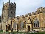 Parish Church of St Mary |
| Parish Church of St Mary | Bridport | Parish church | 13th century | 28 November 1950 | SY4657792595 50°43′50″N 2°45′30″W |
1228336 | |
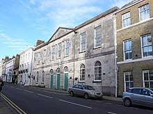
| Town Hall | Bridport | Town hall | 1786 | 28 November 1950 | SY4659192922 50°44′00″N 2°45′29″W |
1227851 | |
| Church of the Holy Rood | Buckland Newton | Parish church | 15th century | 26 January 1956 | ST6877105268 50°50′46″N 2°26′42″W |
1118892 | _-_geograph.org.uk_-_367795.jpg) Church of the Holy Rood |
| Parish Church of St Mary | Burton Bradstock | Parish church | 14th century | 5 September 1960 | SY4886489492 50°42′10″N 2°43′32″W |
1213878 | 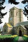 Parish Church of St Mary |
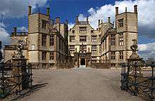
| Sherborne Castle | Castleton, Sherborne | Country house | Late 16th century | 11 July 1951 | ST6491416404 50°56′46″N 2°30′03″W |
1153912 | |
| Sherborne Old Castle | Castleton, Sherborne | Bishop's palace | 1107–35 | 11 July 1951 | ST6480616780 50°56′58″N 2°30′09″W |
1119378 | 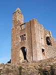 Sherborne Old Castle |
| Chantmarle (Police Training College) | Cattistock | Manor house | 15th century | 19 November 1985 | ST5892102203 50°49′04″N 2°35′04″W |
1119452 | 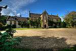 Chantmarle (Police Training College) |
| Parish Church of Saint Peter and Saint Paul | Cattistock | Parish church | 15th century, rebuilt 1857 | 26 January 1956 | SY5914699525 50°47′38″N 2°34′52″W |
1118659 | 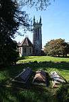 Parish Church of Saint Peter and Saint Paul |
| Cerne Abbey | Cerne Abbas | House | 15th-century fragments | 26 January 1956 | ST6653001355 50°48′39″N 2°28′35″W |
1323849 | |
| Churchyard Cross | Cerne Abbas | Cross | 15th century | 26 January 1956 | ST6657201365 50°48′39″N 2°28′33″W |
1119471 | 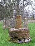 Churchyard Cross |
| Guest House of Cerne Abbey | Cerne Abbas | Cruck house | Late 15th century | 26 January 1956 | ST6655301376 50°48′39″N 2°28′34″W |
1119470 | 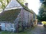 Guest House of Cerne Abbey |
| Parish Church of St Mary | Cerne Abbas | Parish church | 14th century | 26 January 1956 | ST6659501215 50°48′34″N 2°28′32″W |
1323846 | 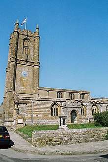 Parish Church of St Mary |
| The Abbot's Porch, Cerne Abbey | Cerne Abbas | Porch | 1497–1509 | 26 January 1956 | ST6653801409 50°48′41″N 2°28′35″W |
1152342 | 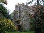 The Abbot's Porch, Cerne Abbey |
| The Tithe Barn | Cerne Abbas | Tithe barn | Late 14th century | 26 January 1956 | ST6629401007 50°48′27″N 2°28′47″W |
1119439 | 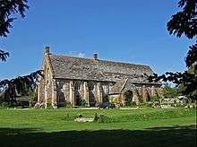 The Tithe Barn |
| 3 & 5 Abbey St, Abbey Cottage and The Pitchmarket | Cerne Abbas | Abbey tenements | Early 16th century | 26 January 1956 | ST6656701204 50°48′34″N 2°28′33″W |
1119467 | 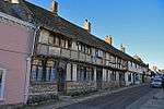 3 & 5 Abbey St, Abbey Cottage and The Pitchmarket |
| 7 Abbey Street | Cerne Abbas | Abbey tenements | Early 16th century | 26 January 1956 | ST6656401219 50°48′34″N 2°28′33″W |
1304868 |  7 Abbey Street |
| 9 Abbey Street | Cerne Abbas | Abbey tenements | Early 16th century | 26 January 1956 | ST6656101235 50°48′35″N 2°28′33″W |
1323848 |  9 Abbey Street |
| Parish Church of St Mary | Charminster | Parish church | 12th century | 26 January 1956 | SY6792392698 50°43′59″N 2°27′21″W |
1324019 |  Parish Church of St Mary |
| Wolfeton House | Wolfeton, Charminster | Manor house | 16th century | 20 September 1954 | SY6782892127 50°43′40″N 2°27′26″W |
1324021 | |
| Parish Church of St Martin | Cheselbourne | Parish church | Late 13th century | 26 January 1956 | SY7621699586 50°47′43″N 2°20′20″W |
1324023 | _-_geograph.org.uk_-_887187.jpg) Parish Church of St Martin |
| Chideock Parish Church (St Giles) | Chideock | Parish church | 14th century | 5 September 1960 | SY4215092868 50°43′57″N 2°49′16″W |
1288169 |  Chideock Parish Church (St Giles) |
| Parish Church (dedication unknown) | Chilcombe | Parish church | 12th century | 5 September 1960 | SY5287791086 50°43′03″N 2°40′08″W |
1288566 |  Parish Church (dedication unknown) |
| Clifton House | Clifton Maybank | Manor house | Mid-16th century | 11 July 1951 | ST5762813910 50°55′23″N 2°36′15″W |
1119383 |  Clifton House |
| Church of St Mary | Corscombe | Parish church | 15th century | 11 November 1966 | ST5222904865 50°50′29″N 2°40′47″W |
1290242 |  Church of St Mary |
| Dewlish House | Dewlish | Country house | 1702 | 26 January 1956 | SY7709697431 50°46′34″N 2°19′34″W |
1154339 |  Dewlish House |
| Church of St George | Fordington, Dorchester | Parish church | 12th century | 8 May 1950 | SY6985390559 50°42′50″N 2°25′42″W |
1292171 | |
| Church of St Peter. Railings on east and south sides of churchyard | Dorchester | Parish church | 1420–21 | 8 May 1950 | SY6924890737 50°42′56″N 2°26′13″W |
1119031 |  Church of St Peter. Railings on east and south sides of churchyard |
| Max Gate | Dorchester | House | 1885 | 8 May 1970 | SY7044189918 50°42′29″N 2°25′12″W |
1110618 | |
| Roman House | Dorchester | Roman house | 4th century | 8 May 1950 | SY6895690964 50°43′03″N 2°26′28″W |
1210098 | |
| Shire Hall | Dorchester | County hall | 1797 | 8 May 1950 | SY6910190736 50°42′56″N 2°26′21″W |
1119069 | |
| Parish Church of St James | Lewcombe, East Chelborough | Parish church | 12th century | 11 November 1966 | ST5589607557 50°51′57″N 2°37′41″W |
1119286 | 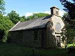 Parish Church of St James |
| Parish Church of the Holy Trinity | East Fleet | Parish church | 1827–29 | 26 January 1956 | SY6338380521 50°37′24″N 2°31′08″W |
1152080 | |
| Parish Church of St Lawrence | Folke | Parish church | 1628 | 31 July 1961 | ST6597013270 50°55′04″N 2°29′08″W |
1172612 | 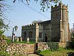 Parish Church of St Lawrence |
| Church of St Mary | Frampton | Parish church | 15th century | 26 January 1956 | SY6269594969 50°45′11″N 2°31′49″W |
1288540 | 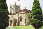 Church of St Mary |
| Parish Church of St Mary | Frome St Quintin | Parish church | 13th century | 26 January 1956 | ST5989002668 50°49′20″N 2°34′15″W |
1323860 | 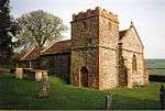 Parish Church of St Mary |
| Church of Holy Trinity | Godmanstone | Parish church | 12th century | 26 January 1956 | SY6658997373 50°46′30″N 2°28′31″W |
1215038 | 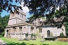 Church of Holy Trinity |
| Church of the Assumption of the Blessed Virgin Mary | Holnest | Parish church | Late 14th or early 15th century | 31 July 1961 | ST6561309818 50°53′13″N 2°29′25″W |
1118875 | 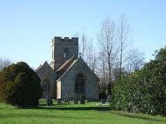 Church of the Assumption of the Blessed Virgin Mary |
| Church of St Lawrence | The Borough, Holwell | Parish church | Late 15th century | 21 May 1984 | ST6994011966 50°54′23″N 2°25′44″W |
1152109 | 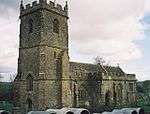 Church of St Lawrence |
| Parish Church of St Giles | Hooke | Parish church | 15th century | 11 November 1966 | ST5354700167 50°47′57″N 2°39′38″W |
1119416 | 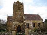 Parish Church of St Giles |
| Kingston Russell House | Lower Kingston Russell | Country house | Late 17th century | 26 January 1956 | SY5719089549 50°42′14″N 2°36′27″W |
1118704 | 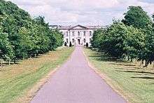 Kingston Russell House |
| Chapel of the Holy Trinity | Leweston | Chapel | 1616 | 11 July 1951 | ST6367712358 50°54′34″N 2°31′05″W |
1153840 | |
| Church of St Martin, including churchyard boundary wall | Lower Lillington | Parish church | 15th century | 31 July 1961 | ST6294912712 50°54′46″N 2°31′42″W |
1304066 |  Church of St Martin, including churchyard boundary wall |
| Parish Church of St Mary | Litton Cheney | Parish church | 15th century | 5 September 1960 | SY5516790723 50°42′52″N 2°38′11″W |
1214851 |  Parish Church of St Mary |
| Parish Church of St Mary Magdelene | Loders | Parish church | 14th century | 5 September 1960 | SY4911994273 50°44′45″N 2°43′21″W |
1288302 |  Parish Church of St Mary Magdelene |
| Parish Church of St Peter | Long Bredy | Parish church | 13th century | 26 January 1956 | SY5706590585 50°42′48″N 2°36′34″W |
1118676 | 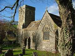 Parish Church of St Peter |
| Parish Church of St James | Longburton | Parish church | 13th century | 31 July 1961 | ST6488712755 50°54′47″N 2°30′03″W |
1154083 |  Parish Church of St James |
| West Hall | Longburton | House | 17th century | 11 July 1951 | ST6530912895 50°54′52″N 2°29′41″W |
1118868 |  West Hall |
| Parish Church of St Mary | Lower Wraxall | Parish church | 12th century | 11 November 1966 | ST5757000828 50°48′20″N 2°36′13″W |
1156747 | 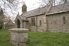 Parish Church of St Mary |
| Bridge 15 yards north-east of Buddle Bridge | Lyme Regis | Bridge | Late 12th or early 13th century | 23 April 1952 | SY3426692110 50°43′30″N 2°55′57″W |
1324343 | |
| Buddle Bridge | Lyme Regis | Bridge | Probably 14th century | 23 April 1952 | SY3425192100 50°43′29″N 2°55′58″W |
1110811 | 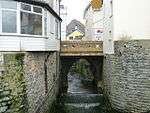 Buddle Bridge |
| Congregational Church and forecourt wall | Lyme Regis | Congregational church | 1750–55 | 31 January 1974 | SY3417492276 50°43′35″N 2°56′02″W |
1278935 | .jpg) Congregational Church and forecourt wall |
| Parish Church of St Michael | Lyme Regis | Parish church | 12th to 15th century | 23 April 1952 | SY3433592205 50°43′33″N 2°55′54″W |
1229389 | 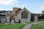 Parish Church of St Michael |
| The Cobb piers and walls including north wall | Lyme Regis | Seawall | Shown in 16th-century sketch | 23 April 1952 | SY3384391509 50°43′10″N 2°56′19″W |
1229437 | 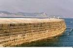 The Cobb piers and walls including north wall |
| Church of St Mary | Maiden Newton | Parish church | 12th century | 26 January 1956 | SY5962997886 50°46′45″N 2°34′26″W |
1215134 | 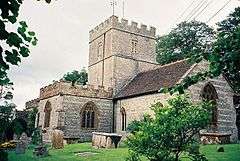 Church of St Mary |
| Church of All Saints attached to Mapperton House | Mapperton | Parish church | c.12th century | 11 November 1966 | SY5034299659 50°47′40″N 2°42′21″W |
1215496 | 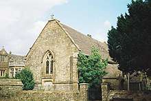 Church of All Saints attached to Mapperton House |
| Mapperton Manor House | Mapperton | Manor house | Mid-16th century | 4 December 1951 | SY5035399673 50°47′40″N 2°42′21″W |
1215471 | 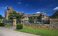 Mapperton Manor House |
| North Stables | Mapperton | Stable | c.1670 | 4 December 1951 | SY5030699688 50°47′41″N 2°42′23″W |
1215497 | |
| South Stables (barn and cart shed) | Mapperton | Barn | 1670 | 4 December 1951 | SY5030199654 50°47′40″N 2°42′23″W |
1215498 | |
| Parish Church of St Mary | Melbury Bubb | Parish church | 15th century | 31 July 1961 | ST5959506549 50°51′25″N 2°34′31″W |
1119274 | 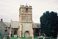 Parish Church of St Mary |
| Parish Church of St Osmond | Melbury Osmond | Parish church | 15th century | 11 November 1966 | ST5740007832 50°52′06″N 2°36′24″W |
1119242 | 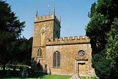 Parish Church of St Osmond |
| Melbury House | Melbury Sampford | Country house | c.1530 | 4 December 1951 | ST5764705989 50°51′07″N 2°36′11″W |
1119248 | |
| Parish Church of St Mary | Melbury House, Melbury Sampford | Parish church | 15th century | 11 November 1966 | ST5773605971 50°51′06″N 2°36′06″W |
1323935 | 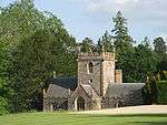 Parish Church of St Mary |
| Stable yard immediately north of Melbury House | Melbury Sampford | Stableyard | Late 17th century | 2 June 1986 | ST5758406023 50°51′08″N 2°36′14″W |
1323936 | |
| Bingham's Melcombe House | Bingham's Melcombe, Melcombe Horsey | House | 16th century | 26 January 1956 | ST7716902150 50°49′06″N 2°19′32″W |
1324138 | 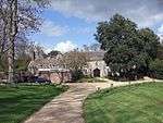 Bingham's Melcombe House |
| Church of St Andrew | Bingham's Melcombe, Melcombe Horsey | Parish church | Mid-14th century | 26 January 1956 | ST7727502082 50°49′04″N 2°19′26″W |
1118852 | 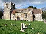 Church of St Andrew |
| Higher Melcombe House with attached chapel | Higher Melcombe, Melcombe Horsey | Country house | Possibly 15th century | 26 January 1956 | ST7494402412 50°49′15″N 2°21′25″W |
1152413 | _-_geograph.org.uk_-_797814.jpg) Higher Melcombe House with attached chapel |
| Church of All Saints | Nether Cerne | Parish church | Late 13th century | 26 January 1956 | SY6699098206 50°46′57″N 2°28′11″W |
1216512 | |
| Parish Church of St Nicholas | Nether Compton | Parish church | 13th century | 31 July 1961 | ST5983417244 50°57′12″N 2°34′24″W |
1323910 | 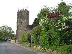 Parish Church of St Nicholas |
| Church of St Mary | Netherbury | Parish church | 14th century | 11 November 1966 | SY4703299460 50°47′32″N 2°45′10″W |
1216095 | 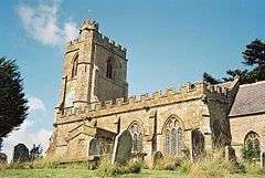 Church of St Mary |
| Parish Church of St Michael | Over Compton | Parish church | 15th century | 31 July 1961 | ST5946316894 50°57′00″N 2°34′42″W |
1119361 | 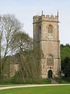 Parish Church of St Michael |
| Moignes Court | Owermoigne | Moated house | Late 13th century | 26 January 1956 | SY7704385714 50°40′14″N 2°19′34″W |
1119236 | |
| Church of St Mary | Piddlehinton | Parish church | 15th century | 26 January 1956 | SY7157097158 50°46′24″N 2°24′16″W |
1304468 | 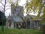 Church of St Mary |
| Church of All Saints | Piddletrenthide | Parish church | c.1500 | 26 January 1956 | ST7021100730 50°48′19″N 2°25′27″W |
1324151 | 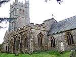 Church of All Saints |
| Church of St Mary | Pilsdon | Parish church | Late 14th century, restored 19th century | 11 November 1966 | SY4146999551 50°47′33″N 2°49′54″W |
1216401 | 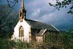 Church of St Mary |
| Parish Church of St Peter | Portesham | Parish church | 13th century | 26 January 1956 | SY6025385840 50°40′15″N 2°33′50″W |
1152497 |  Parish Church of St Peter |
| Waddon Manor with courtyard walls, steps and gate-piers | Waddon, Portesham | Manor house | Late 17th century | 26 January 1956 | SY6201385790 50°40′14″N 2°32′20″W |
1324241 |  Waddon Manor with courtyard walls, steps and gate-piers |
| Mappercombe Manor House | Mappercombe, Powerstock | Manor house | 17th century | 4 December 1951 | SY5120695122 50°45′13″N 2°41′35″W |
1216408 |  Mappercombe Manor House |
| Parish Church of St Mary | Powerstock | Parish church | 14th century | 11 November 1966 | SY5170096192 50°45′48″N 2°41′10″W |
1216639 | 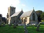 Parish Church of St Mary |
| Poxwell House | Poxwell | Manor house | Early 17th century | 26 January 1956 | SY7412284017 50°39′19″N 2°22′03″W |
1304095 | 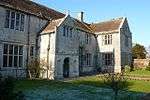 Poxwell House |
| Parish Church of All Saints | Poyntington | Parish church | 14th century | 31 July 1961 | ST6501919972 50°58′41″N 2°29′59″W |
1119366 | 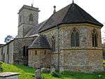 Parish Church of All Saints |
| Church of Saint Mary | Puddletown | Parish church | 16th century | 26 January 1956 | SY7587294352 50°44′54″N 2°20′36″W |
1154532 | 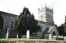 Church of Saint Mary |
| Waterston Manor | Lower Waterston, Puddletown | Country house | Early 17th century, rebuilt 1863 | 26 January 1956 | SY7352995207 50°45′21″N 2°22′36″W |
1119080 | |
| Parish Church of St Mary | Puncknowle | Parish church | 12th century | 5 September 1960 | SY5350188646 50°41′44″N 2°39′35″W |
1288107 | 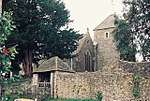 Parish Church of St Mary |
| Parish Church of St Peter | Purse Caundle | Parish church | 15th century | 31 July 1961 | ST6960017590 50°57′25″N 2°26′03″W |
1119331 | 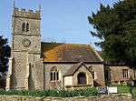 Parish Church of St Peter |
| The Manor House and attached walls north and south | Purse Caundle | Manor house | 15th century | 11 July 1951 | ST6951817649 50°57′27″N 2°26′07″W |
1119330 | 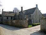 The Manor House and attached walls north and south |
| Parish Church of St Michael and All Angels | Rampisham | Parish church | 15th century | 11 November 1960 | ST5616802206 50°49′04″N 2°37′25″W |
1323863 | 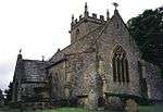 Parish Church of St Michael and All Angels |
| Pugin Hall | Rampisham | Rectory | 1846–47 | 19 November 1985 | ST5587902626 50°49′17″N 2°37′40″W |
1323865 | 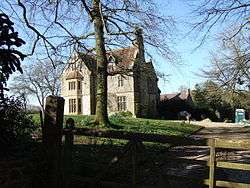 Pugin Hall |
| Parish Church of St Nicholas | Sandford Orcas | Parish church | 14th century | 31 July 1961 | ST6223821049 50°59′15″N 2°32′22″W |
1119333 | 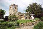 Parish Church of St Nicholas |
| The Manor House | Sandford Orcas | Manor house | c.1550 | 11 July 1951 | ST6228021025 50°59′15″N 2°32′20″W |
1154226 | 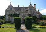 The Manor House |
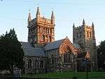
| Abbey Church of St Mary | Sherborne | Abbey | Early 12th century | 28 November 1950 | ST6379216489 50°56′48″N 2°31′00″W |
1110824 | |
| Abbey Grange | Sherborne | Barn | 15th century | 28 November 1950 | ST6373216695 50°56′55″N 2°31′04″W |
1304799 | |
| Chapel at Sherborne School | Sherborne | Chapel | 15th century | 28 November 1950 | ST6374816519 50°56′49″N 2°31′03″W |
1324313 | |
| Hospital of Saints John the Baptist and John the Evangelist | Sherborne | Hospital | 1448 | 28 November 1950 | ST6376916404 50°56′45″N 2°31′02″W |
1110827 | 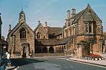 Hospital of Saints John the Baptist and John the Evangelist |
| Library at Sherborne School | Sherborne | Abbey guest hall | Probably 13th century | 28 November 1950 | ST6376216508 50°56′49″N 2°31′02″W |
1110832 | |
| Sherborne House (Lord Digby's School for Girls) | Sherborne | House | c.1720 | 28 November 1950 | ST6390916922 50°57′02″N 2°30′55″W |
1110694 | 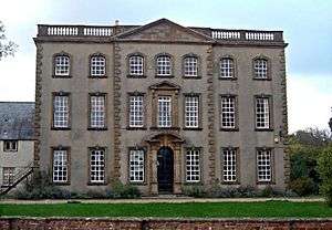 Sherborne House (Lord Digby's School for Girls) |
| Part of Sherborne School on exterior of north transept of Abbey Church | Sherborne | Abbey building | 13th century | 28 November 1950 | ST6376516497 50°56′48″N 2°31′02″W |
1172618 | |
| School House Dining Hall at Sherborne School | Sherborne | School | 1606 or 1608 | 28 November 1950 | ST6384516513 50°56′49″N 2°30′58″W |
1324335 | |
| School House Studies at Sherborne School | Sherborne | Abbey building | 15th century | 28 November 1950 | ST6376916531 50°56′49″N 2°31′02″W |
1110788 | |
| Sherborne Shell House in walled garden of Harper House | Sherborne | Shell house | c.1750 | 17 June 2008 | ST6393616660 50°56′54″N 2°30′53″W |
1392618 | |
| The Cemetery Gate | Sherborne | Abbey gatehouse | 15th century | 28 November 1950 | ST6387016503 50°56′49″N 2°30′56″W |
1324354 |  The Cemetery Gate |
| The Conduit (The Parade) | Sherborne | Abbey conduit house | Early 16th century | 28 November 1950 | ST6388616514 50°56′49″N 2°30′56″W |
1110747 |  The Conduit (The Parade) |
| Church of St Mary | South Perrott | Parish church | 13th century | 22 December 1983 | ST4720506664 50°51′25″N 2°45′05″W |
1211922 |  Church of St Mary |
| Church of Saint Michael | Stinsford | Parish church | 13th-century origin | 10 March 1987 | SY7113390993 50°43′04″N 2°24′37″W |
1119091 | 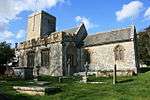 Church of Saint Michael |
| Kingston Maurward House (Dorset College of Agriculture) | Kingston Maurward, Stinsford | Country house | c.1717 | 26 January 1956 | SY7154491039 50°43′06″N 2°24′16″W |
1154732 | 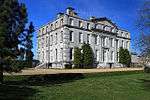 Kingston Maurward House (Dorset College of Agriculture) |
| The Old Manor House | Kingston Maurward, Stinsford | Manor house | Late 16th century | 26 January 1956 | SY7184590984 50°43′04″N 2°24′01″W |
1119861 | 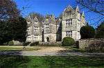 The Old Manor House |
| Parish Church of St Edwold | Stockwood | Parish church | 15th century | 31 July 1961 | ST5901706922 50°51′37″N 2°35′01″W |
1155008 | |
| Parish Church of St Mary | Stoke Abbott | Parish church | 13th century | 11 November 1966 | ST4536400593 50°48′08″N 2°46′36″W |
1287199 | 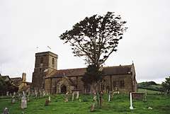 Parish Church of St Mary |
| Church of St Mary | Stratton | Parish church | 12th century | 26 January 1956 | SY6511193776 50°44′33″N 2°29′45″W |
1216517 | 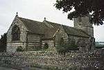 Church of St Mary |
| Parish Church of Holy Trinity | Swyre | Parish church | 15th century | 5 September 1960 | SY5280888238 50°41′31″N 2°40′10″W |
1279224 | 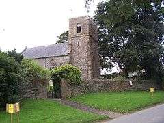 Parish Church of Holy Trinity |
| Parish Church of St Nicholas | Sydling St Nicholas | Parish church | c.1500 | 26 January 1956 | SY6301299280 50°47′31″N 2°31′34″W |
1156621 | 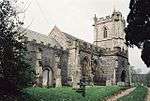 Parish Church of St Nicholas |
| Symondsbury Parish Church (St John the Baptist) | Symondsbury | Parish church | 14th century | 5 September 1960 | SY4450093629 50°44′23″N 2°47′16″W |
1216336 | 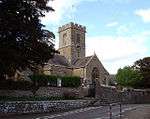 Symondsbury Parish Church (St John the Baptist) |
| Forde Abbey | Thorncombe | Abbey | 12th century | 4 December 1951 | ST3592405177 50°50′33″N 2°54′41″W |
1153362 | |
| Holditch Court, tower 50 metres south of Holditch Court Farmhouse | Thorncombe | Tower of fortified manor house | 15th century | 4 December 1951 | ST3448902152 50°48′55″N 2°55′53″W |
1118927 | 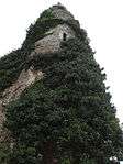 Holditch Court, tower 50 metres south of Holditch Court Farmhouse |
| Church of Saint John | Tolpuddle | Parish church | 14th century | 26 January 1956 | SY7907394500 50°44′59″N 2°17′53″W |
1119870 | 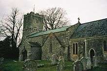 Church of Saint John |
| Martyrs' Cottage | Tolpuddle | Detached house | Probably 18th century | 26 January 1956 | SY7949394415 50°44′56″N 2°17′31″W |
1119869 |  Martyrs' Cottage |
| Church Farmhouse | Trent | Hall-house | 15th century | 11 July 1951 | ST5890118505 50°57′52″N 2°35′12″W |
1119345 | |
| Parish Church of St Andrew | Trent | Parish church | Early 14th century | 31 July 1961 | ST5895018536 50°57′53″N 2°35′09″W |
1323927 | 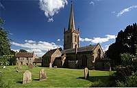 Parish Church of St Andrew |
| The Chantry and attached walls | Trent | Chantry-house | Mid-15th century | 11 July 1951 | ST5899418538 50°57′53″N 2°35′07″W |
1303876 | 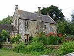 The Chantry and attached walls |
| Dairy Cottage | Up Cerne | House | Probably early 19th century | 26 January 1956 | ST6579102852 50°49′27″N 2°29′13″W |
1153511 | 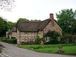 Dairy Cottage |
| Warmwell House | Warmwell | Manor house | Early 17th century, probably after 1618 | 26 January 1956 | SY7537585921 50°40′21″N 2°20′59″W |
1119205 | 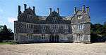 Warmwell House |
| Parish Church of St Andrew | West Chelborough | Parish church | 15th century | 11 November 1966 | ST5416605447 50°50′48″N 2°39′09″W |
1303553 | 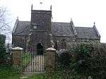 Parish Church of St Andrew |
| Parish Church of St Peter | West Knighton | Parish church | 12th century | 27 October 1986 | SY7324287623 50°41′15″N 2°22′49″W |
1323955 | 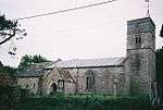 Parish Church of St Peter |
| Church of Saint Andrew | West Stafford | Parish church | 16th century | 26 January 1956 | SY7255189626 50°42′20″N 2°23′24″W |
1119840 |  Church of Saint Andrew |
| Manor House | West Stafford | Manor house | Early 18th century | 26 January 1956 | SY7284189688 50°42′22″N 2°23′10″W |
1119843 | |
| Stafford House, including attached garden walls on north and east | West Stafford | Country house | 1633 | 26 January 1956 | SY7243790017 50°42′33″N 2°23′30″W |
1303432 | 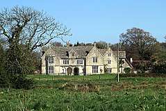 Stafford House, including attached garden walls on north and east |
| Whitchurch Canonicorum Church (St Candida and Holy Cross) | Whitchurch Canonicorum | Minster | 12th century | 5 September 1960 | SY3967895432 50°45′19″N 2°51′23″W |
1227942 | |
| Parish Church (dedication unknown) | Whitcombe | Parish church | 12th century | 26 January 1956 | SY7165488308 50°41′37″N 2°24′10″W |
1119215 | |
| Came House | Winterborne Came | Country house | 1754–62 | 26 January 1956 | SY7045988246 50°41′35″N 2°25′11″W |
1119219 | 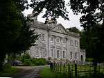 Came House |
| Parish Church of St Peter | Winterborne Came | Parish church | 14th century | 26 January 1956 | SY7047388399 50°41′40″N 2°25′10″W |
1323962 | |
| Parish Church of St Martin | Winterborne St Martin | Parish church | 15th century | 26 January 1956 | SY6475489008 50°41′59″N 2°30′02″W |
1119183 | 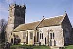 Parish Church of St Martin |
| Church of St Mary | Winterbourne Abbas | Parish church | 13th century | 26 January 1956 | SY6187390482 50°42′46″N 2°32′29″W |
1229078 | 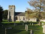 Church of St Mary |
| Church of St Michael | Winterbourne Steepleton | Parish church | 12th century | 26 January 1956 | SY6291289804 50°42′24″N 2°31′36″W |
1229137 | 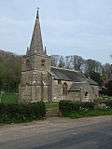 Church of St Michael |
| Woodsford Castle | Woodsford | Fortified manor house | 14th century | 26 January 1956 | SY7581690383 50°42′45″N 2°20′38″W |
1155314 | 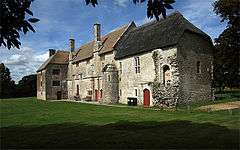 Woodsford Castle |
| Parish Church of St Andrew | Yetminster | Parish church | 15th century | 31 July 1961 | ST5944110645 50°53′38″N 2°34′41″W |
1154308 | 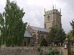 Parish Church of St Andrew |
_-_geograph.org.uk_-_832446.jpg)
Southern coastal area of Weymouth and Portland
| Name | Location | Type | Completed [note 1] | Date designated | Grid ref.[note 2] Geo-coordinates |
Entry number [note 3] | Image |
|---|---|---|---|---|---|---|---|
| Church of St George, Reforne | Easton, Portland | Parish church | 1766 | 16 January 1951 | SY6865372012 50°32′49″N 2°26′38″W |
1203132 | |
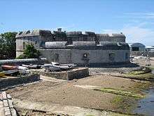
| Portland Castle | Castletown, Portland | Device Fort | c.1540 | 17 May 1993 | SY6845974370 50°34′06″N 2°26′48″W |
1205262 | |
| Rufus Castle with bridge | Easton, Portland | Castle | Probably late 15th century | 16 January 1951 | SY6975771175 50°32′22″N 2°25′41″W |
1280727 | 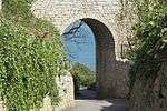 Rufus Castle with bridge |
| Church of All Saints | Wyke Regis, Weymouth | Parish church | 1455 | 12 December 1953 | SY6621277786 50°35′56″N 2°28′44″W |
1096743 | |
| Church of St Mary | Weymouth | Parish church | 1817, restored 1922 | 12 December 1953 | SY6796478823 50°36′30″N 2°27′15″W |
1147947 | |
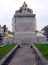
| King's Statue | Weymouth | Statue | 1809–10 | 12 December 1953 | SY6801979302 50°36′45″N 2°27′12″W |
1365879 |
Notes
- The date given is the date used by Historic England as significant for the initial building or that of an important part in the structure's description.
- Sometimes known as OSGB36, the grid reference is based on the British national grid reference system used by the Ordnance Survey.
- The "List Entry Number" is a unique number assigned to each listed building and scheduled monument by Historic England.
gollark: In that case, kill it as an example to the others.
gollark: 8 here.
gollark: Wait, what's the egg description of those hatchlings (non-xeno)?
gollark: Oh.
gollark: Hmm?
See also
References
External links

This article is issued from Wikipedia. The text is licensed under Creative Commons - Attribution - Sharealike. Additional terms may apply for the media files.