Grade II* listed buildings in County Durham
There are over 20,000 Grade II* listed buildings in England. This page is a list of these buildings in the county of Durham, sub-divided by unitary authority.
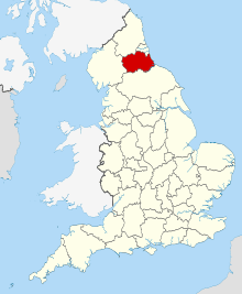
County Durham shown in England
County Durham
| Name | Location | Type | Completed [note 1] | Date designated | Grid ref.[note 2] Geo-coordinates |
Entry number [note 3] | Image |
|---|---|---|---|---|---|---|---|
| Barforth Hall with attached Outbuilding to North East | Barforth, County Durham | Manor House | Late Medieval | 12 January 1967 | NZ1638216695 54°32′43″N 1°44′54″W |
1121707 | 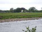 Barforth Hall with attached Outbuilding to North East |
| Chapel Bridge over Black Beck | Barforth, County Durham | Bridge | 14th century | 12 January 1967 | NZ1635416117 54°32′24″N 1°44′55″W |
1121749 | 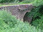 Chapel Bridge over Black Beck |
| Dovecote 100 Metres North of St Lawrence's Chapel | Barforth, County Durham | Dovecote | Late Medieval | 19 January 1952 | NZ1641716256 54°32′29″N 1°44′52″W |
1121750 |  Dovecote 100 Metres North of St Lawrence's Chapel |
| Ruins of St Lawrence's Chapel | Barforth, County Durham | Farmhouse | Early C16-C18 | 12 January 1967 | NZ1640516166 54°32′26″N 1°44′53″W |
1338613 | 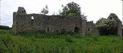 Ruins of St Lawrence's Chapel |
| Winston Bridge | Barforth, County Durham | Road Bridge | 1762-3 | 14 September 1966 | NZ1425716268 54°32′29″N 1°46′52″W |
1323060 | 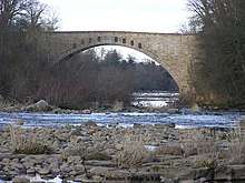 Winston Bridge |
| Winston Bridge, over the River Tees | Barforth, County Durham | Road Bridge | 1762-3 | 19 January 1952 | NZ1425816270 54°32′29″N 1°46′52″W |
1121747 | Winston Bridge, over the River Tees |
| Chapel immediately East of Barnard Castle School | Barnard Castle, County Durham | Wall | 1910-11 | 22 February 1973 | NZ0589516254 54°32′29″N 1°54′37″W |
1201331 |  Chapel immediately East of Barnard Castle School |
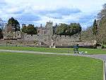
| Entrance Gates and Lodges to Bowes Museum | Barnard Castle, County Durham | Gate Lodge | c. 1885 | 29 September 1954 | NZ0553816183 54°32′27″N 1°54′57″W |
1201332 | 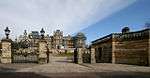 Entrance Gates and Lodges to Bowes Museum |
| Hopper Tomb approx. 2 Metres South of Church of St Mary | Barnard Castle, County Durham | Chest Tomb | 1725 | 29 January 1986 | NZ0506116265 54°32′30″N 1°55′24″W |
1201335 |  |
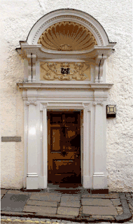
| Thorngate House and Attached Railings | Barnard Castle, County Durham | House | Mid 18th century | 24 February 1950 | NZ0496916107 54°32′25″N 1°55′29″W |
1218873 | |
| 2 and 4 Market Place | Barnard Castle, County Durham | House | 17th century | 22 February 1973 | NZ0501516330 54°32′32″N 1°55′26″W |
1217861 | 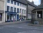 2 and 4 Market Place |
| 6, 6a, 6b, 8 and 8a Market Place | Barnard Castle, County Durham | Apartment | 1994 | 29 September 1954 | NZ0501316343 54°32′32″N 1°55′27″W |
1201355 | |
| 10 and 12 Market Place | Barnard Castle, County Durham | Apartment | 1994 | 24 February 1950 | NZ0501416354 54°32′33″N 1°55′26″W |
1201356 | |
| 15 and 17 Market Place | Barnard Castle, County Durham | House | 1690 | 24 February 1950 | NZ0505516386 54°32′34″N 1°55′24″W |
1292208 | |
| 34 The Bank | Barnard Castle, County Durham | House | 1994 | 24 February 1950 | NZ0501516210 54°32′28″N 1°55′26″W |
1218764 | 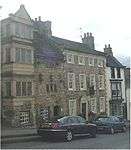 34 The Bank |
| 38–44 The Bank | Barnard Castle, County Durham | Apartment | 1994 | 24 February 1950 | NZ0500316181 54°32′27″N 1°55′27″W |
1291777 | |
| 21 Galgate | Barnard Castle, County Durham | House | Mid 18th century | 24 February 1950 | NZ0503816640 54°32′42″N 1°55′25″W |
1292565 | 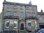 21 Galgate |
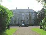
| Barningham Park | Barningham Park, Barningham, County Durham | Country House | Late Medieval or 16th century | 19 January 1952 | NZ0862410213 54°29′14″N 1°52′06″W |
1338635 | |
| Stable Block to North West of Barningham Park | Barningham Park, Barningham, County Durham | Mounting Block | Early 18th century | 12 January 1967 | NZ0857210250 54°29′15″N 1°52′09″W |
1121712 | |
| Building attached to Kepier Hospital Gateway | Durham City, Belmont, County Durham | Farm Building | 19th century | 14 January 1988 | NZ2821143280 54°47′01″N 1°33′46″W |
1323216 | 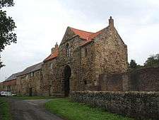 Building attached to Kepier Hospital Gateway |
| Kepier Farmhouse | Belmont, County Durham | Farmhouse | C14-C20 | 10 May 1967 | NZ2825743296 54°47′02″N 1°33′44″W |
1159216 | 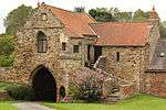 Kepier Farmhouse |
| Town Hall | Bishop Auckland, County Durham | Assembly Rooms | 1860-62 | 20 September 1972 | NZ2115730135 54°39′57″N 1°40′25″W |
1297550 | |
| 11 Market Place | Bishop Auckland, County Durham | House | Early 18th century | 21 April 1952 | 49°46′01″N 7°33′26″W | 1196607 | 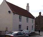 11 Market Place |
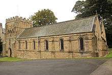
| Church of St Michael and All Angels | Bishop Middleham, County Durham | Church | 1741 | 9 January 1968 | NZ3279931258 54°40′31″N 1°29′34″W |
1322826 | 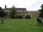 Church of St Michael and All Angels |
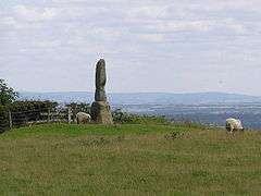
| Legs Cross | Bolam, County Durham | Cross | C9 | 14 September 1966 | NZ2072122496 54°35′50″N 1°40′51″W |
1323020 | |
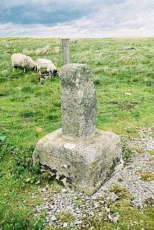
| Rey Cross | Bowes, County Durham | Cross | 10th century | 17 June 1986 | NY9047112284 54°30′21″N 2°08′55″W |
1323025 | |
| Holywell Hall and the West Wing | Brancepeth, County Durham | House | 16th century | 16 September 1975 | NZ2502937328 54°43′49″N 1°36′46″W |
1120764 | |
| Quarry Hill and adjoining Outbuilding | Brancepeth, County Durham | House | Early-Mid 17th century | 10 May 1967 | NZ2154538662 54°44′33″N 1°40′01″W |
1323203 | |
| Littleburn Farmhouse | Brandon and Byshottles, County Durham | Farmhouse | Late 17th century | 10 March 1988 | NZ2559939229 54°44′51″N 1°36′14″W |
1159109 | |
| Little Holmside | Burnhope, County Durham | House | 1668 | 17 January 1967 | NZ1997549276 54°50′16″N 1°41′26″W |
1185989 | |
| The Castle | Castle Eden Dene, Castle Eden, County Durham | Country House | c. 1765 | 8 December 1967 | NZ4275838792 54°44′32″N 1°20′15″W |
1323098 | |
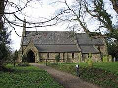
| Church of St. Mary | Cockfield, County Durham | Parish Church | 13th century | 30 September 1987 | NZ1290324244 54°36′47″N 1°48′06″W |
1121827 | 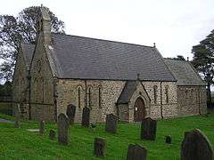 Church of St. Mary |
| Balder Bridge | Cotherstone, County Durham | Road Bridge | 15th century | 12 January 1967 | NZ0091420031 54°34′32″N 1°59′15″W |
1121041 | 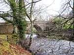 Balder Bridge |
| Haybarn and Rear Yard Walls 110 Metres East of Croxdale Hall | Croxdale Hall, Croxdale and Hett, County Durham | Wall | Late C18-Early 19th century | 7 December 1987 | NZ2744437896 54°44′07″N 1°34′31″W |
1323222 | 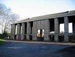 Haybarn and Rear Yard Walls 110 Metres East of Croxdale Hall |
| Low Butterby Farmhouse and Barn Adjoining at South-east | Low Butterby, Croxdale and Hett, County Durham | Farmhouse | 17th century | 28 February 1952 | NZ2756039369 54°44′55″N 1°34′24″W |
1323186 | 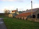 Low Butterby Farmhouse and Barn Adjoining at South-east |
| Moat Walls, 2 Bridges Across Moat, Garden Wall and Gate Piers at Low Butterby Farm | Low Butterby, Croxdale and Hett, County Durham | Gate Pier | Late 18th century | 10 May 1967 | NZ2758839382 54°44′55″N 1°34′23″W |
1159261 | 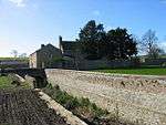 Moat Walls, 2 Bridges Across Moat, Garden Wall and Gate Piers at Low Butterby Farm |
| Priest's House 90 Metres East of Croxdale Hall | Croxdale Hall, Croxdale and Hett, County Durham | Priests House | Early 18th century | 8 December 1982 | NZ2742537876 54°44′06″N 1°34′32″W |
1120739 | |
| Church of St Andrew | Dalton-le-Dale, County Durham | Church | 17th century | 20 February 1967 | NZ4079748034 54°49′32″N 1°21′59″W |
1231690 | 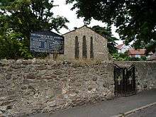 Church of St Andrew |
| Dalton Water Pumping Station | Dalton Pumping Station, Dalton-le-Dale, County Durham | Boiler House | 1873-1879 | 8 February 1983 | NZ4108246918 54°48′56″N 1°21′44″W |
1277461 | 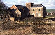 Dalton Water Pumping Station |
| Farmhouse and adjacent Barn 15 Metres to North of Seaton Holme | Easington Village, County Durham | Farmhouse | Possibly 13th century | 29 September 1990 | NZ4136543548 54°47′06″N 1°21′30″W |
1277424 | 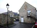 Farmhouse and adjacent Barn 15 Metres to North of Seaton Holme |
| Eggleston Bridge | Eggleston, County Durham | Road Bridge | 15th century | 12 January 1967 | NY9967423228 54°36′15″N 2°00′24″W |
1338580 |  Eggleston Bridge |
| Eggleston Hall | Eggleston, County Durham | House | Pre 1827 | 7 January 1952 | NY9977023345 54°36′19″N 2°00′18″W |
1121626 | |
| Bounds Wall with Racket Ball Courts | Ushaw, Esh, County Durham | Boundary Wall | 1850-1852 | 24 June 1987 | NZ2206743851 54°47′21″N 1°39′30″W |
1185962 | |
| Chapel of College of St Cuthbert | Ushaw, Esh, County Durham | Theological College | 1882-5 | 17 January 1967 | NZ2184443702 54°47′16″N 1°39′43″W |
1116449 | 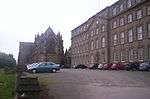 Chapel of College of St Cuthbert |
| Former Junior Seminary Chapel of St Aloysius | Ushaw, Esh, County Durham | Theological College | 1857-9 | 24 June 1987 | NZ2177343689 54°47′15″N 1°39′47″W |
1299434 | 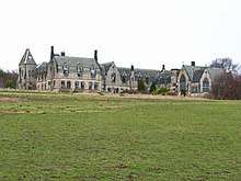 Former Junior Seminary Chapel of St Aloysius |
| Gate Piers at Entrance to Yard of Esh Hall Farm | Esh, Esh, County Durham | Gate Pier | 17th century | 24 June 1987 | NZ1971043896 54°47′22″N 1°41′42″W |
1299431 | |
| Stations Cloister with Chapel of St Charles and Oratory Chapel | Ushaw, Esh, County Durham | Private Chapel | 1852-3 | 24 June 1987 | NZ2182643714 54°47′16″N 1°39′44″W |
1319920 | |
| Ushaw Home Farm Main Block and Wall Attached | Ushaw, Esh, County Durham | Cow House | 1851-2 | 17 January 1967 | NZ2146743616 54°47′13″N 1°40′04″W |
1185963 | |
| Forecourt walls and south tower of Witton Castle | Evenwood and Barony, County Durham | Tower | Medieval | 14 September 1966 | NZ1537130411 54°40′07″N 1°45′48″W |
1338595 | |
| Witton Castle | Evenwood and Barony, County Durham | Castle | Late 14th century | 7 January 1952 | NZ1537230431 54°40′07″N 1°45′47″W |
1311117 | |
| Little Chilton Farmhouse, and Mounting Block Attached | Little Chilton, Ferryhill, County Durham | House | 14th century | 14 June 1988 | NZ2950231436 54°40′38″N 1°32′38″W |
1159411 | |
| Finchale Abbey Farmhouse | Finchale Priory, Framwellgate Moor, County Durham | Farmhouse | c. 1700 | 14 January 1988 | NZ2962447176 54°49′07″N 1°32′26″W |
1323217 | |
| Dovecote, 45 Metres South of Gainford Hall | Gainford, County Durham | Dovecote | 17th century | 7 January 1952 | NZ1684116805 54°32′46″N 1°44′28″W |
1121116 | 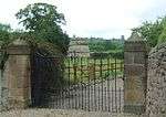 Dovecote, 45 Metres South of Gainford Hall |
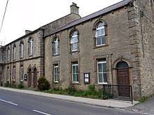
| Hamsterley Baptist Chapel | Hamsterley, County Durham | Baptist Chapel | 1774 | 5 February 1987 | NZ1185631080 54°40′29″N 1°49′04″W |
1322775 | 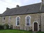 Hamsterley Baptist Chapel |
| Headlam Hall | Headlam, County Durham | Country House | 17th century | 7 January 1952 | NZ1802318884 54°33′54″N 1°43′22″W |
1121082 | |
| Hownes Gill Viaduct | Healeyfield, County Durham | Railway Viaduct | 1858 | 24 June 1987 | NZ0959049013 54°50′09″N 1°51′08″W |
1185970 | 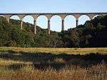 Hownes Gill Viaduct |
| Hilton Hall | Hilton, County Durham | House | Medieval | 14 September 1966 | NZ1673421771 54°35′27″N 1°44′33″W |
1121804 | 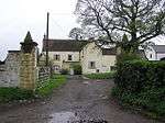 Hilton Hall |
| Middleton Bridge | Holwick, County Durham | Road Bridge | c. 1800 | 12 January 1967 | NY9466025254 54°37′21″N 2°05′03″W |
1160160 | 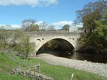 Middleton Bridge |
| Horden Hall | Horden, County Durham | Manor House | Mid 17th century | 6 August 1952 | NZ4328542419 54°46′29″N 1°19′43″W |
1120944 | 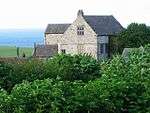 Horden Hall |
| Doe Park | Hunderthwaite, County Durham | Country House | c. 1700 | 12 January 1967 | NZ0057620237 54°34′38″N 1°59′33″W |
1323079 | 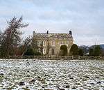 Doe Park |
| Church of St James | Hunstanworth, County Durham | Parish Church | Medieval | 31 January 1967 | NY9490649021 54°50′10″N 2°04′51″W |
1229537 | 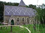 Church of St James |
| Burnhopeside Hall | Lanchester, County Durham | House | 18th century | 17 January 1967 | NZ1866946186 54°48′37″N 1°42′40″W |
1299442 | |
| Burnhopeside Hall Farmhouse and Farm Buildings | Lanchester, County Durham | Farmhouse | Early 19th century | 24 June 1987 | NZ1874346146 54°48′35″N 1°42′36″W |
1116101 | |
| Hamsteels Hall Farmhouse | Lanchester, County Durham | Farmhouse | Early 18th century | 2 September 1985 | NZ1741644886 54°47′55″N 1°43′50″W |
1115409 | 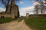 Hamsteels Hall Farmhouse |
| Hansom House, Lartington Hall, Monk's Flat & Witham Court | Lartington, County Durham | House | 1635 | 12 January 1967 | NZ0214217756 54°33′18″N 1°58′06″W |
1310603 | |
| Middleton Bridge | River Tees, Middleton in Teesdale, County Durham | Bridge | c. 1814 | 14 September 1966 | NY9465925256 54°37′21″N 2°05′03″W |
1203554 | Middleton Bridge |
| Stotley Hall | Middleton in Teesdale, County Durham | House | c. 1600 | 14 September 1966 | NY9680925543 54°37′30″N 2°03′03″W |
1322782 | |
| Wynch Bridge | River Tees, Newbiggin, County Durham | Bridge | Pre 1757 | 14 September 1966 | NY9038327898 54°38′46″N 2°09′02″W |
1121562 | 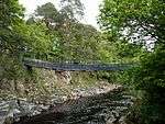 Wynch Bridge |
| Iron Gates, Posts and Railings 200 Metres North West of Lambton Castle | Lambton Park, North Lodge, County Durham | Gate | c. 1820 | 1 February 1967 | NZ2964952674 54°52′05″N 1°32′22″W |
1311161 | |
| Lamb Bridge | Lambton Park, North Lodge, County Durham | Bridge | 1819 | 23 February 1987 | NZ2943952429 54°51′57″N 1°32′34″W |
1120952 | |
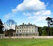
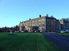
| Lambton Castle | Lambton Park, North Lodge, County Durham | Country House | 18th century | 4 June 1952 | NZ2982852570 54°52′01″N 1°32′12″W |
1159138 | |
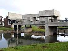
| Apollo Pavilion | Peterlee, County Durham | Pavilion | 1969 | 14 December 2011 | NZ4222339633 54°45′00″N 1°20′44″W |
1400364 | |
| Dutch Barn c.300 Metres North of Stables and Coach House | Raby Park, Raby with Keverstone, County Durham | Hay Barn | Third Quarter 18th century | 14 September 1966 | NZ1293422078 54°35′37″N 1°48′05″W |
1121777 | |
| Raby Home Farm with Walls Attached | Raby Park, Raby with Keverstone, County Durham | Model Farm | Mid 18th century | 14 September 1966 | NZ1101821865 54°35′31″N 1°49′52″W |
1121775 | |
| Stables and Coachhouse, with Wall and Mounting-block attached | Raby Park, Raby with Keverstone, County Durham | Wall | Third Quarter 18th century | 14 September 1966 | NZ1290222043 54°35′36″N 1°48′07″W |
1121776 | 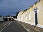 Stables and Coachhouse, with Wall and Mounting-block attached |
| The Folly in Raby Park | Raby with Keverstone, County Durham | Folly | 1780 | 14 September 1966 | NZ1276623152 54°36′12″N 1°48′14″W |
1121773 | |
| The Old Lodge | Raby with Keverstone, County Durham | Fortified House | Late Medieval | 14 September 1966 | NZ0901922183 54°35′41″N 1°51′43″W |
1338624 | |
| Church of St Mary | Rokeby, County Durham | Parish Church | 1778 | 12 January 1967 | NZ0725713808 54°31′10″N 1°53′22″W |
1121673 | 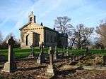 Church of St Mary |
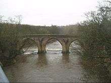
| Greta Bridge | Greta Bridge, Rokeby, County Durham | Bridge | 1773 | 12 January 1967 | NZ0861113168 54°30′49″N 1°52′07″W |
1160430 | 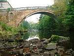 Greta Bridge |
| Eggleston Bridge | River Tees, Romaldkirk, County Durham | Bridge | 15th century | 7 January 1952 | NY9966723228 54°36′15″N 2°00′24″W |
1121638 | Eggleston Bridge |
| Scargill Castle | Scargill, County Durham | Castle | 15th century | 12 January 1967 | NZ0535310726 54°29′31″N 1°55′08″W |
1121820 | 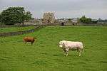 Scargill Castle |
| Dalden Tower | Seaham, County Durham | Hall House | 14th century or Earlier | 21 June 1950 | NZ4202448742 54°49′54″N 1°20′50″W |
1232268 | 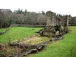 Dalden Tower |
| The Londonderry Institute and Forecourt Wall | Seaham, County Durham | Wall | 1853-5 | 21 June 1950 | NZ4282849618 54°50′22″N 1°20′05″W |
1232455 | %2C_Seaham_-_geograph.org.uk_-_1529306.jpg) The Londonderry Institute and Forecourt Wall |
| Gothick Gatehouse to Hardwick Park | Sedgefield, County Durham | Tower | c. 1764 | 29 April 1952 | NZ3462028838 54°39′12″N 1°27′54″W |
1322811 | 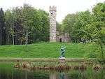 Gothick Gatehouse to Hardwick Park |
| Magistrates Court House | Sedgefield, County Durham | House | 1707 | 29 April 1952 | NZ3545728806 54°39′11″N 1°27′07″W |
1121492 | 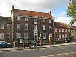 Magistrates Court House |
| Sherburn Hospital Chapel | Sherburn Hospital, Shincliffe, County Durham | Chapel | c. 1181 | 28 February 1952 | NZ3085841581 54°46′06″N 1°31′19″W |
1159384 | |
| Sherburn Hospital Gatehouse, Office Wing, Lodge and Wall | Sherburn Hospital, Shincliffe, County Durham | Wall | 14th century | 10 May 1967 | NZ3077441540 54°46′04″N 1°31′24″W |
1311049 | |
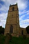
| Church of St.john the Evangelist | Kirk Merrington, Spennymoor, County Durham | Parish Church | Norman | 30 January 1951 | NZ2622831464 54°40′39″N 1°35′41″W |
1310889 | 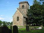 Church of St.john the Evangelist |
| Tudhoe Hall Farm and Tudhoe Hall | Tudhoe, Spennymoor, County Durham | House | Early 17th century | 30 March 1951 | NZ2584435636 54°42′54″N 1°36′01″W |
1121440 | 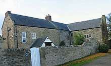 Tudhoe Hall Farm and Tudhoe Hall |
| Church of St Thomas | Stanhope, County Durham | Church | 1727 | 31 January 1967 | NY9970039229 54°44′53″N 2°00′22″W |
1231701 | 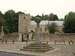 Church of St Thomas |
| Greenhead Farmhouse and Outbuilding Attached | Stanhope, County Durham | Farmhouse | 17th century | 31 January 1967 | NY9772539627 54°45′06″N 2°02′13″W |
1230040 | |
| Low Bishopley Farmhouse and Barn Adjoining | Bishopley, Stanhope, County Durham | Farmhouse | 17th century | 25 March 1986 | NZ0248635957 54°43′07″N 1°57′47″W |
1278846 | |
| Newhouse, and Walls Attached | Newhouse, Stanhope, County Durham | House | 17th century | 31 January 1967 | NY8729038878 54°44′41″N 2°11′56″W |
1232062 | |
| Park Level Mine Jigger House and Crushing Mill Water Wheel | Killhope, Stanhope, County Durham | Crushing Mill | 1970 | 5 June 1987 | NY8267842973 54°46′53″N 2°16′15″W |
1278814 | 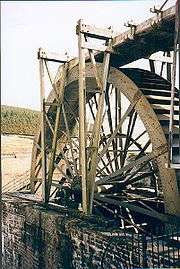 Park Level Mine Jigger House and Crushing Mill Water Wheel |
| Stanhope Bridge over River Wear | Stanhope, Stanhope, County Durham | Bridge | Medieval | 31 January 1967 | NY9851939084 54°44′48″N 2°01′28″W |
1277203 | 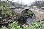 Stanhope Bridge over River Wear |
| Stanhope Castle | Stanhope, County Durham | Flats | 1987 | 5 June 1987 | NY9961839155 54°44′50″N 2°00′27″W |
1231718 | _-_geograph.org.uk_-_1640579.jpg) Stanhope Castle |
| Stanhope Hall | Stanhope, County Durham | House | Pre 16th century | 31 January 1967 | NY9896139377 54°44′58″N 2°01′04″W |
1277202 | 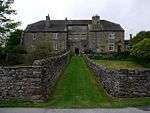 Stanhope Hall |
| Unthank Hall | Stanhope, County Durham | House | 16th century | 31 January 1967 | NY9911739107 54°44′49″N 2°00′55″W |
1230062 | |
| Westernhopeburn West Farmhouse and Adjoining Outbuilding | Eastgate, Stanhope, County Durham | Farmhouse | 1606 | 31 January 1967 | NY9350437845 54°44′08″N 2°06′09″W |
1232384 | 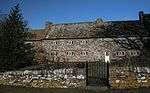 Westernhopeburn West Farmhouse and Adjoining Outbuilding |
| Westgate Primitive Methodist Chapel | Westgate, Stanhope, County Durham | Church School | 1871 | 5 June 1987 | NY9055238033 54°44′14″N 2°08′54″W |
1232510 | |
| Beamish Hall | Beamish, Stanley, County Durham | House | late C16/early 17th century | 19 July 1950 | NZ2119154843 54°53′16″N 1°40′16″W |
1260862 | |
| Garden Wall, Piers, Gates, and House attached at Beamish Hall Gardens | Beamish, Stanley, County Durham | Bath House | Early 18th century | 1 October 1986 | NZ2092854692 54°53′12″N 1°40′31″W |
1240739 | |
| Tanfield Hall | Tanfield, Stanley, County Durham | House | 17th century | 19 July 1950 | NZ1886755455 54°53′37″N 1°42′27″W |
1240892 | .jpg) Tanfield Hall |
| Pele Tower on East Return of Pockerley Farmhouse | Urpeth, County Durham | Pele Tower | 15th century | 23 February 1987 | NZ2225154578 54°53′08″N 1°39′17″W |
1159269 | 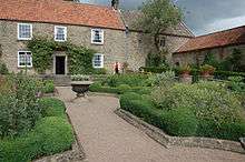 Pele Tower on East Return of Pockerley Farmhouse |
| The Old Hall | West Auckland, County Durham | Farmhouse | 16th century | 21 April 1952 | NZ1801426251 54°37′52″N 1°43′21″W |
1209888 |  The Old Hall |
| Church of St Mary and 2 Arches attached to North | West Rainton, County Durham | Parish Church | 1864 | 10 May 1967 | NZ3229646884 54°48′57″N 1°29′56″W |
1120737 | 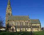 Church of St Mary and 2 Arches attached to North |
| Abbey Bridge | Westwick, County Durham | Road Bridge | 1773 | 7 January 1952 | NZ0661814943 54°31′47″N 1°53′57″W |
1310824 | 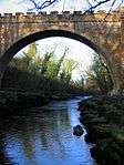 Abbey Bridge |
| Whorlton Bridge | Whorlton, County Durham | Suspension Bridge | 1829-1831 | 7 January 1952 | NZ1066714571 54°31′35″N 1°50′12″W |
1160013 | 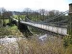 Whorlton Bridge |
| Clock Tower North of Windlestone Hall | Windlestone Park, Windlestone, County Durham | Gate | Early 19th century | 9 January 1968 | NZ2636928755 54°39′12″N 1°35′34″W |
1160369 | |
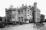
| Windlestone Hall Residential School | Windlestone Park, Windlestone, County Durham | House | 16th century | 9 January 1968 | NZ2636128676 54°39′09″N 1°35′35″W |
1160327 | |
| Stubb House | Winston, County Durham | Country House | Mid 18th century | 14 September 1966 | NZ1212415794 54°32′14″N 1°48′51″W |
1160036 | 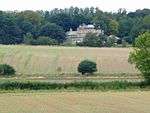 Stubb House |
| Westholme Hall | Winston, County Durham | Manor House | 1606 | 7 January 1952 | NZ1385317926 54°33′23″N 1°47′14″W |
1121056 | 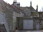 Westholme Hall |
| Witton Hall and Wall Attached | Witton Gilbert, County Durham | House | 12th and 18th century | 28 February 1952 | NZ2349645408 54°48′11″N 1°38′10″W |
1120696 | |
| Witton Bridge, Partly in Crook and Willington Parish, Wear Valley District | Witton Le Wear, County Durham | Bridge | c. 1788 | 30 September 1987 | NZ1478330731 54°40′17″N 1°46′20″W |
1121837 | 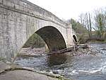 Witton Bridge, Partly in Crook and Willington Parish, Wear Valley District |
| Witton Tower | Witton Le Wear, County Durham | House | Medieval | 17 April 1952 | NZ1435431320 54°40′36″N 1°46′44″W |
1229013 | |
| Coves House Farmhouse | Wolsingham, County Durham | Farmhouse | Late Medieval | 5 June 1987 | NZ0531136312 54°43′18″N 1°55′09″W |
1232636 | |
| Gazebo/dovecote in Garden of Bishop Oak | Wolsingham, County Durham | Dovecote | Mid 18th century | 31 January 1967 | NZ0667239150 54°44′50″N 1°53′52″W |
1276768 | 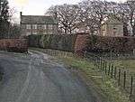 Gazebo/dovecote in Garden of Bishop Oak |
| Low Harperley Farmhouse | Wolsingham, County Durham | Farmhouse | 1967 | 31 January 1967 | NZ1196734912 54°42′33″N 1°48′57″W |
1276972 | 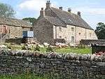 Low Harperley Farmhouse |
| Whitfield House | Wolsingham, County Durham | House | c. 1750 | 31 January 1967 | NZ0744737199 54°43′47″N 1°53′09″W |
1276869 | |
| Girlington Hall Farmhouse | Girlington, Wycliffe with Thorpe, County Durham | Cross Wing House | Early 14th century or Early 15th century | 19 January 1952 | NZ1283213753 54°31′08″N 1°48′12″W |
1161242 | |
| Thorpe Farmhouse and Adjacent Outbuildings | Wycliffe with Thorpe, County Durham | House | Mid 18th century | 12 January 1967 | NZ0939012716 54°30′35″N 1°51′23″W |
1322760 | 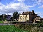 Thorpe Farmhouse and Adjacent Outbuildings |
| Thorpe Hall | Thorpe, Wycliffe with Thorpe, County Durham | House | 13th century | 28 October 1987 | NZ1048314081 54°31′19″N 1°50′22″W |
1121660 | |
| Whorlton Suspension Bridge, over the River Tees | Whorlton, Wycliffe with Thorpe, County Durham | Suspension Bridge | 1829-31 | 19 January 1952 | NZ1066614563 54°31′34″N 1°50′12″W |
1322762 | Whorlton Suspension Bridge, over the River Tees |
| Wycliffe Hall | Wycliffe, Wycliffe with Thorpe, County Durham | Country House | Medieval | 19 January 1952 | NZ1195014231 54°31′24″N 1°49′01″W |
1322784 | 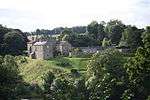 Wycliffe Hall |
| Aykley Heads | Durham, County Durham | House | c. 1700 | 30 April 1971 | NZ2651743844 54°47′20″N 1°35′21″W |
1322874 | |
| Bishop Cosin's Hall | Durham, County Durham | House | c. 1700 | 6 May 1952 | NZ2742742266 54°46′28″N 1°34′31″W |
1121384 | 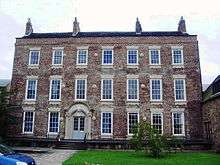 Bishop Cosin's Hall |
| Burn Hall | Durham, County Durham | Country House | 1821-34 | 10 March 1988 | NZ2608438673 54°44′32″N 1°35′47″W |
1323227 | |
| Burnopfield House | Burnopfield, County Durham | House | Third quarter 18th century | 19 July 1950 | NZ1769656781 54°54′20″N 1°43′32″W |
1240869 | |
| Castle Chare Community Arts Centre | Durham, County Durham | House | Early 18th century | 10 March 1988 | NZ2712842609 54°46′40″N 1°34′47″W |
1159303 | |
| Central Methodist Church | Crook, County Durham | Methodist Chapel | 1868 | 5 June 1987 | NZ1661535502 54°42′51″N 1°44′37″W |
1229012 | 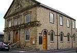 Central Methodist Church |
| Chester New Bridge | Chester-le-Street, County Durham | Bridge | 15th century | 23 February 1987 | NZ2844352286 54°51′52″N 1°33′30″W |
1323102 | |
| Chorister School | Durham, County Durham | House | Medieval | 6 May 1952 | NZ2725942008 54°46′20″N 1°34′40″W |
1120693 | 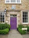 Chorister School |
| Church of St Ebba | Ebchester, County Durham | Parish Church | 12th century | 6 June 1951 | NZ1036555450 54°53′37″N 1°50′24″W |
1240418 | 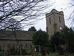 Church of St Ebba |
| Church of St Oswald | Durham, County Durham | Parish Church | Late 12th century | 6 May 1952 | NZ2758541915 54°46′17″N 1°34′22″W |
1120678 | |
| Cosin's Library (university Library) | Durham, County Durham | Library | 1667-8 | 19 October 1962 | NZ2734342284 54°46′29″N 1°34′35″W |
1121382 | 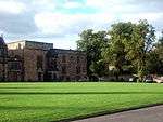 Cosin's Library (university Library) |
| Cow House of Home Farm Burn Hall | Durham, County Durham | Bull Pen | 10 March 1988 | NZ2625838914 54°44′40″N 1°35′37″W |
1120665 | | |
| Crown Court | Durham, County Durham | Crown Court | c. 1811 | 6 May 1952 | NZ2784542203 54°46′26″N 1°34′07″W |
1322878 | 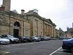 Crown Court |
| Demesne Farm Demesne House | Ebchester, County Durham | Farmhouse | 1705 | 6 June 1951 | NZ1027555455 54°53′37″N 1°50′29″W |
1240412 | |
| Department of Archaeology | Durham, County Durham | House | 17th century | 30 April 1971 | NZ2747642386 54°46′32″N 1°34′28″W |
1322896 | |
| Durham Prison Officer's Club (the Tithe Barn) | Durham, County Durham | Club | Medieval | 19 February 1970 | NZ2783841974 54°46′19″N 1°34′08″W |
1120616 | |
| Friarside Chapel | Burnopfield, County Durham | Chapel | 14th century | 19 July 1950 | NZ1624757863 54°54′55″N 1°44′53″W |
1240894 | |
| Hamsterley Hall, with adjoining Wall and Outbuilding | Hamsterley, County Durham | House | Early 18th century | 6 June 1951 | NZ1425755637 54°53′43″N 1°46′45″W |
1067550 | |
| Hunwick Hall Farmhouse and attached Wall | Hunwick, County Durham | Farmhouse | 1952 | 17 April 1952 | NZ1895432389 54°41′10″N 1°42′27″W |
1229021 | 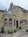 Hunwick Hall Farmhouse and attached Wall |
| Hunwick Hall, North West and North East Ranges | Durham, County Durham | Manor House | Medieval | 17 April 1952 | NZ1894932416 54°41′11″N 1°42′27″W |
1279133 |  Hunwick Hall, North West and North East Ranges |
| Leap Mill Farmhouse and Aqueduct Wall, with Pigsty/Henhouse attached | Burnopfield, County Durham | Farmhouse | Early 18th century | 21 January 1987 | NZ1755657226 54°54′34″N 1°43′40″W |
1240813 | |
| No.4 North Bailey and Castle Wall incorporated | Durham, County Durham | House | 17th century | 19 October 1962 | NZ2748542330 54°46′31″N 1°34′27″W |
1121421 | 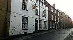 No.4 North Bailey and Castle Wall incorporated |
| Number 12 Bridge Railway Accommodation Bridge at NZ 191 297 | Escomb, County Durham | Accommodation Bridge | 1842 | 23 May 1994 | NZ1909929624 54°39′41″N 1°42′20″W |
1196464 | |
| Old Grammar School (University Music Department) | Durham, County Durham | Teachers House | Early 18th century | 6 May 1952 | NZ2730542229 54°46′27″N 1°34′37″W |
1160796 | 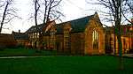 Old Grammar School (University Music Department) |
| Pontop Hall | Dipton, County Durham | Farmhouse | Late 17th century | 19 July 1950 | NZ1482553655 54°52′39″N 1°46′14″W |
1240730 | 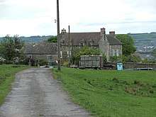 Pontop Hall |
| Railway Viaduct and Drinking Fountain attached | Durham, County Durham | Drinking Fountain | 1860s | 19 February 1970 | NZ2680242570 54°46′38″N 1°35′05″W |
1322851 | 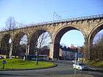 Railway Viaduct and Drinking Fountain attached |
| Salvation Army Citadel | Durham, County Durham | Gate | Medieval | 19 October 1962 | NZ2747042368 54°46′32″N 1°34′28″W |
1121360 |  Salvation Army Citadel |
| St Cuthbert's Society | Durham, County Durham | House | 17th century | 6 May 1952 | NZ2729941844 54°46′15″N 1°34′38″W |
1121375 | |
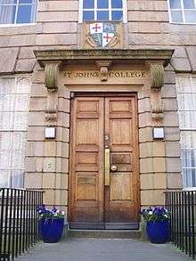
| St John's College | Durham, County Durham | House | Early 18th century | 6 May 1952 | NZ2740141964 54°46′19″N 1°34′32″W |
1161313 | |
| St John's College Second Part | Durham, County Durham | House | 17th century | 6 May 1952 | NZ2738341951 54°46′18″N 1°34′33″W |
1161328 |  St John's College Second Part |
| Statue of Third Marquess of Londonderry | Durham, County Durham | Statue | 1858 | 10 March 1988 | NZ2739642525 54°46′37″N 1°34′32″W |
1120630 |  Statue of Third Marquess of Londonderry |
| Town Hall and Guildhall | Durham, County Durham | Guildhall | 17th century | 19 February 1970 | NZ2737342576 54°46′38″N 1°34′34″W |
1160184 | |
| Water Gate | Durham, County Durham | Gate | 1787 | 6 May 1952 | NZ2724841850 54°46′15″N 1°34′41″W |
1322920 | 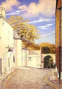 Water Gate |
| 47 and 48 Old Elvet | Durham, County Durham | Terraced House | Early 18th century | 6 May 1952 | NZ2776742352 54°46′31″N 1°34′12″W |
1121416 | |
| 6 The College | Durham, County Durham | Clergy House | Medieval | 6 May 1952 | NZ2733341982 54°46′19″N 1°34′36″W |
1120690 | 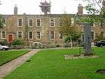 6 The College |
| 16 and 16a The College | Durham, County Durham | Clergy House | 17th century | 6 May 1952 | NZ2739042036 54°46′21″N 1°34′33″W |
1120656 | 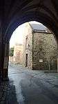 16 and 16a The College |
| 7 The College | Durham, County Durham | Clergy House | Medieval | 6 May 1952 | NZ2731241984 54°46′19″N 1°34′37″W |
1311001 | 7 The College |
Darlington
| Name | Location | Type | Completed [note 1] | Date designated | Grid ref.[note 2] Geo-coordinates |
Entry number [note 3] | Image |
|---|---|---|---|---|---|---|---|
| Barn 100 Metres East of Hall Farmhouse | Hall Farm, Archdeacon Newton, Darlington | House | Late C16-Early 17th century | 6 June 1952 | NZ2548017129 54°32′56″N 1°36′27″W |
1322949 | |
| Heighington Hall | Heighington, Darlington | House | Late C17-Early 18th century | 6 June 1952 | NZ2500322434 54°35′47″N 1°36′52″W |
1121240 | |
| Middridge Grange Farmhouse | Heighington, Darlington | Farmhouse | c. 1600 | 6 June 1952 | NZ2447024631 54°36′58″N 1°37′21″W |
1121214 |  Middridge Grange Farmhouse |
| Church of St Edwin | High Coniscliffe, Darlington | Parish Church | c. 1170 | 20 March 1967 | NZ2257815234 54°31′55″N 1°39′09″W |
1115562 | 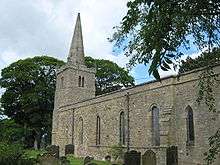 Church of St Edwin |
| The Old Hall | High Coniscliffe, Darlington | House | Medieval | 6 June 1952 | NZ2253715370 54°31′59″N 1°39′12″W |
1322964 |  The Old Hall |
| Dovecote 45 Metres East of Manor House | Houghton Le Side, Darlington | Dovecote | 17th century or Earlier | 16 July 1986 | NZ2255821795 54°35′27″N 1°39′09″W |
1121194 | 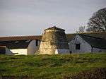 Dovecote 45 Metres East of Manor House |
| The Old Hall | Hurworth, Darlington | House | Mid 18th century | 6 June 1952 | NZ3055410107 54°29′07″N 1°31′48″W |
1185922 | 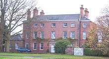 The Old Hall |
| Cross Shaft Fragment About 5 Metres South West of Church of St John the Baptist | Low Dinsdale, Darlington | Cross | Late 11th century | 27 January 1988 | NZ3466811202 54°29′42″N 1°27′59″W |
1299456 | |
| Stone Coffin and Lid About 3.5 Metres West of Church of St John the Baptist | Low Dinsdale, Darlington | Coffin | 11th century | 27 January 1988 | NZ3466811214 54°29′42″N 1°27′59″W |
1185927 | |
| The Manor House | Low Dinsdale, Darlington | Moat | Late Medieval | 6 June 1952 | NZ3462411009 54°29′36″N 1°28′01″W |
1185929 | |
| Low Middleton Hall and Former Stable on Rear | Middleton St. George, Darlington | House | 1721 | 6 June 1952 | NZ3646510885 54°29′31″N 1°26′19″W |
1185935 | |
| Kerbstones Surrounding Pool in Front of Cummins Engine Factory | Morton Palms, Darlington | Pool | 1964-5 | 23 September 1992 | NZ3171413841 54°31′08″N 1°30′42″W |
1299427 | |
| Security Fence at Cummins Engine Factory | Morton Palms, Darlington | Fence | 1964-5 | 23 September 1992 | NZ3171413659 54°31′02″N 1°30′42″W |
1335834 | |
| The Cummins Engine Factory Including Chimney | Morton Palms, Darlington | Factory | 1964-5 | 23 September 1992 | NZ3177113739 54°31′05″N 1°30′39″W |
1185948 | 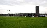 The Cummins Engine Factory Including Chimney |
| Medieval Chapel Ruins on Roman Foundations in Rear Garden of Bath House, Tees View | Piercebridge, Darlington | Chapel | 13th century | 16 July 1986 | NZ2103615632 54°32′08″N 1°40′35″W |
1322972 | 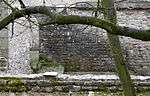 Medieval Chapel Ruins on Roman Foundations in Rear Garden of Bath House, Tees View |
| Pierce Bridge | Piercebridge, Darlington | Bridge | Early 16th century | 19 December 1951 | NZ2108215554 54°32′05″N 1°40′33″W |
1131363 | 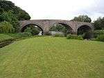 Pierce Bridge |
| Piercebridge Bridge | Piercebridge, Darlington | Road Bridge | Early 16th century | 6 June 1952 | NZ2108015559 54°32′06″N 1°40′33″W |
1145843 | Piercebridge Bridge |
| Sockburn Hall | Sockburn, Darlington | Country House | 1834 | 20 March 1967 | NZ3496607189 54°27′32″N 1°27′44″W |
1116156 | |
| Bank Top Railway Station (main building) | Darlington | Railway Station | 1887 | 6 September 1977 | NZ2945114081 54°31′16″N 1°32′48″W |
1310079 | 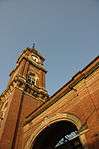 Bank Top Railway Station (main building) |
| Barclays Bank | Darlington | Building | 1864 | 6 September 1977 | NZ2884614555 54°31′32″N 1°33′21″W |
1322928 | 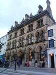 Barclays Bank |
| Blackwell Grange (the Europa Lodge Hotel) | Darlington | Hotel | 18th century | 28 April 1952 | NZ2805613232 54°30′49″N 1°34′05″W |
1322941 | 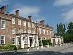 Blackwell Grange (the Europa Lodge Hotel) |
| Bondgate Methodist Church | Darlington | Methodist Chapel | 1812 | 28 April 1952 | NZ2866514605 54°31′33″N 1°33′31″W |
1121254 | |
| Central School Annexe | Darlington | House | Early 19th century | 28 April 1952 | NZ2905314983 54°31′45″N 1°33′09″W |
1242805 | |
| Church of Holy Trinity | Darlington | Chapel of Ease | 1836-38 | 28 April 1952 | NZ2831114818 54°31′40″N 1°33′51″W |
1121226 | |
| Friends Meeting House | Darlington | Friends Meeting House | 1839-40 | 28 April 1952 | NZ2871114394 54°31′26″N 1°33′29″W |
1121255 | |
| Goods Shed East South East of North Road Railway Station | Darlington | Goods Shed | 1833 | 6 September 1977 | NZ2899315629 54°32′06″N 1°33′12″W |
1121262 |  Goods Shed East South East of North Road Railway Station |
| Hillclose Farm House | Darlington | Farmhouse | 17th century | 28 April 1952 | NZ2665914682 54°31′36″N 1°35′23″W |
1322954 | |
| North Road Railway Station (now Railway Museum) | Darlington | Museum | 1977 | 28 April 1952 | NZ2891015712 54°32′09″N 1°33′17″W |
1322962 |  North Road Railway Station (now Railway Museum) |
| Outbuilding to North East of Blackwell Grange | Darlington | Outbuilding | Third Quarter 18th century | 6 September 1977 | NZ2809513287 54°30′51″N 1°34′03″W |
1160162 | |
| St Clare's Abbey Chapel | Darlington | Chapel | 1856 - 1857 | 18 August 2009 | NZ2728914497 54°31′30″N 1°34′48″W |
1393424 | |
| 81 Bondgate | Darlington | House | Early 19th century | 28 April 1952 | NZ2870814709 54°31′37″N 1°33′29″W |
1121316 | |
| 1–8 Harewood Grove | Darlington | Terrace | Early-mid 19th century | 28 April 1952 | NZ2831313845 54°31′09″N 1°33′51″W |
1121296 | |
| 14 Horsemarket | Darlington | Town House | 18th century | 28 April 1952 | NZ2891714397 54°31′27″N 1°33′17″W |
1121275 | |
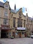
_-_geograph.org.uk_-_226356.jpg)
Hartlepool
| Name | Location | Type | Completed [note 1] | Date designated | Grid ref.[note 2] Geo-coordinates |
Entry number [note 3] | Image |
|---|---|---|---|---|---|---|---|
| Church of St. Peter | Elwick Village, Elwick, Hartlepool | Church | Late 12th century | 16 November 1967 | NZ4534632081 54°40′54″N 1°17′54″W |
1139821 | |
| Church of St John the Baptist | Greatham, Hartlepool | Church | Late 12th century | 16 November 1967 | NZ4923127502 54°38′25″N 1°14′19″W |
1263522 | 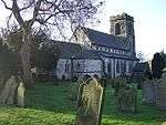 Church of St John the Baptist |
| Boundary Wall to West of Church of St Mary Magdalene | Hart, Hartlepool | Boundary Wall | Medieval | 16 November 1967 | NZ4702735088 54°42′31″N 1°16′18″W |
1249899 | |
| Numbers 2 and 3 (Duke of Cleveland's House) and East Extensions | Headland, Hartlepool | House | Late 17th century | 31 March 1949 | NZ5282633634 54°41′42″N 1°10′55″W |
1250117 | |
| Christ Church | Hartlepool | Church | 1850-1854 | 10 November 1982 | NZ5106232586 54°41′09″N 1°12′34″W |
1250112 | 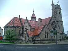 Christ Church |
| Church of All Saints | Hartlepool | Bench | 12th century | 24 March 1950 | NZ5088731992 54°40′50″N 1°12′44″W |
1250534 | 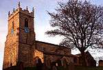 Church of All Saints |
Stockton-on-Tees
| Name | Location | Type | Completed [note 1] | Date designated | Grid ref.[note 2] Geo-coordinates |
Entry number [note 3] | Image |
|---|---|---|---|---|---|---|---|
| Ivy House | Cowpen Bewley, Billingham, Stockton-on-Tees | House | 17th century | 25 January 1951 | NZ4823524764 54°36′57″N 1°15′17″W |
1139244 | |
| Phosphate Rock Silo No 15 at ICI Works, Billingham | Billingham, Stockton-on-Tees | Silo | 1928-1929 | 7 October 1992 | NZ4760821198 54°35′01″N 1°15′54″W |
1115821 | |
| St Cuthbert's Vicarage | Billingham, Stockton-on-Tees | House | 17th century | 21 June 1985 | NZ4574822363 54°35′40″N 1°17′37″W |
1139272 | |
| Transporter Bridge | Billingham, Stockton-on-Tees | Transporter Bridge | 1911 | 21 June 1985 | NZ4999121297 54°35′04″N 1°13′41″W |
1139267 | Transporter Bridge |
| The Hall (East House, West House and Second Floor Flat) | Egglescliffe, Stockton-on-Tees | House | Mid to late 18th century | 16 November 1967 | NZ4222413238 54°30′46″N 1°20′58″W |
1139255 | |
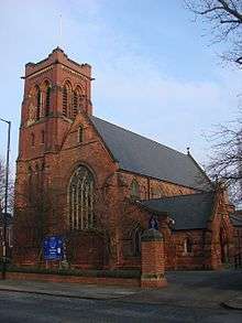
| Church of St John the Baptist | Elton, Stockton-on-Tees | Church | 1841 | 16 November 1967 | NZ4018417372 54°33′00″N 1°22′49″W |
1139261 | 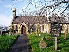 Church of St John the Baptist |
| Lion Bridge to East of Wynyard Hall | Grindon, Stockton-on-Tees | Bridge | Early to mid 19th century | 16 November 1967 | NZ4221025781 54°37′31″N 1°20′52″W |
1139222 | |
| Wellington Obelisk to South East of Wynyard Hall | Grindon, Stockton-on-Tees | Obelisk | 1827 | 23 April 1952 | NZ4233325347 54°37′17″N 1°20′45″W |
1329823 | 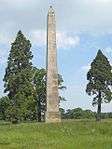 Wellington Obelisk to South East of Wynyard Hall |
| Wynyard Hall | Grindon, Stockton-on-Tees | House | 1822-41 | 23 April 1952 | NZ4204225757 54°37′31″N 1°21′01″W |
1139221 | 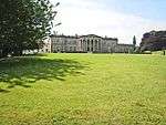 Wynyard Hall |
| Church of St Martin | Kirklevington, Stockton-on-Tees | Church | 12th century | 23 June 1966 | NZ4317309860 54°28′56″N 1°20′07″W |
1329828 | 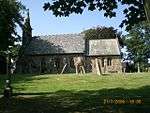 Church of St Martin |
| Church of St Mary | Longnewton, Stockton-on-Tees | Church | 1856-1857 | 16 November 1967 | NZ3827416487 54°32′32″N 1°24′36″W |
1139238 | |
| Manor House | Longnewton, Stockton-on-Tees | Manor House | 18th century | 16 November 1967 | NZ3824516443 54°32′31″N 1°24′37″W |
1329830 | |
| Church of St Luke | Thornaby, Stockton-on-Tees | Parish Church | 1904 | 21 June 1985 | NZ4579817928 54°33′16″N 1°17′36″W |
1329463 | 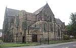 Church of St Luke |
| Old Church of St Peter | Thornaby, Stockton-on-Tees | Church | 12th century | 19 January 1951 | NZ4505516438 54°32′28″N 1°18′18″W |
1139917 | 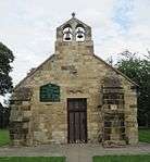 Old Church of St Peter |
| The Rectory | Wolviston, Stockton-on-Tees | House | Pre 1780 | 25 January 1951 | NZ4508825525 54°37′22″N 1°18′12″W |
1329470 | |
| Church of St Mary Magdalene | Yarm, Stockton-on-Tees | Church | Norman | 23 June 1966 | NZ4163312914 54°30′35″N 1°21′31″W |
1054686 | 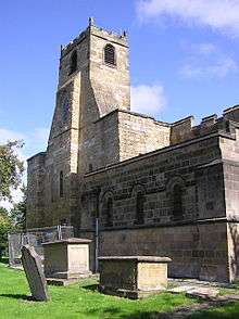 Church of St Mary Magdalene |
| The Ketton Ox Public House | Yarm, Stockton-on-Tees | House | Pre 1767 | 5 May 1952 | NZ4186012998 54°30′38″N 1°21′18″W |
1139901 | 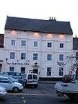 The Ketton Ox Public House |
| Yarm Bridge over River Tees | Yarm, Stockton-on-Tees | Bridge | c. 1400 | 16 November 1967 | NZ4180213139 54°30′43″N 1°21′21″W |
1105658 | 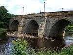 Yarm Bridge over River Tees |
| 10 and 12 High Street | Yarm, Stockton-on-Tees | House | Early 18th century | 5 May 1952 | NZ4195712707 54°30′29″N 1°21′13″W |
1139936 | |
| 14 High Street | Yarm, Stockton-on-Tees | House | Early 18th century | 5 May 1952 | NZ4195712720 54°30′29″N 1°21′13″W |
1049109 | |
| 124 High Street | Yarm, Stockton-on-Tees | House | Mid 18th century | 5 May 1952 | NZ4181313080 54°30′41″N 1°21′21″W |
1139904 | |
| Church of St Michael and All Angels | Stockton-on-Tees | Church | 1913 | 19 January 1951 | NZ4472320946 54°34′54″N 1°18′34″W |
1329478 | |
| Church of St Peter | Stockton-on-Tees | Church | 1880-1881 | 19 January 1951 | NZ4386118186 54°33′25″N 1°19′24″W |
1139916 | |
| Church of the Holy Trinity | Stockton-on-Tees | Church | 1837-1838 | 19 January 1951 | NZ4438918552 54°33′37″N 1°18′54″W |
1329480 | 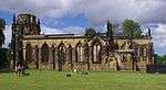 Church of the Holy Trinity |
| Columbia House | Stockton-on-Tees | House | Mid to late 18th century | 19 January 1951 | NZ4477819368 54°34′03″N 1°18′32″W |
1329447 |  Columbia House |
| Friends Meeting House | Stockton-on-Tees | Meeting House | 1876 | 19 January 1951 | NZ4431819005 54°33′52″N 1°18′58″W |
1356201 | |
| Gloucester House | Stockton-on-Tees | House | Mid 18th century | 19 January 1951 | NZ4474119351 54°34′03″N 1°18′34″W |
1084341 | 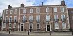 Gloucester House |
| The Manor House | Hartburn, Stockton-on-Tees | House | 17th century | 19 January 1951 | NZ4290017940 54°33′18″N 1°20′18″W |
1325975 | |
| The Market Cross | Stockton-on-Tees | Market Cross | 1768 | 19 January 1951 | NZ4452718955 54°33′50″N 1°18′46″W |
1139976 | |
| The Sun Inn | Stockton-on-Tees | House | Early 19th century | 21 June 1985 | NZ4460319149 54°33′56″N 1°18′42″W |
1343689 | 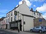 The Sun Inn |
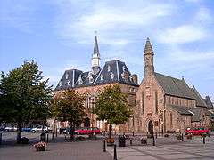
| Town Hall | Stockton-on-Tees | Town Hall | Post 1744 | 19 January 1951 | NZ4452618979 54°33′51″N 1°18′46″W |
1139975 | 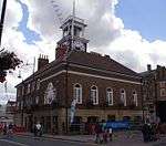 Town Hall |
| War Memorial | Stockton-on-Tees | Sarcophagus | 1923 | 19 January 1951 | NZ4454719231 54°33′59″N 1°18′45″W |
1139979 | 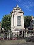 War Memorial |
| 108 High Street | Stockton-on-Tees | House | Mid 18th century | 19 January 1951 | NZ4448618881 54°33′48″N 1°18′49″W |
1101477 | |
| 48 Bridge Road | Stockton-on-Tees | House | 1825 | 19 January 1951 | NZ4469518381 54°33′31″N 1°18′37″W |
1139963 | |
| 74 and 76 Church Road | Stockton-on-Tees | House | Mid to late 18th century | 19 January 1951 | NZ4477019350 54°34′03″N 1°18′33″W |
1139966 | 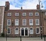 74 and 76 Church Road |
| 80 Church Road | Stockton-on-Tees | House | Mid to late 18th century | 21 June 1985 | NZ4479519353 54°34′03″N 1°18′31″W |
1338865 | 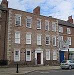 80 Church Road |
| 9 Finkle Street | Stockton-on-Tees | House | 17th century | 19 January 1951 | NZ4460818982 54°33′51″N 1°18′42″W |
1356182 | 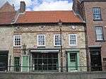 9 Finkle Street |
| 32 Dovecot Street | Stockton-on-Tees | House | Early to mid | 19 January 1951 | NZ4442019022 54°33′52″N 1°18′52″W |
1329448 | |
Notes
- The date given is the date used by Historic England as significant for the initial building or that of an important part in the structure's description.
- Sometimes known as OSGB36, the grid reference is based on the British national grid reference system used by the Ordnance Survey.
- The "List Entry Number" is a unique number assigned to each listed building and scheduled monument by Historic England.
See also
- Category:Grade II* listed buildings in County Durham
References
- National Heritage List for England
- Keys To The Past Durham/Northumbria councils site
External links
![]()
This article is issued from Wikipedia. The text is licensed under Creative Commons - Attribution - Sharealike. Additional terms may apply for the media files.