Grade II* listed buildings in Broadland
There are over 20,000 Grade II* listed buildings in England. This page is a list of these buildings in the district of Broadland in Norfolk.
List of buildings
| Name | Location | Type | Completed [note 1] | Date designated | Grid ref.[note 2] Geo-coordinates |
Entry number [note 3] | Image |
|---|---|---|---|---|---|---|---|
| Church of St John the Baptist | Alderford | Church | 14th century | 10 May 1961 | TG1237618783 52°43′30″N 1°08′37″E |
1076888 | 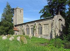 Church of St John the Baptist |
| Church of St Andrew | Attlebridge | Parish church | c.1300 | 10 May 1961 | TG1294416861 52°42′27″N 1°09′02″E |
1372661 | 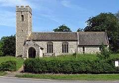 Church of St Andrew |
| Knoll House | Aylsham | House | Early 18th century | 19 January 1952 | TG1915227026 52°47′47″N 1°14′57″E |
1051567 |  |
| Old Bank House | Aylsham | House | Early 18th century | 10 May 1965 | TG1936226831 52°47′40″N 1°15′08″E |
1051551 | |
| The Manor House | Aylsham | House | 17th century | 19 January 1952 | TG1942026751 52°47′37″N 1°15′11″E |
1372668 | |
| Yew Tree House Including Boundary Wall | Aylsham | House | 18th century | 1 June 1984 | TG1917627017 52°47′46″N 1°14′58″E |
1170402 | |
| Church of St Andrew | Blickling | Parish church | Medieval | 10 May 1961 | TG1787328455 52°48′35″N 1°13′52″E |
1171857 | 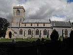 Church of St Andrew |
| The Doric Temple | Blickling Park, Blickling | Garden temple | Early/mid-18th century | 19 January 1952 | TG1823628530 52°48′36″N 1°14′12″E |
1051432 | 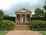 The Doric Temple |
| The Mausoleum | Blickling Park, Blickling | Mausoleum | 1793 | 19 January 1952 | TG1662529463 52°49′09″N 1°12′48″E |
1051437 | 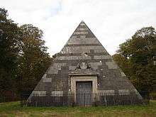 The Mausoleum |
| Church of St Michael and All Angels | Booton | Church | 14th century | 10 May 1961 | TG1229822386 52°45′26″N 1°08′41″E |
1342776 | |
| Church of St Michael | Oxnead, Brampton | Parish church | 13th century | 10 May 1961 | TG2297424051 52°46′05″N 1°18′14″E |
1050959 | 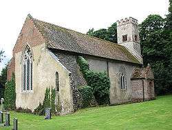 Church of St Michael |
| Church of St Peter | Brampton | Parish church | 12th century | 10 May 1961 | TG2197324610 52°46′24″N 1°17′22″E |
1372950 |  Church of St Peter |
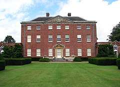
| Oxnead Hall | Oxnead, Brampton | Country house | Late 16th century | 10 May 1961 | TG2307224012 52°46′03″N 1°18′19″E |
1372951 | 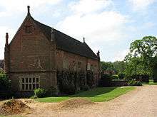 Oxnead Hall |
| Church of St Nicholas | Brandiston | Church | 14th century | 10 May 1961 | TG1413221423 52°44′53″N 1°10′16″E |
1076897 | 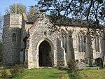 Church of St Nicholas |
| Church of St Lawrence | Brundall | Parish church | 13th century | 25 September 1962 | TG3216108452 52°37′27″N 1°25′43″E |
1051519 | 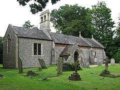 Church of St Lawrence |
| Burgh Mill | Burgh and Tuttington | Watermill | Late 18th century | 18 November 1983 | TG2221525093 52°46′40″N 1°17′36″E |
1250712 | 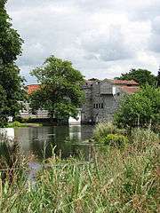 Burgh Mill |
| Church of St Peter and Paul | Tuttington, Burgh and Tuttington | Parish church | 12th century | 10 May 1961 | TG2265527187 52°47′47″N 1°18′04″E |
1050931 | 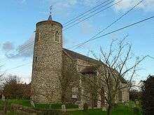 Church of St Peter and Paul |
| Church of St Andrew | Buxton, Buxton with Lammas | Parish church | 14th century | 10 May 1961 | TG2335122704 52°45′21″N 1°18′30″E |
1249960 | 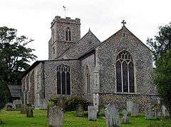 Church of St Andrew |
| Church of St Andrew | Lammas, Buxton with Lammas | Parish church | 15th century | 10 May 1961 | TG2452823217 52°45′36″N 1°19′34″E |
1372945 | 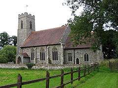 Church of St Andrew |
| Little Hautbois Hall | Little Hautbois, Buxton with Lammas | Country house | Late 16th century | 19 January 1952 | TG2488221942 52°44′54″N 1°19′50″E |
1050941 | 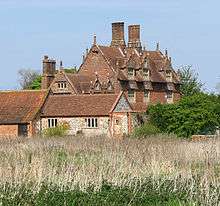 Little Hautbois Hall |
| Church of St Botolph | Limpenhoe, Cantley | Parish church | 15th century | 25 September 1962 | TG3953003992 52°34′51″N 1°32′03″E |
1051451 | 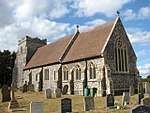 Church of St Botolph |
| Church of St Margaret | Cantley | Parish church | 1250 | 25 September 1962 | TG3816704140 52°34′58″N 1°30′51″E |
1304803 | 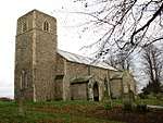 Church of St Margaret |
| Remains of Church of St Edmunds | Southwood, Cantley | Parish church | 14th century | 25 September 1962 | TG3911205316 52°35′35″N 1°31′44″E |
1372698 | 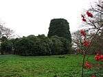 Remains of Church of St Edmunds |
| Bank Cottage and Oak House | Cawston | House | c.1700 | 10 May 1961 | TG1351623897 52°46′14″N 1°09′49″E |
1050949 | |
| Church of St Theobald | Great Hautbois, Coltishall | Church | 15th century | 10 May 1961 | TG2617820431 52°44′03″N 1°20′55″E |
1295280 | 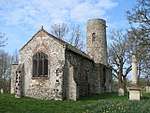 Church of St Theobald |
| The Limes and attached garden walls | Coltishall | House | 1692 | 19 January 1952 | TG2759919831 52°43′42″N 1°22′09″E |
1295241 | |
| The Old House | Coltishall | House | 1727 | 10 May 1961 | TG2694219745 52°43′40″N 1°21′34″E |
1372990 | |
| Drayton Lodge | Drayton | Summerhouse | 15th century | 19 January 1952 | TG1864313154 52°40′19″N 1°13′57″E |
1306023 | 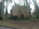 Drayton Lodge |
| Parish Church of St Margaret | Drayton | Parish church | 15th century | 19 January 1952 | TG1804413741 52°40′39″N 1°13′26″E |
1306000 | 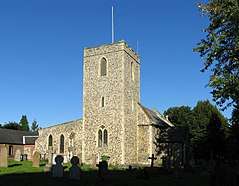 Parish Church of St Margaret |
| Parish Church of St Margaret | Felthorpe | Parish church | 14th century | 10 May 1961 | TG1698017318 52°42′36″N 1°12′38″E |
1051539 | 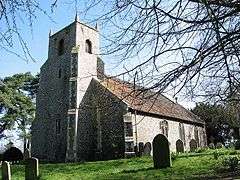 Parish Church of St Margaret |
| Old Hall Farm House | Foulsham | Farmhouse | 16th century | 19 January 1952 | TG0345724907 52°47′00″N 1°00′56″E |
1372926 | |
| Table tomb to the north-east of the west door of the Church of the Holy Innocents | Foulsham | Table tomb | c.1505 | 3 May 1983 | TG0325025068 52°47′06″N 1°00′45″E |
1050985 | 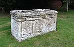 Table tomb to the north-east of the west door of the Church of the Holy Innocents |
| Church of All Saints | Freethorpe | Parish church | Tower probably Norman | 25 September 1962 | TG4086705507 52°35′38″N 1°33′18″E |
1051456 | 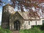 Church of All Saints |
| Stock house 47 metres south of the Manor House | Freethorpe | Animal shed | 1828 | 20 February 1952 | TG4114704986 52°35′21″N 1°33′31″E |
1152503 | |
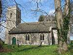
| Church of St Swithin | Frettenham | Parish church | 14th century | 10 May 1961 | TG2448518529 52°43′04″N 1°19′20″E |
1372955 | 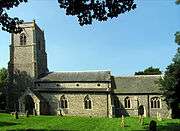 Church of St Swithin |
| Church of St Gervase and Protase | Little Plumstead, Great and Little Plumstead | Parish church | 13th century and later | 25 September 1962 | TG3074110859 52°38′47″N 1°24′34″E |
1051528 | 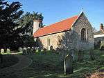 Church of St Gervase and Protase |
| The Grange, garden walls, attached greenhouse and outbuildings | Little Plumstead, Great and Little Plumstead | House | 16th century | 19 March 1985 | TG3146610938 52°38′48″N 1°25′13″E |
1372657 | |
| Great Witchingham Hall | Great Witchingham | Country house | Late 16th–early 17th century | 19 January 1952 | TG1118618603 52°43′26″N 1°07′33″E |
1076861 |  Great Witchingham Hall |
| Manor House | Great Witchingham | Farmhouse | 17th century | 19 January 1952 | TG1029721416 52°44′58″N 1°06′52″E |
1306691 | 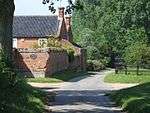 Manor House |
| Congregational Chapel | Guestwick | Chapel/timber framed house | 1625 | 2 November 1972 | TG0606527228 52°48′12″N 1°03′20″E |
1372914 | %2C_Guestwick_(geograph_2263187).jpg) Congregational Chapel |
| Mutton's Mill | Halvergate Marshes, Halvergate | Drainage mill | Mid-19th century | 26 February 1987 | TG4412506349 52°36′00″N 1°36′13″E |
1051457 | |
| Remains of Church of St Peter and St Paul | Tunstall, Halvergate | Parish church | 13th century and later | 25 September 1962 | TG4170508021 52°36′58″N 1°34′09″E |
1372727 | 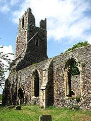 Remains of Church of St Peter and St Paul |
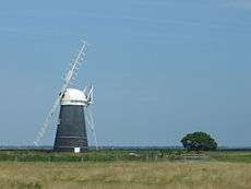
| Stracey Arms Windpump | Tunstall, Halvergate | Drainage mill | 1883 | 7 December 1962 | TG4416408969 52°37′25″N 1°36′22″E |
1051459 | |
| Parish Church of St Peter | Haveringland | Parish church | 11th century tower | 10 May 1961 | TG1514920902 52°44′34″N 1°11′09″E |
1372948 | 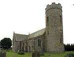 Parish Church of St Peter |
| Parish Church of St Mary | Hellesdon | Parish church | 15th century | 10 May 1961 | TG2005310614 52°38′55″N 1°15′06″E |
1170678 | 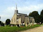 Parish Church of St Mary |
| Cropton Hall | Heydon | Farmhouse | 17th century | 19 January 1952 | TG1079428374 52°48′42″N 1°07′35″E |
1305357 |  Cropton Hall |
| Church of St Andrew | Honingham | Parish church | 14th century | 10 May 1961 | TG1141711245 52°39′28″N 1°07′28″E |
1170701 | 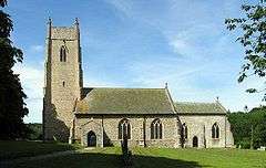 Church of St Andrew |
| Parish Church of All Saints | Horsford | Parish church | 1456 | 10 May 1961 | TG1968415379 52°41′29″N 1°14′57″E |
1170781 | 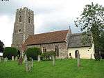 Parish Church of All Saints |
| Mayton Old Bridge | Horstead with Stanninghall | Bridge | Early 16th century | 10 May 1961 | TG2499621561 52°44′41″N 1°19′55″E |
1178140 | 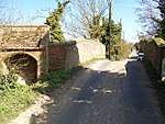 Mayton Old Bridge |
| Parish Church of All Saints | Horstead with Stanninghall | Parish church | Early 14th century | 10 May 1961 | TG2628519915 52°43′46″N 1°21′00″E |
1178235 | 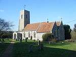 Parish Church of All Saints |
| Old Hall Farmhouse | South Burlingham, Lingwood and Burlingham | Farmhouse | Late 16th century | 20 February 1952 | TG3726007832 52°36′59″N 1°30′12″E |
1152874 | 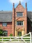 Old Hall Farmhouse |
| Church of St Faith | Little Witchingham | Church | 14th century | 22 July 1983 | TG1154920233 52°44′18″N 1°07′56″E |
1342803 | |
| Church of St Margaret | Morton on the Hill | Parish church | 13th century | 10 May 1961 | TG1249415828 52°41′54″N 1°08′36″E |
1051548 | 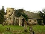 Church of St Margaret |
| Parish Church of St Margaret | Old Catton | Parish church | 12th century | 10 May 1961 | TG2306012324 52°39′46″N 1°17′49″E |
1152550 | 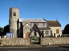 Parish Church of St Margaret |
| The Firs | Old Catton | House | c.1750 | 19 January 1952 | TG2335711812 52°39′29″N 1°18′04″E |
1372964 | |
| Church of St Peter and St Paul | Oulton | Parish church | 15th century | 10 May 1961 | TG1365428460 52°48′41″N 1°10′07″E |
1372723 | 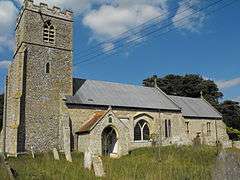 Church of St Peter and St Paul |
| Congregational Chapel | Oulton | Nonconformist chapel | 1728 | 14 February 1978 | TG1409129210 52°49′04″N 1°10′32″E |
1172066 |  Congregational Chapel |
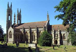
| Church of All Saints | Postwick, Postwick with Witton | Parish church | Medieval | 20 May 1952 | TG2961307826 52°37′11″N 1°23′26″E |
1372681 |  Church of All Saints |
| Church of St Margaret | Witton, Postwick with Witton | Parish church | Medieval | 20 May 1952 | TG3142309713 52°38′09″N 1°25′07″E |
1153110 | 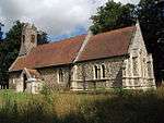 Church of St Margaret |
| Polkey's Mill, 75 metres north-east of Seven Mile House | Reedham | Drainage mill | Mid-19th century | 26 February 1987 | TG4442803494 52°34′27″N 1°36′21″E |
1051425 | 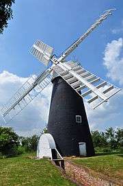 Polkey's Mill, 75 metres north-east of Seven Mile House |
| Church of St Michael and All Angels | Reepham | Church | 14th century | 10 May 1961 | TG1010822856 52°45′45″N 1°06′45″E |
1306488 | 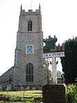 Church of St Michael and All Angels |
| Old Hall | Kerdiston, Reepham | Manor house | Early 17th century | 22 July 1983 | TG0874824144 52°46′28″N 1°05′36″E |
1169735 |  Old Hall |
| Manor House | Salle | House | Early 17th century | 19 January 1952 | TG1168325250 52°47′00″N 1°08′15″E |
1076855 | 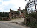 Manor House |
| Moor Hall | Salle Moor, Salle | House | Late 17th century | 19 January 1952 | TG0992424605 52°46′41″N 1°06′40″E |
1342799 | 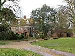 Moor Hall |
| Salle Park | Salle | Country house | 1761 | 19 January 1952 | TG1161824556 52°46′38″N 1°08′10″E |
1170353 | |
| Church of St Lawrence | South Walsham | Parish church | Medieval | 25 September 1962 | TG3658213270 52°39′56″N 1°29′50″E |
1051496 | 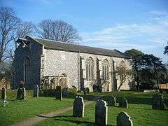 Church of St Lawrence |
| Church of St Mary | Hassingham, Strumpshaw | Parish church | 12th century | 25 September 1962 | TG3690405514 52°35′45″N 1°29′47″E |
1303861 | 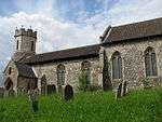 Church of St Mary |
| Swannington Hall | Swannington | House | 16th century | 19 January 1952 | TG1382919302 52°43′45″N 1°09′55″E |
1263205 | |
| Church of St Andrew | Themelthorpe | Parish church | 13th century | 10 May 1961 | TG0575724090 52°46′31″N 1°02′56″E |
1170136 | 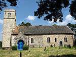 Church of St Andrew |
| Garden house 40m south of Walpole House | Thorpe St. Andrew | Gazebo | Mid-18th century | 20 February 1952 | TG2566008388 52°37′35″N 1°19′58″E |
1372706 | |
| Ruin of Church of St Andrew | Thorpe St. Andrew | Parish church | 15th century | 25 September 1962 | TG2606308411 52°37′35″N 1°20′19″E |
1051503 | .jpg) Ruin of Church of St Andrew |
| Thorpe Hall | Thorpe St. Andrew | Bishops palace | Earlier | 20 February 1952 | TG2554008396 52°37′35″N 1°19′52″E |
1154440 | |
| Walpole House | Thorpe St. Andrew | House | 17th century | 20 February 1952 | TG2565008431 52°37′36″N 1°19′58″E |
1051508 | |
| Church of St Mary | Fishley, Upton with Fishley | Parish church | 12th century | 25 September 1962 | TG3988011491 52°38′53″N 1°32′41″E |
1051427 | 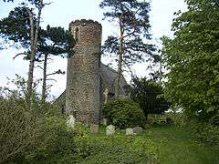 Church of St Mary |
| Wood Dalling Hall | Wood Dalling | Country house | Late 16th century | 19 January 1952 | TG0742927026 52°48′03″N 1°04′32″E |
1305293 | |
| Church of St Fabian and St Sebastian | Woodbastwick | Parish church | Medieval | 25 September 1962 | TG3324915226 52°41′04″N 1°26′58″E |
1154614 | 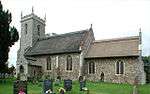 Church of St Fabian and St Sebastian |
| Porch attached to east by garden walls to Ranworth Old Hall | Ranworth, Woodbastwick | Manor house | Early 16th century | 20 February 1952 | TG3449515402 52°41′08″N 1°28′05″E |
1051473 | 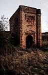 Porch attached to east by garden walls to Ranworth Old Hall |
| Ranworth Old Hall | Ranworth, Woodbastwick | House (demolished 1985) | Earlier | 20 February 1952 | TG3446315393 52°41′08″N 1°28′03″E |
Demolished | .jpg) Ranworth Old Hall |
| Ruined Church of All Saints | Panxworth, Woodbastwick | Church | 14th century | 25 September 1962 | TG3474413567 52°40′08″N 1°28′13″E |
1372709 | 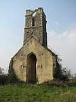 Ruined Church of All Saints |
.jpg)
Notes
- The date given is the date used by Historic England as significant for the initial building or that of an important part in the structure's description.
- Sometimes known as OSGB36, the grid reference is based on the British national grid reference system used by the Ordnance Survey.
- The "List Entry Number" is a unique number assigned to each listed building and scheduled monument by Historic England.
External links
![]()
This article is issued from Wikipedia. The text is licensed under Creative Commons - Attribution - Sharealike. Additional terms may apply for the media files.