Grade II* listed buildings in Rutland
There are over 20,000 Grade II* listed buildings in England. This page is a list of the 71 of these buildings in the county of Rutland.
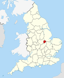
Rutland shown in England
Rutland
| Name | Location | Type | Completed [note 1] | Date designated | Grid ref.[note 2] Geo-coordinates |
Entry number [note 3] | Image |
|---|---|---|---|---|---|---|---|
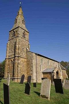
| Church of St Mary | Ayston, Rutland | Parish Church | 13th century | 10 November 1955 | SK8594800964 52°35′59″N 0°43′57″W |
1361553 | |
| Church of St Peter | Barrowden, Rutland | Church | C13-C15 | 10 November 1955 | SP9449399906 52°35′20″N 0°36′24″W |
1361433 | 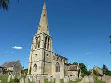 Church of St Peter |
| Durant Farmhouse, Barn, Outhouses and Wall | Barrowden, Rutland | Farmhouse | Late C16-Early 17th century | 10 November 1955 | SK9455700071 52°35′25″N 0°36′20″W |
1073957 | 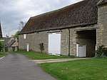 Durant Farmhouse, Barn, Outhouses and Wall |
| Church of St Peter | Belton-in-Rutland, Rutland | Church | Early 13th century | 10 November 1955 | SK8163201349 52°36′14″N 0°47′46″W |
1214903 | 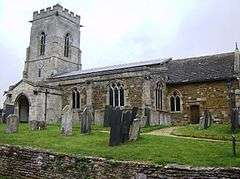 Church of St Peter |
| Old Hall | Belton-in-Rutland, Rutland | House | Late 16th century | 10 November 1955 | SK8159201365 52°36′14″N 0°47′48″W |
1214952 | 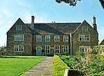 Old Hall |
| Westbourne House | Belton-in-Rutland, Rutland | House | Mid 18th century | 10 November 1955 | SK8157801270 52°36′11″N 0°47′49″W |
1288345 |  |
| Church of All Saints | Braunston-in-Rutland, Rutland | Parish Church | 12th century | 14 June 1954 | SK8325406592 52°39′02″N 0°46′15″W |
1214996 | 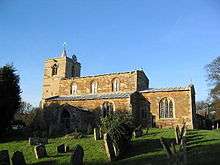 Church of All Saints |
| Hall Farmhouse | Braunston-in-Rutland, Rutland | Farmhouse | Late 16th century | 14 June 1954 | SK8324606554 52°39′01″N 0°46′15″W |
1215077 | |
| Quaintree Hall | Braunston-in-Rutland, Rutland | Base Cruck House | Late 13th century | 14 June 1954 | SK8327906756 52°39′08″N 0°46′13″W |
1214995 |  Quaintree Hall |
| Church of the Holy Cross | Burley, Rutland | Parish Church | Norman | 14 June 1954 | SK8830310215 52°40′57″N 0°41′43″W |
1073794 |  Church of the Holy Cross |
| Entrance Gates and Gate Piers | Burley on the Hill, Burley, Rutland | Gate | 1700 | 18 September 1984 | SK8836410452 52°41′04″N 0°41′39″W |
1177480 | 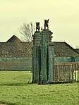 Entrance Gates and Gate Piers |
| Terrace Parapet, Retaining Wall and Staircase | Burley on the Hill, Burley, Rutland | Terrace | 18th century | 18 September 1984 | SK8842410152 52°40′55″N 0°41′36″W |
1073793 | |
| Church of St John | Caldecott, Rutland | Parish Church | 12th century | 10 November 1955 | SP8684093691 52°32′03″N 0°43′16″W |
1116288 | 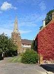 Church of St John |
| Church of St Mary | Clipsham, Rutland | Church | 12th century | 6 June 1961 | SK9701816363 52°44′10″N 0°33′52″W |
1361803 | 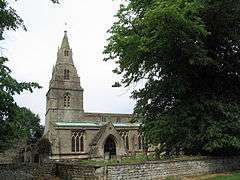 Church of St Mary |
| Clipsham Hall | Clipsham, Rutland | Country House | c. 1700 | 6 June 1961 | SK9703516435 52°44′13″N 0°33′51″W |
1073244 |  Clipsham Hall |
| Manor Farmhouse and Outbuilding Range | Clipsham, Rutland | Farmhouse | Late C16-C17 | 6 June 1961 | SK9706216172 52°44′04″N 0°33′50″W |
1361766 | |
| Church of St Nicholas | Cottesmore, Rutland | Church | C12-C15 | 14 June 1954 | SK9024913637 52°42′46″N 0°39′56″W |
1073252 | 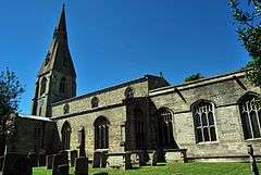 Church of St Nicholas |
| Thor Missile Site at former RAF North Luffenham | Edith Weston, Rutland | Thor Missile Site | 20th century | 17 June 2011 | SK9504404596 52°37′51″N 0°35′50″W |
1400806 |  Thor Missile Site at former RAF North Luffenham |
| Old Prebendal House | Empingham, Rutland | Clergy House | Late 17th century | 14 June 1954 | SK9514108468 52°39′56″N 0°35′41″W |
1361456 | 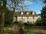 Old Prebendal House |
| Church of St Mary | Essendine, Rutland | Church | 12th century | 6 June 1961 | TF0490212789 52°42′09″N 0°26′56″W |
1073881 | 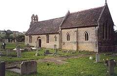 Church of St Mary |
| Church of St Andrew | Glaston, Rutland | Parish Church | 12th century | 10 November 1955 | SK8963200552 52°35′43″N 0°40′41″W |
1264584 | 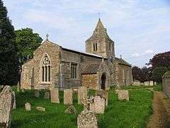 Church of St Andrew |
| Church of St Andrew | Hambleton, Rutland | Parish Church | Norman | 14 June 1954 | SK8997207581 52°39′31″N 0°40′17″W |
1073753 | 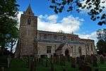 Church of St Andrew |
| Old Hall, Gate Piers and Flanking Wall | Hambleton, Rutland | House | c. 1611 | 14 June 1954 | SK8991106949 52°39′10″N 0°40′20″W |
1295255 | |
| Fort Henry Pleasure House and flanking retaining Walls and Parapet | Exton Park, Horn, Rutland | Wall | Late 18th century | 10 December 1981 | SK9486212169 52°41′56″N 0°35′52″W |
1073724 | 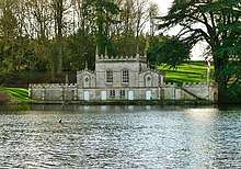 Fort Henry Pleasure House and flanking retaining Walls and Parapet |
| The Priory | Ketton, Rutland | House | 17th century | 6 June 1961 | SK9820404273 52°37′38″N 0°33′02″W |
1361471 | 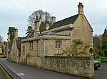 The Priory |
| Old Hall | Langham, Rutland | Hall House | 1665 | 14 June 1954 | SK8447611154 52°41′29″N 0°45′06″W |
1295196 | |
| Church of All Saints | Little Casterton, Rutland | Church | Earlier origin | 6 June 1961 | TF0180509909 52°40′38″N 0°29′44″W |
1361524 | 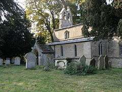 Church of All Saints |
| Tolethorpe Hall | Tolethorpe, Little Casterton, Rutland | Country House | Late 16th century or early 17th century | 6 June 1961 | TF0219410342 52°40′52″N 0°29′23″W |
1073802 | |
| Church of St Martin | Lyndon, Rutland | Church | C13-14 | 14 June 1954 | SK9073304421 52°37′48″N 0°39′39″W |
1177703 | 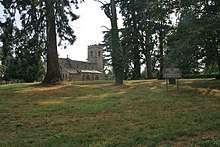 Church of St Martin |
| Lyndon Hall | Lyndon, Rutland | Country House | 1671-3 | 14 June 1954 | SK9069904363 52°37′46″N 0°39′41″W |
1361483 | 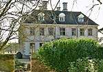 Lyndon Hall |
| Top Hall | Lyndon, Rutland | House | Late 17th century | 14 June 1954 | SK9072504783 52°38′00″N 0°39′39″W |
1361485 | 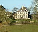 Top Hall |
| Church of St Mary | Manton, Rutland | Parish Church | Late 12th century | 14 June 1954 | SK8807004677 52°37′58″N 0°42′01″W |
1215415 | 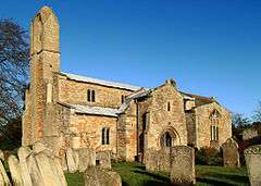 Church of St Mary |
| Barn at Luffenham Hall | North Luffenham, Rutland | Barn | 1555 | 10 November 1955 | SK9354203260 52°37′09″N 0°37′11″W |
1073900 | |
| Bede House Farmhouse | North Luffenham, Rutland | House | Early 15th century | 29 June 1984 | SK9328003418 52°37′14″N 0°37′25″W |
1073865 | |
| Manor Farmhouse | North Luffenham, Rutland | Farmhouse | 1640 | 10 November 1955 | SK9324903464 52°37′15″N 0°37′26″W |
1073863 | |
| The Pastures | North Luffenham, Rutland | House | 1901 | 29 June 1984 | SK9310303405 52°37′14″N 0°37′34″W |
1361473 | |
| Chapel of the Hospitallers of St John the Evangelist and St Anne | Oakham, Rutland | Chapel | c. 1380 | 8 May 1950 | SK8573208719 52°40′10″N 0°44′01″W |
1073262 | 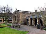 Chapel of the Hospitallers of St John the Evangelist and St Anne |
| College House Sanatorium at Oakham School | Oakham, Rutland | Vicarage | c. 1330 | 8 May 1950 | SK8601708842 52°40′14″N 0°43′46″W |
1073308 | |
| Flores House | Oakham, Rutland | House | 13th or 14th century | 8 May 1950 | SK8603508742 52°40′10″N 0°43′45″W |
1073313 | 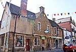 Flores House |
| Hayne House | Oakham, Rutland | House | Early 18th century | 8 May 1950 | SK8571508863 52°40′15″N 0°44′02″W |
1073287 | 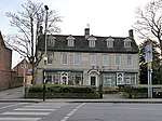 Hayne House |
| Judge's Lodging | Oakham, Rutland | House | Early 17th century | 8 May 1950 | SK8624808646 52°40′07″N 0°43′34″W |
1361755 | 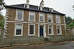 Judge's Lodging |
| Old Grammar School, the Shakespeare Centre | Oakham, Rutland | Grammar School | 1584 | 8 May 1950 | SK8611208967 52°40′18″N 0°43′41″W |
1073309 |  Old Grammar School, the Shakespeare Centre |
| Church of St Nicholas | Pilton, Rutland | Parish Church | Perpendicular and earlier | 10 November 1955 | SK9146602932 52°36′59″N 0°39′02″W |
1215644 | .jpg) Church of St Nicholas |
| Church of St Peter and St Paul | Preston, Rutland | Parish Church | Late 12th/Early 13th century | 10 November 1955 | SK8700802371 52°36′44″N 0°42′59″W |
1361558 | 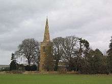 Church of St Peter and St Paul |
| Manor House | Preston, Rutland | House | Mid 16th century | 10 November 1955 | SK8719002456 52°36′46″N 0°42′49″W |
1178203 | |
| 2 Cross Lane | Preston, Rutland | House | Late 17th century | 10 November 1955 | SK8716602428 52°36′46″N 0°42′51″W |
1295182 | |
| The Hall | Ryhall, Rutland | House | Medieval | 6 June 1961 | TF0360810783 52°41′05″N 0°28′07″W |
1361527 | |
| Church of St Mary | South Luffenham, Rutland | Church | C12-C14 | 10 November 1955 | SK9413301899 52°36′24″N 0°36′41″W |
1073877 | 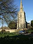 Church of St Mary |
| South Luffenham Hall | South Luffenham, Rutland | Country House | Late 17th century | 10 November 1955 | SK9422601857 52°36′23″N 0°36′36″W |
1073873 | |
| Church of St Nicholas | Stretton, Rutland | Church | C12-C14 | 14 June 1954 | SK9497315769 52°43′52″N 0°35′42″W |
1361819 | 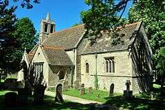 Church of St Nicholas |
| Stocken Hall | Stretton, Rutland | Country House | Early 17th century | 14 September 1979 | SK9571918171 52°45′10″N 0°35′00″W |
1073203 | 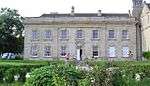 Stocken Hall |
| Church of Holy Trinity | Teigh, Rutland | Church | 13th century | 14 June 1954 | SK8648616012 52°44′05″N 0°43′14″W |
1361821 | 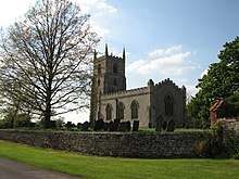 Church of Holy Trinity |
| Old Rectory | Teigh, Rutland | House | 1740 | 14 June 1954 | SK8652316019 52°44′06″N 0°43′12″W |
1073204 | 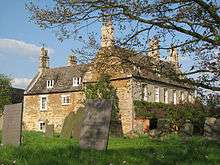 Old Rectory |
| Church of St Nicholas | Thistleton, Rutland | Church | 14th century | 14 June 1954 | SK9133617976 52°45′06″N 0°38′54″W |
1177828 | 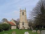 Church of St Nicholas |
| Manor House | Thorpe by Water, Rutland | House | 1691 | 10 November 1955 | SP8930396457 52°33′31″N 0°41′03″W |
1237065 | |
| The Old Manor House | Thorpe by Water, Rutland | House | C1600-c1700 | 10 November 1955 | SP8932696491 52°33′32″N 0°41′02″W |
1237181 | |
| Church of All Saints | Tinwell, Rutland | Church | 13th century | 6 June 1961 | TF0061206369 52°38′45″N 0°30′52″W |
1320402 | 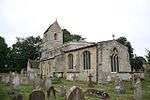 Church of All Saints |
| Wall and Water Point East of Post Office, Nos 26 and 27, Crown Lane | Tinwell, Rutland | Garden Wall | 1880 | 17 December 1984 | TF0054206389 52°38′45″N 0°30′55″W |
1073782 | 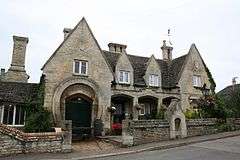 Wall and Water Point East of Post Office, Nos 26 and 27, Crown Lane |
| Church of St Luke/St Mary Magdalen | Tixover, Rutland | Church | C12-C17 | 6 June 1961 | SP9707899767 52°35′13″N 0°34′07″W |
1178264 | Aug2006.jpg) Church of St Luke/St Mary Magdalen |
| Church of St Peter and St Paul | Uppingham, Rutland | Parish Church | 14th century | 10 November 1955 | SP8667299606 52°35′14″N 0°43′20″W |
1073973 | |
| Falcon Hotel Annexe and Nos 5 and 7, High Street East | Uppingham, Rutland | House | late C16-early 17th century | 10 November 1955 | SP8664599694 52°35′17″N 0°43′21″W |
1073181 |  Falcon Hotel Annexe and Nos 5 and 7, High Street East |
| The Hall | Uppingham, Rutland | House | 1612 | 10 November 1955 | SP8684799610 52°35′15″N 0°43′10″W |
1295156 | |
| 9 High Street East | Uppingham, Rutland | House | C16-C17 | 10 November 1955 | SP8667499691 52°35′17″N 0°43′19″W |
1073182 |  9 High Street East |
| Uppingham School Chapel | Uppingham, Rutland | Chapel | 1865 | 10 November 1955 | SP8650499620 52°35′15″N 0°43′29″W |
1073175 | 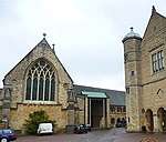 Uppingham School Chapel |
| Uppingham School Library | Uppingham, Rutland | School | c. 1890 | 10 November 1955 | SP8655299594 52°35′14″N 0°43′26″W |
1073172 | 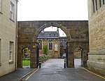 Uppingham School Library |
| Uppingham School School Room | Uppingham, Rutland | Schoolroom | 1861-3 | 10 November 1955 | SP8649399643 52°35′16″N 0°43′29″W |
1073176 | 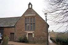 Uppingham School School Room |
| 8 High Street West | Uppingham, Rutland | House | late C16-C17 | 10 November 1955 | SP8656799695 52°35′17″N 0°43′25″W |
1295140 | 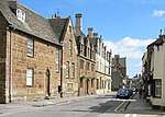 8 High Street West |
| Church of St Botolph | Wardley, Rutland | Parish Church | Early 13th century | 10 November 1955 | SK8319200193 52°35′35″N 0°46′24″W |
1180127 | |
| The Windmill | Whissendine, Rutland | Flour Mill | 1830-1840 | 4 February 1972 | SK8235614242 52°43′10″N 0°46′56″W |
1073211 | 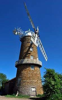 The Windmill |
| Church of St Michael | Whitwell, Rutland | Parish Church | 13th century | 14 June 1954 | SK9236508804 52°40′09″N 0°38′08″W |
1295155 | 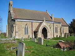 Church of St Michael |
| Church of St Peter and St Paul | Wing, Rutland | Parish Church | Medieval | 10 November 1955 | SK8937202979 52°37′02″N 0°40′53″W |
1215836 | .jpg) Church of St Peter and St Paul |
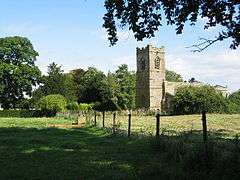
| Church of St Mary and St Andrew | Ridlington, Rutland | Parish Church | 13th century | 10 November 1955 | SK8476802742 52°21′57″N 0°26′45″W |
1178331 |  Church of St Mary and St Andrew |

gollark: I don't think it can ever be actively *harmful* to capture a square, just not optimal.
gollark: That's probably a sensible heuristic.
gollark: I think so.
gollark: I noticed it so the *AI* can't do it, but the actual player can.
gollark: I should probably have fixed that, yes.
See also
Notes
- The date given is the date used by Historic England as significant for the initial building or that of an important part in the structure's description.
- Sometimes known as OSGB36, the grid reference is based on the British national grid reference system used by the Ordnance Survey.
- The "List Entry Number" is a unique number assigned to each listed building and scheduled monument by Historic England.
References
External links
![]()
This article is issued from Wikipedia. The text is licensed under Creative Commons - Attribution - Sharealike. Additional terms may apply for the media files.