Fearn railway station
Fearn railway station is a railway station serving the village of Hill of Fearn in the Highland council area of Scotland, located around 1.3 miles (2.1 km) from the village. It is situated on the Far North Line and is also the nearest station to Balintore, Hilton and Shandwick (the Seaboard Villages), Portmahomack and the Nigg Bay area of Easter Ross.
| Fearn | |
|---|---|
| Scottish Gaelic: Manachainn Rois[1] | |
 | |
| Location | |
| Place | Hill of Fearn |
| Local authority | Highland |
| Coordinates | 57.7780°N 3.9940°W |
| Grid reference | NH815782 |
| Operations | |
| Station code | FRN |
| Managed by | Abellio ScotRail |
| Number of platforms | 1 |
| Live arrivals/departures, station information and onward connections from National Rail Enquiries | |
| Annual rail passenger usage* | |
| 2014/15 | |
| 2015/16 | |
| 2016/17 | |
| 2017/18 | |
| 2018/19 | |
| History | |
| Original company | Inverness and Ross-shire Railway |
| Pre-grouping | Highland Railway |
| Post-grouping | LMSR |
| 1 June 1864[2] | Opened |
| Listed status | |
| Listing grade | Category B |
| Entry number | LB7782[3] |
| Added to list | 6 October 1978 |
| National Rail – UK railway stations | |
| * Annual estimated passenger usage based on sales of tickets in stated financial year(s) which end or originate at Fearn from Office of Rail and Road statistics. Methodology may vary year on year. | |
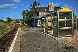
The railway through Fearn station is single track, the nearest passing loops being at Invergordon to the south and Tain to the west. The station is 40 miles 60 chains (65.6 km) from Inverness, and has a single platform which is long enough for a seven-coach train.[4] The platform is very low and this gives rise to difficulties for passengers who are in any way infirm and unable to climb the height to the coaches, so there are portable steps available at the station. At the approach to Fearn station, conductors are obliged to use public address systems to warn alighting passengers of the low platform, and they also frequently do this when inspecting tickets of passengers travelling to Fearn.
Services
| Preceding station | Following station | |||
|---|---|---|---|---|
| Invergordon | Abellio ScotRail Far North Line |
Tain | ||
| Historical railways | ||||
| Nigg Line open; Station closed |
Highland Railway Inverness and Ross-shire Railway |
Tain Line and station open | ||
References
Notes
- Brailsford 2017, Gaelic/English Station Index.
- Butt 1995, p. 95.
- "FEARN RAILWAY STATION". Historic Scotland. Retrieved 27 February 2019.
- Brailsford 2017, map 18D.
Sources
| Wikimedia Commons has media related to Fearn railway station. |
- Brailsford, Martyn, ed. (December 2017) [1987]. Railway Track Diagrams 1: Scotland & Isle of Man (6th ed.). Frome: Trackmaps. ISBN 978-0-9549866-9-8.CS1 maint: ref=harv (link)
- Butt, R. V. J. (1995). The Directory of Railway Stations: details every public and private passenger station, halt, platform and stopping place, past and present (1st ed.). Sparkford: Patrick Stephens Ltd. ISBN 978-1-85260-508-7. OCLC 60251199.
- Jowett, Alan (March 1989). Jowett's Railway Atlas of Great Britain and Ireland: From Pre-Grouping to the Present Day (1st ed.). Sparkford: Patrick Stephens Ltd. ISBN 978-1-85260-086-0. OCLC 22311137.