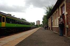
Pollokshaws West railway station
Pollokshaws West railway station is a railway station in Glasgow, Scotland. The station is managed by Abellio ScotRail and is served by trains on the Glasgow South Western Line.
| Pollokshaws West | |
|---|---|
| Scottish Gaelic: Pollokshaws an Iar[1] | |
 | |
| Location | |
| Place | Pollokshaws |
| Local authority | Glasgow |
| Coordinates | 55.8239°N 4.3014°W |
| Grid reference | NS559613 |
| Operations | |
| Station code | PWW |
| Managed by | Abellio ScotRail |
| Number of platforms | 2 |
| Live arrivals/departures, station information and onward connections from National Rail Enquiries | |
| Annual rail passenger usage* | |
| 2014/15 | |
| 2015/16 | |
| 2016/17 | |
| 2017/18 | |
| 2018/19 | |
| Passenger Transport Executive | |
| PTE | SPT |
| History | |
| Original company | Glasgow, Barrhead and Neilston Direct Railway |
| Pre-grouping | CR & G&SWR |
| Post-grouping | LMS |
| 27 September 1848 | Opened as Pollokshaws[2] |
| 5 May 1952 | Renamed as Pollowshaws West[2] |
| National Rail – UK railway stations | |
| |
History
The station was opened as Pollokshaws on 27 September 1848 by Glasgow, Barrhead and Neilston Direct Railway,[2] which later became the Glasgow, Barrhead and Kilmarnock Joint Railway - a joint railway company between the Caledonian Railway and the Glasgow and South Western Railway. To the south west is Busby Junction where the Busby Railway (latterly part of the Caledonian Railway) diverges. Following grouping, the station became part of the London Midland and Scottish Railway.
It was not until British Railways days - 5 May 1952[2] - that the station was renamed as Pollokshaws West. The station buildings are now protected as a category B listed building.[3]
Services
The station is normally served by a service every half hour to Barrhead (hourly on Sundays) and to East Kilbride, and four trains per hour (three per hour on Sundays) to Glasgow Central.[4]
The station is an interchange station for services between the East Kilbride line, and the Barrhead (and also Kilmarnock/Troon/Stranraer) line.
Pollokshaws West is the nearest station to the Burrell Collection and Pollok House (approximately 10 minutes' walk).
| Preceding station | Following station | |||
|---|---|---|---|---|
| Kennishead | Abellio ScotRail Glasgow South Western Line |
Crossmyloof | ||
| Thornliebank | ||||
| Historical railways | ||||
| Kennishead Line and station open |
Caledonian and Glasgow & South Western Railways Glasgow, Barrhead and Neilston Direct Railway |
Crossmyloof Line and station open | ||
| Thornliebank Line and station open |
Caledonian Railway Busby Railway |
connection to GB&KJR | ||
References
Notes
- Brailsford 2017, Gaelic/English Station Index.
- Butt 1995, p. 187.
- Historic Environment Scotland & LB33959.
- Table 222 National Rail timetable, May 2016
Sources
- Brailsford, Martyn, ed. (December 2017) [1987]. Railway Track Diagrams 1: Scotland & Isle of Man (6th ed.). Frome: Trackmaps. ISBN 978-0-9549866-9-8.CS1 maint: ref=harv (link)
- Butt, R. V. J. (1995). The Directory of Railway Stations: details every public and private passenger station, halt, platform and stopping place, past and present (1st ed.). Sparkford: Patrick Stephens Ltd. ISBN 978-1-85260-508-7. OCLC 60251199.
- Historic Environment Scotland. "Pollokshaws Road, Pollockshaws West Station including Embankment Wall to Street (Category B) (LB33959)". Retrieved 20 March 2019.
- Jowett, Alan (March 1989). Jowett's Railway Atlas of Great Britain and Ireland: From Pre-Grouping to the Present Day (1st ed.). Sparkford: Patrick Stephens Ltd. ISBN 978-1-85260-086-0. OCLC 22311137.
- Jowett, Alan (2000). Jowett's Nationalised Railway Atlas (1st ed.). Penryn, Cornwall: Atlantic Transport Publishers. ISBN 978-0-906899-99-1. OCLC 228266687.