Baillieston railway station
Baillieston railway station is located in Caledonia Road on the southern boundary of the Baillieston area of Glasgow, Scotland, with the Broomhouse area on the other side of the tracks. It is on the Whifflet Line (a branch of the more extensive Argyle Line), 8 miles (13 km) east of Glasgow Central railway station. Train services are provided by Abellio ScotRail.
| Baillieston | |
|---|---|
.jpg) Baillieston in 2017, following electrification | |
| Location | |
| Place | Baillieston |
| Local authority | Glasgow |
| Coordinates | 55.8445°N 4.1137°W |
| Grid reference | NS677632 |
| Operations | |
| Station code | BIO |
| Managed by | Abellio ScotRail |
| Number of platforms | 2 |
| Live arrivals/departures, station information and onward connections from National Rail Enquiries | |
| Annual rail passenger usage* | |
| 2014/15 | |
| 2015/16 | |
| 2016/17 | |
| 2017/18 | |
| 2018/19 | |
| History | |
| 8 January 1866 | First station opened |
| 5 October 1964 | First station closed |
| 4 October 1993 | Second station opened |
| National Rail – UK railway stations | |
| |
The line was built in the period 1864-1866 by the Caledonian Railway and was called the Rutherglen to Coatbridge branch. The new station opened by British Rail on 4 October 1993 under the financial management of the Strathclyde PTE.
History
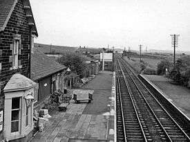
The original station, which was situated 1 km east of the present, was opened by the Caledonian Railway in January 1866 when passenger traffic started. The line became part of the London, Midland and Scottish Railway during the Grouping of 1923. The line then passed on to the Scottish Region of British Railways on nationalisation in 1948. The old station closed to passenger traffic in 1964.
Services
A half-hourly service operates between Glasgow Central (Low Level) and Whifflet stations, on Mondays to Saturdays. Services run to/from Dalmuir, and one train per hour each way extends to/from Motherwell.
Sunday services formerly only ran for the month prior to Christmas and were extended to Shotts, but since the December 2014 timetable change and the start of EMU operation now run hourly each way all day throughout the year (to Balloch and Motherwell).[1] Several freight trains also pass the halt every day.
References
- Table 225 National Rail timetable, May 2016
- Butt, R. V. J. (1995). The Directory of Railway Stations: details every public and private passenger station, halt, platform and stopping place, past and present (1st ed.). Sparkford: Patrick Stephens Ltd. ISBN 978-1-85260-508-7. OCLC 60251199.
- Jowett, Alan (2000). Jowett's Nationalised Railway Atlas (1st ed.). Penryn, Cornwall: Atlantic Transport Publishers. ISBN 978-0-906899-99-1. OCLC 228266687.
- Jowett, Alan (March 1989). Jowett's Railway Atlas of Great Britain and Ireland: From Pre-Grouping to the Present Day (1st ed.). Sparkford: Patrick Stephens Ltd. ISBN 978-1-85260-086-0. OCLC 22311137.
- Station on navigable O.S. map
External links
- Train times and station information for Baillieston railway station from National Rail
| Preceding station | Following station | |||
|---|---|---|---|---|
| Bargeddie | Abellio ScotRail Argyle Line |
Mount Vernon | ||