Tachoires
Tachoires is a commune in the Gers department in southwestern France.
Tachoires | |
|---|---|
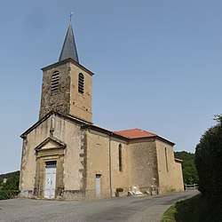 The church in Tachoires | |
Location of Tachoires 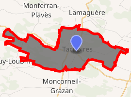
| |
 Tachoires  Tachoires | |
| Coordinates: 43°28′23″N 0°39′56″E | |
| Country | France |
| Region | Occitanie |
| Department | Gers |
| Arrondissement | Mirande |
| Canton | Astarac-Gimone |
| Intercommunality | Val de Gers |
| Government | |
| • Mayor (2014-2020) | Max Balas |
| Area 1 | 9.61 km2 (3.71 sq mi) |
| Population (2017-01-01)[1] | 98 |
| • Density | 10/km2 (26/sq mi) |
| Time zone | UTC+01:00 (CET) |
| • Summer (DST) | UTC+02:00 (CEST) |
| INSEE/Postal code | 32438 /32260 |
| Elevation | 197–304 m (646–997 ft) (avg. 210 m or 690 ft) |
| 1 French Land Register data, which excludes lakes, ponds, glaciers > 1 km2 (0.386 sq mi or 247 acres) and river estuaries. | |
Geography
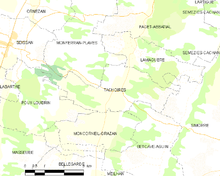
Tachoires and its surrounding communes
Government and politics
Mayors
| Mayor | Term start | Term end |
|---|---|---|
| Michel Cazaban | 2001 | 2014 |
| Max Balas | 2014 | Current |
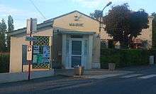
The town hall
Population
| Year | Pop. | ±% |
|---|---|---|
| 2006 | 98 | — |
| 2007 | 98 | +0.0% |
| 2008 | 97 | −1.0% |
| 2009 | 101 | +4.1% |
| 2010 | 102 | +1.0% |
| 2011 | 100 | −2.0% |
| 2012 | 97 | −3.0% |
| 2013 | 95 | −2.1% |
| 2014 | 100 | +5.3% |
| 2015 | 96 | −4.0% |
| 2016 | 97 | +1.0% |
Sites of interest
gollark: ```c#define Rust "GOOD"``````rustconst RUST: &'static str = "GOOD"```
gollark: Rust = Good
gollark: Python < Rust
gollark: C [approximately equal] C++
gollark: ```c#define C "BAD"#define C++ "BAD AND COMPLEX"```
See also
References
- "Populations légales 2017". INSEE. Retrieved 6 January 2020.
| Wikimedia Commons has media related to Tachoires. |
| Authority control |
|
|---|
This article is issued from Wikipedia. The text is licensed under Creative Commons - Attribution - Sharealike. Additional terms may apply for the media files.