Garravet
Garravet is a commune in the Gers department in southwestern France.
Garravet | |
|---|---|
Location of Garravet 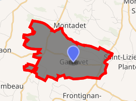
| |
 Garravet  Garravet | |
| Coordinates: 43°24′53″N 0°54′51″E | |
| Country | France |
| Region | Occitanie |
| Department | Gers |
| Arrondissement | Auch |
| Canton | Val de Save |
| Government | |
| • Mayor (2008–2014) | Daniel Worzniack |
| Area 1 | 9.09 km2 (3.51 sq mi) |
| Population (2017-01-01)[1] | 157 |
| • Density | 17/km2 (45/sq mi) |
| Time zone | UTC+01:00 (CET) |
| • Summer (DST) | UTC+02:00 (CEST) |
| INSEE/Postal code | 32138 /32220 |
| Elevation | 183–310 m (600–1,017 ft) (avg. 304 m or 997 ft) |
| 1 French Land Register data, which excludes lakes, ponds, glaciers > 1 km2 (0.386 sq mi or 247 acres) and river estuaries. | |
Geography
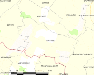
Garravet and its surrounding communes
Population
| Year | Pop. | ±% |
|---|---|---|
| 1962 | 233 | — |
| 1968 | 217 | −6.9% |
| 1975 | 191 | −12.0% |
| 1982 | 155 | −18.8% |
| 1990 | 138 | −11.0% |
| 1999 | 121 | −12.3% |
| 2008 | 140 | +15.7% |
gollark: I can see "it does X in Y circumstances" but not "it will always do X".
gollark: Reverse-engineering does *not* create trust.
gollark: Can't be bothered.
gollark: Not that I'd have much idea regarding making an improvement, but they emulate ancient CPUs in order to run C and C-style code, and are slow/buggy/exploitable because of it.
gollark: Modern CPUs are kind of awful anyway.
See also
References
- "Populations légales 2017". INSEE. Retrieved 6 January 2020.
| Wikimedia Commons has media related to Garravet. |
| Authority control |
|
|---|
This article is issued from Wikipedia. The text is licensed under Creative Commons - Attribution - Sharealike. Additional terms may apply for the media files.