Monpardiac
Monpardiac is a commune in the Gers department in southwestern France.
Monpardiac | |
|---|---|
The church in Monpardiac | |
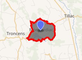
Location of Monpardiac 
| |
 Monpardiac  Monpardiac | |
| Coordinates: 43°27′53″N 0°14′41″E | |
| Country | France |
| Region | Occitanie |
| Department | Gers |
| Arrondissement | Mirande |
| Canton | Pardiac-Rivière-Basse |
| Intercommunality | Bastides et vallons du Gers |
| Government | |
| • Mayor (2008–2014) | Raymond Noilhan |
| Area 1 | 3.5 km2 (1.4 sq mi) |
| Population (2017-01-01)[1] | 45 |
| • Density | 13/km2 (33/sq mi) |
| Time zone | UTC+01:00 (CET) |
| • Summer (DST) | UTC+02:00 (CEST) |
| INSEE/Postal code | 32275 /32170 |
| Elevation | 193–284 m (633–932 ft) (avg. 180 m or 590 ft) |
| 1 French Land Register data, which excludes lakes, ponds, glaciers > 1 km2 (0.386 sq mi or 247 acres) and river estuaries. | |
Geography

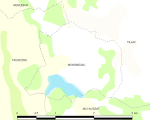
Monpardiac and its surrounding communes
Population
| Year | Pop. | ±% |
|---|---|---|
| 1962 | 70 | — |
| 1968 | 60 | −14.3% |
| 1975 | 51 | −15.0% |
| 1982 | 43 | −15.7% |
| 1990 | 39 | −9.3% |
| 1999 | 33 | −15.4% |
| 2008 | 37 | +12.1% |
gollark: You're wrong, because you're axiomatically beelike.
gollark: I wrote all of them, but I wrote some of all of them more than others.
gollark: Anyway, at some point I'll go over why I did and didn't write each of them.
gollark: I could calculate the probability of it using mathematics.
gollark: It's not gollark impersonation unless it's from certain regions of France, otherwise it's just sparkling apioform.
See also
References
- "Populations légales 2017". INSEE. Retrieved 6 January 2020.
| Wikimedia Commons has media related to Monpardiac. |
This article is issued from Wikipedia. The text is licensed under Creative Commons - Attribution - Sharealike. Additional terms may apply for the media files.