Saint-Christaud, Gers
Saint-Christaud is a commune in the Gers department in southwestern France.
Saint-Christaud | |
|---|---|
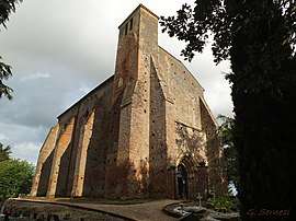 The church in Saint-Christaud | |
Location of Saint-Christaud 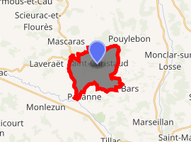
| |
 Saint-Christaud  Saint-Christaud | |
| Coordinates: 43°31′51″N 0°15′50″E | |
| Country | France |
| Region | Occitanie |
| Department | Gers |
| Arrondissement | Mirande |
| Canton | Pardiac-Rivière-Basse |
| Intercommunality | Cœur d'Astarac en Gascogne |
| Government | |
| • Mayor (2008–2014) | Christophe Capdecomme |
| Area 1 | 11 km2 (4 sq mi) |
| Population (2017-01-01)[1] | 65 |
| • Density | 5.9/km2 (15/sq mi) |
| Time zone | UTC+01:00 (CET) |
| • Summer (DST) | UTC+02:00 (CEST) |
| INSEE/Postal code | 32367 /32320 |
| Elevation | 169–291 m (554–955 ft) (avg. 200 m or 660 ft) |
| 1 French Land Register data, which excludes lakes, ponds, glaciers > 1 km2 (0.386 sq mi or 247 acres) and river estuaries. | |
Geography
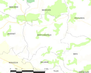
Saint-Christaud and its surrounding communes
Population
| Year | Pop. | ±% |
|---|---|---|
| 1962 | 150 | — |
| 1968 | 136 | −9.3% |
| 1975 | 130 | −4.4% |
| 1982 | 100 | −23.1% |
| 1990 | 112 | +12.0% |
| 1999 | 90 | −19.6% |
| 2008 | 75 | −16.7% |
gollark: It's also hard for you to tell, because being insane impairs any judgement you might make about your sanity.
gollark: It's hard for anyone else to tell.
gollark: Possibly!
gollark: Just make two graphs and have it flow and not flow and then half flow.
gollark: videogame_hacker: what storage thing lets you have multiple terminals?
See also
References
- "Populations légales 2017". INSEE. Retrieved 6 January 2020.
| Wikimedia Commons has media related to Saint-Christaud (Gers). |
| Authority control |
|
|---|
This article is issued from Wikipedia. The text is licensed under Creative Commons - Attribution - Sharealike. Additional terms may apply for the media files.