Gondrin
Gondrin is a commune in the Gers department in southwestern France.
Gondrin | |
|---|---|
.svg.png) Coat of arms | |
Location of Gondrin 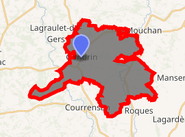
| |
 Gondrin  Gondrin | |
| Coordinates: 43°53′10″N 0°14′16″E | |
| Country | France |
| Region | Occitanie |
| Department | Gers |
| Arrondissement | Condom |
| Canton | Armagnac-Ténarèze |
| Government | |
| • Mayor (2008–2014) | Didier Dupront |
| Area 1 | 34.76 km2 (13.42 sq mi) |
| Population (2017-01-01)[1] | 1,194 |
| • Density | 34/km2 (89/sq mi) |
| Time zone | UTC+01:00 (CET) |
| • Summer (DST) | UTC+02:00 (CEST) |
| INSEE/Postal code | 32149 /32330 |
| Elevation | 80–181 m (262–594 ft) (avg. 161 m or 528 ft) |
| 1 French Land Register data, which excludes lakes, ponds, glaciers > 1 km2 (0.386 sq mi or 247 acres) and river estuaries. | |
Geography
The Auzoue flows north-northwest through the western part of the commune, then forms part of its western border.
The Osse flows north through the eastern part of the commune, then forms part of its northeastern border.
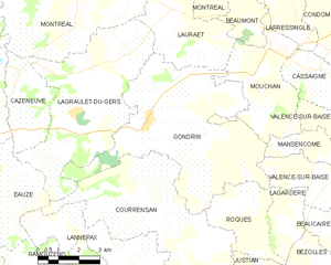
Gondrin and its surrounding communes
Population
| Year | Pop. | ±% |
|---|---|---|
| 1962 | 1,117 | — |
| 1968 | 1,162 | +4.0% |
| 1975 | 1,074 | −7.6% |
| 1982 | 1,041 | −3.1% |
| 1990 | 1,042 | +0.1% |
| 1999 | 999 | −4.1% |
| 2008 | 1,158 | +15.9% |
gollark: ... Yes, I was.
gollark: Perhaps.
gollark: Hmm, based on testing™ it can, yes.
gollark: Move above the starting point?
gollark: Is poor quality mode actually *playable*? Even my AI™ cannot seem to actually make the thing go up.
See also
References
- "Populations légales 2017". INSEE. Retrieved 6 January 2020.
| Wikimedia Commons has media related to Gondrin. |
| Authority control |
|
|---|
This article is issued from Wikipedia. The text is licensed under Creative Commons - Attribution - Sharealike. Additional terms may apply for the media files.