Saint-Arailles
Saint-Arailles is a commune in the Gers department in southwestern France.
Saint-Arailles | |
|---|---|
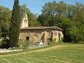 The Bretous chapel in Saint-Arailles | |
Location of Saint-Arailles 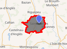
| |
 Saint-Arailles  Saint-Arailles | |
| Coordinates: 43°37′38″N 0°21′30″E | |
| Country | France |
| Region | Occitanie |
| Department | Gers |
| Arrondissement | Auch |
| Canton | Fezensac |
| Intercommunality | Artagnan en Fézensac |
| Government | |
| • Mayor (2008–2014) | Bernard Lasportes |
| Area 1 | 13.2 km2 (5.1 sq mi) |
| Population (2017-01-01)[1] | 135 |
| • Density | 10/km2 (26/sq mi) |
| Time zone | UTC+01:00 (CET) |
| • Summer (DST) | UTC+02:00 (CEST) |
| INSEE/Postal code | 32360 /32350 |
| Elevation | 136–236 m (446–774 ft) (avg. 140 m or 460 ft) |
| 1 French Land Register data, which excludes lakes, ponds, glaciers > 1 km2 (0.386 sq mi or 247 acres) and river estuaries. | |
Geography
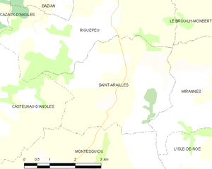
Saint-Arailles and its surrounding communes
Population
| Year | Pop. | ±% |
|---|---|---|
| 1962 | 150 | — |
| 1968 | 154 | +2.7% |
| 1975 | 139 | −9.7% |
| 1982 | 136 | −2.2% |
| 1990 | 133 | −2.2% |
| 1999 | 116 | −12.8% |
| 2008 | 133 | +14.7% |
gollark: Lua doesn't ship with much beyond the bare minimum.
gollark: Wait, hmm, that probably iterates the lines, not counts them.
gollark: Try `local h = fs.open(file, "r") local m = h.readAll() if m:sub(-1)~="\n" then m=m.."\n" end h.close() return m:gmatch("(.-)\n")` instead?
gollark: He's not defining `s` anywhere.
gollark: Oh, no, pjals was just wrong.
See also
References
- "Populations légales 2017". INSEE. Retrieved 6 January 2020.
| Wikimedia Commons has media related to Saint-Arailles. |
| Authority control |
|
|---|
This article is issued from Wikipedia. The text is licensed under Creative Commons - Attribution - Sharealike. Additional terms may apply for the media files.