Labéjan
Labéjan is a commune in the Gers department in southwestern France.
Labéjan | |
|---|---|
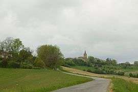 A general view of Labéjan | |
Location of Labéjan 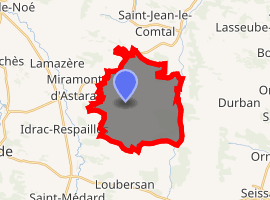
| |
 Labéjan  Labéjan | |
| Coordinates: 43°32′21″N 0°30′03″E | |
| Country | France |
| Region | Occitanie |
| Department | Gers |
| Arrondissement | Mirande |
| Canton | Mirande-Astarac |
| Intercommunality | Vals et villages en Astarac |
| Government | |
| • Mayor (2001–2008) | Patrick Yvernes |
| Area 1 | 18.71 km2 (7.22 sq mi) |
| Population (2017-01-01)[1] | 303 |
| • Density | 16/km2 (42/sq mi) |
| Time zone | UTC+01:00 (CET) |
| • Summer (DST) | UTC+02:00 (CEST) |
| INSEE/Postal code | 32172 /32300 |
| Elevation | 156–273 m (512–896 ft) (avg. 266 m or 873 ft) |
| 1 French Land Register data, which excludes lakes, ponds, glaciers > 1 km2 (0.386 sq mi or 247 acres) and river estuaries. | |
Geography
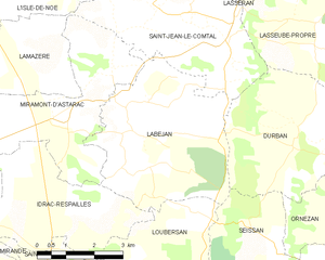
Labéjan and its surrounding communes
Population
| Year | Pop. | ±% |
|---|---|---|
| 1962 | 290 | — |
| 1968 | 273 | −5.9% |
| 1975 | 224 | −17.9% |
| 1982 | 229 | +2.2% |
| 1990 | 255 | +11.4% |
| 1999 | 259 | +1.6% |
| 2008 | 314 | +21.2% |
gollark: ←∆↑→↓∆
gollark: ({)}[<]>}
gollark: ¡!
gollark: ¿?
gollark: ???
See also
References
- "Populations légales 2017". INSEE. Retrieved 6 January 2020.
| Wikimedia Commons has media related to Labéjan. |
| Authority control |
|
|---|
This article is issued from Wikipedia. The text is licensed under Creative Commons - Attribution - Sharealike. Additional terms may apply for the media files.