Bourrouillan
Bourrouillan is a commune in the Gers department in southwestern France.
Bourrouillan | |
|---|---|
Location of Bourrouillan 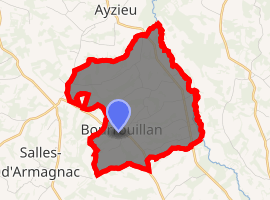
| |
 Bourrouillan  Bourrouillan | |
| Coordinates: 43°49′15″N 0°00′50″W | |
| Country | France |
| Region | Occitanie |
| Department | Gers |
| Arrondissement | Condom |
| Canton | Grand-Bas-Armagnac |
| Intercommunality | Bas-Armagnac |
| Government | |
| • Mayor (2008–2014) | Michel Brazzalotto |
| Area 1 | 8.7 km2 (3.4 sq mi) |
| Population (2017-01-01)[1] | 157 |
| • Density | 18/km2 (47/sq mi) |
| Time zone | UTC+01:00 (CET) |
| • Summer (DST) | UTC+02:00 (CEST) |
| INSEE/Postal code | 32062 /32370 |
| Elevation | 102–182 m (335–597 ft) (avg. 160 m or 520 ft) |
| 1 French Land Register data, which excludes lakes, ponds, glaciers > 1 km2 (0.386 sq mi or 247 acres) and river estuaries. | |
Geography
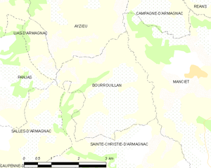
Bourrouillan and its surrounding communes
Population
| Year | Pop. | ±% |
|---|---|---|
| 1962 | 209 | — |
| 1968 | 175 | −16.3% |
| 1975 | 169 | −3.4% |
| 1982 | 174 | +3.0% |
| 1990 | 167 | −4.0% |
| 1999 | 174 | +4.2% |
| 2008 | 150 | −13.8% |
gollark: Yeeees.
gollark: Want me to steal them?
gollark: One server I'm on has this, thistbh and fancythis.
gollark: So use full message ID?
gollark: Disagreement should be maybe ^❌?
See also
References
- "Populations légales 2017". INSEE. Retrieved 6 January 2020.
| Wikimedia Commons has media related to Bourrouillan. |
| Authority control |
|
|---|
This article is issued from Wikipedia. The text is licensed under Creative Commons - Attribution - Sharealike. Additional terms may apply for the media files.