Lavardens
Lavardens (Occitan: Lavardens) is a commune in the Gers department in southwestern France.
Lavardens | |
|---|---|
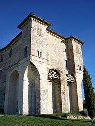 The chateau | |
.svg.png) Coat of arms | |
Location of Lavardens 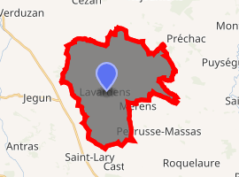
| |
 Lavardens  Lavardens | |
| Coordinates: 43°45′42″N 0°30′52″E | |
| Country | France |
| Region | Occitanie |
| Department | Gers |
| Arrondissement | Auch |
| Canton | Gascogne-Auscitaine |
| Intercommunality | Cœur de Gascogne |
| Government | |
| • Mayor (2008–2014) | Jean-Pierre Mothe |
| Area 1 | 30.55 km2 (11.80 sq mi) |
| Population (2017-01-01)[1] | 385 |
| • Density | 13/km2 (33/sq mi) |
| Time zone | UTC+01:00 (CET) |
| • Summer (DST) | UTC+02:00 (CEST) |
| INSEE/Postal code | 32204 /32360 |
| Elevation | 126–245 m (413–804 ft) (avg. 280 m or 920 ft) |
| 1 French Land Register data, which excludes lakes, ponds, glaciers > 1 km2 (0.386 sq mi or 247 acres) and river estuaries. | |
Geography
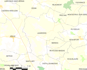
Lavardens and its surrounding communes
Population
| Year | Pop. | ±% |
|---|---|---|
| 1962 | 517 | — |
| 1968 | 504 | −2.5% |
| 1975 | 422 | −16.3% |
| 1982 | 373 | −11.6% |
| 1990 | 377 | +1.1% |
| 1999 | 378 | +0.3% |
| 2008 | 397 | +5.0% |
gollark: There are over 70000 characters (well, codepoints) by now, it's quite something.
gollark: Oh, I was just using anomalous Unicode.
gollark: Good for you?
gollark:
gollark:
See also
References
- "Populations légales 2017". INSEE. Retrieved 6 January 2020.
| Wikimedia Commons has media related to Lavardens. |
| Authority control |
|
|---|
This article is issued from Wikipedia. The text is licensed under Creative Commons - Attribution - Sharealike. Additional terms may apply for the media files.