Montamat
Montamat is a commune in the Gers department in southwestern France.
Montamat | |
|---|---|
Location of Montamat 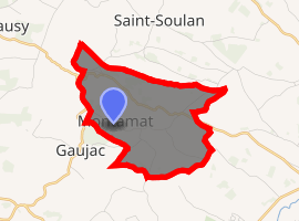
| |
 Montamat  Montamat | |
| Coordinates: 43°29′11″N 0°50′42″E | |
| Country | France |
| Region | Occitanie |
| Department | Gers |
| Arrondissement | Auch |
| Canton | Val de Save |
| Intercommunality | Savès |
| Government | |
| • Mayor (2008–2014) | Sylvain Lauzes |
| Area 1 | 6.6 km2 (2.5 sq mi) |
| Population (2017-01-01)[1] | 136 |
| • Density | 21/km2 (53/sq mi) |
| Time zone | UTC+01:00 (CET) |
| • Summer (DST) | UTC+02:00 (CEST) |
| INSEE/Postal code | 32277 /32220 |
| Elevation | 185–306 m (607–1,004 ft) (avg. 280 m or 920 ft) |
| 1 French Land Register data, which excludes lakes, ponds, glaciers > 1 km2 (0.386 sq mi or 247 acres) and river estuaries. | |
Geography
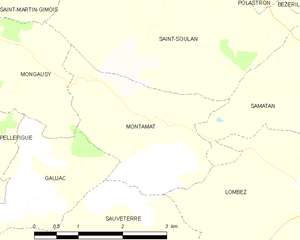
Montamat and its surrounding communes
Population
| Year | Pop. | ±% |
|---|---|---|
| 1962 | 114 | — |
| 1968 | 125 | +9.6% |
| 1975 | 116 | −7.2% |
| 1982 | 91 | −21.6% |
| 1990 | 87 | −4.4% |
| 1999 | 92 | +5.7% |
| 2008 | 106 | +15.2% |
| 2010 | 121 | +14.2% |
| 2012 | 128 | +5.8% |
gollark: Mostly they're just fancy GUIs and a few bundled programs.
gollark: Well, "real"er than average.
gollark: There are not many real OSes for CraftOS anyway.
gollark: People see CraftOS's blank outdated looking shell and go "hey, this looks outdated, I can make a GUI for it so it looks more like an 'actual computer'! I can't believe the CC developers didn't think of that!"
gollark: Indeed. You are correct.
See also
References
- "Populations légales 2017". INSEE. Retrieved 6 January 2020.
| Wikimedia Commons has media related to Montamat. |
| Authority control |
|
|---|
This article is issued from Wikipedia. The text is licensed under Creative Commons - Attribution - Sharealike. Additional terms may apply for the media files.