Rosevale, Queensland
Rosevale is a rural locality in the Scenic Rim Region, Queensland, Australia.[2] In the 2016 census, Rosevale had a population of 208 people.[1]
| Rosevale Queensland | |||||||||||||||
|---|---|---|---|---|---|---|---|---|---|---|---|---|---|---|---|
 Rosevale Retreat Hotel, 2015 | |||||||||||||||
 Rosevale | |||||||||||||||
| Coordinates | 27.8594°S 152.4916°E | ||||||||||||||
| Population | 208 (2016 census)[1] | ||||||||||||||
| • Density | 1.556/km2 (4.029/sq mi) | ||||||||||||||
| Postcode(s) | 4340 | ||||||||||||||
| Elevation | 105 m (344 ft) | ||||||||||||||
| Area | 133.7 km2 (51.6 sq mi) | ||||||||||||||
| Time zone | AEST (UTC+10:00) | ||||||||||||||
| LGA(s) | Scenic Rim Region | ||||||||||||||
| State electorate(s) | Scenic Rim | ||||||||||||||
| Federal Division(s) | |||||||||||||||
| |||||||||||||||
Geography
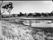
The Bremer River passes through the town.
History


The name Rosevale is a corruption of Rossvale, the name of a pastoral run pastoral used first in 1850s by William Ross.[2]
The Historic Rosevale Retreat Hotel, built in 1852 as a homestead, is the state's oldest hotel building. A victualler's licence was granted in 1887 to a Matthew Carmody.[3]
Rosevale State School opened 24 November 1884.[4] It closed on 31 December 2010.[5] The school was located at Rosevale Road (27.8466°S 152.4824°E).[6]
St Stephen's Anglican Church was opened circa 1887. The church closed circa 1962.[7]
Rosevale has previously belonged to the Shire of Mutdapilly, Shire of Moreton and the Shire of Boonah local government areas.
The Lutheran church burned down in 1928.[8] In 1929 the Congregational Church in Peak Crossing was to be replaced so the former church building was purchased and relocated to Rosevale to become the new Lutheran church.[9]
For a detailed history of the district see St Patrick's Church, Rosevale#History.
At the 2011 census the town recorded a population of 268.[10]
Heritage listings
Rosevale has a number of heritage-listed sites, including:
- Rosewood – Aratula Road: St Patrick's Church and Graveyard [11]
- 572 Rosevale Road: St Paul's Lutheran Church [12]
- 903 Rosevale Road: Rosevale Retreat Hotel [12]
References
- Australian Bureau of Statistics (27 June 2017). "Rosevale (SSC)". 2016 Census QuickStats. Retrieved 20 October 2018.

- "Rosevale - locality in Scenic Rim Region (entry 47270)". Queensland Place Names. Queensland Government. Retrieved 30 November 2019.
- "History". Rosevale Retreat Hotel. Retrieved 9 February 2015.
- Queensland Family History Society (2010), Queensland schools past and present (Version 1.01 ed.), Queensland Family History Society, ISBN 978-1-921171-26-0
- "Opening and closing dates of Queensland Schools". Queensland Government. Retrieved 30 October 2019.
- Chiclcott, Tanya; Vlasic, Kimberley (7 June 2013). "Full school asssets sale list". The Courier-Mail. Retrieved 30 October 2019.
- "Closed Anglican Churches". Anglican Church South Queensland. Archived from the original on 3 April 2019. Retrieved 29 June 2020.
- "ROSEVALE FIRE". Queensland Times. Queensland, Australia. 15 September 1928. p. 8 (DAILY.). Retrieved 3 June 2020 – via Trove.
- "Local Heritage Register" (PDF). Scenic Rim Regional Council. Archived from the original (PDF) on 24 September 2015. Retrieved 9 February 2015.
- Australian Bureau of Statistics (31 October 2012). "Rosevale (State Suburb)". 2011 Census QuickStats. Retrieved 12 July 2013.
- "St Patrick's Church and Graveyard (entry 602735)". Queensland Heritage Register. Queensland Heritage Council. Retrieved 12 July 2013.
- "Local Heritage Register" (PDF). Scenic Rim Regional Council. Retrieved 10 February 2015.
Further reading
- Willey, Marilyn; Rosevale State School. Centenary Committee (1984), Centenary 1884-1984 Rosevale State School, Rosevale State School Centenary Committee, ISBN 978-0-9589728-0-2
External links
| Wikimedia Commons has media related to Rosevale, Queensland. |
- "Rosevale". Queensland Places. Centre for the Government of Queensland, University of Queensland.
- St Patrick's Church and Cemetery: Headstone photos