Teviotville, Queensland
Teviotville is a rural locality in the Scenic Rim Region, Queensland, Australia.[2] In the 2016 census, Teviotville had a population of 125 people.[1]
| Teviotville Queensland | |||||||||||||||
|---|---|---|---|---|---|---|---|---|---|---|---|---|---|---|---|
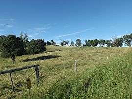 Farm along Teviotville Road, 2015 | |||||||||||||||
 Teviotville | |||||||||||||||
| Coordinates | 27.9488°S 152.6780°E | ||||||||||||||
| Population | 125 (2016 census)[1] | ||||||||||||||
| • Density | 13.74/km2 (35.6/sq mi) | ||||||||||||||
| Postcode(s) | 4309 | ||||||||||||||
| Area | 9.1 km2 (3.5 sq mi) | ||||||||||||||
| Time zone | AEST (UTC+10:00) | ||||||||||||||
| LGA(s) | Scenic Rim Region | ||||||||||||||
| State electorate(s) | Scenic Rim | ||||||||||||||
| Federal Division(s) | Wright | ||||||||||||||
| |||||||||||||||
Geography
Teviotville is in the Scenic Rim of South East Queensland.
History
The name Teviotville is derived from the name of its railway station, which was named by the Queensland Railway Department in 1887, which in turn was named after the major watercourse in the area, Teviot Brook.[3] The brook in turn was named on 6 August 1828 by explorer Allan Cunningham after the River Teviot in Roxburghshire, Scotland.[2]
The Fassifern railway line (Queensland's first branch railway line) opened from Ipswich to Harrisville on 10 July 1882. On 12 September 1887 the line was extended to Dugundan with Teviotville being served by Teviotville railway station on Stanfield Road near the junction with Teviotville (27.9472°S 152.6867°E). The line closed in June 1964.[4][5]
Teviotville Railway Station Provisional School opened on 1 August 1899 with 25 students under teacher Miss M.J.A. Alcorn.[6] In 1903 it was renamed Teviotville Provisional School. On 1 January 1909 it became Teviotville State School. A new school building was opened on 13 March 1914 by Ernest Thomas Bell, the Member of the Queensland Legislative Assembly for Fassifern.[7][8][9] It was on the south-west corner of Hoya Road and Haag Road (27.9495°S 152.6850°E).[10] It closed on 11 December 1981 due to low student numbers.[11][12]
At the 2011 census the locality and surrounds recorded a population of 273.[13]
Teviot Tree
The Teviotville Tree is located on private property in Teviotville. The tree was used in the filming of the 2010 film The Tree.
References
- Australian Bureau of Statistics (27 June 2017). "Teviotville (SSC)". 2016 Census QuickStats. Retrieved 20 October 2018.

- "Teviotville - locality in Scenic Rim Region (entry 45197)". Queensland Place Names. Queensland Government. Retrieved 17 November 2019.
- "Nomenclature Of Queensland–276". The Courier-Mail. Brisbane: National Library of Australia. 18 August 1936. p. 16. Retrieved 15 April 2015.
- Kerr, John (1990). Triumph of narrow gauge : a history of Queensland Railways. Boolarong Publications. pp. 57–58, 224. ISBN 978-0-86439-102-5.
- "Flinders" (Map). Queensland Government. 1927. Archived from the original on 29 May 2020. Retrieved 29 May 2020.
- "GOLDEN JUBILEE OF TEVIOTVILLE SCHOOL". Queensland Times (19, 527). Queensland, Australia. 2 August 1949. p. 3 (DAILY). Retrieved 25 November 2019 – via National Library of Australia.
- "PUBLIC WORKS". The Brisbane Courier (17, 362). Queensland, Australia. 5 September 1913. p. 9. Retrieved 25 November 2019 – via National Library of Australia.
- "TENDERS ACCEPTED". Queensland Times. LV (8857). Queensland, Australia. 5 September 1913. p. 4 (Daily). Retrieved 25 November 2019 – via National Library of Australia.
- "New Teviotville State School". Queensland Times. LVI (8971). Queensland, Australia. 17 March 1914. p. 6 (Daily). Retrieved 25 November 2019 – via National Library of Australia.
- "Flinders". Queensland Government. 1954. Archived from the original on 29 May 2020. Retrieved 29 May 2020.
- Queensland Family History Society (2010), Queensland schools past and present (Version 1.01 ed.), Queensland Family History Society, ISBN 978-1-921171-26-0
- "Teviotville State School". Queensland State Archives Agency ID10356. Queensland State Archives. Archived from the original on 23 September 2015. Retrieved 15 April 2015.
- Australian Bureau of Statistics (31 October 2012). "Teviotville (Gazetted Locality)". 2011 Census QuickStats. Retrieved 15 April 2015.
External links
![]()