Kagaru, Queensland
Kagaru is a rural locality split between Scenic Rim Region and City of Logan , Queensland, Australia.[2][3] In the 2016 census, Kagaru had a population of 13.[1]
| Kagaru Queensland | |||||||||||||||
|---|---|---|---|---|---|---|---|---|---|---|---|---|---|---|---|
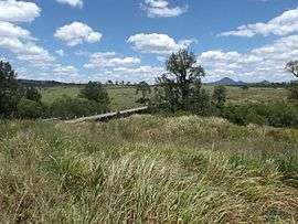 Teviot Brook crossing, 2016 | |||||||||||||||
| Population | 13 (2016 census)[1] | ||||||||||||||
| Established | 1997 | ||||||||||||||
| Postcode(s) | 4285 | ||||||||||||||
| LGA(s) | City of Logan, Scenic Rim Region | ||||||||||||||
| State electorate(s) | |||||||||||||||
| Federal Division(s) | Wright | ||||||||||||||
| |||||||||||||||
Geography
Kagaru's eastern border is marked by the Sydney–Brisbane rail corridor, the Logan River and Teviot Brook. There is very little development in the area.
History
In the 1930s, a railway station in the area was named Kagaru, an Aboriginal word for the blue-winged kookaburra. In 1996, the locality was formally bounded and took the name of the railway station.[4]
Formerly in the Shire of Beaudesert, Kagaru became split between Logan City and Scenic Rim Region following the local government amalgamations in March 2008.
Demographics
Kagaru has a population of 13 at the 2016 census. The locality contains 6 households, in which 45.0% of the population are males and 55.0% of the population are females with a median age of 57, 19 years above the national average. The average weekly household income is $1,375, $63 below the national average.[1]
References
- Australian Bureau of Statistics (27 June 2017). "Kagaru". 2016 Census QuickStats. Retrieved 18 January 2020.

- "Kagaru - locality in the Scenic Rim Region (entry 45150)". Queensland Place Names. Queensland Government. Retrieved 28 September 2017.
- "Kagaru - locality in Logan City (entry 45302)". Queensland Place Names. Queensland Government. Retrieved 28 September 2017.
- "Kagaru". Suburbs. Logan City Council. Retrieved 6 May 2014.