Wonglepong, Queensland
Wonglepong is a rural locality in the Scenic Rim Region of Queensland, Australia.[1]
| Wonglepong Queensland | |||||||||||||||
|---|---|---|---|---|---|---|---|---|---|---|---|---|---|---|---|
 Wonglepong and surrounds | |||||||||||||||
 Wonglepong | |||||||||||||||
| Coordinates | 27.9692°S 153.1613°E | ||||||||||||||
| Postcode(s) | 4275 | ||||||||||||||
| LGA(s) | Scenic Rim Region | ||||||||||||||
| State electorate(s) | Scenic Rim | ||||||||||||||
| Federal Division(s) | Wright | ||||||||||||||
| |||||||||||||||
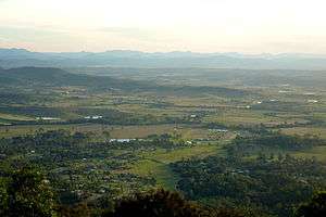
Wonglepong straddles a valley upstream from where Canungra Creek joins the Albert River. Development is centered along Beaudesert Nerang Road which passes through the lowest elevations. In the east the slopes of the valley rise sharply towards the Tamborine Mountain plateau.
History
The name Wonglepong was the name of the local railway station name from 1927 (previously known as Sarah Vale). Wonglepong is believed to be an Aboriginal name possibly meaning either forgotten sound or referring to some feature of Mount Tamborine.[1]
Wonglepong railway station (27.9716°S 153.1628°E) was on the Canungra railway line, which operated from 1915 to 1955.[2]
At the 2011 census Wonglepong recorded a population of 367.[3]
Heritage listings
Wonglepong has a number of heritage-listed sites, including:
- 2779 Beaudesert-Nerang Road: Wonglepong QCWA Hall[4]
Community groups
The Wonglepong branch of the Queensland Country Women's Association meets at the Wonglepong QCWA Hall at 2779 Beaudesert Nerang Road.[5]
References
- "Wonglepong (entry 45208)". Queensland Place Names. Queensland Government. Retrieved 13 September 2015.
- "Tamborine" (Map). Queensland Government. 1954. Archived from the original on 2 April 2020. Retrieved 4 July 2020.
- Australian Bureau of Statistics (31 October 2012). "Wonglepong (State Suburb)". 2011 Census QuickStats. Retrieved 14 July 2013.

- "Wonglepong QCWA Hall (entry 602549)". Queensland Heritage Register. Queensland Heritage Council. Retrieved 12 July 2013.
- "Branch Locations". Queensland Country Women's Association. Retrieved 26 December 2018.
External links
![]()