Hoya, Queensland
Hoya is a locality in the Scenic Rim Region, Queensland, Australia.[2] In the 2016 census, Hoya had a population of 220 people.[1]
| Hoya Queensland | |||||||||||||||
|---|---|---|---|---|---|---|---|---|---|---|---|---|---|---|---|
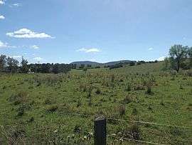 Fields at Hoya, 2016 | |||||||||||||||
 Hoya | |||||||||||||||
| Coordinates | 27°58′28″S 152°40′55″E | ||||||||||||||
| Population | 220 (2016 census)[1] | ||||||||||||||
| Postcode(s) | 4310 | ||||||||||||||
| Location |
| ||||||||||||||
| LGA(s) | Scenic Rim Region | ||||||||||||||
| State electorate(s) | Scenic Rim | ||||||||||||||
| Federal Division(s) | Wright | ||||||||||||||
| |||||||||||||||
Geography
Hoya is farming land approximately 150 metres about sea level.[3]
History
The Fassifern railway line (Queensland's first branch railway line) opened from Ipswich to Harrisville on 10 July 1882. On 12 September 1887 the line was extended to Dugundan with Hoya being served by Hoya railway station on Hoya Road near the junction with Heise Road (27.9706°S 152.6891°E). The line closed in June 1964.[4][5]
A postal receiving office was opened in Hoya on 22 January 1892. A post office opened on 1 July 1927. It closed on 1 April 1955.[6]
Demographics
Hoya has a population of 220 at the 2016 census. The locality contains 87 households, in which 52.3% of the population are males and 47.7% of the population are females with a median age of 52, 14 years above the national average. The average weekly household income is $1,406, $32 below the national average.
0.0% of Hoya's population is either of Aborigional or Torres Strait Islander descent. 74.5% of the population aged 15 or over is either registered or de facto married, while 25.5% of the population is not married. 23.9% of the population is currently attending some form of a compulsory education. The most common nominated ancestries were Australian (31.2%), English (27.7%) and German (10.6%), while the most common country of birth was Australia (87.1%), and the most commonly spoken language at home was English (90.0%). The most common nominated religions were No religion (24.6%), the Uniting Church (14.5%) and Anglican (12.7%). The most common occupation was a professional (21.1%) and the majority/plurality of residents worked 40 or more hours per week (30.6%).[1]
References
- Australian Bureau of Statistics (27 June 2017). "Hoya". 2016 Census QuickStats. Retrieved 18 January 2020.

- "Hoya (entry 45146)". Queensland Place Names. Queensland Government. Retrieved 17 March 2017.
- "Queensland Globe". State of Queensland. Retrieved 17 March 2017.
- Kerr, John (1990). Triumph of narrow gauge : a history of Queensland Railways. Boolarong Publications. pp. 57–58, 224. ISBN 978-0-86439-102-5.
- "Flinders" (Map). Queensland Government. 1927. Archived from the original on 29 May 2020. Retrieved 29 May 2020.
- Premier Postal History. "Post Office List". Premier Postal Auctions. Retrieved 17 March 2017.
External links
![]()