Cryna, Queensland
Cryna is a rural locality in the Scenic Rim Region, Queensland, Australia.[2] In the 2016 census, Cryna had a population of 113 people.[1]
| Cryna Queensland | |||||||||||||||
|---|---|---|---|---|---|---|---|---|---|---|---|---|---|---|---|
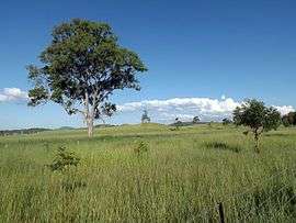 Fields, Markwell Creek Road, 2016 | |||||||||||||||
 Cryna | |||||||||||||||
| Coordinates | 28.0405°S 152.9863°E | ||||||||||||||
| Population | 113 (2016 census)[1] | ||||||||||||||
| • Density | 4.93/km2 (12.78/sq mi) | ||||||||||||||
| Postcode(s) | 4285 | ||||||||||||||
| Area | 22.9 km2 (8.8 sq mi) | ||||||||||||||
| Time zone | AEST (UTC+10:00) | ||||||||||||||
| LGA(s) | Scenic Rim Region | ||||||||||||||
| State electorate(s) | Scenic Rim | ||||||||||||||
| Federal Division(s) | Wright | ||||||||||||||
| |||||||||||||||
Geography
Part of the western border is marked by the Mount Lindesay Highway. Part of the northern boundary follow Spring Creek. The main land use in the area is agriculture. Parts of the central area are elevated along a ridge marking the northern extent of Jinbroken Range.
History
Cryna Provisional School opened on 30 April 1907.[3][4] On 1 January 1909 it became Cryna State School. It closed in 1935.[5]
The Beaudesert Shire Tramway passed through the area but did not have a station. The closest station was at Josephville or the terminus in Beaudesert.
Demographics
Cryna has a population of 113 at the 2016 census. The locality contains 51 households, in which 52.6% of the population are males and 47.4% of the population are females with a median age of 42, 4 years above the national average. The average weekly household income is $1,281, $157 below the national average.
0.0% of Cryna's population is either of Aborigional or Torres Strait Islander descent. 56.0% of the population aged 15 or over is either registered or de facto married, while 44.0% of the population is not married. 24.1% of the population is currently attending some form of a compulsory education. The most common nominated ancestries were English (37.1%), Australian (30.5%) and Irish (14.6%), while the most common country of birth was Australia (80.7%), and the most commonly spoken language at home was English (100.0%). The most common nominated religions were Catholic (27.4%), No religion (27.4%) and Anglican (15.1%). The most common occupation was a manager (21.8%) and the majority/plurality of residents worked 40 or more hours per week (46.4%).[1]
References
- Australian Bureau of Statistics (27 June 2017). "Cryna (SSC)". 2016 Census QuickStats. Retrieved 20 October 2018.

- "Cryna - locality in Scenic Rim Region (entry 45134)". Queensland Place Names. Queensland Government. Retrieved 5 November 2019.
- "Advertising". The Brisbane Courier. Queensland, Australia. 5 January 1907. p. 16. Retrieved 3 May 2020 – via Trove.
- "Public Works". The Telegraph. Queensland, Australia. 30 January 1907. p. 8 (SECOND EDITION). Retrieved 3 May 2020 – via Trove.
- Queensland Family History Society (2010), Queensland schools past and present (Version 1.01 ed.), Queensland Family History Society, ISBN 978-1-921171-26-0