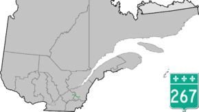
Quebec Route 267
Route 267 is a two-lane north/south highway on the south shore of the Saint Lawrence River in Quebec, Canada. Its northern terminus is in Plessisville at the junction of Route 265, and the southern terminus is at the junction of Route 269 in Adstock (secteur Saint-Méthode).
| ||||
|---|---|---|---|---|
 | ||||
| Route information | ||||
| Length | 64.0 km[1] (39.8 mi) | |||
| Major junctions | ||||
| South end | ||||
| North end | ||||
| Location | ||||
| Major cities | Thetford Mines, Plessisville, Adstock | |||
| Highway system | ||||
| ||||

List of towns along Route 267
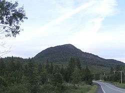 Mount Adstock near Saint-Daniel.
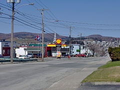 Saint-Alphonse street in Thetford Mines.
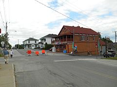 Dublin street in Inverness.
.jpg) Quebec Route 267 in Inverness.
Quebec Route 267 in Inverness.
gollark: Did you know? #meta has been constructed → none are safe.
gollark: It should be possible to horribly bodge the DNS→IRC thing to also answer queries for .apioformic and such.
gollark: Idea: .apioformic TLD via osmarksDNSßserver™.
gollark: RPNCalc array language: to occur at time 🐝.
gollark: Ominous palaiologistic activity.
See also
References
- Ministère des transports, "Distances routières", page (?), Les Publications du Québec, 2005
External links
- Route 267 on Google Maps
- Provincial Route Map (Courtesy of the Quebec Ministry of Transportation) (in French)
This article is issued from Wikipedia. The text is licensed under Creative Commons - Attribution - Sharealike. Additional terms may apply for the media files.