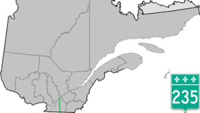
Quebec Route 235
Route 235 is a Quebec provincial highway located in the Estrie and Montérégie regions in the southeastern part of the province. The highway runs from the Morses Line Border Crossing at the Canada-United States border in Saint-Armand to Yamaska. It overlaps Route 239 in Massueville and Route 137 and Route 116 in Saint-Hyacinthe, Quebec. A small portion of the highway near its northern terminus runs parallel to the Yamaska River.
| ||||
|---|---|---|---|---|
 | ||||
| Route information | ||||
| Maintained by Transports Québec | ||||
| Length | 131.0 km[1] (81.4 mi) | |||
| Major junctions | ||||
| South end | ||||
| North end | ||||
| Highway system | ||||
| ||||

Municipalities along Route 235
- Saint-Armand
- Bedford
- Sainte-Sabine
- Farnham
- Ange-Gardien
- Saint-Paul-d'Abbotsford
- Saint-Pie
- Saint-Hyacinthe
- Saint-Barnabé-Sud
- Saint-Jude
- Saint-Louis
- Massueville
- Saint-Aimé
- Yamaska
gollark: How is a lot of water and electrolysis machinery going to be lighter then motors?
gollark: Simply beam down electricity to planes via orbiting solar power satellites.
gollark: If you're storing all the energy anyway then the hydrogen is just a pointless wasteful layer of indirection.
gollark: It isn't really a thing in much of Europe.
gollark: I don't believe this is accurate unless you have really cheap panels somehow. Or it's very sunny.
See also
References
- Ministère des transports, "Distances routières", page 86-87, Les Publications du Québec, 2005
This article is issued from Wikipedia. The text is licensed under Creative Commons - Attribution - Sharealike. Additional terms may apply for the media files.