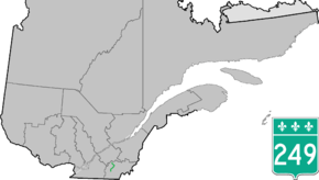
Quebec Route 249
Route 249 is a two-lane north/south highway on the south shore of the Saint Lawrence River in Quebec, Canada. Its northern terminus is in Asbestos at the junction of Route 255, and the southern terminus is at the junction of Route 112 close to Magog.
| ||||
|---|---|---|---|---|
 | ||||
| Route information | ||||
| Maintained by Transports Québec | ||||
| Length | 68.8 km[1] (42.8 mi) | |||
| Major junctions | ||||
| South end | ||||
| North end | ||||
| Location | ||||
| Major cities | Magog, Sherbrooke, Asbestos | |||
| Highway system | ||||
| ||||

Municipalities along Route 249
- Magog
- Sherbrooke
- Saint-Denis-de-Brompton
- Saint-François-Xavier-de-Brompton, Quebec
- Windsor
- Val-Joli
- Saint-Claude
- Saint-Georges-de-Windsor
- Asbestos
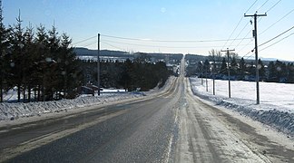 Rhéaume road south of Saint-Denis-de-Brompton.
.jpg) Route 249 shares part of its itinerary with route 222.
Route 249 shares part of its itinerary with route 222..jpg) Principale street in Saint-François-Xavier-de-Brompton.
Principale street in Saint-François-Xavier-de-Brompton..jpg) Route 249 descends in the valley of Saint-François River, near Windsor.
Route 249 descends in the valley of Saint-François River, near Windsor.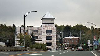 Bridge over the Saint-François in Windsor.
gollark: Exactly.
gollark: <nil />
gollark: Brainf*** but with HTML tags!
gollark: Or...<list><symbol>+</symbol><integer>1</integer><integer>1</integer></list>
gollark: Or HTML, if you want to just make the syntax weird and inconsistent.
See also
References
- Ministère des transports, "Distances routières", page 88, Les Publications du Québec, 2005
External links
- Route 249 on Google Maps
- Provincial Route Map (Courtesy of the Quebec Ministry of Transportation) (in French)
This article is issued from Wikipedia. The text is licensed under Creative Commons - Attribution - Sharealike. Additional terms may apply for the media files.