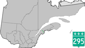
Quebec Route 295
Route 295 is a 98 km two-lane north/south highway in Quebec, Canada, which starts in Saint-Jean-de-Dieu at the junction of Route 293 and ends in Dégelis at the junction of Autoroute 85.
| ||||
|---|---|---|---|---|
 | ||||
| Route information | ||||
| Length | 98.0 km[1] (60.9 mi) | |||
| Major junctions | ||||
| North end | ||||
| South end | ||||
| Location | ||||
| Major cities | Degelis | |||
| Highway system | ||||
| ||||
List of towns along Route 295
- Saint-Jean-de-Dieu
- Sainte-Rita
- Squatec
- Saint-Michel-du-Squatec
- Lejeune
- Auclair
- Lots Renverses
- Degelis
- Route 295 passes through Saint-Michel-du-Squatec.
 Advance sign for Route 295 junction in Sainte-Rita.
gollark: It's because pulling in external dependencies is more convenient than having to program everything yourself or whatever, although npm has gone too far with `is-number` and `is-thirteen` and whatever.
gollark: That's possible, yes. Most Node.js applications use a lot of packages, because npm.
gollark: Most communication already isn't done by satellites, but tons of stuff relies on GPS - not even just for navigation, I think phone towers and stuff use it for timing too.
gollark: It's apparently part of a series of similar pieces, which seems interesting.
gollark: Personally, I'm running actual Linux instead of "Linux" on Windows, because I dislike Windows for a bunch of other reasons, but it's nice for some workflows I guess.
See also
References
- Ministère des transports, "Distances routières", page (?), Les Publications du Québec, 2005
External links
- Provincial Route Map (Courtesy of the Quebec Ministry of Transportation) (in French)
- Route 295 on Google Maps
This article is issued from Wikipedia. The text is licensed under Creative Commons - Attribution - Sharealike. Additional terms may apply for the media files.
