Quebec Route 226
Route 226 is a two-lane east/west highway in Quebec, Canada. Its western terminus is at the junction of Route 132 in Pierreville and its eastern terminus is in Sainte-Croix at the junction of Route 271.
| ||||
|---|---|---|---|---|
 | ||||
| Route information | ||||
| Maintained by Transports Québec | ||||
| Length | 129.2 km[1] (80.3 mi) | |||
| Major junctions | ||||
| West end | ||||
| East end | ||||
| Highway system | ||||
| ||||

Route 226 is an exclusively rural highway going through very small villages in the Chaudière-Appalaches and mostly in the Centre-du-Québec regions. The biggest village along the way is Saint-Édouard-de-Lotbinière, with 1,200 people.
Municipalities along Route 226
- Pierreville
- Saint-Elphège
- La-Visitation-de-Yamaska
- Sainte-Monique
- Grand-Saint-Esprit
- Saint-Célestin (municipality)
- Saint-Célestin (village)
- Bécancour
- Sainte-Marie-de-Blandford
- Sainte-Sophie-de-Lévrard
- Fortierville
- Parisville
- Leclercville
- Saint-Édouard-de-Lotbinière
- Sainte-Croix
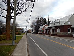 Route 226 in Sainte-Gertrude.
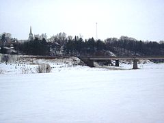 Bridge over Nicolet River in Sainte-Monique.
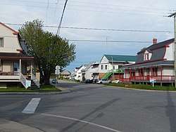 Route 226 through Sainte-Marie-de-Blandford.
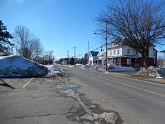 Route 226 follows Principale street in Fortierville.
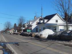 Intersection with Route 265 in Parisville.
gollark: I mean, the screen's 1280xsomething, but that's... basically fine for me.
gollark: Really? I have one from 2015 which works fine.
gollark: Should be fine.
gollark: ... sure?
gollark: Network or sound cards, *maybe*.
See also
References
- Ministère des transports, "Distances routières", page 84-85, Les Publications du Québec, 2005
External links
- Provincial Route Map (Courtesy of the Quebec Ministry of Transportation) (in French)
- Route 226 on Google Maps
This article is issued from Wikipedia. The text is licensed under Creative Commons - Attribution - Sharealike. Additional terms may apply for the media files.