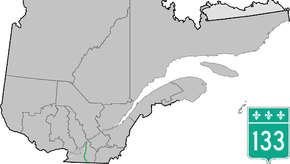
Quebec Route 133
Route 133 is a historic and heritage road of the Montérégie region in the province of Quebec, with north/south orientation and located on the eastern shore of the Richelieu River. Its northern terminus is in Sorel-Tracy, on the south shore of the Saint Lawrence River. The southern terminus is in Saint-Armand at the United States border with Vermont, close to Highgate Springs, where it continues southward past the Highgate Springs–St. Armand/Philipsburg Border Crossing as Interstate 89. Prior to the 1970s, the portion between the international border and Saint-Jean-sur-Richelieu was known as Route 7, which served as a continuation of US 7.
| ||||
|---|---|---|---|---|
 | ||||
| Route information | ||||
| Maintained by Transports Québec | ||||
| Length | 132.9 km[1] (82.6 mi) | |||
| Major junctions | ||||
| South end | ||||
| North end | ||||
| Highway system | ||||
| ||||
Route 133 is designated as historic and called Chemin des Patriotes in honour of the Patriot Rebellion of 1837–1838.
The stretch between the US border and Saint-Jean-sur-Richelieu, where Autoroute 35 begins, is relatively busy, as it provides the main link between Boston and Montreal. Construction to extend Autoroute 35 South of Saint-Jean-sur-Richelieu to the US border by-passing Route 133 started in 2009. Construction is slated to be finished in 2017.
Trucking is prohibited on this road between Saint-Jean-sur-Richelieu and Autoroute 10 (section of 10 km) and between the junction of road 116 in Mont-Saint-Hilaire and Autoroute 20 (section of 3.5km). Controversy persists and has gained momentum in 2005 between the Ministry of Transports of Quebec and nearly 3000 residents along the road at Saint-Denis-sur-Richelieu, Saint-Charles-sur-Richelieu and Mont Saint-Hilaire, north of Autoroute 20. This controversy follows the decision of this ministry in 1995 to transfer north-south truck traffic from the roads parallel to the 133 and force it to converge, without impacts study, on chemin des Patriotes, a historical and heritage path, located on a fragile and weak soil and in the most populated area. The resulting intense heavy traffic generates noise, vibrations and pollution day and night, causing health, insomnia and safety problems to the local population.
Municipalities along Route 133
- Saint-Armand
- Pike River (formerly Saint-Pierre-de-Véronne-à-Pike-River)
- Saint-Sébastien
- Henryville
- Sainte-Anne-de-Sabrevois
- Saint-Athanase
- Saint-Jean-sur-Richelieu
- Richelieu
- Saint-Mathias-sur-Richelieu
- Otterburn Park
- Mont-Saint-Hilaire
- Saint-Charles-sur-Richelieu
- Saint-Denis-sur-Richelieu
- Saint-Ours
- Sainte-Victoire-de-Sorel
- Sorel-Tracy
See also
References
- Ministère des transports, "Distances routières", page 65-66, Les Publications du Québec, 2005
