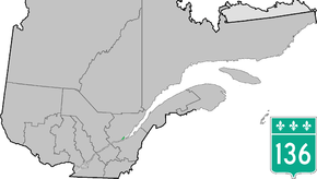
Quebec Route 136
Route 136 is a provincial highway located in the Capitale-Nationale region of Quebec. The highway runs from Autoroute 440 (Autoroute Dufferin-Montmorency) to Autoroute 73 near the Pierre Laporte and Quebec bridges in Quebec City. A short route, most of Route 136 is a parkway along the Saint Lawrence River connecting the Basse-Ville of Old Quebec to the bridges. The eastern section follows city streets in that community.
| ||||
|---|---|---|---|---|
| Boulevard Champlain | ||||
 | ||||
| Route information | ||||
| Maintained by Transports Québec | ||||
| Length | 11.6 km[1] (7.2 mi) | |||
| Major junctions | ||||
| West end | ||||
| East end | ||||
| Location | ||||
| Counties | Quebec | |||
| Highway system | ||||
| ||||

Route 136 is shown in the Quebec Ministry of Transportation road network map but is not identified as such on some other maps. It is also known as Boulevard Champlain for most of its length as well as several other short streets near A-440, following the north shore of the Saint Lawrence River just south of downtown.
Municipalities along Route 136
gollark: It also now communicates with icecast to harvest a current listener count.
gollark: Among many other things it fetches information from the MPD instance running my internet radio system, but after several hours it just stops working for ??? reasons.
gollark: This is the one which is partly broken for no reason.
gollark: My miscellaneous API stuff goes into one big 500 line python file, for economies of scale.
gollark: One somewhat important API I have running breaks mysteriously a few hours after I stop watching it and I haven't been able to work out why after several weeks.
See also
References
- Ministère des transports, "Distances routières", page 65, Les Publications du Québec, 2005
This article is issued from Wikipedia. The text is licensed under Creative Commons - Attribution - Sharealike. Additional terms may apply for the media files.